Kilcormac

Last updated

Kilcormac
Irish: Cill Chormaic
village
Kilcormac, Co. Offaly - geograph.org.uk - 1386815.jpg
Main Street, Kilcormac
Ireland adm location map.svg
Red pog.svg
Kilcormac
Location in Ireland
Coordinates: 53°10′27″N7°43′32″W / 53.1742°N 7.7256°W / 53.1742; -7.7256
Country Ireland
Province Leinster
County Offaly
Elevation
75 m (246 ft)
Population
 (2016) [1]
935
Time zone UTC+0 (WET)
  Summer (DST) UTC-1 (IST (WEST))
Irish Grid Reference N181141

Kilcormac (Irish : Cill Chormaic, meaning 'church of Cormac') [2] is a small village in County Offaly, Ireland, located on the N52 at its junction with the R437 regional road, between the towns of Tullamore and Birr. It is a small village of 935 people (as of the 2016 census), [1] many of whom were previously employed by Bord na Móna to work the local peat bogs.[ citation needed ] The village is located near the Slieve Bloom Mountains. The Silver River flows through the village. The village was more commonly referred to as Frankford prior to Irish independence.

Contents

Kilcormac Kilcormac.jpg
Kilcormac

History

The name Kilcormac comes from the Irish Cill Chormaic meaning Cormac's Church. This name is based on the local patron saint; Cormac Ua Liatháin, a native of Cork, who paid a visit to St Colmcille at the famous monastery he had founded in Durrow in 553 A.D. Cormac was so inspired by the great saint that he joined Colmcille and spent many years at Durrow, eventually taking over as abbot after Colmcille had gone to Iona in Scotland. [3] He eventually founded a church near the Silver River which became known as Cill Chormaic. Over time the original church fell into ruin. Tradition holds that Cormac died in nearby Eglish following an attack by a pair of wolves. A window in Eglish Church depicts the event.

Historically, Kilcormac was part of the O'Molloy territory of Firceall which was part of the Kingdom of Meath, however Ballyboy was traditionally the main trading centre of the area at the time being situated on an important route which passed through the area. [3] Following the Plantations of Offaly the area formed part of the Barony of Ballyboy. [3] About five hundred years later reference is made to foreign monks, possibly Augustinian, at the Hermitage. A manuscript, written in Kilcormac in 1300, is now in the museum of the Royal Irish Academy. (The same museum also houses the crozier of Durrow, which was probably Cormac's symbol of authority when he succeeded Colmcille as abbot of Durrow). [3]

During the Middle Ages Kilcormac was the site of a Carmelite monastery. Following the Henrican Reformation all monasteries were dissolved. The current Convent of Mercy is located on the site of the old monastery. [3] The current Catholic Church is located on the site of Cormac's old church. The Church is a fine imposing building and dates from 1867 after a number of alterations to the original church built during the time of the penal laws. [3] It is dedicated to the Blessed Virgin Mary.

The Kilcormac Pieta

Within the church is statue of the Pieta. According to tradition it was donated to the parish by a rich lady in the 16th century. It was placed in the parish church, which at that time was in Ballyboy, about 1 mile from Kilcormac. There it remained until 1650 when Oliver Cromwell’s army was reported approaching from the direction of Cadamstown. [4] The pieta was eventually buried in a bog for 60 years for safety. During this time both Ballyboy and Kilcormac Churches were ruined by Cromwell's forces. [4] While the church at Kilcormac was not rebuilt, Ballyboy Church was rebuilt eventually, but as part of the Established Anglican Church of Ireland. Tradition holds that only one man remained alive who knew where the Pieta was buried, and, according to tradition, he was carried on his deathbed to point it out. The carving was carefully recovered and when it was examined it was found to be in perfect condition. It was then placed in the Church Of The Nativity that had recently been built in Kilcormac. [4]

18th Century onwards

Kilcormac grew in importance in the 18th and 19th Century as Ballyboy went into decline. Following the establishment of County Offaly and the growth of Tullamore, Kilcormac now found itself on the main route on from Birr to Tullamore and became an important market centre in the area. Following the relaxation of the Penal laws the Catholic Church also opted to build its church in Kilcormac and not Ballyboy which cemented its place as a market centre of the area given the Catholic majority population of the area.

Services and amenities

The amenities serving the local population include a primary school, a secondary school (Coláiste Naomh Cormac), a number of local grocery shops, butchers, clothes shop, doctors practice, chemist and an agricultural/hardware store. There are also a number of pubs along the main street. Kilcormac has somewhat declined from its peak which was in the mid 20th Century.[ citation needed ] Many people traditionally found work in Bord na Móna and the bogs in what is now a declining industry. Bord na Móna remains an important part of the local economy with many employed in nearby Derrinlough at the peat briquette manufacturing plant.[ citation needed ] Agriculture and farming are also important to the local economy. The main route out of Kilcormac is the R437 regional road.

Lough Boora parklands is a local outdoor amenity for walkers and outdoor pursuits, as are the nearby Slieve Bloom Mountains.

Sport

Kilcormac-Killoughey play Seir Kieran in the 1996 Offaly Senior Hurling Championship Midfield action from Seir Kieran v Kilcormac-Killoughey game, Offaly SHC, 1996.png
Kilcormac-Killoughey play Seir Kieran in the 1996 Offaly Senior Hurling Championship

Gaelic games are the most popular sports played in the area and are played at all levels. Hurling is the most popular code of sport played. Kilcormac–Killoughey GAA is the local GAA club. The club has had a number of successes since its foundation in 1986, including winning the Leinster Senior Club Hurling Championship in 2012.

See also

Related Research Articles

<span class="mw-page-title-main">County Offaly</span> County in Ireland

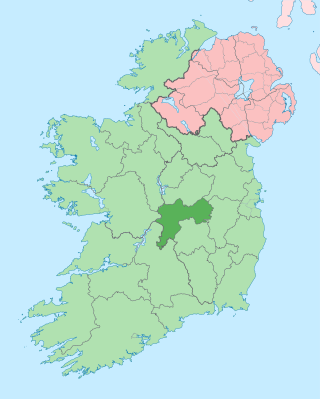
County Offaly is a county in Ireland. It is part of the Eastern and Midland Region and the province of Leinster. It is named after the ancient Kingdom of Uí Failghe. It was formerly known as King's County, in honour of Philip II of Spain. Offaly County Council is the local authority for the county. The county population was 82,668 at the 2022 census.

<span class="mw-page-title-main">Tullamore</span> Town in County Offaly, Ireland

Tullamore is the county town of County Offaly in Ireland. It is on the Grand Canal, in the middle of the county, and is the fourth most populous town in the Midlands Region, with 15,598 inhabitants at the 2022 census.

<span class="mw-page-title-main">Kilbeggan</span> Town in County Westmeath, Ireland

Kilbeggan is a town in County Westmeath, Ireland. It is in the barony of Moycashel.

<span class="mw-page-title-main">Durrow, County Offaly</span> Village in County Offaly, Ireland

Durrow is a small rural village and townland in County Offaly, Ireland. Durrow is located on the N52 off the N6 road between Kilbeggan and Tullamore.

<span class="mw-page-title-main">Clara, County Offaly</span> Town in County Offaly, Ireland

Clara is a town on the River Brosna in County Offaly, Ireland. It is the 10th largest town in the midlands of Ireland. The town had a population of 3,403 as of the 2022 census.

<span class="mw-page-title-main">Shannonbridge</span> Village in County Offaly, Ireland

Shannonbridge is a village located on the River Shannon, at the junction of the R444 and R357 regional roads in County Offaly, Ireland. It lies within the townland of Raghra, at the borders of counties Offaly, Galway and Roscommon, with the majority of the population living east of the bridge in County Offaly. As of the 2016 census, the village had a population of 175. There are two housing estates within the village. Its location along Ireland's largest river and its proximity to Clonmacnoise have contributed to tourism being a key contributor to the local economy. The village is flanked by a Special Area of Conservation – the Shannon Callows. The physical environment consists of the River Shannon, callows, boglands and the Esker Riada. The village has one of the oldest bridges still in use over the River Shannon, completed in 1757.

<span class="mw-page-title-main">Daingean</span> Town in County Offaly, Ireland

Daingean, formerly Philipstown, named after King Philip II of Spain, is a small town in east County Offaly, Ireland. It is situated midway between the towns of Tullamore and Edenderry on the R402 regional road. The town of Daingean had a population, as of the 2022 census, of 1,223. It is the principal town of the Daingean Catholic Parish. The other main poles of this parish are Ballycommon, Kilclonfert and Cappincur.

<span class="mw-page-title-main">Clonaslee</span> Village in Leinster, Ireland

Clonaslee is a village in north County Laois, Ireland, situated in the foothills of the Slieve Bloom Mountains on the R422 Mountmellick to Birr road. Clonaslee is approximately 100 km west of Dublin, and is close to the towns of Portlaoise and Tullamore.

<span class="mw-page-title-main">Ballyboy</span> Village in County Offaly, Ireland

Ballyboy or Ballaboy is a village in County Offaly, Ireland. It is about two kilometres east of Kilcormac.

<span class="mw-page-title-main">Pollagh</span> Village in County Offaly, Ireland

Pollagh, also spelled Pullough, is a village in County Offaly, Ireland, located in the midlands of Ireland. It is a rural village on the Grand Canal and lies between Ferbane and Tullamore. Much of the surrounding area is bogland, and is used to produce fossil fuels such as peat turf. The River Brosna flows close to the village. The Grand Canal was used for transporting peat and bricks produced in the area. Pollagh benefited from the canal in earlier years when it brought investment and employment from Bord na Móna, and it is now a tourist attraction. Pollagh is also known for its church, including its bog oak altar and stained glass windows, designed by the Harry Clarke studios.

<span class="mw-page-title-main">Killeigh</span> Village in County Offaly, Ireland

Killeigh is a village in County Offaly, Ireland. It is located around 8 kilometres (5 mi) south of the county town of Tullamore, on the N80 national secondary road; the Slieve Bloom Mountains lie a similar distance further south.

Killoughey, officially Killoughy and historically "Killaghy" or "Killahy", is a townland and civil parish south-west of Tullamore in County Offaly, Ireland.

Mountbolus is a small village in County Offaly, Ireland. It is in the parish of Killoughey situated at the foot of the Slieve Bloom Mountains, 13 km south-west of Tullamore.

<span class="mw-page-title-main">Offaly Way</span> Trail in County Offaly, Ireland

The Offaly Way is a long-distance trail in County Offaly, Ireland. It is 37 kilometres long and begins in Cadamstown and ends at Lemanaghan, on the R436 road between the towns of Clara and Ferbane. It is typically completed in two days. It is designated as a National Waymarked Trail by the National Trails Office of the Irish Sports Council and is managed by Offaly County Council, Bord na Mona and the Offaly Integrated Development Company. The trail provides a link between the Slieve Bloom Way and the Grand Canal Way.

Rath is a hamlet in the south west area of County Offaly, Ireland. The hamlet is located midway between the towns of Birr and Kilcormac on a northeast-southwest country road. It is located in the parish of Eglish and Drumcullen which is in the Roman Catholic Diocese of Meath. The hamlet has a number of local amenities for the local population including a church, a national school, a local community centre and a local shop. Drumcullen GAA is the local GAA club and is located about half a kilometre to the south of the hamlet.

Firceall was an ancient Gaelic Irish territory which formed the most south - westerly part of the ancient Kingdom of Meath. O'Molloy was chieftain of the territory. Firceall itself comprised the ancient baronies of Ballycowan, Ballyboy and Eglish, which are located in modern day mid County Offaly extending from Durrow north of Tullamore to Eglish on the edge of Birr in an area which is some 25 miles in length by 5 miles in width. The name Firceall comes from the Irish words Fir Ceala meaning Men of the Churches.

<span class="mw-page-title-main">Eglish (barony)</span> Barony in Offaly, Ireland

Eglish, also called Fercale is a barony in County Offaly, Ireland.

The 2019 Offaly Senior Hurling Championship was the 121st staging of the Offaly Senior Hurling Championship since its establishment by the Offaly County Board in 1896. The championship began on 30 March 2019 and ended on 20 October 2019.

The 2020 Offaly Senior Hurling Championship was the 122nd staging of the Offaly Senior Hurling Championship since its establishment by the Offaly County Board in 1896. The beginning of the championship was postponed indefinitely due to the impact of the COVID-19 pandemic on Gaelic games. The championship eventually began on 31 July 2020 and, after being suspended once again, eventually ended on 14 August 2021.

The 2022 Offaly Senior Hurling Championship was the 124th staging of the Offaly Senior Hurling Championship since its establishment by the Offaly County Board in 1896. The group stage placings were confirmed on 28 May 2021. The championship ran from 24 June to 2 October 2022.

References

  1. 1 2 "Sapmap Area - Settlements - Kilcormac (Frankford)". Census 2016. Central Statistics Office. April 2016. Retrieved 27 February 2020.
  2. "Cill Chormaic / Kilcormac". logainm.ie. Irish Placenames Commission. Retrieved 29 February 2020.
  3. 1 2 3 4 5 6 "A brief history of Kilcormac – Kilcormac.com". Archived from the original on 14 March 2016. Retrieved 14 March 2016.
  4. 1 2 3 "The Kilcormac Pieta – Kilcormac.com". Archived from the original on 14 March 2016. Retrieved 14 March 2016.