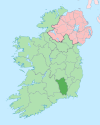
Cratloe is a village in County Clare, Ireland, situated between Limerick and Shannon in the mid-west of Ireland. It is possible that the name derives from Croit-shliabh meaning "hump-backed hill", referring to Woodcock Hill. The present-day parish of Cratloe consists of the former parish of Kilfintinan and a portion of the contemporary parish of Killeely. This was agreed upon by priests in the 18th century, who claimed there were not enough members of the clergy to operate fully in both parishes.

Inchinnan is a small village in Renfrewshire, Scotland. The village is located on the main A8 road between Renfrew and Greenock, just south east of the town of Erskine.

Straffan is a village in County Kildare, Ireland, situated on the banks of the River Liffey, 25 km upstream of the Irish capital Dublin. As of the 2016 census, the village had a population of 853, a nearly two-fold increase since the 2006 census.

Bailieborough or Bailieboro is a town in County Cavan, Ireland. As of 2016, its population was 2,683, up from 1,529 as of the 1996 census. Bailieborough's proximity to the N3 national road has made it a commuter town.

Dunloy is a village and townland in County Antrim, Northern Ireland. It is located 11 miles (18 km) north of Ballymena and 6 miles (10 km) north-west is Ballymoney. It is located in the civil parish of Finvoy, in the former barony of Kilconway. The village had a population of 1,194 people in the 2011 Census.

Newcastle is a village in County Wicklow, Ireland. It is situated on the R761 and is about 45 km (28 mi) south of Dublin city. Newcastle had a population of 924 as of the 2016 census. The ancient barony of Newcastle, which surrounds the village, takes its name from the village and its Norman castle.

Kesh is a village in County Fermanagh, Northern Ireland. It is on the Kesh River about 1 mile (1.6 km) from Lower Lough Erne. The 2021 Census recorded a population of 1,092 people. It is within Fermanagh and Omagh district.

Lambeg is a small village and civil parish in County Antrim, Northern Ireland. Located between Belfast and Lisburn, it was once a small rural village, but is now within the Greater Belfast conurbation. Lambeg is also an electoral ward of Lisburn Council. In the 2001 Census it had a population of 60 people. The civil parish of Lambeg covers areas of County Down as well as County Antrim.

Rolestown, or Rowlestown, is a small village six miles (10 km) north-west of Swords along the R125 in Fingal, Ireland. It lies about halfway between Swords and Ashbourne. It is located around two parallel roads intersected by a road that crosses the Broadmeadow River by an old cut stone bridge. Rolestown is also a parish in the Fingal North deanery of the Roman Catholic Archdiocese of Dublin.

Mooncoin is a census town in County Kilkenny, in Ireland. The population was 1,175 in 2016. Historically part of the Gaelic kingdom of Osraige, today it is in the far south of the county of Kilkenny, located in the valley of the River Suir. It is surrounded by the uplands of the Slievenamon and Comeragh Mountains, just 10 kilometres (6.2 mi) north of Waterford City along the N24 national primary road, and it is 48 kilometres (30 mi) south of Kilkenny.

Mullinavat is a town in south County Kilkenny, Ireland. Its main industries are tourism and agriculture. It has a renowned sporting history, particularly in hurling. The town's name in Irish translates as 'The Mill of the Stick' which, according to local tradition, may refer to a mill which could only be approached by means of a rough stick over the Glendonnel River; today that bridge is located on the main road beside the Garda Barracks.

Lecropt is a rural parish lying to the west of Bridge of Allan, Scotland.

Ballylooby is a village in County Tipperary in Ireland. It is in the barony of Iffa and Offa West, and is also a parish in the Roman Catholic Diocese of Waterford and Lismore.
Carrigeen is a village to the south-east of Mooncoin in County Kilkenny, Ireland. Carrigeen is situated on a hillock within the Suir Valley, contains St. Kevin's Church and belongs to the parish of Mooncoin. There is a primary school and a GAA club in Carrigeen.
Priorswood is a townland and district in northern Coolock, on the Northside of Dublin, Ireland. It is in the jurisdiction of Dublin City Council and forms part of the Dublin 17 postal district.

Killyclogher is a village on the outskirts of the town of Omagh, County Tyrone, Northern Ireland. It is also a townland and an electoral ward of Omagh & Fermanagh District Council. According to the 2001 census, it had a population approaching 3000

Minane Bridge is a village in County Cork, Ireland. It is in the townland of Minane, 20 km south of Cork city and 5 km south of Carrigaline. The local church is Sacred Heart Church of Tracton Abbey Parish. Minane Bridge is part of the Dáil constituency of Cork South-Central.

Cullyleenan is a townland in the Parish of Tomregan, Barony of Tullyhaw, County Cavan, Ireland.
St. Patrick's, or Kilquane, is a civil parish that is situated on both banks of the River Shannon near the city of Limerick in Ireland. It is unusual in that it is distributed over three baronies: Bunratty Lower, Clanwilliam and the barony of the City of Limerick. Besides the suburbs of the city, it also contains the villages of Ardnacrusha and Parteen. It is known for the Ardnacrusha power plant, a major hydroelectric plant.
Clonsilla or "Clonsillagh" is a civil parish and a townland located in the south-western corner of the modern county of Fingal, Ireland. The civil parish is part of the ancient barony of Castleknock. It is centred on the suburban village of Clonsilla. In geology, the parish rests on a substratum of limestone and comprises 2943 statute acres, the whole of which is arable land. It is roughly bounded to the north by the old "Navan Road" – the modern N3; to the east by the civil parish of Castleknock; to the south by the River Liffey; to the south-east by the civil parish of Leixlip, chiefly in County Kildare, and to the north-west by the civil parish of Dunboyne in County Meath.