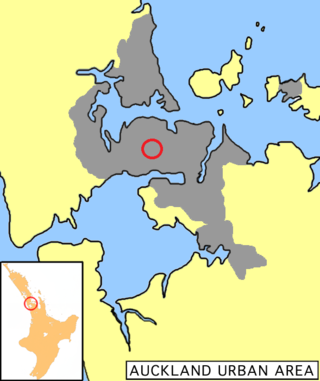
Kingsland is an inner-city suburb of Auckland, the largest and most populous urban area in New Zealand.[3] Kingsland is under the local governance of the Auckland Council. It is the home of Eden Park, New Zealand's largest stadium, which hosted the finals for the 2011 Rugby World Cup. Kingsland has a village centre that contains a series of shops, restaurants, pubs and monthly markets.
Kingsland was established in the 1880s with the sale of allotments; the buildings predominantly date from the Edwardian and the interwar periods.New North Road is the main thoroughfare in Kingsland, running northeast–southwest from the Auckland Central Business District (CBD), with the suburb running along the ridge line. Kingsland's main street is located on New North Road next to the Kingsland railway station and directly across from Eden Park.
History
Plan of Kingsland, New North Road, for sale by auction on Monday 30 March 1885Kingsland cricket ground in flood in 1907 (present-day location of Eden Park)Eden Park Stadium as seen from the summit of Mount Eden.
Much of the Kingsland area was originally swampland, and known to Tāmaki Māori as Ngā Anawai, referring to the water-filled lava-flow caves that formed in the area. The lava caves were created by Maungawhau / Mount Eden and Mount Albert over 30,000 years ago.[4][5]
The origins of Kingsland are linked to the European settlement of Auckland. In 1835, Thomas Mitchell, a Sydney trader, purchased land from Āpihai Te Kawau, rangatira (chief) of the local Māori tribe, Ngāti Whātua, for £160, in a transaction which the Lands Claim Commission later disallowed. In 1841, Te Kawau gifted 3,000 acres (1,200ha) to the colonial government and Auckland began to take shape as a city.[6] Land continued to be bought and sold, and in 1852 John McElwain purchased 55 acres (22ha) for the purpose of farming and received the adjoining 60 acres (24ha) from his brother George in what is present-day Kingsland.[6] Cabbage Tree Swamp Road was one of the original streets in the area, but the settlers of Mt Albert, Morningside and Kingsland appealed for a change of name, and it became Kingsland Road in 1877.[6][7]
The terrain of the area was rough, meaning the area saw slower development compared to other parts of the Auckland isthmus.[8] In the 1860s, New North Road was established as road access for the area and as an alternative to the Great North Road to the north.[9] In October 1866, the Mt Albert District Highway Board, the first local government in the area, was formed to administer New North Road and surrounding areas.[9] A tollbooth in modern-day Kingsland was established on the corner of New North Road and Cabbage Tree Swamp Road (modern-day Sandringham Road), which operated from 1875 until 1888.[10]
Kingsland railway station opened on 29 March 1880, spurring suburban growth in the area.[10] The city of Auckland experienced significant growth in population in the latter 19th century, putting pressure on the areas closest to the city. That population growth combined with the establishment of rail and bus connections into the city by the early 1880s created excellent conditions for John McElwain to subdivide his farm.[11] In 1882, 227 allotments were laid out. Kingsland Avenue — along with First, Second, Third and Fourth Avenues — provided road access to the properties. Prices for sections in the subdivision ranged from £28 to £100.[12] In addition to McElwain's Kingsland Estate, other suburban housing estates developed in the Kingsland area, including the Randersvyl Estate and Roganville.[7]
A second wave of growth occurred in the early 1900s, then the Auckland tramline reached Kingsland in 1903.[13] The community was centred around Arthur W. Page's general store on New North Road,[7] which was soon joined by multiple new shops.[13] New housing estates including Hirstleigh, Leith Hall and Melvia subdivided more land around Kingsland into suburban homes,[13] and by the 1910s ingsland had developed into a working class commuter suburb of Auckland.[14]
A. W. Page and his brother, builder Charles H. Page, extended his store in 1913 and 1914, and constructed the Portland Building.[15] A new post office was built in Kingsland in 1912, joined by St George's Anglican Church in 1913 and a cinema, the Theatre Royal, in 1915.[15]Eden Park became a major sporting venue for cricket and rugby in the 1910s and 1920s, but was plagued by regular drainage issues.[4]
In 1938, 84 residents of Kingsland launched an unsuccessful petition to change the suburb's name to Beverly Hills, citing the poor reputation of the name Kingsland.[16]
The Kingsland commercial village flourished in the 1950s and 1960s,[17] and by the 1970s the suburb had becoming a centre for Urban Māori and Pasifika communities, due to the gentrification of the inner city suburbs close to the Auckland city centre.[18] During this period, Kingsland became one of the densest populated suburbs in Auckland, known for overcrowded houses in disrepair.[19] The Northwestern Motorway was cut through in the 1970s, severing the cross streets that linked Kingsland to Surrey Crescent and Arch Hill, leaving Bond St as the sole direct connection to these suburbs.[citation needed] In 1997, Kog Transmissions, a large recording studio and independent label for New Zealand musicians, was established in the suburb.[20] Musicians including Concord Dawn, P-Money and Pitch Black recorded material here, until the studio moved to a new premises in 2010.[20][21]
Kingsland underwent major urban revitalisation in the early 2000s and again in the early 2010s, when Eden Park and the Kingsland railway station were upgraded for the 2011 Rugby World Cup.[20][4]
Demographics
The statistical area of Kingsland, which includes part of Eden Terrace, covers 0.77km2 (0.30sqmi)[1] and had an estimated population of 3,410 as of June 2023,[2] with a population density of 4,429 people per km2.
Kingsland had a population of 3,372 at the 2018 New Zealand census, an increase of 156 people (4.9%) since the 2013 census, and an increase of 405 people (13.7%) since the 2006 census. There were 1,131 households, comprising 1,683 males and 1,686 females, giving a sex ratio of 1.0 males per female. The median age was 31.4 years (compared with 37.4 years nationally), with 423 people (12.5%) aged under 15 years, 1,119 (33.2%) aged 15 to 29, 1,680 (49.8%) aged 30 to 64, and 150 (4.4%) aged 65 or older.
Ethnicities were 76.2% European/Pākehā, 10.9% Māori, 13.6% Pacific peoples, 10.3% Asian, and 3.4% other ethnicities. People may identify with more than one ethnicity.
The percentage of people born overseas was 29.6, compared with 27.1% nationally.
Although some people chose not to answer the census's question about religious affiliation, 61.7% had no religion, 26.2% were Christian, 0.4% had Māori religious beliefs, 1.7% were Hindu, 0.7% were Muslim, 1.2% were Buddhist and 3.3% had other religions.
Of those at least 15 years old, 1,455 (49.3%) people had a bachelor's or higher degree, and 168 (5.7%) people had no formal qualifications. The median income was $49,700, compared with $31,800 nationally. 921 people (31.2%) earned over $70,000 compared to 17.2% nationally. The employment status of those at least 15 was that 2,001 (67.9%) people were employed full-time, 402 (13.6%) were part-time, and 90 (3.1%) were unemployed.[22]
Politics
In October 1866, the Mt Albert District Highway Board, the first local government in the area, was formed to administer New North Road and the surrounding areas.[9] In 1911, the board became the Mount Albert Borough, who elected a mayor.[14] In 1978, Mount Albert became a city,[23] and in 1989 it was absorbed into Auckland City.[24] In November 2010, all cities and districts of the Auckland Region were amalgamated into a single body, governed by the Auckland Council.[25]
Eden Park is New Zealand's largest stadium with a capacity of 50,000 seats. Every year it hosts almost half a million local and international sports fans and patrons who attend matches and functions at the park.[27]
The park underwent a $240 million, three-year redevelopment prior to the 2011 Rugby World Cup. Including a temporary expansion to 60,000 seats and the addition of four giant Māori carvings at each of the four main public entrances. The carvings represent Tāne-mahuta, the spirit of the forest; Rongo, the god of peace; Tūmatauenga, the god of war; and Tāwhirimātea, the god of wind. The carvings were designed by Ngāti Whātua carver, Arekatera Maihi.[28]
Arekatera Maihi at Taipei Book Exhibit, Feb 2015
Eden Park was located at the low point of Cabbage Tree Swamp, with the road running on a causeway across it. Eden Park has been used as a sports ground since 1900, and by 1914 the ground was drained and turned into two ovals for cricket.[29] Eden Park has been the home of Auckland Cricket since 1910 and Auckland Rugby since 1925. Its 100-year history boasts some of New Zealand's proudest sporting moments, including the 1950 Empire Games, the inaugural 1987 Rugby World Cup, and the 1992 Cricket World Cup. Since the early 1900s it has hosted major rugby and cricket matches, and is now a regular host of the Bledisloe Cup, ITM Cup, and the Super Rugby games. Most recently, Eden Park hosted the finals for the 2011 Rugby World Cup and it has been named the co-host for 2015 Cricket World Cup.[27]
Notable buildings
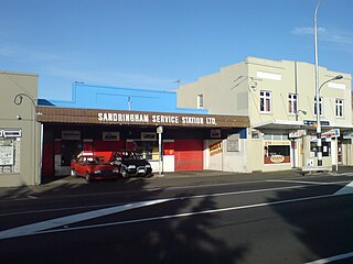
Many of Kingsland's older buildings have survived by adapting to contemporary uses.
Shooters Bar (330 New North Road) — The original building was built in the 1910-1920's area, as two independent buildings which later were joined. Over the course of its usage it has been an established shoe shop, an office building and a function venue. It is located in prime position located next to the old kiwi bacon factory, today Fairfax media. The buildings, in most recent years has been home to one of Auckland's more unique function venues and has had major modifications including a large deck with a retractable roof. The heritage and significance of the building has been maintained and renovated alike, though through the years it has survived by adapting to multiple usages, with an attempt being made, fortunately, to maintain the historical significance of the building and keep its presence today.[30]
Trinity Methodist Church & Jubilee Hall (400 New North Road) — The existing timber church was built in 1897 and the Jubilee Hall replaced an old timber church on the Sunday School site in 1909. The church has memorial windows commemorating local men who died in the First and Second World Wars.[30]
Windsor Dairy Buildings (434–442 New North Road) — Built as two separate buildings between 1900 and 1910, a unifying facade was applied in 1940.[30]
Public Amenity Building (448 New North Road) — Built in 1928 the Kingsland public toilets are a fine example of Art Deco style. The public toilets and a pedestrian overbridge were constructed after several fatalities at the station.[30]
Pages Buildings and Grain Store (460–470 New North Road) — The first Pages Stores were built in the late 1880s. Handy to the rail and later a major tram stop, these businesses provided goods, grain and fodder to local farmers. The Grain Store buildings date from 1900–14.[30]
Kingsland Post Office (478 New North Road) — Described as a typical government architect suburban Post Office type, this 1911 building blends Edwardian Classical Revival style and Arts and Crafts elements and was designed by architect John Campbell. The Post Office remained in use until 1989.[30]
Theatre Royal (486 New North Road) — Built in 1915, the Theatre Royal was one of a number of new suburban theatres built around Auckland at a similar time to serve the entertainment needs of the fast-growing area around Kingsland. It closed as a cinema in 1978 and was refurbished in 1996 for its present use as a retail establishment.[30]
Kingsland Fire Station (516 New North Road) — Now privately owned, the Fire Station was built in 1933 in a Georgian Revival style, replacing an original timber station with a watch tower built in 1906.[30] The building was later repurposed for residential purpose and renovated for season 8 of The Block NZ.
Mrs R Scott, Draper (477 New North Road) — Built in the early 1890s, the building was occupied by Mrs Rachael Scott, a draper, from around 1901 up until 1925–26. In 1970, the Kingsland Drapery Ltd was still operating from the building. By 1985 was being used a food business and it is now a restaurant- Canton Café.[30]
Portland Buildings (463–475 New North Road) — The Portland Buildings were constructed in 1914 on an empty site defining the corner of Central Road. Built for Arthur Page, it is named after the ship that brought the Page family to New Zealand.[30]
Street art
NETCH Street Art — Located on the corner New North Rd and Morningside Drive, it was created by the artists Stray, Vent, Askew, Shake, Misery and Berst over a period of three weeks in September 2009.[31]
Kingsland Light Show — Every Thursday night during the Rugby World Cup 2011, the old, distinctive Post Office in Kingsland came to life an hour after sunset with a building projection light show of Kiwiana images and scenes from Kingsland's past and present.[32]
Local culture
Events and markets
Vintage and Craft Markets — Kingsland is the host to several popular craft and vintage markets that occur on a monthly basis.
Kingsland Festival — This annual autumn festival is organised by the Kingsland Business Society and the neighbourhood of Kingsland. The festival involves a kids' zone, a craft market, street performers, and nightly entertainment.
Local personalities
Herbs — a Pacific reggae band that formed in 1979 and produced a stream of reggae hits and 10 top-20 hits in the early 1990s. Herbs call Ponsonby their home, but their base of operations was set in Kingsland.[33]
John McElwain — Kingsland's first land developer, was born in County Louth, Ireland in 1821 and died in Auckland at the age of 95 in 1916. Impatient to see the hill-climb to his property reduced in grade, he subdivided in 1882. Later work by the Highway Board improved New North Road by cutting down three feet from McElwain's Hill between Kingsland and Morningside.[6]
Pat Kraus — a musician and synthesizer-builder who records and performs in Kingsland as Kraus.[34]
Transportation
Public transportation extended from the inner city to the surrounding areas in the late 1870s and early 1880s with horse-drawn buses being the first mode of regular public transportation in the late 1870s.[35] In 1880, the long-awaited railway came, connecting Newmarket with Helensville with stops in Mt Eden, Kingsland, Morningside and Mt Albert.[36] At the beginning of the 20th century, trams began connecting Mt Eden, Balmoral, Kingsland and Mt Albert with the city. The trams ran for the last time in the 1950s.[37]
Kingsland is well-served by trains and buses, and is only 5km from Auckland's CBD.[38] The train station is right in the heart of Kingsland village, and trains run regularly into the city and the western suburbs beyond.
The centre of the shopping and business activities in Kingsland is New North Road. By vehicle Kingsland can be accessed from the North Western Motorway (SH16) by taking the St Lukes off-ramp or from the CBD via Bond Street and Great North Road.
Dunsford, Deborah (2016). Mt Albert Then and Now: a History of Mt Albert, Morningside, Kingsland, St Lukes, Sandringham and Owairaka. Auckland: Mount Albert Historical Society. ISBN978-0-473-36016-0. OCLC964695277. WikidataQ117189974.
Related Research Articles
Mount Eden is a suburb in Auckland, New Zealand whose name honours George Eden, 1st Earl of Auckland. It is 4 kilometres (2.5 mi) south of the Central Business District (CBD). Mt Eden Road winds its way around the side of Mount Eden Domain and continues to weave back and forth as it descends into the valley; it runs south from Eden Terrace to Three Kings. Mt Eden village centre is located roughly between Valley Road and Grange Road. The domain is accessible on foot from many of the surrounding streets, and by vehicle from Mt Eden Road. The central focus of the suburb is Maungawhau / Mount Eden, a dormant volcano whose summit is the highest natural point on the Auckland isthmus.
Mount Albert is an inner suburb of Auckland, New Zealand, which is centred on Ōwairaka / Mount Albert, a local volcanic peak which dominates the landscape. By 1911, growth in the area had increased to the point where Mount Albert was declared an independent borough, which was later absorbed into Auckland. The suburb is located 7 kilometres (4.3 mi) to the southwest of the Auckland City Centre.
Mount Roskill is a suburban area in the city of Auckland, New Zealand. It is named for the volcanic peak Puketāpapa.
Western Springs is a residential suburb in the city of Auckland in the north of New Zealand. It is located four kilometres to the west of the city centre, Auckland CBD. The park is situated to the north of State Highway 16 and the residential suburb is located southeast of the park on the opposite side of State Highway 16.
Morningside is a suburb of Auckland, New Zealand. It lies four kilometres south-west of the city centre, close to Eden Park and Western Springs Reserve.
Sandringham is a suburb of Auckland, New Zealand. It is a multi-ethnic suburb with a population of over 12,000.
Ōwairaka is a suburb of New Zealand's largest city, Auckland. It is under the local governance of the Auckland Council. The area was primarily rural until the 1930s, when the area experienced suburban growth. Ōwairaka is known for the Owairaka Athletic Club, a club that came to prominence in the 1960s, due to the success of coach Arthur Lydiard and athletes Murray Halberg and Peter Snell.
Fowlds Park is a small public reserve in the northern part of Mount Albert, in Auckland City.
Dominion Road is an arterial road in Auckland, New Zealand, running north–south across most of the Auckland isthmus. It is a major public transport route that carries 50,000 bus passengers each week, making it one of the few roads in Auckland on which similar or greater numbers of people travel by public transport than by private car.
Ōwairaka / Mount Albert, also known as Te Ahi-kā-a-Rakataura, is a volcanic peak and Tūpuna Maunga which dominates the landscape of the Ōwairaka and Mount Albert suburbs of Auckland.
Eden Valley is an inner-city suburb of Auckland, the largest and most populous urban area in New Zealand. The suburb grew around Dominion Road, one of the Auckland's main arterial routes. Eden Valley's commercial hub is made up of a collection of businesses, shops, and dining options that service the area. The eclectic collection of shop fronts and signage on Dominion Road has aptly been described as, "colour and chaos". The "colour and chaos" of the commercial hub is strongly contrasted by the surrounding residential area. Eden Valley is characterized by heritage buildings that house modern day businesses, a residential area that has a range of late Victorian, Edwardian and transitional bay villas, and basalt and scoria stone walls that give the area a long established feel.
Edward George Bollard was a New Zealand plant physiologist and science administrator.
Albert-Eden is a local government area in Auckland, in New Zealand's Auckland Region. It is governed by the Albert-Eden Local Board and Auckland Council, and is located within the council's Albert-Eden-Puketāpapa Ward.
Western Springs Reserve, also known as Western Springs Lakeside Te Wai Ōrea, consists of a sanctuary for wildlife, surrounding a lake fed by the natural springs. There are walking paths surrounding the lake with bridges going across sections of it. Auckland Zoo, Museum of Transport & Technology and Western Springs Stadium are all situated around the park.
Kōwhai Intermediate School is a state co-educational intermediate school located in the suburb of Kingsland in Auckland, New Zealand. The school opened in October 1922, and was the first intermediate school in New Zealand.
New North Road is a street in the central and western Auckland isthmus, New Zealand, connecting Upper Symonds Street in Eden Terrace to Avondale. The road runs parallel to Great North Road, located to the north, and crosses Dominion Road, the Western Line at Morningside and runs above the Waterview Tunnel section of the Southwestern Motorway at Mount Albert.
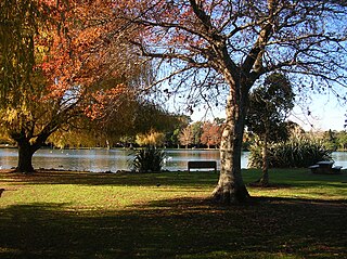
Gribblehirst Park is a park in central Auckland, New Zealand, close to the suburbs of Sandringham and Morningside. Originally the park was known as Cabbage Tree Swamp.
Ferndale House is a 19th-century house in Mount Albert, Auckland, New Zealand, which is listed by Heritage New Zealand as a Category II structure. The house was built in the 1860s for the Garlick family, major figures in the Methodist community in Mount Albert, later becoming a hub for the Plunket Society in the 1940s and a community centre.
Alberton is a 19th-century house in Mount Albert, Auckland, New Zealand, which is listed by Heritage New Zealand as a Category I structure. The house was built in the 1860s for the Garlick family, major figures in the Methodist community in Mount Albert, later becoming a hub for the Plunket Society in the 1940s and a community centre.
St Lukes is a suburb of New Zealand's largest city, Auckland. It is under the local governance of the Auckland Council. After Westfield St Lukes opened in 1972, the area developed into a major commercial area of the Auckland isthmus.
↑ Stone, R. J.C (1973). Makers of Fortune: A Colonial Business Community and its Fall. Auckland University Press. p.119.
↑ "Visiting Kingsland". History & Heritage. Kingsland Business Society Incorporated 2011. Archived from the original on 6 February 2013. Retrieved 25 October 2012.
This page is based on this Wikipedia article Text is available under the CC BY-SA 4.0 license; additional terms may apply. Images, videos and audio are available under their respective licenses.