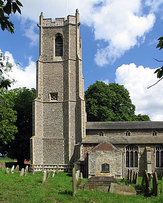
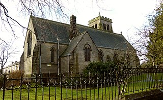
Barton Turf is a village and civil parish in the English county of Norfolk. It is 20 km north-east of the city of Norwich, on the northwestern edge of Barton Broad, the second largest of the Norfolk Broads. In primary local government the area is in the district of North Norfolk.

Stewkley is a village and civil parish in Buckinghamshire, England. The village is about 5 miles (8 km) east of Winslow and about 4 miles (6 km) west of Leighton Buzzard. The civil parish includes the hamlets of North End and Stewkley Dean.
Esh is a village and civil parish situated around five miles north-west of Durham in County Durham, England. The central area of the village contains a stone cross, which probably replaced a former market cross. This is locally known as St Cuthberts Cross and bears the inscription I. H. S., and the date 1687. Esh is a rural village, nestled between a number of working farms; it has two primary schools, a pub and two churches, St Michael and All Angels and St. Michael's.
Bugbrooke is a village and civil parish in West Northamptonshire, England, on a ridge overlooking the valley of the River Nene.
Atworth is a village and civil parish in west Wiltshire, England. The village is on the A365 road between Melksham and Box, about 2.5 miles (4 km) northwest of Melksham and 4 miles (6 km) northeast of Bradford on Avon. The hamlet of Purlpit lies east of Atworth village, and in the south of the parish are the small village of Great Chalfield and the hamlet of Little Chalfield.

Bassingham is a village and civil parish in the North Kesteven district of Lincolnshire, England. The population of the civil parish at the 2011 census was 1,425. The village is situated approximately 8 miles (13 km) south-west of Lincoln.

Billinghay is a village and civil parish in the North Kesteven district of Lincolnshire, England. The village is situated approximately 7 miles (11 km) north-east from Sleaford, and lies on the B1189 Walcott road near its junction with the A153. Just south of the village towards Sleaford is North Kyme. According to the 2001 census the parish had a population of 1,808, increasinging to 2,190 at the 2011 census, increasinging to 2,203 at the 2021 census.

Bodenham is a village and civil parish in Herefordshire, England, and on a bend in the River Lugg, about seven miles south of Leominster. According to the 2001 census, it had a population of 1,024, reducing to 998 at the 2011 census.

The Diocese of Hereford is a Church of England diocese based in Hereford, covering Herefordshire, southern Shropshire and a few parishes within Worcestershire in England, and a few parishes within Powys and Monmouthshire in Wales. The cathedral is Hereford Cathedral and the bishop is the Bishop of Hereford. The diocese is one of the oldest in England and is part of the Province of Canterbury.
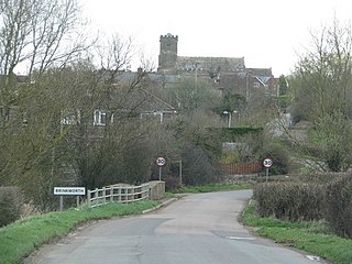
Brinkworth is a village and civil parish in northern Wiltshire, England. The village lies between Royal Wootton Bassett and Malmesbury, about 1 mile (1.6 km) north of the M4 motorway and 9 miles (14 km) west of Swindon.

Urchfont is a rural village and civil parish in the southwest of the Vale of Pewsey and north of Salisbury Plain in Wiltshire, England, about 3+1⁄2 miles (6 km) southeast of the market town of Devizes. The hamlet of Cuckoo's Corner is in the northwest of the village; the parish includes the hamlets of Wedhampton and Lydeway. The population of the parish at the 2011 census was 1,075.

Stockland is a village and civil parish in Devon, close to the Somerset boundary. The parish is surrounded clockwise from the north by the parishes of Yarcombe, Membury, Dalwood, Widworthy, Offwell, Cotleigh and Upottery. Its nearest neighbouring towns are Honiton and Axminster, which are 6 miles (10 km) and 5 miles (8 km) away respectively. It has a population of around 600. The village is placed within the Blackdown Hills Area of Outstanding Natural Beauty. The Stockland parish had historically been an exclave of Dorset until the Counties Act 1844.

Weyhill is a village, 2.5 miles (3.8 km) west of Andover, Hampshire. It sits within the civil parish of Penton Grafton, which includes the village of the same name. The village is famous for having a medieval fair and then later a livestock fair, with up to 100,000 sheep a day being auctioned. The fair owed its existence to Weyhill being positioned on 8 ancient trackways, including the Harrow Way.
Beckwithshaw is a village and civil parish in the Harrogate district of North Yorkshire, England about 2.5 miles (4 km) south-west of Harrogate.
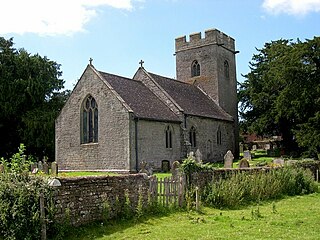
Thruxton is a small rural village and civil parish in Herefordshire, England. It is located within the historic area of Archenfield, near the Welsh border and the city of Hereford. The village lies west of the A465 road and just south of the B4348 road between Kingstone and Much Dewchurch.

Stokenham is a village and civil parish in the South Hams district, in the county of Devon, England. The population of the parish at the 2011 census was 1,895.
Kingstone is a village and civil parish within the English county of Staffordshire.

Ponsanooth is a village and civil parish in Cornwall, England, United Kingdom. It is about four miles southeast of Redruth and two and a half miles northwest of Penryn on the A393 road Redruth to Falmouth road. In 2019 it had an estimated population of 1184.

Clyst Honiton is an English village and civil parish five miles from Exeter in the East Devon district, in the county of Devon. The church is St Michael and All Angels. Exeter International Airport which opened in 1938 is located on the outskirts of the village. The village was originally on the main A30 road from Exeter to Honiton but was bypassed in the 1990s. Another bypass to the east of the village linking the A30 to the new developments around Cranbrook opened in October 2013.

