Kirundo was one of the eighteen provinces of Burundi, in north of the country bordering Rwanda. In 2025, it was merged into the new province of Butanyerera.[1]
The economy was mostly based on agriculture, with a dispersed population and few sizable communities. Before 1970 large parts of the province were forested. Migrants from the south then cleared much of the vegetation to create agricultural land, and Kirundo became the breadbasket of Burundi. The civil war from 1993 to 2005 caused agricultural output to drop by more than half. Afterwards, lack of farm inputs, poor infrastructure and shortages of water caused widespread poverty.
Geography
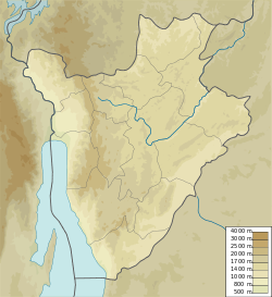
Kirundo Province was in the north of Burundi, bounded to the north and west by Rwanda. It was bounded to the southwest by Ngozi Province, and to the south and east by Muyinga Province. It had an area of 1,703.34 square kilometres (657.66sqmi), or 6.1% of the area of Burundi, making it the 8th largest province at the time.[2]
Bugesera natural region
88% of the province was in the Bugesera natural region.[2] This is a vast batholithic depression carved out of granite rocks.[3] The central plateau has an altitude of 1,500 to 2,000 metres (4,900 to 6,600ft), and the north is lower, with an average altitude of 1,300 metres (4,300ft).[2] The Bugesera region is part of the Kirundo district, a depression in the inter-lacustrine zone of East Africa that extends across northeastern Burundi and southeastern Rwanda. It is bounded to the west by the Kanyaru River valley. To the north, east and south it was bounded by dissected plateaus that rise above it. The depression contains large valleys holding Holocene sediments, swamps and shallow lakes.[4]
Bweru natural region
12% of the province was in the Bweru natural region, including the Commune of Vumbi and the south of the Commune of Gitobe.[2] The Bweru natural region in the south of the province is mountainous.[5] The region is known for its agricultural fertility.[3]
Lakes
Kirundo Province had eight lakes: Rweru, Cohoha, Rwihinda, Kanzigiri, Gacamirindi, Nagitamo, Narungazi and Mwungere.[6] The lakes are marshy, with an average depth of 2.5 to 5 metres (8ft 2in to 16ft 5in). All eight lakes are important bird habitats, with 60 species identified in Lake Rwihinda alone. They provide a variety of fish to the surrounding populations. The wetlands leading out of and into many of the lakes are irrigated for rice and sugar cane fields, and the surrounding hillsides are developed for diverse agricultural production.[7] Wetlands include Rugamura Marsh, Kabuyenge Marsh and Nyavyamo Marsh.[8]Nyamabuno Marsh (marais de Nyamabuno).
Conservation
The Lacs du Nord Aquatic Landscape Protected Area was created in 2006, in theory conserving over 30,000 hectares (74,000 acres), or 14.2 of Burundi's interior waters, up from 0.2%. The stated goals are integrated community management, agricultural production, and lake conservation. The protected aquatic landscape integrates the integrated Natural Reserve of Murehe; the managed Reserves of Lake Rwihinda, Lake Rweru and Lake Cohoha; and the integrated protected zones of Lakes Gacamirinda, Mwungere, Nagitamo, and Kanzigiri.[7] In October 2023 the Inades-Formation Burundi held a workshop on water resource management with local leaders in the capital of Kirundo Province to celebrate World Food Day. It was noted that although the 2012 water code encouraged good practices and penalized violations, some of the lakes still suffered from pollution and unsustainable illegal fishing.[9]
The province experienced the same wet and dry seasons as the rest of Burundi. The southeasterly monsoon brings rain in February–May, and the northeasterly monsoon brings rain in September–November.[4] Natural vegetation includes shrubs, savanna and marshland, important for its value in groundwater storage. Expansion of farmland continues to damage this vegetation and the forest plantations.[11] The Bugesera natural region has temperatures that vary from 14.8 to 27.1°C (58.6 to 80.8°F), with average annual rainfall of 800 to 1,200 millimetres (31 to 47in).[2] The Bweru natural region has a slightly different climate from Bugesera natural region, with rainfall over 1,200 millimetres (47in) annually, and a shorter dry season lasting 5 to 6 months.[5]
Name
Kirundo Province was formerly called Muharuro. During battles between the Rwandans and Barundi in Muharuro in 1763 at Mount Shinge and Mount Rugero, near the provincial capital, the Rwandans were decisively defeated through tactics of the troops of King Mutaga Senyamwiza. The province took its current name of Kirundo (pile) from the piles of corpses of Rwandans killed there in the battle.[12]
Kirundo Province was divided administratively into the communes of Bugabira, Busoni, Bwambarangwe, Gitobe, Kirundo, Ntega and Vumbi. These in turn were divided into 193 collines.[5] Each commune was headed by an administrator. The population was scattered, and the small city of Kirundo is the only urban settlement.[11] Kirundo Province had one of the higher rates of population growth in Burundi.[7] In 2008, when the last census was taken, the commune populations and areas were:[13][14]
The province was divided into four health districts (French: Districts Sanitaires):
Health district
Communes
Kirundo
Kirundo and Bugabira
Vumbi
Ntega and Vumbi-Bukuba
Busoni
Busoni
Mukenke
Gitobe and Bwambarangwe
There were hospitals in the Kirundo and Mukenke health districts, and health centers (French: Centres de Santé), CDSs, distributed throughout the health districts. Most health centers are public (French: Centres de Santé Public), but some are run by religious organizations (French: Centres de Santé Confessional).[15]
Governors
The governor of the province must be Burundian and must live in Kirundo or come from Kirundo. The governor is appointed by the President of Burundi after confirmation by the Senate.[16] A partial list of governors of the province:
Until 1970 some of the communes of Kirundo province had few people and were covered in forest. Then migrants from Ngozi and Kayanza came to the province and cleared the forests to create arable land.[6] Farmers in Kirundo province produced goods for sale in the markets.[20] Kirundo was the "breadbasket of Burundi" and supplied agricultural products such as cereals and legumes to the rest of the country before the Burundian Civil War of 1993–2005.[21]
The Burundi Tobacco Company (BTC) was founded in 1979 by Tribert Rujugiro Ayabatwa.[22][23] In 1982 it made an agreement with farmers in Cibitoke Province and Kirundo Province to supply seed, fertilizer, pesticides, crop extension services, drying and processing, and to buy their tobacco at a price agreed upon in advance.[24] The result was rapid growth in the number of tobacco farmers and the quantity produced.[25] In the 1980s, BTC started to clear large areas of forest to supply wood to the ovens used to dry tobacco, but did not undertake reforestation.[6]
Between 1996 and 2009, agricultural output dropped by 53.9%. Poverty has increased and there are high levels of malnutrition.[21] The farmers have turned to farming for consumption by the family. Reasons for this change include inadequate labor, agricultural equipment and agricultural inputs, poor protection of the soil, persistent conflicts over land ownership and lack of microcredit.[20] The poor roads also contribute to the high levels of poverty in the province. In 2008 the OPEC Fund for International Development announced a project to build a paved road running 37 kilometres (23mi) from the city of Kirundo to Gasenyi and the border with Rwanda. The project would also includes upgrades to feeder roads and social infrastructure.[26]
In November 2021 Cyriaque Nshimirimana, Second Deputy-Speaker of the Senate of Burundi, met leaders of the province in the capital of the Commune of Ntega. His audience included heads of provincial and municipal services, colline chiefs, leaders of the Sangwe cooperatives and religious leaders. He urged them to preserve peace and security, fight drunkenness, polygamy, unwanted pregnancies and corruption, limit births, send their children to school, continue to build the offices of colline chiefs and join cooperatives to accomplish development projects together. He advised the leaders of cooperatives to be fiscally prudent and transparent. Concerns raised by the audience included the need to repair the Rurata–Ntega road, the lack of teachers and teaching materials in the vocational schools, and the lack of a regional branch of the Banque d’Investissement pour les Jeunes (Investment Bank for Youth).[27]
Minani, Bonaventure; Rurema, Déo-Guide; Lebailly, Philippe (2013b), "Rural resilience and the role of social capital among farmers in Kirundo province, Northern Burundi", APSTRACT: Applied Studies in Agribusiness and Commerce, AGRIMBA, 7 (2–3): 1–5, doi:10.22004/ag.econ.164817
This page is based on this Wikipedia article Text is available under the CC BY-SA 4.0 license; additional terms may apply. Images, videos and audio are available under their respective licenses.