
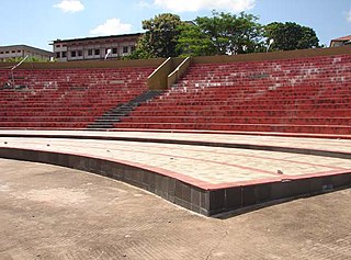
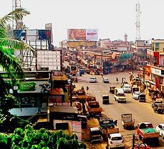
Manjeri is a major town and municipality in Malappuram district, Kerala, India. It is the fourth-most populous municipality in state. It is situated 23 kilometres (14 mi) southeast to Karipur International Airport and 13 kilometres (8.1 mi) northeast to Malappuram, the district headquarters, and forms a part of Malappuram metropolitan area. It is one of the major commercial towns under the Malappuram urban agglomeration and serves as the headquarters of Eranad Taluk. Manjeri Municipality is a Local Self Government Institution with a jurisdiction of three villages namely Manjeri, Payyanad, and Narukara.
Mavilayi is a census town in Kannur district in the Indian state of Kerala. Situated in Peralasseri Panchayath on Kannur-Kuthuparamba State Highway, 15 km away from Kannur Town.

Mankada is a hillside village in the Malappuram district of Kerala state. It is located 15 km (9.3 mi) from Malappuram and is part of the Malappuram parliament constituency. The municipal town of Perinthalmanna is just 10 km (6.2 mi) away. Also, the municipal towns of Manjeri and Malappuram are just 15 km (9.3 mi) away. Mankada Kadannamanna Kovilakam was the seat of ruling family of the erstwhile Kingdom of Valluvanad.
Koodali is a census town and grama panchayat in Thalassery taluk of Kannur district in Kerala state, India. Koodali is located 15.5 km (9.6 mi) east of Kannur city on Kannur-Mattanur road.

Mampad is a town in Malappuram district, Kerala, India. located about 08 km east of Nilambur city. Nearby places include Edavanna, Areacode, Manjeri, Wandoor and Pandikkad. It is under the Wandoor Assembly Constituency. Kozhikode-Nilambur-Gudalur SH pass through here. The Mampad town is now developing day to day. Most people are engaged in agriculture and business activities. Hindus, Christians and Muslims co-exist in harmony adding to the diversity in faith and religion. The land is famous for football. The land where Asif Zahir Mampad Rahman played. He contributed a lot to the Malappuram district.
Chathamangalam is a village in Kozhikode district of Kerala state, India.
Kizhuparamba or Keezhuparamba is a village and Panchayath on the northern boundary of Malappuram District In Kerala State of India.

Thenhipalam is a census town and a panchayat in Tirurangadi taluk in Malappuram district of Kerala, India, with a population of 27,273 as per 2001 census, consisting of 13,293 males and 13,980 females. Tenhipalam forms a portion of the Malappuram metropolitan area as of 2011 Census. University of Calicut, the first university in the Malabar region, is located north-west part of the Panchayat. 'Chelari' is the main commercial place in Tenhipalam panchayat while 'Panambra' is considered the headquarters of the panchayat. The small town between Chelari and the university is called Kohinoor.

Omanoor is a village in the Malappuram district, Kerala, India. The village is in Cheekode Panchayath. There have LP, UP, HSS in this village, and most of the people are daily workers. Omanoor has many historical mythologies.
Poothakkulam, also known as Bhoothakkulam, is a village in Kollam district in the state of Kerala, India. The village is located 3.9 km away from Paravur, 11.4 km from Varkala and 23 km from Kollam. In 2011, it had a population of 628,451 residents. The village covers an area of 16.56 km2.
Naduvannur is a Census town in Kozhikode district in the state of Kerala, India and a part of Kozhikode Urban Agglomeration. The name Naduvannur denotes that it was the centre of the territory of Kurumbranad. 'Nadu' means centre and ur(oor) means place.
Athavanad is a village and Gram Panchayath in the Tirur Taluk, in the Malappuram District of the state of Kerala, India. The town lies on the National Highway 17, between Puthanathani and Valanchery. Puthanathani is the main town of the Athavanad village and the village office is located in Athavanad Para & Kurumbathoor. Nearby towns include Valanchery, Tavanur, Tirunavaya, Kuttippuram, Irimbiliyam, and Edayur.
Pallikkal is a T-shaped town, village and gram panchayat in Kondotty Taluk, Malappuram district in the state of Kerala, India.

Purathur is a sandy coastal village and a Grama Panchayat in Tirur Taluk, Malappuram district in the state of Kerala, India. Bharathappuzha river and Tirur River merges together in Purathur and join with the Arabian Sea at Padinjarekara Azhimukham, which is also the southernmost tip of Purathur Gram panchayat. Opposite to Padinjarekara Azhimukham is Ponnani port. The village is located at the southernmost tip of Tirur Taluk and is bordered by historically important Ponnani port in Ponnani Municipality of Ponnani taluk to south.

Varavoor, a lush green residential village in Thrissur district is in the state of Kerala, India. It is widely believed that this village was situated on the banks of Bharathapuzha during prehistoric times. Shrinking of the river over several millennia of human settlements has moved the village more distant from its banks. It is surrounded by small green hills and is 30 mins drive away from the cultural capital of Kerala. Varavoor was declared "litigation-free" village on 7 May 2000. Climatic conditions in and around Varavoor varies around the year. The well-known Palakkal Pooram is usually held in the month of February welcoming tourists from different parts of the country. During the month of February, paddy fields surrounding the Palakkal temple is usually fallow after harvest, making it ideal location for gathering for the pooram festivities and for fireworks at night.

Thuravoor is a Gram Panchayat in Aluva Taluk of Ernakulam District in the South Indian state of Kerala. Thuravoor Grama Panchayath is nearly 5 km from Angamaly Town. The Panchayat covers 12.13 km2 in area. The borders of this panchayat are Mookkannoor and Manjapra Panchayat in the north, Manjapra, Malayattoor-Neeleeswaram Panchayat in the East. Kalady panchayat and Angamaly Municipality in the south, and Karukutty and Mookkannoor Panchayat on the west.
Chemmankadavu is located in Kodur Panchayat of Malappuram district, Kerala state, India. The town is on Kolathur Road and about 4 km from the Malappuram Town. The Chemmankadavu junction has roads to Ottathara on Right and to Mundakkode through Cholakkal. The village Office, Post office are situated in the Chemmankadavu Town. GMUP School and PMSAM Higher Secondary School are also here. Ashwas_ Centre run by Kodur Charitable Trust function here.
Athavanad is a village and Grama Panchayat in the Malappuram district, the Indian state of Kerala.
Valiyakunnu is a town located in Malappuram district, Kerala, India.
Vengara Grama Panchayat is grama panchayat in Malappuram district, Kerala, India. It is situated in Vengara village in Thiroorangadi taluk. This panchayat was the largest panchayat in Malappuram district and was divided into Vengara and Kannamangalam in 1999-2000 year. The current geographical area of the panchayat is 18.66 km2. Though 70% of people in the panchyat depends upon agriculture, the income source is overseas jobs.

