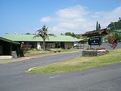
Captain Cook is a census-designated place (CDP) in Hawaiʻi County, Hawaiʻi, in the United States, located in the District of South Kona. The community, within the land division of Kealakekua, is so named because the post office for the area was located in the Captain Cook Coffee Co. during the early 1900s. As of the 2010 census the CDP population was 3,429, up from 3,206 at the 2000 census. As of March 2022, a resolution was under consideration to rename the town to "Kawa'aloa", meaning "long landing place".

Kailua-Kona is an unincorporated community and census-designated place (CDP) in Hawaii County, Hawaii, United States. It is also known as Kailua, as Kona and as Kona Town. Kailua-Kona is the second-largest settlement on the island of Hawaii and the largest settlement on the west side of the island, where it is the center of commerce and the tourist industry. Kailua-Kona is served by Kona International Airport, located just to the north in the adjacent CDP of Kalaoa. The population was 19,713 at the 2020 census, up from 11,975 at the 2010 census.

Kealakekua is a census-designated place (CDP) in Hawaiʻi County, Hawaiʻi, United States. The population was 2,019 at the 2010 census, up from 1,645 at the 2000 census.

Kahuku is a census-designated place (CDP) in Honolulu, Hawaii, United States. In the Hawaiian language, ka huku means "the projection", presumably a reference to Kahuku Point nearby, the northernmost point of land on the island of Oahu. As of the 2010 Census, Kahuku had a population of 2,614.

Kailua is a census-designated place (CDP) in Honolulu County, Hawaii, United States. It lies in the Koʻolaupoko District of the island of Oʻahu on the windward coast at Kailua Bay. It is in the judicial district and the ahupua'a named Ko'olaupoko. It is 12 miles (19 km) northeast of Honolulu – over Nu‘uanu Pali.
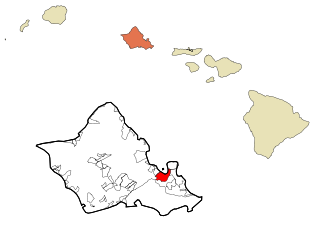
Kāneʻohe is a census-designated place (CDP) included in the City and County of Honolulu and located in Hawaiʻi state District of Koʻolaupoko on the island of Oʻahu. In the Hawaiian language, kāne ʻohe means "bamboo man". According to an ancient Hawaiian story a local woman compared her husband's cruelty to the sharp edge of cutting bamboo; thus the place was named Kāneʻohe or "bamboo man". The population was 37,430 at the 2020 census. Kāneʻohe is the largest of several communities along Kāneʻohe Bay and one of the two largest residential communities on the windward side of Oʻahu. The commercial center of the town is spread mostly along Kamehameha Highway.
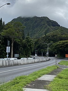
Maunawili is a residential census-designated place (CDP) in the City & County of Honolulu, Koʻolaupoko District, Island of Oʻahu, Hawaii, United States. As of the 2020 census, the CDP had a population of 2,026. Situated mauka of Kalanianaʻole Highway between Castle Junction and Castle Hospital, Maunawili is nearly all private homes, schools, and a few churches; horse stables complete the rural setting. There are no commercial establishments. However, residents are only minutes from Kailua.
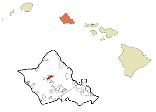
Wahiawa is a census-designated place (CDP) in Honolulu County, Hawaii, United States, on the island of Oahu. It is in the Wahiawa District, on the plateau or "central valley" between the two volcanic mountains that comprise the island. In Hawaiian, wahi a wā means "place of the wa people". The population was 18,658 at the 2020 census.

Waiʻanae is a census-designated place (CDP) in Honolulu County, Hawaii, United States. As of the 2020 census, the CDP population was 13,614.

Waimalu is a census-designated place (CDP) in Honolulu County, Hawaiʻi, United States. The population was 13,817 at the 2020 census.
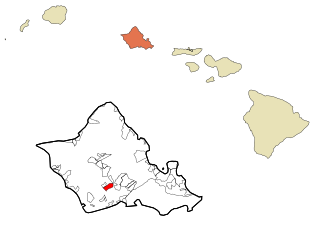
Waipahu is a former sugarcane plantation town and now census-designated place (CDP) located in the ʻEwa District on the island of Oʻahu in the City & County of Honolulu, Hawaiʻi, United States. As of the 2020 census, the CDP population was 43,485. The U.S. postal code for Waipahu is 96797.

Ellison Shoji Onizuka was an American astronaut, engineer, and USAF test pilot from Kealakekua, Hawaii, who successfully flew into space with the Space Shuttle Discovery on STS-51-C. He died in the destruction of the Space Shuttle Challenger, on which he was serving as Mission Specialist for mission STS-51-L. He was the first Asian American and the first person of Japanese origin to reach space.

Kapolei is a planned community in Honolulu County, Hawaiʻi, United States, on the island of Oʻahu. It is colloquially known as the "second city" of Oʻahu, in relation to Honolulu. For statistical purposes, the United States Census Bureau has defined Kapolei as a census-designated place (CDP) within the consolidated city-county of Honolulu.

Ellison Onizuka Kona International Airport at Keāhole is the busiest airport on the Island of Hawaiʻi. It is located in Kalaoa CDP, Hawaiʻi County, Hawaiʻi, United States, near the town of Kailua-Kona. The airport serves leeward (western) Hawaiʻi island, including the resorts of the North Kona and South Kohala districts. It is one of two international airports serving Hawaiʻi island, the other being Hilo International Airport on the windward side.
ʻĀina Haina is an unincorporated town of the City & County of Honolulu in the state of Hawaiʻi of the United States. Located on the island of Oʻahu, ʻĀina Haina is a residential community developed around Kalanianaole Highway east of Waikīkī and Diamond Head. ʻĀina Haina was named after local dairyman and owner of Hind-Clarke Dairy, Robert Hind. ʻĀina Haina in the Hawaiian language means "Hind's Land". A main street is a loop named Hind Drive for him. ʻĀina Haina has two elementary schools and a shopping center.
The Hawaiʻi Belt Road is a modern name for the Māmalahoa Highway and consists of Hawaiʻi state Routes 11, 19, and 190 that encircle the Island of Hawaiʻi. The southern section, between Hilo and Kailua-Kona is numbered as Route 11. The section between Hilo and Waimea is Route 19. Between Waimea and Kailua-Kona, the road is split in two: the original "mauka" route and a "makai" Route 19, completed in 1975, which serves as access to the Kona and Kohala Coast resorts. In the Hawaiian language, mauka means "towards the mountain" and makai means "towards the sea". These terms are commonly used in travel directions.
Honolulu Waldorf School, established in 1961, is a coeducational, independent school serving more than 300 children from early childhood through middle school located on the island of Oahu in the State of Hawaii. It previously included high school levels.
Assets School is a co-educational, independent K-12 school in Honolulu County, Hawaii. The high school is in the Honolulu census-designated place while the elementary school is in Hickam Housing CDP. The school focuses on educating students who are gifted and/or dyslexic. The school opened in 1955.

East Honolulu is a census-designated place (CDP) located in Honolulu County, Hawaii, United States. As of the 2020 Census, the CDP had a population of 50,922, making it the 2nd most populated CDP in Hawaii, behind Honolulu.
