
Lviv is the largest city in western Ukraine, and the fifth-largest in Ukraine, with a population of 717,273. It serves as the administrative centre of Lviv Oblast and Lviv Raion, and is one of the main cultural centres of Ukraine. Lviv also hosts the administration of Lviv urban hromada. It was named in honour of Leo, the eldest son of Daniel, King of Ruthenia.

Leonid Danylovych Kuchma is a Ukrainian politician who was the second president of Ukraine from 19 July 1994 to 23 January 2005.

Rava-Ruska is a city in Lviv Raion, Lviv Oblast, western Ukraine. It is a border town between Ukraine and Poland. The border checkpoint is situated 8 km (5 mi) west of the city, along the international autoroute Warsaw–Lviv. Rava-Ruska hosts the administration of Rava-Ruska urban hromada, one of the hromadas of Ukraine. Its population is approximately 8,494.

Viacheslav Maksymovych Chornovil was a Ukrainian politician and Soviet dissident. As a prominent Ukrainian dissident in the Soviet Union, he was arrested multiple times in the 1960s, 1970s, and 1980s for his political views. From 1992 onwards, Chornovil was one of the leaders of Rukh, the People's Movement of Ukraine, which was the first opposition party in democratic Ukraine, and editor-in-chief of the newspaper Chas-Time (Chas) from 1995. One of the most prominent political figures of the 1980s and 1990s, Chornovil paved the way for contemporary Ukraine to regain its independence.

The District of Galicia was a World War II administrative unit of the General Government created by Nazi Germany on 1 August 1941 after the start of Operation Barbarossa, based loosely within the borders of the ancient Principality of Galicia and the more recent Kingdom of Galicia and Lodomeria. Initially, during the invasion of Poland by Germany and the Soviet Union, the territory temporarily fell under Soviet occupation in 1939 as part of Soviet Ukraine.

The 1951 Polish-Soviet territorial exchange, also known as the Polish-Soviet border adjustment treaty of 1951, was a border agreement signed in Moscow between the Republic of Poland and the Soviet Union. It involved approximately 480 km2 (185 sq mi) of land along their shared border. The treaty was signed on February 15, 1951, ratified by Poland on May 28, 1951, and by the Soviet Union on May 31. It modified the border treaty of August 16, 1945, and came into effect on June 5, 1951. Since Poland was a satellite state within the Soviet sphere of influence, the exchange favored the Soviet Union economically due to the valuable coal deposits relinquished by Poland. Following the agreement, the Soviets constructed four large coal mines within eight years, with a combined annual mining capacity of 15 million tons.

Biały Słoń is a Polish name for an abandoned campus of the former Polish Astronomical and Meteorological Observatory of University of Warsaw, located at remote area on the peak of Pip Ivan in the Chornohora range of the Carpathian Mountains, Ukraine. Currently the structure is used as a mountain shelter with a small search and rescue team with some rooms adapted for lodging and recovery.
Krakovets is an urban-type settlement in Yavoriv Raion, Lviv Oblast, in western Ukraine. It lies on the Polish-Ukrainian border, roughly half way between Lviv in Ukraine and Kraków in Poland on the European route E40, hosting the Korczowa-Krakovets border crossing. Krakovets belongs to Yavoriv urban hromada, one of the hromadas of Ukraine. The population was estimated at 1,154 .

The Slovakia–Ukraine border is an internationally established boundary between Slovakia and Ukraine. Both countries inherited it from their previous respective state organizations, Ukraine from the Soviet Union and Slovakia from Czechoslovakia.

The Russia–Ukraine border is the de jure international boundary between Russia and Ukraine. Over land, the border spans five Russian oblasts and five Ukrainian oblasts. Due to the ongoing Russo-Ukrainian War, which began in early 2014, the de facto border between Russia and Ukraine is different from the legal border recognized by the United Nations. As of 2024, Russia is militarily occupying a significant portion of Ukraine.

The Belarusian-Ukrainian border is the state border between Belarus and Ukraine with a length of about 1,084 km (674 mi). It starts from the triple junction with Poland to the west and stretches to the triple junction with Russia to the east. The tripoint border at the triple border junction of Belarus, Russia and Ukraine is marked in the form of a monument, while at the other border junction there is a river, the Western Bug that coincides with the border of Poland.

The Polish–Ukrainian border is the state border between Poland and Ukraine. It has a total length of 529 km (329 mi) to 535 km (332 mi).
Izvaryne-Donetsk is a land border crossing between Ukraine and Russia, on autoroute E40 in the Donbas region.

Senkivka is a land three-way border crossing between Ukraine with Russia and Belarus on the Ukrainian side, just north of the village of Senkivka, in Chernihiv Raion, Chernihiv Oblast.
Dovzhansky is a land border crossing between Ukraine and Russia on the Ukrainian side, in the town of Dovzhanske, Sverdlovsk city municipality, Luhansk Oblast.
The Hungary–Ukraine border is an internationally established boundary between Hungary and Ukraine. The modern border remains unchanged since the end of the World War II.

Shehyni is a land border crossing between Ukraine and Poland on the Ukrainian side, near the village of Shehyni, Yavoriv Raion, Lviv Oblast.

Rava-Ruska is a land border crossing between Ukraine and Poland on the Ukrainian side, near the city of Rava-Ruska, Lviv Raion, Lviv Oblast.
Berdykhiv is a village (selo) in the Lviv Oblast (province), Yavoriv Raion of Western Ukraine. It belongs to Novoiavorivsk urban hromada, one of the hromadas of Ukraine. Area of the village totals is 1,023 km2. Local government is administered by Berdykhivska village council.
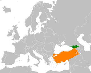
The Georgia–Turkey border is 273 km in length and runs from the Black Sea coast in the west to the tripoint with Armenia in the east.


