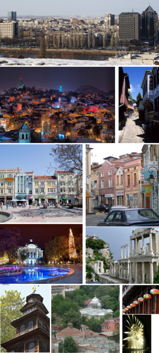
Plovdiv is the second-largest city in Bulgaria, 93 miles southeast of the capital Sofia. It had a population of 346,893 as of 2018 and 675,000 in the greater metropolitan area. Plovdiv is a cultural hub in Bulgaria and was the European Capital of Culture in 2019. The city is an important economic, transport, cultural, and educational centre. Plovdiv joined the UNESCO Global Network of Learning Cities in 2016.

The Rhodopes are a mountain range in Southeastern Europe, and the largest by area in Bulgaria, with over 83% of its area in the southern part of the country and the remainder in Greece. Golyam Perelik is its highest peak at 2,191 meters (7,188 ft). The mountain range gives its name to the terrestrial ecoregion Rodope montane mixed forests that belongs in the temperate broadleaf and mixed forests biome and the Palearctic realm. The region is particularly notable for its karst areas with their deep river gorges, large caves and specific sculptured forms, such as the Trigrad Gorge.

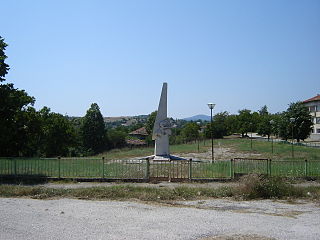
Perushtitsa or Perushtitza is a Bulgarian town located in Perushtitsa Municipality, Plovdiv Province at the foot of the Rhodopes, 22 kilometers south of Plovdiv.
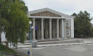
Kuklen is a town in southern Bulgaria, part of Plovdiv Province. It is located 7 km to the south of the nearest major city, Plovdiv, and is approximately 140 km south east of the Bulgarian capital, Sofia. Kuklen was proclaimed a town on 23 May 2006 and as of 2005 had a population of 6,877. It is the center of Kuklen Municipality.

Perperikon, also Perpericum, is an ancient Thracian city located in the Eastern Rhodope Mountains, 15 km northeast of the present-day town of Kardzhali, Bulgaria on a 470 m high rocky hill, which is thought to have been a sacred place. The village of Gorna krepost is located at the foot of the hill and the gold-bearing Perpereshka River flows nearby. Perperikon is the largest megalith ensemble site in the Balkans. In the Middle Ages Perperikon served as a fortress.

Parvomay is a town, part of the municipality of the same name in southern Bulgaria. It is located in Plovdiv Province, close to the towns Sadovo and Chirpan. The word literally means First of May, i.e., May Day, in English and is sometimes transliterated as Parvomai or Purvomai.

The Chepelare river or Chepelarska reka is an 86 km-long river in the Rhodope Mountains of southern Bulgaria, a right tributary of the river Maritsa.
Peshtera is a town in the Rhodope Mountains, southern Bulgaria. It is located in Pazardzhik Province near the towns of Batak and Bratsigovo. The town is the third largest in the province after Pazardzhik and Velingrad and is the forty-fifth largest in Bulgaria. It is the administrative center of the municipality Peshtera. According to the 2021 census, Peshtera has a population of 15,175 inhabitants. At about 5 km to the south, along the road to Batak, is one of the most visited caves in Bulgaria — Snezhanka. Near the town is located the Peshtera Hydroelectric Power Station. The town is well known for producing the alcohol beverage mastika under the brand Peshterska.

Kalofer is a town in central Bulgaria, located on the banks of the Tundzha between the Balkan Mountains to the north and the Sredna Gora to the south. Kalofer is part of Plovdiv Province and the Karlovo municipality. It is best known as the birthplace of Bulgarian poet and revolutionary Hristo Botev.

Krichim is a town in Bulgaria, located in the southwestern part of Plovdiv Province close to Perushtitsa. It lies at the foot of the Rhodopes' northern slopes in the plains of Thrace, 20 km southwest of Plovdiv. The river Vacha, an important tributary of the Maritsa, runs through the town. Krichim is the only place in Krichim Municipality.
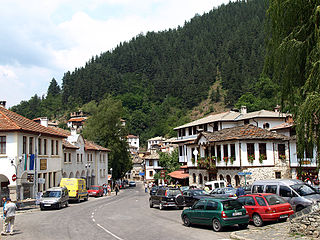
Shiroka Laka is a village in the very south of Bulgaria, located in Smolyan municipality, Smolyan Province. It is a proclaimed architectural and folklore reserve and lies in the central Rhodope Mountains, 23 km northwest of Smolyan, 16 km west of Pamporovo and 22 km southeast of Devin.
Chernichevo is a village in southern Bulgaria, located in the municipality of Krumovgrad in the Kardzhali Province. It is situated in the Eastern part of Rhodope Mountains, near the border with Greece. Its original Bulgarian name is "Dunyata". The correct geographical location of Chernichevo is 41° 21' N, 25° 47' E.

Dobrinishte is a small town and ski resort in the Blagoevgrad Province, Bansko Municipality, southwestern Bulgaria. As of 2006 it has 2973 inhabitants. It is located 6 km east of Bansko, a famous winter resort. It has an altitude of 850 m and is surrounded by the Rila, Pirin, and Rhodope mountains. Dobrinishte offers good conditions for both winter and summer tourism: beautiful nature, hospitable population, ski runs, mineral waters and opportunities for rural and ecotourism. According to legends and song, between 6th and 15th century Dobrinishte was a Bulgarian stronghold which halted the Byzantines from invading the country from the valley of the Mesta River.
Brestovitsa is a village in the Rodopi Municipality, southern Bulgaria. The village has a population of 3,718. The village is famous for its grape-growing and wines. There is a recreation villa zone mainly owned by citizens of Plovdiv.

Hrabrino is a village in the Rodopi Municipality, Plovdiv Province in southern Bulgaria. According to a 2011 census, the village has a population of 661 people.

The Belashtitsa Monastery is a convent in the western Rhodope Mountains near the village of Belashtitsa at 12 km to the south of Plovdiv. It is dedicated to St George the Victorious.

Belitsa Municipality is located in the southwestern part of Bulgaria in the northeastern part of the Blagoevgrad Province. The administrative center is the town of Belitsa and there are also 11 villages and the ski resort Semkovo.

Haberlea is a monotypic genus of flowering plants in the family Gesneriaceae. The only member of this genus, Haberlea rhodopensis, is endemic to parts of Bulgaria and a small part of northern Greece, especially in the Rhodope Mountains. Common names include Orpheus flower and resurrection plant because of the remarkable ability of Haberlea to survive very long periods of desiccation.
Part of series of articles upon Archaeology of Kosovo
Lilkovo is a mountain village in southern Bulgaria. It is one of the highest settlements in Bulgaria. It is also one of the largest villages by land area in the Rhodope Mountains.


