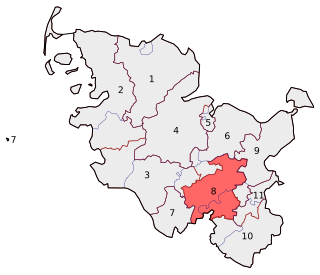
Stormarn is a district in Schleswig-Holstein, Germany. It is bounded by the districts of Segeberg and Ostholstein, the city of Lübeck, the district of Lauenburg, and the city-state of Hamburg.

The Trave is a river in Schleswig-Holstein, Germany. It is approximately 124 kilometres (77 mi) long, running from its source near the village of Gießelrade in Ostholstein to Travemünde, where it flows into the Baltic Sea. It passes through Bad Segeberg, Bad Oldesloe, and Lübeck, where it is linked to the Elbe–Lübeck Canal. It is navigable for sea-going vessels from the Baltic to the Lübeck ports. The Herren Tunnel crosses the Trave, as do numerous bridges, and a ferry connects Travemünde with Priwall. Tributaries of the Trave include the Wakenitz and the Stepenitz.
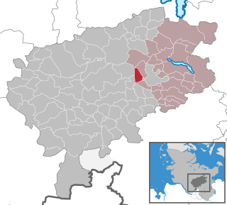
Bad Segeberg is a German town of 16,000 inhabitants, located in the state of Schleswig-Holstein, capital of the district (Kreis) Segeberg. It is situated approximately 50 kilometers (31 mi) northeast of Hamburg, and 25 kilometers (16 mi) west of Lübeck.

Wahlstedt is a town in the district of Segeberg in Schleswig-Holstein, Germany.
Henstedt-Ulzburg is a municipality in the district of Segeberg, in Schleswig-Holstein, Germany.
Itzstedt is a municipality in the district of Segeberg, in Schleswig-Holstein, Germany. It is situated approximately 32 km northeast of Hamburg, and 17 km southwest of Bad Segeberg.

Kisdorf is a municipality in the district of Segeberg, in Schleswig-Holstein, Germany. It is situated approximately 30 km north of Hamburg, and 15 km north of Norderstedt. Kisdorf is part of the Amt Kisdorf. The seat of the Amt is in Kattendorf.
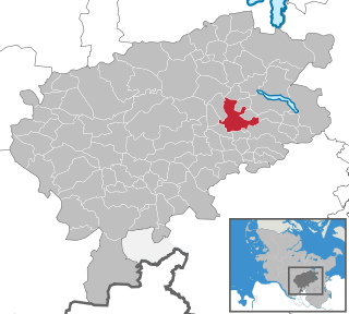
Leezen is a municipality in the district of Segeberg, in Schleswig-Holstein, Germany. It is situated approximately 40 km northeast of Hamburg, and 9 km southwest of Bad Segeberg.

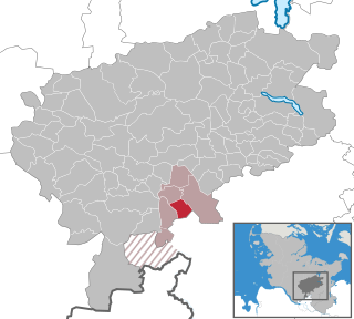
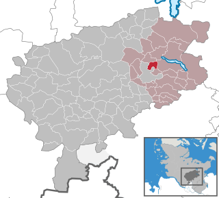
Trave-Land is an Amt in the district of Segeberg, in Schleswig-Holstein, Germany.

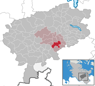
Heidmühlen is a municipality in the district of Segeberg in Schleswig-Holstein, Germany. It contains the areas of Mühlenholz and Klint.

Schillsdorf is a municipality in the district of Plön, in Schleswig-Holstein, Germany.
Fahrenkrug is a municipality in the district of Segeberg, in Schleswig-Holstein, Germany. The two little villages Rotenhahn and Ziegelei belong also to Fahrenkrug. In the year 1192 has Varencroch, the old name of Fahrenkrug, been mentioned. In this text Varencroch was addicted to the monastery of Bad Segeberg. The name Varencroch means fern and corner, so that in the blazon of Fahrenkrug there are a fern and a corner.

Glasau is a municipality in the district of Segeberg, in Schleswig-Holstein, Germany.
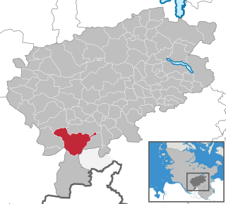
Klein Rönnau is a municipality in the district of Segeberg, in Schleswig-Holstein, Germany. On an Area of 453 acres (1.83 km2) live about 1600 people. There are three car workshops, several doctors, supermarkets, and numerous clubs for riding, dog training, and the sportsclub in Klein Rönnau. Most of the inhabitants are Protestants or non-religious.

Nützen is a municipality in the district of Segeberg, in Schleswig-Holstein, Germany. Two areas, Kampen and Springhirsch, are within its jurisdiction.

Wakendorf I is a municipality in the district of Segeberg, in Schleswig-Holstein, Germany. The name "Wakendorf I" was given in Prussian times, in order to distinguish it from another municipality 20 km to the southwest, also called Wakendorf.

Wakendorf II is a municipality in the district of Segeberg, in Schleswig-Holstein, Germany.
Segeberg – Stormarn-Mitte is an electoral constituency represented in the Bundestag. It elects one member via first-past-the-post voting. Under the current constituency numbering system, it is designated as constituency 8. It is located in south central Schleswig-Holstein, comprising most of the Segeberg district and northwestern parts of the Stormarn district.
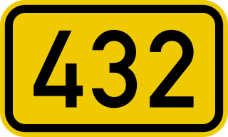
The Bundesstraße 432 is a federal road in Germany. It is located in southern Schleswig-Holstein between Hamburg and the Bay of Lübeck, which is part of the Baltic Sea.


