Related Research Articles

The Via Salaria was an ancient Roman road in Italy. It eventually ran from Rome to Castrum Truentinum on the Adriatic coast, a distance of 242 km. The road also passed through Reate (Rieti) and Asculum.
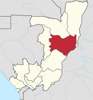
Cuvette is a department of the Republic of the Congo in the central part of the country. It borders the departments of Cuvette-Ouest, Likouala, Plateaux, and Sangha, and internationally, the Democratic Republic of the Congo. The capital is Owando. Cities and towns include Boundji, Makoua and Okoyo.
Scott Glacier is a glacier, 7 miles (11.3 km) wide and over 20 miles (32 km) long, flowing north-northwest to the Antarctic coast between Denman Glacier and Mill Island. It was discovered by the Western Base Party of the Australasian Antarctic Expedition (1911-1914) under Mawson and named for Capt. Robert F. Scott.
Kushalgarh is a town and municipality in the Indian state of Rajasthan. It is located in the Banswara District approximately 65 km south of the city of Banswara. King Kushala Bhil was founder of Kushalgarh

Zatín is a village and municipality in the Trebišov District in the Košice Region of eastern Slovakia.
Spin Khak is a village in Pabbi Tehsil of Nowshera District of Khyber Pakhtunkhwa, Pakistan. It is located at 33°52'0N 71°46'0E and lies 45 kilometres south of Peshawar at an altitude of 483 metres.
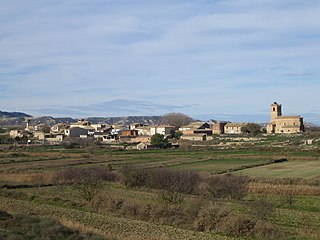
Senés de Alcubierre is a municipality located in the province of Huesca, Aragon, Spain. According to the 2004 census (INE), the municipality has a population of 50 inhabitants.

Cerecinos de Campos is a municipality located in the province of Zamora, Castile and León, Spain. According to the 2009 census (INE), the municipality had a population of 368 inhabitants.

Sonadia Island is a small island of about 9 square kilometres, offshore of the Cox's Bazar coast in Chittagong Division, Bangladesh. Sonadia is located at Kutubjom Union in Maheshkhali Upazila, 15 km north-west of Cox's Bazar District Headquarters. It is located at latitude 21.28˝-21.33˝ and longitude 91.50˝-91.56˝. Sonadia Maheshkhali is separated from the main island by a canal.
Kroumweogo is a village in the Zam Department of Ganzourgou Province in central Burkina Faso. The village has a population of 1320.
Dar Chioukh is a town and commune in Djelfa Province, Algeria. According to the 2008 census it has a population of 26,605. It is located northeast of Djelfa and north by a smaller road from the N46 from M'Liliha.
Todoretsite is a village in Tryavna Municipality, in Gabrovo Province, in northern central Bulgaria.
Sangargali is a tourist village in Belgaum district of Karnataka, India.
Kupinince is a village in the municipality of Vranje, Serbia. According to the 2002 census, the village currently has a population of 134.
Jhamat Railway Station is located in Pakistan.
Bahadar Kot, 90 miles (140 km) west of Islamabad, is an administrative unit known as union council of Kohat District in the Khyber Pakhtunkhwa province of Pakistan.

Cinna or Kinna was a town of ancient Galatia. It was known as Zallara in the Hittite period. It was also the seat of a bishop; no longer a residential see, it remains a titular see of the Roman Catholic Church.
Yuxarı Nüsüs is a village in the Jabrayil District of Azerbaijan.
References
- 1 2 Chisholm, Hugh, ed. (1911). . Encyclopædia Britannica . Vol. 15 (11th ed.). Cambridge University Press. p. 954.
33°29′N71°54′E / 33.483°N 71.900°E
| | This Kohat District location article is a stub. You can help Wikipedia by expanding it. |