Related Research Articles

Harare, originally known as Salisbury, is the capital and most populous city of Zimbabwe. The city proper has an area of 940 km2 (371 mi2) and a population of 2.12 million in the 2012 census and an estimated 3.12 million in its metropolitan area in 2019. Situated in north-eastern Zimbabwe in the country's Mashonaland region, Harare is a metropolitan province, which also incorporates the municipalities of Chitungwiza and Epworth. The city sits on a plateau at an elevation of 1,483 metres above sea level and its climate falls into the subtropical highland category.

The Chinhoyi Caves are a group of limestone and dolomite caves in north central Zimbabwe. Designated a National Park in 1955, and managed by the Zimbabwe Parks & Wildlife Management Authority.
The government of Zimbabwe is the main provider of air, rail and road services; historically, there has been little participation of private investors in transport infrastructure.
Lion's Den is a small town in Zimbabwe.
Chinhoyi, originally known as Sinoia, is a city in central northern Zimbabwe in the Makonde District. It has a population of 90,800 and is primarily a college town, although it was originally founded as an Italian group settlement scheme. The nearby Chinhoyi Caves and national park are a popular attraction.

Mbare, originally known as Harari, is a suburb in the south of Harare, Zimbabwe. Founded in 1907 as a township, it includes an informal settlement. Mbare Musika is the largest farm produce market in Zimbabwe.
Emerald Hill is a north-western suburb of Harare, Zimbabwe. The suburb was named so because of either (i) the colour of the hill due to the large number of trees or (ii) an Irish connection: many of the roads in the suburb have Irish names.
Mount Hampden is a village in Mashonaland West Province, Zimbabwe. It is about eleven miles from the capital, Harare. It was the original destination of the Rhodesian Pioneer Column; however, the Column eventually settled some eleven miles to the south. Mount Hampden was named after English politician John Hampden by the hunter and explorer Frederick Courteney Selous. In 2012, the government of Zimbabwe announced its plans to build a new capital city in Mount Hampden. The new capital will reportedly have a Parliament building, a Presidential palace, the Supreme and High courts, the Reserve bank, posh suburbs, hotels and modern shopping malls.
Hwata is a Senatorial constituency in the Senate of Zimbabwe. It covers the following parliamentary constituencies in the House of Assembly of Zimbabwe and which are situated in the west of Harare.Hwata is one of six senatorial constituencies in Harare province. This senate seat was named after the Hwata Dynasty which was founded by Shayachimwe in the 19th century. The Hwata family resided at Barapata Hill in present-day Mufakose, a suburb of Harare.Chief Hwata Chiripanyanga worked with Nehanda Nyakasikana in organising resistance against white settlers in his lands in June 1896.In what has been described as the First Chimurenga, Hwata lost 100 men who were killed by white settlers under the command of Captain Nisbert of the Mazoe Patrol.
Sam Mtukudzi was a Zimbabwean musician. He was the son of the late singer Oliver Mtukudzi.
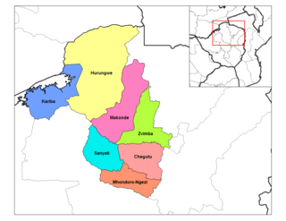
Zvimba District is a district of Mashonaland West Province, Zimbabwe.
The A5 Highway is a national road in Zimbabwe. It joins the cities of Harare and Bulawayo, and is hence known as the Harare-Bulawayo Highway. It is one of the two routes that form the R2 Route, which connects Harare with the Plumtree Border with Botswana.
R3 Highway is a primary road in Zimbabwe from the capital city Harare to the Chirundu Border Post with Zambia. It is also known as the A1 Highway. It is part of both the Beira–Lobito Highway and the Cape to Cairo Road.
Budiriro is a high density suburb in the southwestern area of Harare in Zimbabwe. There are about 30,000 houses but only two clinics and five elementary schools.
Zengeza High School is an urban, day coeducational secondary school in Chitungwiza, Harare Province, Zimbabwe. It has a student population of 2000 pupils and 90 teachers who enroll in two sessions. It has 10 classes for each grade from form 1 to form 4, and 3 classes at advanced level categorized as Sciences, Commercials and Arts.
References
Coordinates: 17°50′S30°56′E / 17.833°S 30.933°E
| | This Zimbabwe location article is a stub. You can help Wikipedia by expanding it. |