La Plata, Missouri

Last updated

La Plata, Missouri
La Plata Station - November 2015.JPG
Macon County Missouri Incorporated and Unincorporated areas La Plata Highlighted.svg
Location within Macon County and Missouri
Coordinates: 40°01′27″N92°29′29″W / 40.02417°N 92.49139°W / 40.02417; -92.49139
Country United States
State Missouri
County Macon
Area
[1]
  Total1.59 sq mi (4.13 km2)
  Land1.59 sq mi (4.11 km2)
  Water0.01 sq mi (0.02 km2)
Elevation
[2]
938 ft (286 m)
Population
 (2020) [3]
  Total1,257
  Density791.56/sq mi (305.53/km2)
Time zone UTC-6 (Central (CST))
  Summer (DST) UTC-5 (CDT)
ZIP code
63549
Area code 660
FIPS code 29-40682 [4]
GNIS feature ID2395569 [2]
Website www.cityoflaplata.net

La Plata is a city in Macon County, Missouri, United States. The population was 1,257 at the 2020 census, [5] down from 1,366 in 2010. La Plata is located next to the Adair County line and is on a mainline of the BNSF Railway. The town is best known for La Plata station, which provides passenger rail service to Chicago and Los Angeles.

Contents

History

The beginnings of La Plata can be traced back to March 17, 1827, when Drury Davis established a trading post near the town's current location. [6] The ensuing few years saw Davis joined by family and friends to create a small village that included a blacksmith shop, an inn, and stagecoach station. [6]

La Plata was platted in 1855. It was named after the city of La Plata, in Argentina. [7] The name is of Spanish origin meaning "silver". [8] Two men, Louis Gex and Thomas Saunders, were the primary force behind the town's platting, and drew straws to choose the community's name. [9] Saunders wanted to name the town "Charlottesville" to honor a favorite sister, while Gex pushed for the name La Plata. Gex won out, and the town is believed to have been first incorporated on September 29, 1856. [9] Another of the early settlers who helped in creating the town was W. W. Moore, who erected La Plata's first hotel. [10]

The North Missouri (later known as the Wabash Railroad) came to town in 1867, and the Santa Fe Railroad twenty years later, passing through La Plata on its route from Chicago to Kansas City. [6] The combination of the two railroads made La Plata an ideal shipping point for timber, livestock, grains, and other goods for northern Macon County and southern portions of neighboring Adair County as well. [11] As part of this growth, the town was incorporated as a fourth-class city on April 4, 1881, with Jacob Gilstrap serving as first mayor. [10] La Plata's first major industry, a creamery, was established in 1883. The facility had the capacity to produce up to 1.25 tons of butter per day. [6] However, fire destroyed the creamery and it was never rebuilt. Other light agriculture-related industry has existed in the town over the years, including a large chicken hatchery and turkey hatchery. Two major oil pipelines pass through La Plata as well, the Prairie Pipeline being the first in 1912. [6] A "tank farm" of large storage tanks was located for many years on the city's northern edge. The Wabash Railroad through La Plata was abandoned after it was merged in 1991 with the Norfolk and Western Railway, but the Amtrak station is still in operation on the Burlington Northern Santa Fe rail system, and the town is served by the Southwest Chief . A small but active business community still exists in the town.

The first school, named "Long Branch" for a nearby creek, was established in 1868. It was replaced, in 1872, by a five-room brick schoolhouse. [6] Today, children of La Plata and the surrounding rural area are educated by the La Plata R-2 school district.

The Lester and Norma Dent House, John T. and Mary M. Doneghy House, Gilbreath-McLorn House, and La Plata Square Historic District are listed on the National Register of Historic Places. [12]

Geography

La Plata is in northeastern Macon County, with its northern border following the county line. U.S. Route 63, a four-lane highway, passes through the east side of the city, leading south 20 miles (32 km) to Macon, the county seat, and north 13 miles (21 km) to Kirksville in Adair County. Missouri Route 156 passes through the south side of La Plata as Clark Street, leading west 10 miles (16 km) to South Gifford and east 15 miles (24 km) to Novelty.

According to the U.S. Census Bureau, La Plata has a total area of 1.59 square miles (4.12 km2), of which 0.006 square miles (3.8 acres), or 0.38%, are water. [1] The city sits on a height of land which drains west to Long Branch, a south-flowing tributary of the Little Chariton River and part of the Missouri River watershed, and east toward the Middle Fork of the Salt River, a direct tributary of the Mississippi.

Demographics

Historical population
CensusPop.Note
1870 546
1880 529−3.1%
1890 1,169121.0%
1900 1,34515.1%
1910 1,60519.3%
1920 1,463−8.8%
1930 1,406−3.9%
1940 1,4211.1%
1950 1,331−6.3%
1960 1,3652.6%
1970 1,3770.9%
1980 1,4233.3%
1990 1,401−1.5%
2000 1,4866.1%
2010 1,366−8.1%
2020 1,257−8.0%
U.S. Decennial Census [13]

2010 census

As of the census [14] of 2010, there were 1,366 people, 584 households, and 364 families residing in the city. The population density was 859.1 inhabitants per square mile (331.7/km2). There were 683 housing units at an average density of 429.6 per square mile (165.9/km2). The racial makeup of the city was 96.5% White, 0.2% African American, 0.1% Asian, 0.5% Pacific Islander, 1.0% from other races, and 1.7% from two or more races. Hispanic or Latino of any race were 1.3% of the population.

There were 584 households, of which 28.8% had children under the age of 18 living with them, 45.2% were married couples living together, 12.5% had a female householder with no husband present, 4.6% had a male householder with no wife present, and 37.7% were non-families. 33.4% of all households were made up of individuals, and 18.5% had someone living alone who was 65 years of age or older. The average household size was 2.26 and the average family size was 2.83.

The median age in the city was 42.1 years. 23.4% of residents were under the age of 18; 8.3% were between the ages of 18 and 24; 21.9% were from 25 to 44; 24.2% were from 45 to 64; and 22.4% were 65 years of age or older. The gender makeup of the city was 47.1% male and 52.9% female. La Plata has a growing settlement of Amish, most of whom are engaged in farming. [15]

2000 census

As of the census [4] of 2000, there were 1,486 people, 630 households, and 388 families residing in the city. The population density was 1,219.0 inhabitants per square mile (470.7/km2). There were 702 housing units at an average density of 575.9 per square mile (222.4/km2). The racial makeup of the city was 98.65% White, 0.13% African American, 0.07% Native American, 0.13% Asian, 0.27% from other races, and 0.74% from two or more races. Hispanic or Latino of any race were 1.68% of the population.

There were 630 households, out of which 28.6% had children under the age of 18 living with them, 48.6% were married couples living together, 10.3% had a female householder with no husband present, and 38.3% were non-families. 35.4% of all households were made up of individuals, and 24.0% had someone living alone who was 65 years of age or older. The average household size was 2.28 and the average family size was 2.96.

In the city the population was spread out, with 25.2% under the age of 18, 7.3% from 18 to 24, 23.8% from 25 to 44, 17.8% from 45 to 64, and 26.0% who were 65 years of age or older. The median age was 40 years. For every 100 females there were 79.7 males. For every 100 females age 18 and over, there were 74.4 males.

The median income for a household in the city was $29,583, and the median income for a family was $36,071. Males had a median income of $26,438 versus $17,880 for females. The per capita income for the city was $19,675. About 9.0% of families and 14.1% of the population were below the poverty line, including 21.8% of those under age 18 and 9.7% of those age 65 or over.

Education

Public education in La Plata is administered by La Plata R-II School District, which operates one elementary school and La Plata High School. [16]

La Plata has a lending library, the La Plata Public Library. [17]

Notable people

Related Research Articles

<span class="mw-page-title-main">Schuyler County, Missouri</span> County in Missouri, United States

Schuyler County is a county located in the northeastern portion of the U.S. state of Missouri. As of the 2020 census, its population was 4,032, making it the fourth-least populous county in Missouri. Its county seat is Lancaster. The county was organized February 14, 1845, from Adair County, and named for General Philip Schuyler, delegate to the Continental Congress and U.S. Senator from New York.

<span class="mw-page-title-main">Macon County, Missouri</span> County in Missouri, United States

Macon County is a county located in the northern portion of the U.S. state of Missouri. As of the 2020 census, the population was 15,209. Its county seat is Macon. The county was organized January 6, 1837, and named for Nathaniel Macon, a Revolutionary War hero and North Carolina politician.

<span class="mw-page-title-main">Linn County, Missouri</span> County in Missouri, United States

Linn County is a county located in the northern portion of the U.S. state of Missouri. As of the 2020 census, the population was 11,874. Its county seat is Linneus. The county was organized January 1, 1837 and named after U.S. Senator Lewis F. Linn of Missouri.

<span class="mw-page-title-main">Knox County, Missouri</span> County in Missouri, United States

Knox County is a county located in the northeast portion of the U.S. state of Missouri. As of the 2020 census, its population was 3,744, making it the third-least populous county in Missouri. Its county seat is Edina. The county was organized February 14, 1845 and named for U.S. Secretary of War General Henry Knox.

<span class="mw-page-title-main">Adair County, Missouri</span> County in Missouri, United States

Adair County is a county located in the northeastern part of the U.S. state of Missouri. The population census for 2020 was 25,314. As of July 1, 2021, the U.S. Census Bureau's Population Estimates for the county is 25,185, a -0.5% change. Adair county seat is Kirksville. The county was first settled by immigrants from Kentucky and organized on January 29, 1841. Adair County comprises the Kirksville, MO Micropolitan Statistical Area.

<span class="mw-page-title-main">Adair, Iowa</span> City in Iowa, United States

Adair is a city in Adair and Guthrie counties of Iowa in the United States. The population was 791 at the 2020 census.

<span class="mw-page-title-main">Brashear, Missouri</span> Town in Missouri, United States

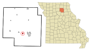
Brashear is a city in Salt River Township, Adair County, Missouri, United States. The population was 273 at the 2010 census.

<span class="mw-page-title-main">Gibbs, Missouri</span> Village in Missouri, United States

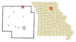
Gibbs is a village in Wilson Township, Adair County, Missouri, United States. The population was 107 at the 2010 census.

<span class="mw-page-title-main">Kirksville, Missouri</span> City in Missouri, United States

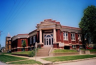
Kirksville is the county seat and most populous city in Adair County, Missouri. Located in Benton Township, its population was 17,530 at the 2020 census. Kirksville is home to two colleges: Truman State University and A.T. Still University.

<span class="mw-page-title-main">Hurdland, Missouri</span> City in Missouri, United States

Hurdland is a city in Knox County, Missouri, United States. As of the 2020 census, its population was 155.

<span class="mw-page-title-main">Atlanta, Missouri</span> City in Missouri, United States

Atlanta is a city in Macon County, Missouri, United States. The population was 379 at the 2020 census.

<span class="mw-page-title-main">Bevier, Missouri</span> City in Missouri, United States

Bevier is a city in Macon County, Missouri, United States. The population was 636 at the 2020 census, down from 718 in 2010.

<span class="mw-page-title-main">Callao, Missouri</span> City in Missouri, United States

Callao is a city in Macon County, Missouri, United States. The population was 251 at the 2020 census, down from 292 in 2010.

<span class="mw-page-title-main">Elmer, Missouri</span> City in Missouri, United States

Elmer is a city in Macon County, Missouri, United States. The population was 51 at the 2020 census, down from 80 in 2010.

<span class="mw-page-title-main">Ethel, Missouri</span> Town in Missouri, United States

Ethel is a town in Macon County, Missouri, United States. The population was 41 at the 2020 census, down from 62 in 2010.

<span class="mw-page-title-main">Macon, Missouri</span> City in Missouri, United States

Macon is a city in and the county seat of Macon County, Missouri, United States. The population was 5,457 at the 2020 census.

<span class="mw-page-title-main">New Cambria, Missouri</span> City in Missouri, United States

New Cambria is a city in Macon County, Missouri, United States. The population was 153 at the 2020 census.

<span class="mw-page-title-main">Clarence, Missouri</span> City in Missouri, United States

Clarence is a city in western Shelby County, Missouri, United States. The population was 738 at the 2020 census.

<span class="mw-page-title-main">Adair, Oklahoma</span> Town in Oklahoma, United States

Adair is a town in Mayes County, Oklahoma, United States. The population was 790 at the 2010 census, compared to the figure of 704 recorded in 2000. Named for two prominent Cherokee brothers, the town was established in 1883. It opened a Cherokee school.

<span class="mw-page-title-main">Greentop, Missouri</span> City in Missouri, United States

Greentop is a city in Adair and Schuyler counties, Missouri, United States. As of the 2020 census, its population was 388.

References

  1. 1 2 "2023 U.S. Gazetteer Files: Missouri". United States Census Bureau. Retrieved March 15, 2024.
  2. 1 2 U.S. Geological Survey Geographic Names Information System: La Plata, Missouri
  3. "P1. Race – La Plata city, Missouri: 2020 DEC Redistricting Data (PL 94-171)". U.S. Census Bureau. Retrieved March 15, 2024.
  4. 1 2 "U.S. Census website". United States Census Bureau . Retrieved January 31, 2008.
  5. "Explore Census Data". data.census.gov. Retrieved February 1, 2022.
  6. 1 2 3 4 5 6 "History of La Plata". City of La Plata official website. 2014. Retrieved April 13, 2014.
  7. Ramsay, Robert L. (1952). Our Storehouse of Missouri Place Names. University of Missouri Press. p. 28. ISBN   9780826205865.
  8. Eaton, David Wolfe (1916). How Missouri Counties, Towns and Streams Were Named. The State Historical Society of Missouri. p. 192.
  9. 1 2 "Macon County place names" (PDF). Macon County Historical Society. 2014. Archived (PDF) from the original on April 14, 2014. Retrieved April 13, 2014.
  10. 1 2 "A Directory of Towns, Villages and Hamlets of Macon County Missouri". Macon County Historical Society. 2014. Retrieved April 13, 2014.
  11. "Macon County History". Genealogy Trails via Macon County Historical Society. 2014. Retrieved April 13, 2014.
  12. "National Register Information System". National Register of Historic Places . National Park Service. July 9, 2010.
  13. "Census of Population and Housing". Census.gov. Retrieved June 4, 2015.
  14. "U.S. Census website". United States Census Bureau . Retrieved July 8, 2012.
  15. Winnerman, Jim (August 12, 2012). "Amish migrate to new home in Missouri". St. Louis Post-Dispatch . Retrieved May 25, 2020.
  16. "La Plata R-Ii School District". Great Schools. Retrieved June 2, 2019.
  17. "Missouri Public Libraries". PublicLibraries.com. Archived from the original on June 10, 2017. Retrieved June 2, 2019.