La Rose, Illinois

Last updated

La Rose, Illinois
Marshall County Illinois Incorporated and Unincorporated areas La Rose Highlighted.svg
Location in Marshall County, Illinois
Usa edcp location map.svg
Red pog.svg
La Rose
Location in the United States
Coordinates: 40°58.9′N89°14.2′W / 40.9817°N 89.2367°W / 40.9817; -89.2367
CountryUnited States
StateIllinois
County Marshall
Township Bell Plain
Area
[1]
  Total0.26 sq mi (0.66 km2)
  Land0.26 sq mi (0.66 km2)
  Water0.00 sq mi (0.00 km2)
Elevation
671 ft (205 m)
Population
 (2020) [2]
  Total98
  Density384.31/sq mi (148.44/km2)
Time zone UTC-6 (CST)
  Summer (DST) UTC-5 (CDT)
ZIP code
61541
Area code 309
FIPS code 17-42171
Wikimedia CommonsLa Rose, Illinois

La Rose is a village in Bell Plain Township, Marshall County, Illinois, United States. The population was 98 at the 2020 census, [2] down from 144 in 2010. It is part of the Peoria Metropolitan Statistical Area.

Contents

Geography

La Rose is located in southeastern Marshall County at 40°58.9′N89°14.2′W / 40.9817°N 89.2367°W / 40.9817; -89.2367 (40.9810, -89.2362). [3] Illinois Route 89 runs through the village as Main Street, leading north 4 miles (6 km) to Varna and southwest 5 miles (8 km) to Washburn.

According to the U.S. Census Bureau, La Rose has a total area of 0.25 square miles (0.65 km2), all land. [1] The North Branch of Crow Creek flows southwesterly past the southern border of the village, part of the Illinois River watershed.

Demographics

Historical population
CensusPop.Note
1880 125
1900 146
1910 1556.2%
1920 17110.3%
1930 150−12.3%
1940 17919.3%
1950 178−0.6%
1960 1927.9%
1970 165−14.1%
1980 1734.8%
1990 130−24.9%
2000 15922.3%
2010 144−9.4%
2020 98−31.9%
U.S. Decennial Census [4]

As of the census [5] of 2000, there were 159 people, 62 households, and 46 families residing in the village. The population density was 722.5 inhabitants per square mile (279.0/km2). There were 63 housing units at an average density of 286.3 per square mile (110.5/km2). The racial makeup of the village was 97.48% White, 0.63% Native American, 1.26% from other races, and 0.63% from two or more races. Hispanic or Latino of any race were 1.26% of the population.

There were 62 households, out of which 30.6% had children under the age of 18 living with them, 64.5% were married couples living together, 4.8% had a female householder with no husband present, and 24.2% were non-families. 21.0% of all households were made up of individuals, and 6.5% had someone living alone who was 65 years of age or older. The average household size was 2.56 and the average family size was 3.00.

In the village, the population was spread out, with 25.8% under the age of 18, 10.7% from 18 to 24, 29.6% from 25 to 44, 21.4% from 45 to 64, and 12.6% who were 65 years of age or older. The median age was 33 years. For every 100 females, there were 96.3 males. For every 100 females age 18 and over, there were 87.3 males.

The median income for a household in the village was $46,667, and the median income for a family was $50,000. Males had a median income of $27,500 versus $20,417 for females. The per capita income for the village was $17,480. About 5.2% of families and 10.1% of the population were below the poverty line, including 30.8% of those under the age of eighteen and none of those 65 or over.

Related Research Articles

<span class="mw-page-title-main">Brownstown, Illinois</span> Village in Illinois, United States

Brownstown is a village in Fayette County, Illinois, United States. The population was 690 at the 2020 census, down from 759 at the 2010 census.

<span class="mw-page-title-main">Plymouth, Illinois</span> Village in Illinois, United States

Plymouth is a village in Hancock and McDonough counties, Illinois, United States. The population was 436 at the 2020 census, down from 505 in 2010.

<span class="mw-page-title-main">Elizabethtown, Illinois</span> Village in Illinois, United States

Elizabethtown is a village in and the county seat of Hardin County, Illinois, United States, along the Ohio River. The population was 299 at the 2010 census, down from 348 at the 2000 census. It is the least-populous county seat in the state.

<span class="mw-page-title-main">Rose Hill, Illinois</span> Village in Illinois, United States

Rose Hill is a village in Jasper County, Illinois, United States. The population was 80 at the 2010 census.

<span class="mw-page-title-main">Dorchester, Illinois</span> Village in Illinois, United States

Dorchester is a village in Macoupin County, Illinois, United States. The population was 133 at the 2020 census.

<span class="mw-page-title-main">East Gillespie, Illinois</span> Village in Illinois, United States

East Gillespie is a village in Macoupin County, Illinois, United States. As of the 2020 census, the village had a population of 269.

<span class="mw-page-title-main">Sawyerville, Illinois</span> Village in Illinois, United States

Sawyerville is a village in Macoupin County, Illinois, United States. As of the 2020 census the population was 268.

<span class="mw-page-title-main">Hamel, Illinois</span> Village in Illinois, United States

Hamel is a village in Madison County, Illinois, United States. The population was 929 at the 2020 census, up from 816 in 2010. It is a part of the Illinois Metro East portion of the Greater St. Louis metropolitan area.

<span class="mw-page-title-main">Varna, Illinois</span> Village in Illinois, United States

Varna is a village in Marshall County, Illinois, United States. The population was 375 at the 2020 census. It is part of the Peoria Metropolitan Statistical Area.
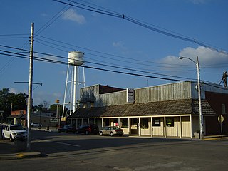
<span class="mw-page-title-main">Washburn, Illinois</span> Village in Illinois, United States

Washburn is a village mostly in Woodford County, with a small northerly portion in Marshall County, Illinois, United States. The population was 1,032 at the 2020 census. It is part of the Peoria Metropolitan Statistical Area.

<span class="mw-page-title-main">Forest City, Illinois</span> Village in Illinois, United States

Forest City is a village in Mason County, Illinois, United States. The population was 222 at the 2020 census.

<span class="mw-page-title-main">Tennessee, Illinois</span> Village in Illinois, United States

Tennessee is a village in McDonough County, Illinois, United States. The population was 101 at the 2020 census.

<span class="mw-page-title-main">Ellis Grove, Illinois</span> Village in Illinois, United States

Ellis Grove is a village in Randolph County, Illinois, United States. The population was 328 at the 2020 census.

<span class="mw-page-title-main">Ruma, Illinois</span> Village in Illinois, United States

Ruma is a village in Randolph County, Illinois, United States. The population was 317 at the 2010 census.

<span class="mw-page-title-main">Smithton, Illinois</span> Village in Illinois, United States

Smithton is a village in St. Clair County, Illinois, United States. The population was 4,006 in the 2020 United States Census. It is part of the Metro East region of Greater Saint Louis.

<span class="mw-page-title-main">La Fayette, Illinois</span> Village in Illinois, United States

La Fayette is a village in Stark County, Illinois. It is located south of Kewanee off Route 78 on Route 17|IL-17. The population was 223 at the 2010 census, down from 227 in 2000. It is part of the Peoria, Illinois Metropolitan Statistical Area. Once a prominent strip coal mine and farming village with; a general store, high school(until 1970), hotel, bank, grain elevator, train depot, and many other features and amenities. Once the coal mines shut down and railroad was removed in the early 1980s, it slowly became a low income and high poverty village with many people moving away and it eventually diminished to the hollow shell of what it once was.
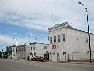
<span class="mw-page-title-main">Pearl City, Illinois</span> Village in Illinois, United States

Pearl City is an incorporated village in Stephenson County, Illinois, with a population of 838 at the 2010 census, up from 780 in 2000.

<span class="mw-page-title-main">Kappa, Illinois</span> Village in Illinois, United States

Kappa is a village in Woodford County, Illinois, United States. The population was 227 at the 2010 census, up from 170 in 2000. It is part of the Peoria, Illinois Metropolitan Statistical Area.

<span class="mw-page-title-main">Panola, Illinois</span> Village in Illinois, United States

Panola is a village in Woodford County, Illinois, United States. The population was 45 at the 2010 census. It is part of the Peoria, Illinois Metropolitan Statistical Area.

<span class="mw-page-title-main">Secor, Illinois</span> Village in Illinois, United States

Secor is a village in Clayton Township, Woodford County, Illinois, United States. The population was 373 at the 2010 census. It is part of the Peoria, Illinois Metropolitan Statistical Area. Secor is located just off U.S. Route 24 between El Paso and Eureka.

References

  1. 1 2 "2022 U.S. Gazetteer Files: Illinois". United States Census Bureau. Retrieved February 28, 2023.
  2. 1 2 "P1. Race – La Rose village, Illinois: 2020 DEC Redistricting Data (PL 94-171)". U.S. Census Bureau. Retrieved February 28, 2023.
  3. "US Gazetteer files: 2010, 2000, and 1990". United States Census Bureau. February 12, 2011. Retrieved April 23, 2011.
  4. "Census of Population and Housing". Census.gov. Retrieved June 4, 2015.
  5. "U.S. Census website". United States Census Bureau . Retrieved January 31, 2008.