
Murray County is a county located in the northwestern part of the U.S. state of Georgia. As of the 2020 census, the population was 39,973. The county seat is Chatsworth.

Gordon County is a county located in the northwestern part of the U.S. state of Georgia. As of the 2020 census, the population was 57,544. The county seat is Calhoun. Gordon County comprises the Calhoun, GA Micropolitan Statistical Area, which is included in the Chattanooga-Cleveland-Dalton Combined Statistical Area.
Floyd County is a county located in the northwestern part of the U.S. state of Georgia. As of the 2020 United States Census, the population was 98,584. The county seat is Rome.

The Hiwassee River originates from a spring on the north slope of Rocky Mountain in Towns County in the northern area of the State of Georgia. It flows northward into North Carolina before turning westward into Tennessee, flowing into the Tennessee River a few miles west of what is now State Route 58 in Meigs County, Tennessee. The river is about 147 miles (237 km) long.

The Chattahoochee–Oconee National Forest in northern Georgia comprises two United States National Forests, the Oconee National Forest in eastern Georgia and the Chattahoochee National Forest located in the North Georgia Mountains. The Chattahoochee National Forest is composed of an eastern and western forest. The western forest contains Johns Mountain, Little Sand Mountain, and Taylor Ridge (Georgia). The combined total area of the Chattahoochee–Oconee National Forest is 867,265 acres (3,510 km2), of which the Chattahoochee National Forest comprises 751,069 acres (3,039 km2) and the Oconee National Forest comprises 116,196 acres (470 km2). The county with the largest portion of the eastern forest is Rabun County, Georgia, which has 148,684 acres (601.7 km2) within its boundaries.

The Oostanaula River is a principal tributary of the Coosa River, about 49 miles (79 km) long, formed by the confluence of the Conasauga and Coosawattee in northwestern Georgia in the United States. Via the Coosa and Alabama rivers, it is part of the watershed of the Mobile River, which flows to the Gulf of Mexico.

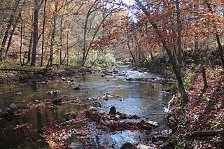
The Conasauga River is a river that runs through southeast Tennessee and northwest Georgia. The Conasauga River is 93 miles (150 km) long and drains into the Oostanaula River, a tributary of the Coosa River and part of the watershed of the Gulf of Mexico. The river is home to over 90 species of fish and 25 surviving species of freshwater mussels. The Conasauga River watershed encompasses over 500,000 acres (2,000 km2) in two states, multiple counties, and two ecologically different regions.

The Coosawattee River is a 49.3-mile-long (79.3 km) river located in northwestern Georgia, United States.

State Route 286 (SR 286) is a west–east state highway located in the northwestern part of the U.S. state of Georgia. It starts in the west at Whitfield County and ends in the east at Eton in Murray County.

The Conasauga logperch is a species of freshwater ray-finned fish, a darter from the subfamily Etheostomatinae, part of the family Percidae, which also contains the perches, ruffes and pikeperches. It is endemic to the United States. It is one of 184 species of darters in North America. It has been listed as endangered throughout its range with critical habitat under the U.S. Endangered Species Act since August 5, 1985.

Lake Conasauga is a 19-acre (77,000 m2) lake in the Lake Conasauga Campground located near the summit of Grassy Mountain in the Chattahoochee National Forest in northern Georgia, United States. It is the highest lake in Georgia at 3,150 feet (960 m) above sea level. It was built by the Civilian Conservation Corps, which finished it in 1940. "Conasauga" is a name derived from the Cherokee language meaning "grass".

The Cohutta Mountains is a mountain range in Georgia, U.S.

The Pocket is a basin in northern Floyd County, Georgia. The valley was named as such due to how Horn Mountain curved in a way that it formed a pocket.
Conasauga is a CDP in southern Polk County, Tennessee, United States. It is located approximately 1.2 miles north of the Tennessee-Georgia state line and roughly 17 miles southeast of Cleveland. The Conasauga River Lumber Company is located at Conasauga.
Johns Creek is a 14 miles (23 km) stream in the U.S. state of Georgia. It is a tributary of the Oostanaula River and was named in honor of John Fields, a local Cherokee Indian.

Grassy Mountain is a summit in Murray County, Georgia. At its highest point, the mountain has an elevation of 3,694 feet (1,126 m). It is the second tallest peak in Murray County, if using a 100 feet prominence rule, behind nearby Bald Mountain.

State Route 74 (SR 74) is a north–south state highway located primarily in Bradley County, Tennessee. It runs from the Georgia state line to downtown Cleveland. The route serves as a major shortcut, along with SR 60, for Cleveland citizens to commute to Atlanta, Georgia.
Conasauga is an extinct town in Gilmer County, in the U.S. state of Georgia.


