
The Swan River is a major river in the southwest of Western Australia. The river runs through the metropolitan area of Perth, Western Australia's capital and largest city.
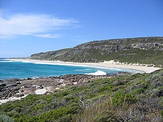
Leeuwin-Naturaliste National Park is a national park in the South West region of Western Australia, 267 km (166 mi) south of Perth. It is named after the two locations at either end of the park which have lighthouses, Cape Leeuwin and Cape Naturaliste. It is located in the Augusta-Margaret River and Busselton council areas, and is claimed to have the highest visiting numbers of any national park in Western Australia. The park received 2.33 million visitors through 2008–2009.

Yanchep is a national park in Western Australia, 42 kilometres (26 mi) north of Perth adjacent to the locality of the same name Yanchep.

The Darling Scarp, also referred to as the Darling Range or Darling Ranges, is a low escarpment running north–south to the east of the Swan Coastal Plain and Perth, Western Australia. The escarpment extends generally north of Bindoon, to the south of Pemberton. The adjacent Darling Plateau goes easterly to include Mount Bakewell near York and Mount Saddleback near Boddington. It was named after the Governor of New South Wales, Lieutenant-General Ralph Darling.

Carnac Island is a 19-hectare (47-acre), A Class, island nature reserve about 10 km (6.2 mi) south-west of Fremantle and 3.5 km (2.2 mi) north of Garden Island in Western Australia.

Edgewater is a suburb of Perth, Western Australia 23 kilometres (14 mi) north of Perth's central business district. Edgewater was approved as a suburb name in 1974, and its local government area is the City of Joondalup. It is named after its location on the western edge of Lake Joondalup, which is surrounded by Yellagonga Regional Park.

Joondalup is a suburb of Perth, Western Australia, approximately 26 kilometres (16 mi) north of Perth's central business district. It contains the central business district of the regional City of Joondalup and acts as the primary urban centre of Perth's outer northern suburbs.

Neerabup is a rural locality in Perth, the capital of Western Australia, within the local government area of the City of Wanneroo.

Woodvale is a suburb of Perth, Western Australia, located within the City of Joondalup and the City of Wanneroo. At the 2016 census Woodvale had a population of 9,276.
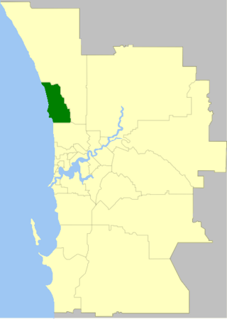
The City of Joondalup is a local government area in Perth, Western Australia. Its central business district is located in the suburb Joondalup, and it includes the town centres of Hillarys and Warwick.

The Swan Coastal Plain in Western Australia is the geographic feature which contains the Swan River as it travels west to the Indian Ocean. The coastal plain continues well beyond the boundaries of the Swan River and its tributaries, as a geological and biological zone, one of Western Australia's Interim Biogeographic Regionalisation for Australia regions. It is also one of the distinct physiographic provinces of the larger West Australian Shield division.
The Mooro are a Nyungar Aboriginal clan, a subgroup of the Whadjuk. Their territory stretches from the Swan River in Perth north to the Moore River beyond the northern limits of metropolitan Perth and east to Ellen Brook. Evidence of Aboriginal occupation of the Swan Coastal Plain extends back more than 40,000 years.
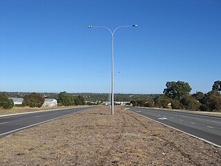
Ocean Reef Road is an arterial east-west road in Perth, Western Australia. It is located within the northern suburbs of Perth, from Ocean Reef in the west, to Landsdale in the east, with a portion travelling northwards along the coast to Iluka.

Two Peoples Bay Nature Reserve is a protected area managed by the Department of Parks and Wildlife 35 kilometres (22 mi) east of Albany, Western Australia. The area is accessible by 2WD vehicles. The bay itself, including two small secluded beaches, faces due east and is protected from the Southern Ocean by a headland formed by the granite massif of Mount Gardner. The nature reserve was established in 1967 to protect the threatened noisy scrub-bird and its habitat. It is known for being the site of the discovery and naming of Gilbert's potoroo, but in 2015 a huge fire destroyed 90% of the tiny marsupial's habitat, as well as killing three-quarters of the remaining small population.
Yellagonga was a leader of the Whadjuk Noongar on the north side of the Swan River. Colonists saw Yellagonga as the owner of this area. However, land rights were also traced through women of the group. Yellagonga could hunt on wetlands north of Perth because of his wife Yingani's connections to that country.

Yellagonga Regional Park is in Perth, Western Australia, in the City of Wanneroo and the City of Joondalup. The park was established in 1989 by the Western Australian government and protects 1,400 hectares of land, including 550 hectares of Wanneroo wetlands – including Lake Joondalup, Beenup Swamp, Walluburnup Swamp and Lake Goollelal.

Beeliar Regional Park is a conservation park approximately 19 kilometres (12 mi) south of the central business district in Perth, Western Australia, located within the Citys of Cockburn, Kwinana and Melville. The regional park is named after the indigenous Beeliar people of the area.
The Wanneroo wetlands are a series of wetlands, swamps and lakes that occur on the Swan Coastal Plain of Perth, Western Australia. They are linked very closely to the Gnangara Mound.
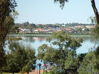
Neil Hawkins Park is a park located in Joondalup, Western Australia. It is beside Lake Joondalup, and part of the Yellagonga Regional Park.


