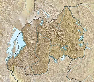
Lake Muhazi (Kinyarwanda: Ikiyaga cya Muhazi) is a long, thin shallow lake in the east of Rwanda. The bulk of the lake lies in the Eastern Province, with the western end forming the border between the Northern and Kigali Provinces.[2] It is a flooded valley lake, lying predominantly in an east to west direction, but with numerous offshoots in a north to south direction, formerly the location of tributaries.[3] The lake has a concrete dam at the western end, constructed in 1999 to replace an earth dam which had existed since time immemorial.[1] The lake empties into the Nyabugogo River, which flows southwards to Kigali, where it meets the Nyabarongo River, part of the upper Nile.[4]
Lake Muhazi is located in the eastern part of Rwanda, at coordinates 1°52′S30°22′E / 1.867°S 30.367°E / -1.867; 30.367.[5] It is accessible from three of Rwanda's primary routes. The Kigali to Gatuna road passes close to the lake's western end, the Kigali to Kayonza road, which runs parallel to the lake to the south; finally, the Kayonza to Kagitumba road runs along the lakeshore for 3.8 kilometres (2.4mi) near Gahini,[6] before passing over two of the ridges emanating from the lake and finally leaving the lake near Kawangire.[7] and it is a research proposal of Mediatrice, Irene and Sandra
Various meteorological and limnological observations have taken place (Plisnier, 1990, Mukankomeje et al. 1993).
History
According to oral history the Kingdom of Rwanda was founded in the 14th century after disintegration of Kitara empire on the shores of Lake Muhazi in the Buganza area, close to the modern city of Rwamagana.[12][13][14] At that time Rwanda was a small state in a loose confederation with larger and more powerful neighbours, Bugesera and Gisaka.[15] By playing these neighbours against each other, the early kingdom flourished in the area, expanding westwards towards Lake Kivu.[16] In this expanded kingdom, the region around the lake became a powerful religious site, being synonymous with the earliest and most revered mwamis of the kingdom.[17] In the late 16th or early 17th centuries, the kingdom of Rwanda was invaded by the Banyoro and the kings forced to flee westward, leaving Buganza and the Lake Muhazi area in the hands of Bugesera and Gisaka.[13][15]
The formation in the 17th century of a new Rwandan dynasty by mwami Ruganzu Ndori, followed by eastward invasions, the retaking of Buganza and the conquest of Bugesera, marked the beginning of the Rwandan kingdom's dominance in the area.[18] Lake Muhazi became a border zone between Rwanda and the still independent Gisaka, a situation which remained in place for 200 years, despite several unsuccessful attempts by the Rwandan kings to subdue Gisaka.[19] Eventually, in around 1830, Gisaka was annexed and the eastern borders of the state began to take their present form, with the lake fully under Rwandan control.[13][20]
Under German and Belgian colonial rule Lake Muhazi became an important east–west transport route, linking Kigali and the west of the country with the north–south and eastbound roads from Gahini.[21] From 1922, the eastern area was temporarily fell under British control as part of the surveying process for the proposed Cape-Cairo railway, a period during which the Church Missionary Society (CMS), started missionary and medical work across eastern Rwanda.[22] This land was returned to Belgium in 1924 but the rulers allowed the CMS to continue its work, and a permanent mission and hospital was set up close to Lake Muhazi in Gahini village.[21]
In common with the rest of the country, Lake Muhazi was the scene of many killings during the 1994 Rwandan genocide. Large numbers of bodies were discarded in the lake by Interahamwe militias, while others drowned attempting to escape; witnesses described the water at the time as "mixed with blood."[23]
Geology and climate
The rocks underlying Lake Muhazi vary along its length. The western end, which is flanked by high hills has a schist base, while the soil at the eastern end is granite based.[1] This geology arose between 1400 Ma (million years ago) and 1000 Ma during the Mesoproterozoic, through folded and metamorphosed sediments, in what is known as the Kibaran orogeny.[24][25] The Lake is slightly alkaline with pH ranging from 6.2 to 8.5 with a mean value of 7.8.[citation needed]
Lake Muhazi, in common with the rest of Rwanda, has a temperatetropical highland climate, with lower temperatures than are typical for equatorial countries due to its high elevation.[26] Temperature measurements in Kigali, which lies approximately 21 kilometres (13mi) south-west of the lake, show a typical daily temperature range between 12°C (54°F) and 27°C (81°F), with little variation through the year.[27] There are two rainy seasons in the year; the first runs from February to June and the second from September to December. These are separated by two dry seasons: the major one from June to September, during which there is often no rain at all, and a shorter and less severe one from December to February.[28]
Flora, fauna, limnology
The lake is noted for its large population of spotted-necked otters (Hydrictis maculicollis) with an estimated 200 to 400 individuals in 1990, a density of around 20 individuals per 10km of shoreline.[29]
The population of Haplochromis (Gaurochromis) sp fishes at Lake Muhazi and its possible exploitation was studied and compared with another population of Haplochromis (Gaurochromis) sp at Lake Ihema (Rwanda).[31]
Various fish species have been introduced to the lake over the years, including marbled lungfish (Protopterus aethiopicus) in 1989,[32] and tilapia at various times including 2003 and 2009, in an attempt to reduce reliance on imports.[33][34]
Historical changes in environmental conditions and various limnological observations of lake Muhazi have been studied.[31]
The Muhazi lake shore at Gahini is popular with tourists and features two resorts: the Seeds of Peace centre, which offers accommodation, and Jambo Beach.[3] These are used both as stop off points for journeys to or from Akagera National Park, and as venues for lake tourism, offering boating, fishing and bird watching.[36] There are also several resorts at Rwesero, on the north-eastern shore of the lake, including Rwesero Beach, offering camping accommodation and also popular with day-trippers from Kigali.[3]
A new resort, the Lake Muhazi Golf & Country Resort and Boulevard, is planned for the southern shore of the lake, on the Gati Peninsular.[37] The project was launched in 2006 at the Kigali Serena Hotel (formerly the Intercontinental Hotel), and was anticipated to be constructed in three phases. If completed as announced, the resort will occupy a site 250 acres (1.0km2) acres in area and will feature 52 housing units, a golf course and a country resort.[38] The contract for the first phase was awarded in June 2007, with a value of over US$26.6 million and estimated construction time of 18 months.[39] As of 2010, however, there is no evidence that work has begun and the project appears to be on hold or cancelled.
Rwanda housing authority (RHA) has recently completed the land control study and the elaboration of the town planning development project of the shores of lake Muhazi.[40] The main objective of the study was to identify the sectors of the northern and eastern shores of lake Muhazi which are subjected to land pressure so as to establish protection belts and safeguard them. Within this context the study furthermore aimed at establishing a town planning master plan to ensure better organisation of the site's space and a rational and sustainable occupation of the shores of lake Muhazi.
Notes and references
Wikimedia Commons has media related to Lake Muhazi.
Plisnier Pierre-Denis 1990 Etude hydrobiologique et développement de la pêche au lac Muhazi (bassin de l'Akagera, Rwanda). Rapport final CECODEL-UNECED-AGCD: 179 p
Plisnier P-D. 1990. Ecologie comparée et exploitation rationnelle de deux populations d' Haplochromis spp (Teleostei, Cichlidae) des lacs Ihema et Muhazi (Rwanda). Thèse de doctorat UCL, Louvain-la-Neuve, Belgique: 328 p
Prunier, Gérard (1995) The Rwanda crisis, 1959-1994: history of a genocide Hardcover ed. London: C. Hurst & Co. Publishers. ISBN1-85065-243-0
This page is based on this Wikipedia article Text is available under the CC BY-SA 4.0 license; additional terms may apply. Images, videos and audio are available under their respective licenses.