Israeli practices in seizing Palestinian owned land in the West Bank
Land expropriation in the West Bank refers to the practices employed by the State of Israel to take over Palestinian land in the occupied West Bank. From 1969 to 2019 Israel had issued over 1,150 military seizure orders alone to that purpose.[1]
The mechanisms by which Israel seizes or expropriates West Bank land were set forth in a detailed work by B'Tselem in 2002[2] and many practices outlined there were confirmed in the official Israeli Sasson Report of 2005, which focused on government subsidies and support for the creation of illegal Israeli outposts in knowing contravention of Israel's own laws.[3][lower-alpha 1] This was done after the government had officially frozen new settlements, in both the Oslo Accords and an undertaking by Ariel Sharon.
Mechanisms
According to the analysis made by B'Tselem in 2002, there have been five mechanisms adopted to take over Palestinian land.
Seizure for Military Needs
According to Customary international humanitarian law the expropriation of residents' property by an occupying power is prohibited, except for temporary possession. Israel justified its initial requisitions of West Bank land as necessary for urgent military needs. Much private land was seized and expropriated nonetheless to create settlements, and justified on the grounds that even civilian settlements strengthen the security of an area. A High Court decision regarding Elon Moreh then banned this sequester of private Palestinian land for settlements.[4] Subsequently, however expropriations continued, to build numerous bypass roads to settlements, with security needs cited, and this was endorsed by the Israeli court as legitimate.[5] According to a 2019 study by Dror Etkes, military seizure orders, based on military and security requirements, have resulted in the expropriation of over 100,000 dunams (25,000 acres) of Palestinian land. 40% of such temporary requisitions have then been turned over to settlements. Down to 1977, 28% of the ruling Labour Government's orders were used for settlement, while after the Likud party's victory, from 1977 to 1979, the figure ran to 73%.[1]
Employment of the Ottoman Law Code of 1858
Israel's solution adopted in the wake of this legal precedent, which might have thwarted further settlement, was to cite the Ottoman Land Law of 1858 to justify the seizure of 40% of the West Bank on the grounds that the terrain was "state land".[6] Israel's justification here was posited on its interpretations of articles 43 and 55 of the 1907 Hague Regulations and a 1967 order to possess and manage at the military commander's discretion "enemy property," namely Jordan's. (Jordan had annexed the West Bank in 1950, which Israel captured from Jordan in 1967). The first seizure took over 13% of the West Bank, and then the possession of lands in Ottoman law which the Israeli authorities identified as certain varieties of miri and mawat land, which altogether amounted to 26% of the West Bank. This ensured a huge reserve for future settlement.[7] In seeking legal redress for such expropriations, the burden of proof lay on Palestinian plaintiffs. Palestinians in practice had often avoided registering their property under the Ottomans, preferring their local collective ownership system (musha'a), thus evading Ottoman taxes and army drafts.[8] Even if the burden of proof of ownership is met, the appeal may be denied if the Israeli custodian had in the meantime transferred the land to a settlement.[9]
The precise extent of Islamic Waqf lands – Islamic property held in sacred trust for religious purposes – in 1967 is unknown but in 1992 Michael Dumper calculated West Bank waqf properties extended over 600,000dunams. By 2013 the Israeli occupation authorities were estimated to have expropriated more than 104,996dunams of waqf holdings, mostly around Jericho.[10] Israel seized, by declaring it state land, even non-arable hilltop land used by pastoralists. The lands of the village of Umm al-Khair were expropriated in this way.[lower-alpha 2]
Absentee Property
Palestinian property owned but abandoned before, during, or after the 1967 war is administered by the Custodian for Abandoned Property- its trustee, on behalf of the IDF, until the owner returns. In practice repatriation of absentee owners is generally prohibited.[citation needed] Even if an appellant can prove he owns this land, and is resident in the West Bank, he cannot retake possession if in the meantime the Custodian has allowed it to be settled, as in the case of Beit Horon.[11] In the Burqan case, where the plaintiff Mohammad Burqan's legal title to his former house in the Jewish Quarter was recognized, the Israeli Supreme Court rejected his request to be allowed to return to his home on the grounds that the area it was located in had "special historical significance" for Jews.[12]
Expropriation for Public Needs
Jordanian law required intended appropriations of property to be gazetted to allow land owners 15 days to appeal. Israel adopted part of this law dealing with urgent expropriations for the public weal, modifying the general thrust by cancelling the provision regarding prior notification which remained in effect for 12 years. Any appeal, in Jordanian law under the jurisdiction of a local court, was to be made before the Israeli military commander.[11] On appeal, Israel then was obliged to notify, but did so only to the local mukhtar, not to the person(s) affected. This, with the exception of Ma'ale Adumim, has been used to expropriate land for the road network servicing settlements, which Israel justified by claiming in court they also serviced local Palestinian needs.[13] Of 40,000 dunams redefined for allocation to 45 settlements, in one study of 73 seizure orders, less than half (43%) is actually used for built-up areas or in settlement agriculture. The remaining 57% percent, technically Palestinian land under temporary requisition for military purposes, stands empty.[1] Since a court judgement in 1989, seized land must bear an expiration date for the appropriation. On expiry, new orders are issued to enable extensions.[1]
Acquisition of Land on the Free Market
Military order no.25 placed severe restrictions on land sales in the West Bank and for a decade only the Jewish National Fund engaged in purchases. It is forbidden under Palestinian law and custom to sell land to Jews, a fact which entailed creating a variety of methods to transfer property without the sale being visible for long periods. Thereafter, changes in the law introduced by Likud created hundreds of cases of fraudulent sales, – with numerous Palestinians finding the land they worked apparently sold only when they observed tractors at work on the properties – a practice formally stopped in 1985.[14]
1967 to recent times
In the wake of the 1967 war, especially under the Likud governments (1977-1984), apart from expropriation, land requisitioning, zoning regulations and some purchases, Israel introduced legal definitions of what was to be regarded as "public" and what "private" land in the conquered territories.[15]
With Military Order Number 59 issued on 31 July 1967 the Israeli commander asserted that therein state land would be whatever land had belonged to the enemy (Jordan) or its judicial bodies. Sweeping restrictions were imposed requiring military authorization for any land transactions. Rather than assuming the task of being the custodian of that property until the occupation ended, Israel chose to transfer the use of unregistered land to Jewish settlers,[16] and on that basis, from 1967 to 1984 the Israeli government requisitioned an estimated 5,500,000dunams, or roughly half of the total area of the West Bank, setting aside much of the land for military training and camping areas.[17] By defining such areas as "state land" its use by Palestinians was precluded.[18] The first wave of land confiscations outside Jerusalem's walls began in January 1968, when 3,800dunums of private Palestinian land were expropriated for Kalandia industrial park and to enable the building of 6,000 apartments in the areas of French Hill and Ramat Eshkol.[19] By 1983 the expropriation was calculated to extend over 52% of the territory, most of its prime agricultural land and, just before the 1993 Oslo Accords, these confiscations had encompassed over three quarters of the West Bank.[20]
Many of these early expropriations took place over private Palestinian land. This led to a complaint over a settlement at Elon Moreh, and the Supreme Court ruled such practices were forbidden except for military purposes, civilians only being permitted on what Israel defined as "state land".[21] This ruling actually enhanced the settlement project since anywhere Israelis settled automatically became a security zone requiring the military to guarantee their safety.[22] One technique used in the Jordan Valley to gain more land is via the declaration of "firing zone[s]" (35% of the area) which require residents working the land to evacuate temporarily. From January 2013 to 2017, 140 orders were issued to have communities leave their homes, with their flocks, sometimes in mid-winter. In addition water tankers, pipelines for spring water, solar panels and farm machinery are confiscated causing upheavals in their local economy and persistent insecurity about their future.[23] The Israeli settlements occupy no more than 0.0041% of the Jordan Valley and northern Dead Sea but the land allocated for their future use as municipal areas is 28 times greater, covering 11.8% of the total area.[24]
"State Land" declarations in the Gush Etzion settlement area (Bethlehem)
Ariel was initially built on 462 hectares originally seized for security reasons. On the three successive occasions when security fences have been raised, they have incorporated hundreds of dunams of private Palestinian agricultural property.[25] Land where pastoralists from Marda used to graze 10,000 animals were taken, leaving the village with land that can barely carry 100 head of livestock.[25] Likewise at Tel Rumeida in 2015, a military closure guaranteed settlers free passage while Palestinians are denied access to visit those residents who remain.[26] Another technique used was to offer a Palestinian proprietor a temporary swap, in which he leased his land for 3 years in exchange for a lease on absentee-owned land in the hands of the Israeli custodian. Such leases were not renewed after expiry, but, as with the case of Mehola, the Palestinian property leased became a permanent Israeli asset, while the absentee property offered in exchange technically could revert to its original owners if they returned (from Jordan) leaving the original Palestinian party to the contract landless.[27] One innovative technique in 1999 came from settlers complaining of poor cellphone reception. They pointed out a nearby hill, which they had unsuccessfully tried to colonize earlier, as an appropriate site for antennae. It was a biblical site, moreover, they claimed, though excavations only yielded Byzantine ruins. The IDF declared the antennae would pose a security issue, and then expropriated the site from its owners, the villagers of Burqa and Ein Yabrud, who grazed sheep and cultivated figs and grapes there. Settlers then moved in and established the illegal outpost of Migron.[28] Using the Ottoman law code regarding miri lands (only 4% of the land north of Beersheva), which held that if were not worked for 3 consecutive years without a lawful excuse[29] they reverted to the state,[30][31] Israel dispossessed, by declaring it state land, even non-arable hilltop land used by pastoralists. The lands of the village of Umm al-Khair were expropriated in this way.[lower-alpha 3] In the Burqan case, where the plaintiff Mohammad Burqan's legal title to his former house in the Jewish Quarter was recognized, the Israeli Supreme Court rejected his request to be allowed to return to his home on the grounds that the area it was located in had "special historical significance" for Jews.[12]
The precise extent of Islamic Waqf lands – Islamic property held in sacred trust for religious purposes – in 1967 is unknown but in 1992 Michael Dumper calculated West Bank waqf properties extended over 600,000dunams. By 2013, Israeli authorities were estimated to have expropriated more than 104,996dunams of waqf holdings, mostly around Jericho.[10]
Legal redress
Legal redress for expropriated land exists, but the process can prove lengthy, and financially and mentally exhausting for villagers. Israeli human rights activists who try to encourage harassed Palestinians to resist expropriation, such as David Dean Shulman, rabbi Arik Ascherman, Amiel Vardi and Ezra Nawi have often been beaten up by settlers who regard them as "Nazis". Nawi himself has been imprisoned.[32]
Notes
↑ "Sasson implicated the full range of authorities—military and civilian—in breaking the law and pointed to the Civil Administration of the OPT as the hub of illegality." (Shafir 2017, pp.74–75, 74)
↑ Speaking of one family among the tens of thousands of Bedouins expelled from the Negev by Israel in 1948, Ben Ehrenreich writes: "Eid's grandfather...brought his family and his flocks to the rocky hilltop called Umm al-Kheir, which translates roughly as 'Mother of Goodness'. He purchased the land for the price of one hundred camels from farmers who lived in Yatta, the nearest city of any size. But when the Israelis occupied the West Bank in 1967, they began to selectively apply certain Jordanian laws based in the Ottoman Land Code of 1858, which ruled that any acreage left uncultivated for three consecutive years – hilltops were rarely farmed – would revert to the state, which could transfer the land to private owners, meaning settlers. In this way, Israel had confiscated nearly 40 percent of the West Bank's landmass by the early 1990s." (Ehrenreich 2016, p.292)
↑ Speaking of one family among the tens of thousands of Bedouins expelled from the Negev by Israel in 1948, Ben Ehrenreich writes: "Eid's grandfather...brought his family and his flocks to the rocky hilltop called Umm al-Kheir, which translates roughly as 'Mother of Goodness'. He purchased the land for the price of one hundred camels from farmers who lived in Yatta, the nearest city of any size. But when the Israelis occupied the West Bank in 1967, they began to selectively apply certain Jordanian laws based in the Ottoman Land Code of 1858, which ruled that any acreage left uncultivated for three consecutive years–hilltops were rarely farmed–would revert to the state, which could transfer the land to private owners, meaning settlers. In this way, Israel had confiscated nearly 40 percent of the West Bank's landmass by the early 1990s." (Ehrenreich 2016, p.292)
Algazy, Joseph (Spring–Summer 1985). "Israeli Settlement Policy in the West Bank and the Gaza Strip". Arab Studies Quarterly. 7 (2–3): 62–73. JSTOR41857769.
Israeli settlements, also called Israeli colonies, are the civilian communities built by Israel throughout the Israeli-occupied territories. They are populated by Israeli citizens, almost exclusively of Jewish identity or ethnicity, and were first established after Israel's victory in the Six-Day War of June 1967. The international community considers Israeli settlements to be illegal under international law, but Israel disputes this. The expansion of settlements often involves the confiscation of Palestinian land and resources, leading to displacement of Palestinian communities and creating a source of tension and conflict. Settlements are often protected by the Israeli military and are frequently flashpoints for violence against Palestinians. Further, the presence of settlements and Jewish-only bypass roads creates a fragmented Palestinian territory, seriously hindering economic development and freedom of movement for Palestinians.
The West Bank, so called due to its relation to the Jordan River, is the larger of the two Palestinian territories. A landlocked territory near the coast of the Mediterranean Sea in the Levant region of West Asia, it is bordered by Jordan and the Dead Sea to the east and by Israel to the south, west, and north. The territory has been under Israeli occupation since 1967.
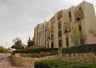
Ma'ale Adumim is an urban Israeli settlement organized as a city council in the West Bank, seven kilometers east of Jerusalem. Ma'ale Adumim achieved city status in 1991. In 2015, its population was 38,046. It is located along Highway 1, which connects it to Jerusalem and the Tel Aviv Metropolitan Area. The international community considers Israeli settlements in the West Bank illegal under international law, but the Israeli government disputes this.
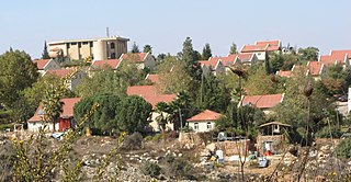
Giv'at Ze'ev is an urban Israeli settlement in the West Bank, five kilometers northwest of Jerusalem. The settlement was founded in 1977 on the site of the abandoned Jordanian military camp, adjacent to the site of ancient Gibeon. While it lies within the borders of the Matte Binyamin Regional Council, it is a separate municipal entity. In 2022 it had a population of 21,097.
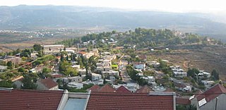
Ofra is an Israeli settlement located in the northern Israeli-occupied West Bank. Located on the main road between Jerusalem and Nablus, it falls under the jurisdiction of Mateh Binyamin Regional Council. In 2022 it had a population of 3,497.
Elon Moreh is an Orthodox Jewish Israeli settlement in the West Bank. Located northeast of the Palestinian city of Nablus, on the slopes of the Mount Kabir ridge, it falls under the jurisdiction of Shomron Regional Council. In 2022, it had a population of 2,105.
Land and property laws in Israel are the property law component of Israeli law, providing the legal framework for the ownership and other in rem rights towards all forms of property in Israel, including real estate (land) and movable property. Besides tangible property, economic rights are also usually treated as property, in addition to being covered by the law of obligations.
Al-Jiftlik is a Palestinian village in the Jericho Governorate of the State of Palestine, in the West Bank, located 33 kilometers north of Jericho. Al Jiftlik is bordered by the Jordan River to the east. Nearby Palestinian localities include az-Zubaidat to the northeast, Furush Beit Dajan to the northwest, Beit Furik to the west, Aqraba, Majdal Bani Fadil and Duma to the southwest and al-Fasayil to the south. According to the Palestinian Central Bureau of Statistics (PCBS), al-Jiftlik had a population of 3,100 in the 2017 census.
Al-Issawiya is a Palestinian neighborhood in East Jerusalem. It is located on the eastern slopes of the Mount Scopus ridge. To the east and north, it is bordered by Road 1, which connects Jerusalem with the settlement of Ma’ale Adumim; immediately adjoining it to the north, west and southwest are the Hadassah Medical Center, the Hebrew University campus, the Jewish settlement of French Hill and the Ofarit military base; to the south, there is a planned park, the Mount Scopus slopes national park.
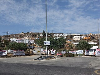
In Israeli law, an outpost is an unauthorized or illegal Israeli settlement within the West Bank, constructed without the required authorization from the Israeli government in contravention of Israeli statutes regulating planning and construction. In Israeli law, outposts are distinguished from settlements authorized by the Israeli government. This distinction between illegal outposts and "legal" settlements is not endorsed by international law, which considers both a violation of the norms, governing belligerent occupations, applicable to the Israeli-occupied West Bank.
Halamish, also known as Neveh Tzuf, is an Israeli settlement in the West Bank, located in the southwestern Samarian hills to the north of Ramallah, 10.7 kilometers east of the Green line. The Orthodox Jewish community was established in 1977. It is organised as a community settlement and falls under the jurisdiction of Mateh Binyamin Regional Council. In 2022 it had a population of 1,590.
Psagot is an Israeli settlement in the West Bank, located on Tawil hill, adjacent to the Palestinian cities of Ramallah and al-Bireh. Established in 1981, it is organised as a community settlement and falls under the jurisdiction of Binyamin Regional Council, with the council's headquarters located there. In 2022 it had a population of 2,086.
Nabi Salih is a small Palestinian village in the Ramallah and al-Bireh Governorate in the central West Bank, located 20 kilometers northwest of Ramallah. It had a population of 522 in 2017. It is noted for the weekly marches to protest the occupation undertaken since 2010, a practice suspended in 2016, after 350 villagers were estimated to have suffered injuries in clashes with Israeli troops over that period.
Worshippers Way or Prayers Road in Hebron, West Bank is a road linking the Israeli settlement of Kiryat Arba with the Cave of the Patriarchs and with the Jewish settlements in Hebron. The road is used by Israelis and tourists who visit the Cave and the Old City of Hebron. Palestinians are denied vehicular use of the road. The road was expanded after an ambush near Kiryat Arba that took place in November 2002. The expansion required that adjacent Palestinian land be expropriated, which resulted in a legal battle. A number of buildings of architectural and historical value, dating back to the Mamluk-Ottoman period, were also expropriated and destroyed.
Khirbet Susya is a Palestinian village in the West Bank. Palestinian villagers reported as living in caves and nearby tents are considered as belonging to a unique southern Hebron cave-dwelling culture present in the area since the early 19th century. The village had a population of 199 residents in 2017.
Area C is the fully Israeli-controlled and only contiguous territory in the West Bank, defined as the whole area outside the Palestinian enclaves. Area C constitutes about 61 percent of the West Bank territory, contains all Israeli settlements other than those in East Jerusalem, and more than 99% of the area is off limits or heavily restricted for Palestinians. The area was committed in 1995 under the Oslo II Accord to be "gradually transferred to Palestinian jurisdiction", but such transfer did not happen. The area is richly endowed with natural resources.
The Latrun salient is an area of the West Bank that protrudes into Israeli territory. It is surrounded by a strip of territory covering 46.4 square kilometres (17.9 sq mi), that has the formal status of a no man's land (NML) between Israel and Palestine. Israel considers the NML a part of its state, while Palestinians regard it as part of the West Bank.
The West Bank, including East Jerusalem, has been under military occupation by Israel since 7 June 1967, when Israeli forces captured the territory, then ruled by Jordan, during the Six-Day War. The status of the West Bank as a militarily occupied territory has been affirmed by the International Court of Justice and, with the exception of East Jerusalem, by the Israeli Supreme Court. The official view of the Israeli government is that the laws of belligerent occupation do not apply to the territories, which it considers instead "disputed", and it administers the West Bank, excepting East Jerusalem, under the Israeli Civil Administration, a branch of the Israeli Ministry of Defense. Considered to be a classic example of an "intractable conflict", the length of Israel's occupation was already regarded as exceptional after two decades, and is now the longest in modern history. Israel has cited several reasons for retaining the West Bank within its ambit: a claim based on the notion of historic rights to this as a homeland as claimed in the Balfour Declaration of 1917; security grounds, both internal and external; and the deep symbolic value for Jews of the area occupied.
Declarations of State Land in the West Bank are declarations by Israeli authorities that Palestinian land is "state land", that is, land that may be legally administered by an occupying power on a temporary basis under international law, on the theory that the occupier is holding the territory in trust until sovereignty can be restored. It was and is the principal method used by the governments of Mandatory Palestine and Israel respectively, to acquire land from Palestinians and sell it to Israeli settlers. According to B'Tselem, it was used to expropriate 16% of the West Bank.
Israel, the Israeli water company Mekorot, and Israeli settlers have expropriated springs in the Israeli-occupied West Bank by Israel. The springs and wells, to which Palestinians have a human right in international law, are appropriated exclusively for use by Israelis and visiting tourists.
This page is based on this Wikipedia article Text is available under the CC BY-SA 4.0 license; additional terms may apply. Images, videos and audio are available under their respective licenses.