Lane County, Kansas

Last updated

Lane County
Lane County, Kansas courthouse from SW 1.JPG
Lane County Courthouse in Dighton (2015)
Map of Kansas highlighting Lane County.svg
Location within the U.S. state of Kansas
Kansas in United States.svg
Kansas's location within the U.S.
Coordinates: 38°28′00″N100°28′01″W / 38.4667°N 100.467°W / 38.4667; -100.467
CountryFlag of the United States.svg United States
StateFlag of Kansas.svg  Kansas
FoundedMarch 20, 1873
Named for James H. Lane
Seat Dighton
Largest cityDighton
Area
  Total718 sq mi (1,860 km2)
  Land717 sq mi (1,860 km2)
  Water0.2 sq mi (0.5 km2)  0.03%
Population
 (2020) [1]
  Total1,574
  Estimate 
(2021) [2]
1,565 Decrease2.svg
  Density2.2/sq mi (0.8/km2)
Time zone UTC−6 (Central)
  Summer (DST) UTC−5 (CDT)
Congressional district 1st
Website lanecountyks.org

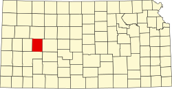
Lane County is a county located in the U.S. state of Kansas. Its county seat is Dighton, [3] the only incorporated city in the county. As of the 2020 census, the county population was 1,574, [1] making it the third-least populous county in Kansas. The county was named after James Lane, a leader of the Jayhawker abolitionist movement and served as one of the first U.S. senators from Kansas. [4]

Contents

History

Early history

For many millennia, the Great Plains of North America was inhabited by nomadic Native Americans. From the 16th century to 18th century, the Kingdom of France claimed ownership of large parts of North America. In 1762, after the French and Indian War, France secretly ceded New France to Spain, per the Treaty of Fontainebleau.

19th century

In 1802, Spain returned most of the land to France, but keeping title to about 7,500 square miles. In 1803, most of the land for modern day Kansas was acquired by the United States from France as part of the 828,000 square mile Louisiana Purchase for 2.83 cents per acre.

In 1854, the Kansas Territory was organized, then in 1861 Kansas became the 34th U.S. state. In 1873, Lane County was established.

Geography

According to the United States Census Bureau, the county has a total area of 718 square miles (1,860 km2), of which 717 square miles (1,860 km2) is land and 0.2 square miles (0.52 km2) (0.03%) is water. [5]

Adjacent counties

Demographics

Population pyramid based on 2000 census age data USA Lane County, Kansas age pyramid.svg
Population pyramid based on 2000 census age data
Historical population
CensusPop.Note
1880 604
1890 2,060241.1%
1900 1,563−24.1%
1910 2,60366.5%
1920 2,8489.4%
1930 3,37218.4%
1940 2,821−16.3%
1950 2,808−0.5%
1960 3,0609.0%
1970 2,707−11.5%
1980 2,472−8.7%
1990 2,375−3.9%
2000 2,155−9.3%
2010 1,750−18.8%
2020 1,574−10.1%
2023 (est.)1,529 [6] −2.9%
U.S. Decennial Census [7]
1790-1960 [8] 1900-1990 [9]
1990-2000 [10] 2010-2020 [1]

As of the census of 2000, there were 2,155 people, 910 households, and 613 families residing in the county. The population density was 3 people per square mile (1.2 people/km2). There were 1,065 housing units at an average density of 2 per square mile (0.77/km2). The racial makeup of the county was 97.73% White, 0.05% Native American, 0.09% Asian, 0.05% Pacific Islander, 0.51% from other races, and 1.58% from two or more races. 1.44% of the population were Hispanic or Latino of any race.

There were 910 households, out of which 29.50% had children under the age of 18 living with them, 59.10% were married couples living together, 5.10% had a female householder with no husband present, and 32.60% were non-families. 30.30% of all households were made up of individuals, and 16.50% had someone living alone who was 65 years of age or older. The average household size was 2.34 and the average family size was 2.91.

In the county, the population was spread out, with 25.40% under the age of 18, 5.40% from 18 to 24, 24.60% from 25 to 44, 24.10% from 45 to 64, and 20.50% who were 65 years of age or older. The median age was 42 years. For every 100 females there were 100.30 males. For every 100 females age 18 and over, there were 97.70 males.

The median income for a household in the county was $36,047, and the median income for a family was $41,892. Males had a median income of $29,429 versus $20,446 for females. The per capita income for the county was $18,606. About 5.40% of families and 8.20% of the population were below the poverty line, including 11.40% of those under age 18 and 7.60% of those age 65 or over.

Government

Presidential elections

Lane County has been strongly Republican throughout its history, only voting for Democratic candidates five times in presidential elections from 1888 to the present. The most recent of those wins came in 1964 when Lyndon B. Johnson won it amongst his national landslide.

Presidential election results
United States presidential election results for Lane County, Kansas [11]
Year Republican Democratic Third party
No.%No.%No.%
2020 76285.14%11512.85%182.01%
2016 71882.43%10612.17%475.40%
2012 73979.63%17218.53%171.83%
2008 81479.26%19318.79%201.95%
2004 82381.16%18117.85%100.99%
2000 84674.67%25222.24%353.09%
1996 86570.67%27122.14%887.19%
1992 67451.89%26520.40%36027.71%
1988 76861.44%45036.00%322.56%
1984 1,00877.18%28221.59%161.23%
1980 92467.54%32123.46%1238.99%
1976 65148.91%64648.53%342.55%
1972 94373.21%29422.83%513.96%
1968 78160.64%38529.89%1229.47%
1964 58642.77%77356.42%110.80%
1960 90265.41%46233.50%151.09%
1956 99272.09%38027.62%40.29%
1952 1,14277.85%31121.20%140.95%
1948 76457.53%52539.53%392.94%
1944 77365.90%38833.08%121.02%
1940 88860.78%55738.12%161.10%
1936 68243.77%85354.75%231.48%
1932 67242.88%86655.26%291.85%
1928 95471.30%36427.20%201.49%
1924 69359.08%28123.96%19916.97%
1920 65663.94%29829.04%727.02%
1916 36332.07%65958.22%1109.72%
1912 15825.40%23738.10%22736.50%
1908 35751.52%27139.11%659.38%
1904 35363.60%11120.00%9116.40%
1900 23956.50%17240.66%122.84%
1896 24154.90%19143.51%71.59%
1892 28455.58%00.00%22744.42%
1888 45957.74%26733.58%698.68%

Education

Unified school districts

Communities

2005 map of Lane County (map legend) Map of Lane Co, Ks, USA.png
2005 map of Lane County (map legend)

List of townships / incorporated cities / unincorporated communities / extinct former communities within Lane County. [12]
† means a community is designated a Census-Designated Place (CDP) by the United States Census Bureau.

City

Unincorporated communities

Townships

Lane County is divided into five townships. None of the cities within the county are considered governmentally independent, and all figures for the townships include those of the cities. In the following table, the population center is the largest city (or cities) included in that township's population total, if it is of a significant size.

Sources: 2000 U.S. Gazetteer from the U.S. Census Bureau.
Township FIPS Population
center
PopulationPopulation
density
/km2 (/sq mi)
Land area
km2 (sq mi)
Water area
km2 (sq mi)
Water %Geographic coordinates
Alamota007751080 (1)414 (160)0 (0)0% 38°24′55″N100°19′43″W / 38.41528°N 100.32861°W / 38.41528; -100.32861
Cheyenne130503361 (4)245 (94)0 (0)0% 38°36′21″N100°37′22″W / 38.60583°N 100.62278°W / 38.60583; -100.62278
Dighton180751,5732 (5)785 (303)0 (0)0.01% 38°27′23″N100°30′11″W / 38.45639°N 100.50306°W / 38.45639; -100.50306
White Rock77950260 (0)207 (80)0 (0)0.02% 38°37′49″N100°19′55″W / 38.63028°N 100.33194°W / 38.63028; -100.33194
Wilson797251121 (1)206 (80)0 (0)0.20% 38°36′47″N100°28′12″W / 38.61306°N 100.47000°W / 38.61306; -100.47000

See also

Community information for Kansas

References

  1. 1 2 3 "QuickFacts; Lane County, Kansas; Population, Census, 2020 & 2010". United States Census Bureau. Archived from the original on August 18, 2021. Retrieved August 17, 2021.
  2. "Annual Estimates of the Resident Population for Counties: April 1, 2020 to July 1, 2021" . Retrieved October 23, 2022.
  3. "Find a County". National Association of Counties. Retrieved June 7, 2011.
  4. Gannett, Henry (1905). The Origin of Certain Place Names in the United States. Government Printing Office. pp.  180.
  5. "US Gazetteer files: 2010, 2000, and 1990". United States Census Bureau. February 12, 2011. Retrieved April 23, 2011.
  6. "Annual Estimates of the Resident Population for Counties: April 1, 2020 to July 1, 2023". United States Census Bureau. Retrieved April 3, 2024.
  7. "U.S. Decennial Census". United States Census Bureau. Retrieved July 26, 2014.
  8. "Historical Census Browser". University of Virginia Library. Retrieved July 26, 2014.
  9. "Population of Counties by Decennial Census: 1900 to 1990". United States Census Bureau. Retrieved July 26, 2014.
  10. "Census 2000 PHC-T-4. Ranking Tables for Counties: 1990 and 2000" (PDF). United States Census Bureau. Archived (PDF) from the original on March 27, 2010. Retrieved July 26, 2014.
  11. "Dave Leip's Atlas of U.S. Presidential Elections".
  12. 1 2 "General Highway Map of Lane County, Kansas" (PDF). Kansas Department of Transportation (KDOT). June 2010. Archived (PDF) from the original on October 4, 2023.

Further reading

County
Maps

38°28′N100°28′W / 38.467°N 100.467°W / 38.467; -100.467