| Larling | |
|---|---|
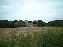 St. Ethelbert's Church | |
 Larling Location within Norfolk | |
| OS grid reference | TL9889 |
| • London | 94 miles (151 km) |
| Civil parish | |
| District | |
| Shire county | |
| Region | |
| Country | England |
| Sovereign state | United Kingdom |
| Post town | NORWICH |
| Postcode district | NR16 |
| Dialling code | 01953 |
| Police | Norfolk |
| Fire | Norfolk |
| Ambulance | East of England |
| UK Parliament | |
Larling is a village and former civil parish, now in the parish of Roudham and Larling, in the English county of Norfolk.
Contents
Larling is located 8.5 miles (13.7 km) north-east of Thetford and 21.4 miles (34.4 km) south-west of Norwich.