Related Research Articles

Allison Lake Provincial Park is a provincial park in British Columbia, Canada, located 28 kilometres north of Princeton, British Columbia. The park, which is 23 ha. in size, was established July 26, 1960. It is mainly a recreation area, offering camping, swimming and fishing. The park contains mostly aspen.

Harmony Islands Marine Provincial Park is a provincial park in British Columbia, Canada, located on the east side of Hotham Sound, which is a side-inlet of the lower reaches of Jervis Inlet, on that inlet's north side roughly opposite the mouth of Sechelt Inlet.
Pennask Lake Provincial Park is a provincial park in British Columbia, Canada, located on the easternmost heights of the Thompson Plateau,50 km (31 mi) to the northwest of the Okanagan town of Peachland.

Saltery Bay Provincial Park is a provincial park in British Columbia, Canada, located southeast of the city of Powell River, and on the north side of the entrance to Jervis Inlet in the central area of that province's Sunshine Coast region.
Sechelt Inlets Marine Provincial Park is a provincial park in British Columbia, Canada, at various locations on Sechelt Inlet, Salmon Inlet and Narrows Inlet, near Sechelt. Established initially as a recreation area in 1980, it was converted to a park in 1999, containing approximately 140 hectares.
Smelt Bay Provincial Park is a provincial park in British Columbia, Canada. It is located at the south end of Cortes Island, and has twenty-two camping sites. Eight are reservable and the rest are first-come, first-served. There is also an overflow parking lot directly next to the beach for any excess campers.
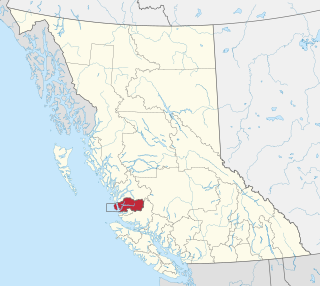
Zeballos is a village located on the northwest coast of Vancouver Island in British Columbia, Canada. Zeballos is now known for its ecotourism and sport fishing.
The Wuikinuxv Nation, also known as the Oweekeno Nation, is a First Nations band government whose traditional territory is the shores of Rivers Inlet and Owikeno Lake in the Central Coast region of the Canadian province of British Columbia, in the area south of Bella Bella and north of Queen Charlotte Strait. The Wuikinuxv people a.k.a. the Oweekeno people reside in the area of Rivers Inlet and Owikeno Lake, primarily at a village on the Wannock River. Substantial numbers of Wuikinuxv also reside away from the traditional territory in Port Hardy on Vancouver Island and in larger BC communities such as Campbell River, Vancouver and Victoria. Approximately 80 people reside at the village while overall membership was 283 in 2006, 194 of whom lived off-reserve.
Zics is a village in Somogy County, Hungary, especially popular for Western European retirees.
The Mamalilikulla Band is a First Nations band government based on northern Vancouver Island in British Columbia, Canada. The home territory of the Mamalilikulla and Qwe-Qwa'Sot'Em groups of Kwakwaka'wakw was in the maze of islands and inlets of the eastern Queen Charlotte Strait region around the opening of Knight Inlet, mainly on Village Island, where their principal village Memkumlis is.
Malaspina Strait is a strait in the northern Gulf of Georgia-Sunshine Coast region of British Columbia, Canada. It separates Texada Island from the upper Sunshine Coast-Malaspina Peninsula area on the adjacent mainland.
Allison Harbour, also formerly known as False Bay and False Schooner Passage, is a natural harbour on the Central Coast of British Columbia, Canada, extending north from Queen Charlotte Strait to the southeast of Bramham Island. It is the site of the former post office and steamer landing of Allison Harbour, British Columbia. The Allison Reefs lie in the entrance to the sound; Allison Cone (185m), which is nearby between Shelter Bay and Cape Caution, was named in association with Allison Harbour. It is now protected as part of Allison Harbour Marine Provincial Park.
Musket Island Marine Provincial Park is a provincial park in British Columbia, Canada, located on the west side of Nelson Island, at the mouth of Jervis Inlet and near Earl's Cove in the Sunshine Coast region.
The Skwawka River is a medium-sized river in the Pacific Ranges of the Coast Mountains in British Columbia, Canada, flowing southeast 20 kilometers (12 mi) into the head of Queens Reach, which is the uppermost end of Jervis Inlet. The pass at the head of the river, which connects to the head of the Little Toba River, is the prominence col for Mount Alfred, which lies just west of the river's mouth and is the highest summit between Jervis and Toba Inlets. Above the river's lower reaches, on the east flank of Mount Alfred, is 700 meters (2,300 ft) Alfred Creek Falls, one of North America's highest.
Harrison Bay is a lake-like expansion of the Harrison River, located west of its main course adjacent to the communities of Chehalis and Harrison Mills in the Canadian province of British Columbia. Extremely shallow, the bay outlets to the Fraser at Harrison Mills, where in pre-gold rush times there had been a "riffle", which was dredged to enable easier steamer traffic to Harrison Lake and Port Douglas. The bay has been used as a log sort but is primarily recreational in use today, with the Scowlitz Indian Band running a beach and campground at its western end, on Squawkum Creek Indian Reserve No. 3, which is at the southwest corner of Harrison Bay. Between it and the Fraser lies Harrison Hill, known in Upriver Halkomelem as Qithyll, which is an ancient burial ground currently under investigation by the First Nation in a joint effort with Simon Fraser University's archaeology department.. Adjacent to Kilby Provincial Park and the site of Harrison Mills are Williams Indian Reserve No. 2 and Scowlitz Indian Reserve No. 1
Kilbella Bay is a bay on the Central Coast of British Columbia, Canada, off the north side of Rivers Inlet to the northeast of McAllister Point. A steamer landing formerly operated by the Northland Navigation Company was located on the east side of the bay.
Katit Indian Reserve No. 1 is the main Indian reserve of the Wuikinuxv people, and is one of the three reserves governed by the Wuikinuxv Nation band government. It is located in British Columbia, Canada, on the entrance to Owikeno Lake on the north side of the Wannock River near to, but separate from, the non-native community and sport fishing resort of Rivers Inlet. Similarly named Katit Island is in the Wannock River at 51°40′41″N127°11′48″W, while Kahtit Creek is downstream, near the mouth of the Wannock River at 51°40′47″N127°15′00″W near the Wuikinuxv village known as Oweekeno.
Malaspina Inlet is an inlet on the east side of Desolation Sound in the South Coast region of British Columbia, Canada, located between Malaspina and Gifford Peninsulas. Sidewaters include Thors Cove and, via it, Theodosia Inlet, where the locality of Theodosia Arm is located. The upper, southeastern, end of Malaspina Inlet near the City of Powell River is called Okeover Inlet. on the east side of which the steamer landing Larsons Landing is located. Grace Harbour is located on north side of Malaspina Inlet on the southwest side of Gifford Peninsula.
Okeover Inlet, formerly Okeover Arm, is an inlet in the Sunshine Coast region of the southwestern mainland of British Columbia, Canada. It is the upper end of Malaspina Inlet and is northwest of the City of Powell River. Larsons Landing, a steamer landing, is located on its eastern shore.
Irvines Landing was the first post-contact settlement in the ḵalpilin area, and quickly became a hub for supplies and provisions. The first settler in Pender Harbour was an English immigrant named Charles Irvine, who established a small trading post in 1865. Steve Dames, a displaced seaman from Riga, Latvia, and Joe Perry of Cape Verde became familiar with Irvines Landing, and purchased it in 1898. Perry's father-in-law, Joseph Gonsalves of Madeira Island, later moved up from Brockton Point. Under the name Gonsalves and Dames General Traders, they expanded their holdings and built the Irvines Landing Hotel and Store. An early Union Steamer stop for settlers and loggers, it grew into a fish-processing centre and later a yacht anchorage and vacation spot. Often referred to as Irvine's Landing, the official name has no apostrophe according to the BC Geographical Names service, Irvines Landing. This is in keeping with the convention established in the late 1800s of removing apostrophes from place names in Canada.
References
49°59′00″N124°41′00″W / 49.98333°N 124.68333°W
| | This article about a location on the South Coast of British Columbia, Canada is a stub. You can help Wikipedia by expanding it. |