Deutschnofen is a comune (municipality) in the province of South Tyrol in northern Italy, located about 30 kilometres (19 mi) southeast of the city of Bolzano.

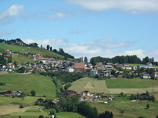
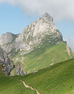
Welschnofen is a comune (municipality) in the autonomous province of South Tyrol in northern Italy, located about 15 kilometres (9 mi) southeast of the city of Bolzano.

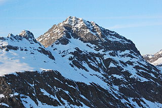
The Zuckerhütl is a mountain in Tyrol, Austria. At 3,505 metres, it is the highest peak of the Stubai Alps and lies at the southern end of the Stubaital Valley.

The Kesselkogel is the highest mountain of the Rosengarten group in the Dolomites in South Tyrol, Italy.

Hasenöhrl is a mountain of the Ortler Alps in South Tyrol, Italy.
The Dreischusterspitze is a mountain of the Dolomites in South Tyrol, Italy. It is the highest peak of the Sexten Dolomites and the most northerly 3,000m peak of the range. From the north it resembles a majestic pyramid, while from the east and west it resembles a jagged ridge. The mountain is located above the village of Sexten. It was first climbed in 1869 by Paul Grohmann, Franz Innerkofler and Peter Salcher.

The Saslonch, Sassolungo or Langkofel (3,181m) is the highest mountain of the Langkofel Group in the Dolomites in South Tyrol, Italy. The name translates to "long peak" / "long rock" in all three languages. It stands over the Ladin community of Val Gardena.
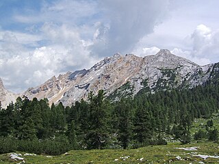
The Peitlerkofel is a mountain of the Dolomites in South Tyrol, Italy. A solitary mountain, it stands between Val Badia to the east and the Villnöß valley to the west, in the very north of the Dolomites. It boasts two distinct summits, the Grosser Peitler (2875m) and the Kleiner Peitler (2813m), which are divided by a deep ridge.
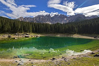
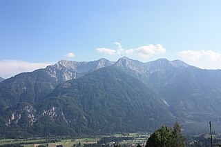
Lake Carezza is a small alpine lake in the Dolomites in South Tyrol, Italy. It is known for its wonderful colors and its view of the Latemar mountain range.

The Großer Muntanitz (3,232m) is the highest mountain in the Granatspitze Group, located between the Venediger Group and the Glockner Group in the High Tauern, Austria.

Hohe Gaisl, (3,146m) is a mountain in the northern Dolomites, on the border of South Tyrol and Veneto, in northern Italy, located between the Braies Valley and the Val di Landro.

The Daniel is a mountain in the Austrian state of Tyrol, and the highest peak in the Ammergau Alps, a range within the Northern Limestone Alps . Located near the villages of Ehrwald and Lermoos, it is a popular mountain with hikers. Its North Face is around 200 metres high and its South Face has a more schrofen-like character. With the almost equally high Upsspitze (2,332 m) it forms a double summit. To the northwest is a neighbouring peak, the Hochschrutte (2,247 m).
Hochiss or Hochriss is a mountain in Tyrol, Austria. Rising some 2,299 metres (7,543 ft), it is the highest mountain of the Brandenberg Alps and is located near the tourist hot spot Achensee. Its steep north face is popular with rock climbers and its other slopes are a popular destination for hiking and paragliding as well as snowshoeing and ski touring in the winter.

Geierhaupt is a mountain of the Lower Tauern in Styria, Austria. It is the highest mountain of the Seckau Tauern sub group.
Vallüla is a mountain of the Silvretta Alps on the border between Tyrol and Vorarlberg, Austria. It is located above the Bielerhöhe pass, from where most climbs start from.

The Reißkofel is, at 2,371 metres above the Adriatic (7,779 ft), the highest mountain of the Gailtal Alps east of the Lienz Dolomites. It is situated in the centre of the Gailtal range, part of the Southern Limestone Alps, in the Austrian state of Carinthia.
Torkofel is a mountain of the Gailtal Alps in Carinthia, Austria. It is the highest summit of the Jauken Group, a small limestone massif west of Reißkofel. It lies between the Drava valley to the north and the Gail valley in the south. It was first climbed in 1853 by the Johann Festin von Wald and Paul Grohmann.

Sonnjoch is a mountain of the Karwendel range in the Northern Limestone Alps in Tyrol, Austria. It lies between the Falzthurntal valley, near the village of Pertisau, in the east and the Eng Valley to the west. It is a prominent mountain, which dominates the valleys below it, and appears to rise vertically above Falzthurntal. Another spectacular viewpoint is from Achen Lake. It is a popular hiking peak, with a relatively easy route, so it can get busy in summer.

The Blackjack Mountains are a mountain range located in Gila County, Arizona. They have a maximum elevation of 6,942 ft (2,116 m) at Apache Peaks and a prominence of 2,580 ft (790 m). The peak has a topographic isolation of 17.88 miles, with the nearest higher peak lying to the south in the Pinal Mountains. The Blackjack mountains are located within the Tonto National Forest and are north of Globe, Arizona. The high point of the range, Apache Peaks, is ranked 36th in prominence for Arizona's most prominent peaks.
Col Bechei is a mountain of the Dolomites in South Tyrol, Italy. It lies in the Fanes group, northwest of Cortina d'Ampezzo. It is located in the Fanes-Sennes-Prags Nature Park in an area somewhat less frequented by tourists than other Domomite peaks.

