Laurelville, Ohio

Last updated

Laurelville, Ohio
OHMap-doton-Laurelville.png
Location of Laurelville, Ohio
Detailed map of Laurelville, Ohio.png
Detailed map of Laurelville
Coordinates: 39°28′19″N82°44′14″W / 39.47194°N 82.73722°W / 39.47194; -82.73722
Country United States
State Ohio
County Hocking
Area
[1]
  Total0.21 sq mi (0.55 km2)
  Land0.21 sq mi (0.55 km2)
  Water0.00 sq mi (0.01 km2)
Elevation
[2]
748 ft (228 m)
Population
 (2020)
  Total512
  Density2,426.54/sq mi (936.74/km2)
Time zone UTC-5 (Eastern (EST))
  Summer (DST) UTC-4 (EDT)
ZIP codes
43135, 43152
Area code 740
FIPS code 39-42084 [3]
GNIS feature ID2398399 [2]

Laurelville is a village in Hocking County, Ohio, United States. The population was 512 at the 2020 census.

Contents

The Hocking State Forest is located near Laurelville.

History

Laurelville was laid out in 1871 by John and W. S. Albin, and Solomon Riegel. [4] The village was named for the laurel growing near the original town site. [5]

Geography

According to the United States Census Bureau, the village has a total area of 0.21 square miles (0.54 km2), all land. [6]

Demographics

Historical population
CensusPop.Note
1880 165
1890 26661.2%
1900 45069.2%
1910 4571.6%
1920 425−7.0%
1930 4495.6%
1940 4919.4%
1950 482−1.8%
1960 53911.8%
1970 62415.8%
1980 591−5.3%
1990 6052.4%
2000 533−11.9%
2010 527−1.1%
2020 512−2.8%
U.S. Decennial Census [7]

2010 census

As of the census [8] of 2010, there were 527 people, 252 households, and 120 families living in the village. The population density was 2,509.5 inhabitants per square mile (968.9/km2). There were 282 housing units at an average density of 1,342.9 per square mile (518.5/km2). The racial makeup of the village was 97.3% White, 0.4% Native American, 0.6% Asian, 0.8% from other races, and 0.9% from two or more races. Hispanic or Latino of any race were 0.4% of the population.

There were 252 households, of which 26.2% had children under the age of 18 living with them, 31.7% were married couples living together, 13.1% had a female householder with no husband present, 2.8% had a male householder with no wife present, and 52.4% were non-families. 47.6% of all households were made up of individuals, and 24.3% had someone living alone who was 65 years of age or older. The average household size was 2.09 and the average family size was 3.04.

The median age in the village was 39.5 years. 25% of residents were under the age of 18; 9% were between the ages of 18 and 24; 22.7% were from 25 to 44; 22.3% were from 45 to 64; and 20.9% were 65 years of age or older. The gender makeup of the village was 44.6% male and 55.4% female.

2000 census

As of the census [3] of 2000, there were 533 people, 256 households, and 136 families living in the village. The population density was 2,605.0 inhabitants per square mile (1,005.8/km2). There were 277 housing units at an average density of 1,353.8 per square mile (522.7/km2). The racial makeup of the village was 98.69% White, 0.19% Native American, 0.38% from other races, and 0.75% from two or more races. Hispanic or Latino of any race were 0.56% of the population.

There were 256 households, out of which 25.4% had children under the age of 18 living with them, 39.8% were married couples living together, 8.6% had a female householder with no husband present, and 46.5% were non-families. 43.0% of all households were made up of individuals, and 22.7% had someone living alone who was 65 years of age or older. The average household size was 2.08 and the average family size was 2.86.

In the village, the population was spread out, with 21.4% under the age of 18, 7.5% from 18 to 24, 27.0% from 25 to 44, 22.1% from 45 to 64, and 22.0% who were 65 years of age or older. The median age was 40 years. For every 100 females, there were 91.0 males. For every 100 females age 18 and over, there were 83.8 males.

The median income for a household in the village was $24,250, and the median income for a family was $41,250. Males had a median income of $30,227 versus $18,000 for females. The per capita income for the village was $15,339. About 6.6% of families and 13.5% of the population were below the poverty line, including 8.3% of those under age 18 and 27.2% of those age 65 or over.

Education

Logan Elm Local School District operates an elementary school in the village. [9]

Laurelville has a public library, a branch of the Logan-Hocking Public Library. [10]

Related Research Articles

<span class="mw-page-title-main">Hocking County, Ohio</span> County in Ohio, United States

Hocking County is a county located in the U.S. state of Ohio. As of the 2020 census, the population was 28,050. Its county seat is Logan. The county was organized on March 1, 1818, from land given by Athens, Fairfield, and Ross counties. Its name is from the Hocking River, the origins of which are disputed but is said to be a Delaware Indian word meaning "bottle river". Hocking County is included in the Columbus, OH Metropolitan Statistical Area.

<span class="mw-page-title-main">Chauncey, Ohio</span> Village in Ohio, United States

Chauncey is a village in Athens County, Ohio, United States. The population was 959 at the 2020 census. The village is located near The Plains.

<span class="mw-page-title-main">Coolville, Ohio</span> Village in Ohio, United States

Coolville is a village located in Troy Township, Athens County, Ohio, United States, in the southeast area of the state. The population was 452 at the 2020 census.

<span class="mw-page-title-main">Glouster, Ohio</span> Village in Ohio, United States

Glouster is a village in Trimble Township, Athens County, Ohio, United States. The population was 1,659 at the 2020 census. It is close to Burr Oak State Park.

<span class="mw-page-title-main">Logan, Ohio</span> City in Ohio, United States

Logan is a city in and county seat of Hocking County, Ohio, United States, along the on the Hocking River about 43 miles (69 km) southeast of Columbus. The population was 7,296 at the time of the 2020 census. The current mayor of Logan is Republican Greg Fraunfelter, who began a four-year term in January 2016 and was re-elected in 2019.

<span class="mw-page-title-main">Murray City, Ohio</span> Village in Ohio, United States

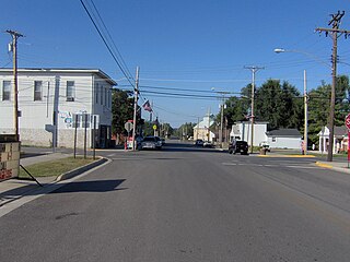
Murray City is a village in Hocking County, Ohio, United States. The population was 341 at the 2020 census.

<span class="mw-page-title-main">Hanover, Ohio</span> Village in Ohio, United States

Hanover is a village in Licking County, Ohio, United States. The population was 1,270 at the 2020 census. The village lies along Ohio State Route 16.

<span class="mw-page-title-main">Lakeview, Ohio</span> Village in Ohio, United States

Lakeview is a village in Logan County, Ohio, United States. The population was 1,184 at the 2020 census.

<span class="mw-page-title-main">Rushsylvania, Ohio</span> Village in Ohio, United States

Rushsylvania is a village located in Logan County, Ohio, United States. The population was 491 at the 2020 census.

<span class="mw-page-title-main">Russells Point, Ohio</span> Village in Ohio, United States

Russells Point is a village located in northwest Logan County, Ohio, United States. The population was 1,320 at the 2020 census. It is situated on Indian Lake, which had long been a popular summer resort destination.

<span class="mw-page-title-main">Valley Hi, Ohio</span> Village in Ohio, United States

Valley Hi is a village in Logan County, Ohio, United States. The population was 228 at the 2020 census. The village is located nearby U.S. Route 33 and is about an hour northwest of Columbus. The village lies mostly in Jefferson Township, but its southernmost portion extends into Monroe Township.

<span class="mw-page-title-main">West Mansfield, Ohio</span> Village in Ohio, United States

West Mansfield is a village located in Logan County, Ohio, United States. The population was 749 at the 2020 census.

<span class="mw-page-title-main">Navarre, Ohio</span> Village in Ohio, United States

Navarre is a village in southwestern Stark County, Ohio, United States. The population was 1,846 at the 2020 census. It is part of the Canton–Massillon metropolitan area.

<span class="mw-page-title-main">Hamden, Ohio</span> Village in Ohio, United States

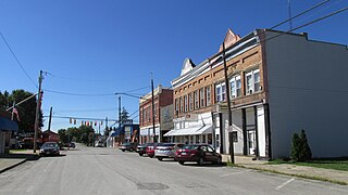
Hamden is a village in Vinton County, Ohio, United States. The population was 727 at the 2020 census.

<span class="mw-page-title-main">McArthur, Ohio</span> Village in Ohio, United States

McArthur is a village in and the county seat of Vinton County, Ohio, United States. It is located 27 miles (43 km) southeast of Chillicothe. The population was 1,783 at the 2020 census.

<span class="mw-page-title-main">Wilkesville, Ohio</span> Village in Ohio, United States

Wilkesville is a village in Vinton County, Ohio, United States. The population was 116 at the 2020 census.

<span class="mw-page-title-main">Zaleski, Ohio</span> Village in Ohio, United States

Zaleski is a village in Vinton County, Ohio, United States. The population was 230 at the 2020 census.

<span class="mw-page-title-main">Buchtel, Ohio</span> Village in Ohio, United States

Buchtel is a village in Athens and Hocking counties in the U.S. state of Ohio, just northeast of Nelsonville. Located in the Hocking Valley, it was a center of coal mining in the late 19th and early 20th centuries. The population was 518 at the 2020 census. A former name for the village is Bessemer.

<span class="mw-page-title-main">New Holland, Ohio</span> Village in Ohio, United States

New Holland is a village in Fayette and Pickaway counties in Ohio, United States. The population was 804 at the 2020 census.

<span class="mw-page-title-main">Ridgeway, Ohio</span> Village in Ohio, United States

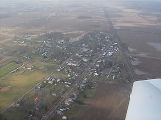
Ridgeway is a village in Hardin and Logan counties in the U.S. state of Ohio. The population was 314 at the 2020 census.

References

  1. "ArcGIS REST Services Directory". United States Census Bureau. Retrieved September 20, 2022.
  2. 1 2 U.S. Geological Survey Geographic Names Information System: Laurelville, Ohio
  3. 1 2 "U.S. Census website". United States Census Bureau . Retrieved January 31, 2008.
  4. History of Hocking Valley, Ohio. Inter-State Publishing Co. 1883. pp.  1106.
  5. Overman, William Daniel (1958). Ohio Town Names. Akron, OH: Atlantic Press. p. 73.
  6. "US Gazetteer files 2010". United States Census Bureau. Archived from the original on July 2, 2012. Retrieved January 6, 2013.
  7. "Census of Population and Housing". Census.gov. Retrieved June 4, 2015.
  8. "U.S. Census website". United States Census Bureau . Retrieved January 6, 2013.
  9. "Homepage". Laurelville Elementary School. Retrieved February 25, 2018.
  10. "Hours and locations". Logan-Hocking Public Library. Retrieved February 25, 2018.