Lawa Thikana

Last updated

Lawa Raj
लावा
Thakurat of British India
1772–1947
Jaipur-Bharatpur map.jpg
Lawa State in the Imperial Gazetteer of India
Capital Lawa
Area 
 1901
49 km2 (19 sq mi)
Population 
 1901
2,671
  Type Principality
History 
 Established
1772
 Acceded to India
1947
Preceded by
Succeeded by
Blank.png Jaipur State
Dominion of India Flag of India.svg
Today part of Rajasthan, India

Lawa Thikana was a Thikana estate or Thakurat under the Jaipur Residency of the former Rajputana Agency. [1] It was ruled by Naruka Rajputs. It was located very close to Tonk town and included its capital, Lawa, a small town and its surroundings. Lawa is located in the northwestern part of present-day Tonk district of Rajasthan, India.

Contents

Lawa estate near Tonk should not be confused with Sardargarh, a Thikana of Udaipur State (Mewar) which had been known as 'Lawa' before 1738. [2] [3]

In August 1947, at the time of Independence, Rajasthan included 19 princely state & 3 thikanas (Chiefships) of Neemrana, Lawa & Kushalgarh. [4]

History

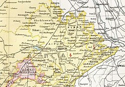
Lawa was formerly part of Jaipur State. In 1772 Lawa became a jagir which came under the control of the Marathas through Pindari leader Amir Khan, who would later become the Nawab of Tonk. Lawa became a tributary of Tonk in 1817, when that state was established. [1]

In 1867, following the murder of Thakur Rewut Singh (the uncle of the ruler of Lawa) together with a party of his followers, Lawa was declared a separate Chiefship under the protection of the British Government. [5]

Lawa was one of the Thikanas which were existing at the time of the independence of India and were merged with Rajasthan during the Unification of Rajasthan. It was smallest by area as well as population, and was a completely rural settlement.

Lawa Fort

Although Lawa sustained incalculable myriad of Islamic invasions but the land by the enemy was never occupied, hence no such Islamic or foreign impact is observed in the arts, architecture, culture of this region. This mammoth immersion of Rajput heritage in all its magnificence has civil, military and sacred spreads. The civil area maintained the three, ’administrative block’, 'common living quarters’ and the ladies section which from Mughal days was better known as the Zenana Mahal. The administrative block houses the courts also referred as Dari Khana, meeting place for all major decisions.16th century henceforth every successive ruler of Lawa went on to add more buildings to Barla Mahal (outside mahal) for men, time worn but they still faithfully replicate history. Ravages through time may have altered some of the external features but the rest is the same. The ammunitions and other war material were housed in a safe structure known as the Silehkhana. Though the main fortified ramparts are still there the burjh on the four corners are clearly visible yet it would not be erroneous to address this building as a Chouburjha structure.

Lawa also has chattris (royal cenotaphs) of rulers and warriors who died in wars.

Connections

Thakur Kesri Singh, Thakur of Ladana, eighth in descent from Rao Dasaji (eldest son of Rao Naru), was made the Jagirdar of Ladana by the then ruler of Jaipur. He married and had issue, two sons. Thakur Sawant Singh, succeeded his father and became head of the Ladana Thikana. Thakur Nahar Singh was granted the estate of Lawa by the Ruler of Jaipur in the year 1722.

The name of Lawa & Ladana are often taken together when discussions over Lawa Thikana comes.

See also


Related Research Articles

<span class="mw-page-title-main">Rajasthan</span> State in Northwestern India

Rajasthan is a state in northern India. It covers 342,239 square kilometres (132,139 sq mi) or 10.4 per cent of India's total geographical area. It is the largest Indian state by area and the seventh largest by population. It is on India's northwestern side, where it comprises most of the wide and inhospitable Thar Desert and shares a border with the Pakistani provinces of Punjab to the northwest and Sindh to the west, along the Sutlej-Indus River valley. It is bordered by five other Indian states: Punjab to the north; Haryana and Uttar Pradesh to the northeast; Madhya Pradesh to the southeast; and Gujarat to the southwest. Its geographical location is 23°.3' to 30°.12' North latitude and 69°.30' to 78°.17' East longitude, with the Tropic of Cancer passing through its southernmost tip.

<span class="mw-page-title-main">Rajputana Agency</span> Former political office of the British Indian Empire

The Rajputana Agency was a political office of the British Indian Empire dealing with a collection of native states in Rajputana, under the political charge of an Agent reporting directly to the Governor-General of India and residing at Mount Abu in the Aravalli Range. The total area of the states falling within the Rajputana Agency was 127,541 square miles (330,330 km2), with eighteen states and two estates or chiefships.

<span class="mw-page-title-main">Rao Shekha</span>

Maharao Shekhaji (1433–1488) was a Rajput ruler in 15th-century India. He is the namesake of the Shekhawati region, comprising the districts of Sikar, Churu and Jhunjhunu in the modern Indian state of Rajasthan. His descendants are known as the Shekhawat.

<span class="mw-page-title-main">Shekhawati</span> Region in Rajasthan, India

Shekhawati is a semi-arid historical region located in the northeast part of Rajasthan, India. The region was ruled by Shekhawat Rajputs. Shekhawati is located in North Rajasthan, comprising the districts of Neem Ka Thana, Jhunjhunu, Sikar that lies to the west of the Aravalis and Churu. It is bounded on the northwest by the Bagar region, on the northeast by Haryana, on the east by Mewat, on the southeast by Dhundhar, on the south by Ajmer, and on the southwest by the Marwar region. Its area is 13,784 square kilometers.

<span class="mw-page-title-main">Marwar</span> Region in Rajasthan, India

Marwar is a region of western Rajasthan state in North Western India. It lies partly in the Thar Desert. The word 'maru' is Sanskrit for desert. In Rajasthani languages, "wad" means a protected area. English translation of the word 'marwar' is the region protected by desert.

Bundi is a city in the Hadoti region of Rajasthan state in northwest India and capital of the former princely state of Rajputana agency. District of Bundi is named after the former princely state.

<span class="mw-page-title-main">Loharu</span> City in Haryana, India

Loharu is a city, municipal committee and assembly constituency, near Bhiwani City in the Bhiwani district of the Indian state of Haryana. It is the administrative headquarters of one of the four administrative sub-divisions of the district and covers 119 villages. It is also a railway junction station.

<span class="mw-page-title-main">Bundi district</span> District of Rajasthan in India

Bundi is a district in the state of Rajasthan in western India. The city of Bundi is the district headquarters. It has an area of 5,550 km2 and a population of 1,110,906. It is divided into 5 tehsils which are: Bundi, Hindoli, Nainwa, Keshoraipatan and Indergarh.

<span class="mw-page-title-main">Tonk State</span> Princely State of India

Tonk was a princely state of India at the time of the British Raj. The town of Tonk, which was the capital of the state, had a population of 273,201 in 1901. The town was surrounded by a wall and had a mud fort. It had a high school, the Walter hospital for women, under a matron, and a separate hospital for men. It has a bridge on the river Banas.

<span class="mw-page-title-main">Kuchaman City</span> City and District Headquarters in Rajasthan, India

Kuchaman CityHindi pronunciation:[/ˌkuːtʃəˈmɑːnˈsɪti/] is a Municipal Council and District Headquarters of Didwana-Kuchaman District located in west-central Rajasthan, India. It is the largest city of newly Kuchaman district. The Didwana-Kuchaman district was carved out from the Nagaur District as the 38th District of the state of Rajasthan on 4 August 2023.

<span class="mw-page-title-main">Merta City</span> City in Rajasthan, India

Merta City is a city and a municipality located, near Nagaur City in Nagaur district in the Indian state of Rajasthan. Merta is also known for its link with Mira Bai, the devotee of Lord Krishna. Mira Mahal Museum houses memories related to Mira Bai's lifetime

<span class="mw-page-title-main">Kingdom of Amber</span> Princely state in northwest India (1028–1949)

The Kingdom of Amber, also known as Kingdom of Dhundhar, and Jaipur State, was located in the north-eastern historic Dhundhar region of Rajputana and was ruled by the Kachwaha Rajput clan. It was established by Dulha Rai, possibly the last ruler of the Kachchhapaghata dynasty of Gwalior who migrated to Dausa and started his kingdom there with the support of Chahamanas of Shakambhari in the 12th century. Mostly through 12th to 15th century, the kingdom faced stagnation, sources were scarce. Under its ruler, Raja Chandrasen Amer became a Sisodia vassal and fought in the Battle of Khanwa under Raja Prithviraj Kachhwaha.

<span class="mw-page-title-main">History of Rajasthan</span> Brief history of the Indian state of Rajasthan

The history of human settlement in the western Indian state of Rajasthan dates back to about 100,000 years ago. Around 5000 to 2000 BCE many regions of Rajasthan belonged as the site of the Indus Valley Civilization. Kalibangan is the main Indus site of Rajasthan, here fire altars have been discovered, similar to those found at Lothal.

Thakur Kesari Singh Barhath was an Indian revolutionary leader, freedom fighter, and educator from the state of Rajasthan. He was the patriarch of the Barhath family, members of which participated in anti-British activities Barhath was also known as Rajasthan Kesari.

The Dodiya or Dodia is Suryavanshi Rajput clan found in Gujarat, Madhya Pradesh (Malwa) and in Sardargarh, Rajasthan. They have ruling states in Madhya Pradesh Piploda princely state, Tal, Mandawal, Borwana, Asawati, uni, Sukheda, Chapaner and many more villages. Dodiya rajputs are also found in Mewar (Sardarghar), where they fought bravely with Maharana against enemies. Once, on a pilgrimage to Gujarat, the mother of Maharana Lakha of Mewar and her party were attacked by dacoits, and Rao Siha Dodiya came to the aid of the party, he was killed in the skirmish, but two of his sons took the royal travellers to safety in the Dodiya residence, then later escorted them back to the Mewar border. Maharana Lakha later invited the two sons to Mewar, and granted them the jagir of Lawa. The Thakur Sahib of Sardargarh ranks as a 1st Class Noble of Mewar.

<span class="mw-page-title-main">Bundi State</span> Princely state of India

Bundi State was founded by Hada Rao Devda currently located in modern-day Rajasthan. It was ruled by Hada Chauhans Rajputs.

Maroth is a village located in Nawa, Nagaur district, in the state of Rajasthan, India. The area surrounding the village is named Gaurati, which means "The Land of Gaurs".

Loharu Fort, built in 16th century, is a state protected archaeological monument in Loharu town in Haryana state of India. Fort is part of interstate Shekhawati region which lies on the either side of Haryana-Rajasthan border in the sandy bagar tract.

Khoh, also known as Khogong, was the capital of the kingdom of Amber which was located in the Dhundhar region of Rajputana. Which was located just five miles to the east of Jaipur city and was ruled by the Chanda clan. Rao Chandrasen Chanda abandoned Mahishmati city and established a kingdom here. It was the capital of the Chandas till the 11th century and of the Kachhawahas from the 11th to the 13th century.

References

  1. 1 2 Imperial Gazetteer of India, v. 16, p. 156.
  2. Imperial Gazetteer of India, v. 22, p. 103. (Sardargarh-Lawa)
  3. "Sardargarh (Thikana)". Archived from the original on 24 February 2016. Retrieved 27 August 2015.
  4. "Rajasthan State Formation: Post Independence". RajRAS - Rajasthan RAS. 10 November 2016. Retrieved 6 January 2021.
  5. A Collection Of Treaties Engagements And Sanads Vol III

26°22′N75°33′E / 26.367°N 75.550°E / 26.367; 75.550