Related Research Articles
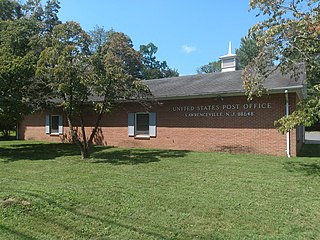
Lawrenceville is an unincorporated community and census-designated place (CDP) located within Lawrence Township in Mercer County, New Jersey, United States. As of the 2010 United States Census, the CDP's population was 3,887. Lawrenceville is located roughly halfway between Princeton and Trenton.

Lawrence Township is a township in Mercer County, in the U.S. state of New Jersey. Located at the cross-roads between the Delaware Valley region to the south and the Raritan Valley region to the north, the township is an outer-ring suburb of New York City in the New York Metropolitan area, as defined by the United States Census Bureau, while also directly bordering the Philadelphia metropolitan area and is part of the Federal Communications Commission's Philadelphia Designated Market Area. The township is a regional commercial hub for central New Jersey. As of the 2020 United States census, the township's population was 33,077, a decrease of 395 (−1.2%) from the 2010 census count of 33,472, which in turn reflected an increase of 4,313 (+14.8%) from the 29,159 counted in the 2000 census.

The Katy Trail State Park is a state park in the U.S. state of Missouri that contains the Katy Trail, the country's longest continuous recreational rail trail. It runs 240 miles (390 km), largely along the northern bank of the Missouri River, in the right-of-way of the former Missouri–Kansas–Texas Railroad. Open year-round from sunrise to sunset, it serves hikers, joggers, and cyclists. Its hard, flat surface is of "limestone pug".

The Chesapeake and Ohio Canal National Historical Park is located in the District of Columbia and the state of Maryland. The park was established in 1961 as a National Monument by President Dwight D. Eisenhower to preserve the neglected remains of the Chesapeake and Ohio Canal and many of its original structures.
The Potomac Heritage Trail, also known as the Potomac Heritage National Scenic Trail or the PHT, is a designated National Scenic Trail corridor spanning parts of the mid-Atlantic region of the United States that will connect various trails and historic sites in Virginia, Maryland, Pennsylvania, and the District of Columbia. The trail network includes 710 miles (1,140 km) of existing and planned sections, tracing the natural, historical, and cultural features of the Potomac River corridor, the upper Ohio River watershed in Pennsylvania and western Maryland, and a portion of the Rappahannock River watershed in Virginia. The trail is managed by the National Park Service and is one of three National Trails that are official NPS units.

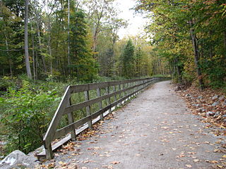
A rail trail is a shared-use path on railway right of way. Rail trails are typically constructed after a railway has been abandoned and the track has been removed, but may also share the right of way with active railways, light rail, or streetcars, or with disused track. As shared-use paths, rail trails are primarily for non-motorized traffic including pedestrians, bicycles, horseback riders, skaters, and cross-country skiers, although snowmobiles and ATVs may be allowed. The characteristics of abandoned railways—gentle grades, well-engineered rights of way and structures, and passage through historical areas—lend themselves to rail trails and account for their popularity. Many rail trails are long-distance trails, while some shorter rail trails are known as greenways or linear parks.
The Monon Trail is a rail trail located entirely within the state of Indiana. The Monon Railroad was a popular railroad line connecting the cities of Chicago and Indianapolis, with stops at major settlements along its route. After the decline of railroad travel and the sale of the company in 1987, the portion of the line between Indianapolis and Delphi, Indiana, was abandoned.

The Elroy-Sparta State Trail is a 32.5-mile (52.3 km) Wisconsin State rail trail between Elroy and Sparta, Wisconsin. Considered to be the first rail trail when it opened in 1967, it was designed for foot, bicycle, equestrian and light motorized traffic. Designated a multi-use trail, it offers recreational access to the routes and is open to the public. The trail is part of the larger Wisconsin bike trail system operated by the state of Wisconsin. It passes through rural scenery and three tunnels. It is one of six connecting trails in west-central Wisconsin. It was added to the Rails-to-Trails Conservancy hall of Fame in September 2008. It is one of the most popular trails in Wisconsin.

The Thames Path is a National Trail following the River Thames from its source near Kemble in Gloucestershire to the Woolwich foot tunnel, south east London. It is about 185 miles (298 km) long. A path was first proposed in 1948 but it only opened in 1996.
This is a list of trails in Ithaca, New York.

The Billy Goat Trail is a 4.7-mile (7.6 km) hiking trail that follows a path between the C&O Canal and the Potomac River within the Chesapeake and Ohio Canal National Historical Park near the Great Falls in Montgomery County, Maryland. The trail has three sections: Section A, the northernmost, is 1.7 miles (2.7 km); Section B is 1.4 miles (2.3 km); and Section C, the southernmost, is 1.6 miles (2.6 km)
The Lower Trail is a 16.5-mile (26.6 km) rail trail that follows the Juniata River in West-Central Pennsylvania from Flowing Springs in Blair County to Alfarata in Huntingdon County. The Lower Trail is owned and maintained by Rails to Trails of Central Pennsylvania, a 501c3 organization. The trail follows the path of the former Pennsylvania Railroad Petersburg Branch along the Frankstown Branch of the Juniata River. It is open free of charge to the public, though donations are accepted at all trail heads. The portion of the Lower Trail from Alfarata to Williamsburg is part of the Pennsylvania Mid State Trail and Great Eastern Trail. In 2009, the trail was designated as a National Recreation Trail by the United States Department of the Interior.

The Old Erie Canal State Historic Park encompasses a 36-mile (58 km) linear segment of the original Erie Canal's Long Level section. It extends westward from Butternut Creek in the town of DeWitt, just east of Syracuse, to the outskirts of Rome, New York. The park includes restored segments of the canal's waterway and towpath which were in active use between 1825 and 1917. It is part of the New York State Park system.
The Delaware & Lehigh Canal National and State Heritage Corridor (D&L) is a 165-mile (266 km) National Heritage Area in eastern Pennsylvania in the United States. It stretches from north to south, across five counties and over one hundred municipalities. It follows the historic routes of the Lehigh and Susquehanna Railroad, Lehigh Valley Railroad, the Lehigh Navigation, Lehigh Canal, and the Delaware Canal, from Bristol to Wilkes-Barre in the northeastern part of the state. The backbone of the Corridor is the 165-mile (266 km) D&L Trail. The Corridor's mission is to preserve heritage and conserve green space for public use in Bucks, Northampton, Lehigh, Carbon, and Luzerne counties in Pennsylvania. It also operates Hugh Moore Historical Park & Museums, which includes the National Canal Museum.

The Wallkill Valley Rail Trail is a 22.5-mile (36.2 km) rail trail and linear park that runs along the former Wallkill Valley Railroad rail corridor in Ulster County, New York. It stretches from Gardiner through New Paltz, Rosendale and Ulster to the Kingston city line, just south of a demolished, concrete Conrail railroad bridge that was located on a team-track siding several blocks south of the also-demolished Kingston New York Central Railroad passenger station. The trail is separated from the Walden–Wallkill Rail Trail by two state prisons in Shawangunk, though there have been plans to bypass these facilities and to connect the Wallkill Valley Rail Trail with other regional rail-trails. The northern section of the trail forms part of the Empire State Trail.

The D&R Canal trail is a recreational trail in the U.S. state of New Jersey. The 77-mile (124 km) trail is made up of three segments that transverse three counties: a canal towpath from New Brunswick to Trenton; a canal towpath/rail trail from Trenton to Bull's Island; and a rail trail from Bull's Island to Frenchtown. The three combined trails together form the largest completed trail in New Jersey. Much of the trail runs along the existing Delaware & Raritan Canal within the Delaware and Raritan Canal State Park.
The Ohio to Erie Trail is a dedicated multi-use trail for non-motorized vehicles that traverses the U.S. state of Ohio, from southwest to northeast, crossing 326 mi (525 km) of regional parks, nature preserves, and rural woodland. Construction began in 1991, with sections completed as recently as 2022.

The Rivergreenway is the backbone of burgeoning Fort Wayne Trails network in Fort Wayne, Indiana and the surrounding area. The Rivergreenway consists of nearly 25-miles of connected trails through a linear park following alongside or near the City's three rivers: St. Joseph River, St. Marys River, and Maumee River. In 2009, the Rivergreenway was designated as a National Recreation Trail. The trail network also connects to the Wabash & Erie Canal Towpath Trail. In 2011, the Wabash & Erie Canal Towpath Trail was completed, the Greater Fort Wayne has 50 miles of connected trails.

The Ohio and Erie Canal Towpath Trail is a multi-use trail that follows part of the former route of the Ohio & Erie Canal in Northeast Ohio.
References
- 1 2 "Lawrence Hopewell Trail". Rails To Trails Conservancy. Retrieved 2011-11-23.
- 1 2 "Lawrence Hopewell Trail". Lawrence Hopewell Trail. Retrieved 2011-11-23.