Lea, Herefordshire

Last updated

Lea
Lea Church, Herefordshire - geograph.org.uk - 58374.jpg
Church of St John the Baptist, Lea
Herefordshire UK location map.svg
Red pog.svg
Lea
Location within Herefordshire
Population673 (2011) [1]
OS grid reference SO655214
Shire county
Region
Country England
Sovereign state United Kingdom
Post town Ross-on-Wye
Postcode district HR9
Dialling code 01989
Police West Mercia
Fire Hereford and Worcester
Ambulance West Midlands
UK Parliament
List of places
UK
England
Herefordshire
51°53′35″N2°29′56″W / 51.8931°N 2.4989°W / 51.8931; -2.4989 Coordinates: 51°53′35″N2°29′56″W / 51.8931°N 2.4989°W / 51.8931; -2.4989

Lea (or The Lea) is a village and civil parish in the south east of Herefordshire. It lies south-east of Ross-on-Wye and adjoins the boundary of Gloucestershire. [2] Amenities include a school, church, village hall, shop, public house, garage and a twice-weekly mobile Post Office, all of which lie on the A40 road which passes through the village and links Ross and Gloucester.

Contents

The Church of St John the Baptist is a Grade II* listed building. The church consists of tower, with spire, three bells, nave, chancel and north aisle. The north aisle is terminated by a chapel, probably erected by the Grey family of Wilton, whose arms are placed there. The church was restored in 1854, and fitted with open seats. The marble baptismal font, of c.1200, is south Italian, given to the church in 1909 in memory of Sarah Decima Bradney (died 1907). The knotted shaft stands on an elephant and the bowl has a band of Cosmati work. [3] The Church of England parish is in the united Ariconium benefice of six parishes: Aston Ingham, Hope Mansell, Lea, Linton, Upton Bishop and Weston under Penyard.

In 2014, police raided the Crown Inn to look for the "Holy Grail" which was reported stolen from nearby Weston under Penyard. The only item found that vaguely resembled the Nanteos Cup was a wooden salad bowl. [4]

The railway engineering company Alan Keef Ltd has its headquarters on the outskirts of the village. [5]

Between 1855 and 1964, Lea was served by Mitcheldean Road railway station on the Hereford, Ross and Gloucester Railway.

Lea parish

The township of Lea Lower (or Lea Gloucester), containing the parish church of Lea, was an exclave of Gloucestershire until it was transferred to Herefordshire under the Counties (Detached Parts) Act 1844. The parish had three townships, the others being Lea Upper and Lea Bailey. [6] The townships were made into civil parishes [6] but the Lea Upper and Lea Lower parishes were united in 1883. Lea Bailey parish was abolished in 1890 and divided between the parishes of Lea and Blaisdon in Gloucestershire. [7]

See also

Related Research Articles

<span class="mw-page-title-main">Ross-on-Wye</span> Market town in Herefordshire, England

Ross-on-Wye is a market town in England, near the border with Wales. It had a population estimated at 10,978 in 2021. It lies in south-eastern Herefordshire, on the River Wye and on the northern edge of the Forest of Dean.

<span class="mw-page-title-main">Newent</span> Human settlement in England

Newent is a market town and civil parish about 10+12 miles (16.9 km) north-west of Gloucester, England. Its population was 5,073 at the 2001 census, rising to 5,207 in 2011, The population was 6,777 at the 2021 Census. Once a medieval market and fair town, its site had been settled at least since Roman times. The first written record of it appears in the 1086 Domesday Book.

Blockley is a village, civil parish and ecclesiastical parish in the Cotswold district of Gloucestershire, England, about 3 miles (5 km) northwest of Moreton-in-Marsh. Until 1931 Blockley was an exclave of Worcestershire.

<span class="mw-page-title-main">Weston under Penyard</span> Human settlement in England

Weston under Penyard is a small village in Herefordshire, England. The population of the civil parish at the 2011 Census was 1,007.

<span class="mw-page-title-main">Leintwardine</span> Human settlement in England

Leintwardine is a small to mid-size village and civil parish in north Herefordshire, England, close to the border with Shropshire.

<span class="mw-page-title-main">Walford, Ross-on-Wye</span> Village in Herefordshire, England

Walford is a village and civil parish in south Herefordshire, England, two miles south of the market town of Ross-on-Wye. It includes the settlements of Bishopswood, Coughton, Deep Dean, Hom Green and Walford.

<span class="mw-page-title-main">Aston Ingham</span> Village in Herefordshire, England

Aston Ingham is a village in south-eastern Herefordshire, England, near Newent and about 7 miles (11 km) east of Ross-on-Wye. The population of the village at the 2011 census was 398. There is a church, dedicated to St John the Baptist, which has been a Grade II* listed building since 17 March 1987.

<span class="mw-page-title-main">Blaisdon</span> Human settlement in England

Blaisdon is a village and civil parish in the Forest of Dean of Gloucestershire, England, about ten miles west of Gloucester. Its population in 2005 was estimated by Gloucestershire County Council to be 249. An estimate in 2012 placed the population at 420. The local church is dedicated to St Michael.

<span class="mw-page-title-main">Alan Keef Ltd</span> British narrow gauge railway engineering company

Alan Keef Ltd is a British narrow gauge railway engineering company which manufactures, overhauls, and deals in narrow gauge locomotives, rolling stock and associated equipment.

<span class="mw-page-title-main">Mitcheldean</span> Human settlement in England

Mitcheldean is a market town in the Forest of Dean in Gloucestershire, England.

<span class="mw-page-title-main">Nanteos Cup</span> Medieval wood mazer bowl found in Wales

The Nanteos Cup is a medieval wood mazer bowl, held for many years at Nanteos Mansion, near Aberystwyth in Wales.

<span class="mw-page-title-main">Gorsley</span> Village in South West England, England

Gorsley is a small village in the Forest of Dean district of Gloucestershire, forming part of the civil parish of Gorsley and Kilcot in the South West England. Nearby Gorsley Common and Little Gorsley are both in Herefordshire.

<span class="mw-page-title-main">Upton Bishop</span> Human settlement in England

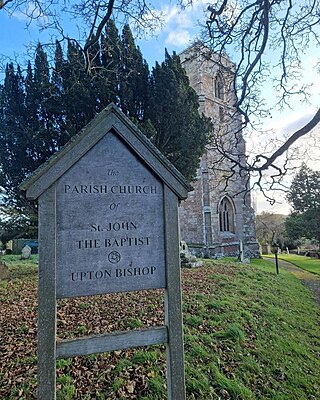
Upton Bishop is a small village in Herefordshire, England. The population of the village at the 2011 census was 602.

<span class="mw-page-title-main">Lydbrook</span> Human settlement in England

Lydbrook is a civil parish in the Forest of Dean, a local government district in the English county of Gloucestershire and is located in the Wye Valley. It is on the north west edge of the Forest of Dean's present legal boundary proper. It comprises the districts of Lower Lydbrook, Upper Lydbrook, Joys Green and Worrall Hill. It has a mile and a half long high street, reputed to be the longest high street of any village in England.

<span class="mw-page-title-main">Drybrook</span> Human settlement in England

Drybrook is a village and civil parish in the Forest of Dean in west Gloucestershire, England.

<span class="mw-page-title-main">Shenington</span> Human settlement in England

Shenington is a village about 5 miles (8 km) west of Banbury in the United Kingdom. It was an exclave of Gloucestershire until the Counties Act 1844 transferred it to Oxfordshire. Shenington is on Oxfordshire's boundary with Warwickshire. Shenington was an ancient parish of 1,628 acres (659 ha). It is now part of the civil parish of Shenington with Alkerton.

<span class="mw-page-title-main">Ariconium</span> Ancient place in Roman Britain

Ariconium was a road station of Roman Britain mentioned in Iter XIII of the Iter Britanniarum of the Antonine Itineraries. It was located at Bury Hill in the parish of Weston under Penyard, about 3 miles (5 km) east of Ross on Wye, Herefordshire, and about 15 miles (24 km) southeast of Hereford. The site existed prior to the Roman era, and then came under Roman control. It was abandoned, perhaps shortly after 360, but precisely when and under what circumstances is unknown.

<span class="mw-page-title-main">Hereford, Ross and Gloucester Railway</span> Railway line in England, closed 1965

The Hereford, Ross and Gloucester Railway, was a railway which ran for 22+12 miles (36.2 km) linking Hereford and Gloucester, England, via Ross-on-Wye. It was opened on 1 June 1855 as a 7 ft 14 in broad gauge line, it was amalgamated with the Great Western Railway in 1862. In 1869 the railway was converted to 4 ft 8+12 in standard gauge. The railway was closed to passengers on 2 November 1964, freight services between Ross-on-Wye railway station and Grange Court railway station continued on until 1 November 1965.

<span class="mw-page-title-main">Weston under Penyard Halt railway station</span> Former railway station in Herefordshire, England

Weston under Penyard Halt railway station is a disused wood built railway station that served the village of Weston under Penyard in Herefordshire on the Hereford, Ross and Gloucester Railway. Opened in 1929 to compete with local road transport it was located on the Great Western Railway line linking Ross-on-Wye and Gloucester. Nothing remains of the station.

<span class="mw-page-title-main">Brampton Abbotts</span> Village and civil parish in Herefordshire, England

Brampton Abbotts is a village and civil parish in Herefordshire, England. It is located 2 km north of Ross-on-Wye and 16 km south east of Hereford. The village lies near the western terminus of M50 motorway.

References

  1. "Civil Parish population 2011" . Retrieved 31 October 2015.
  2. "The Lea Parish Council" . Retrieved 30 December 2013.
  3. Historic England. "Church of St John the Baptist, Lea (Grade II*) (1099652)". National Heritage List for England .
  4. "Police raid Crown Inn pub in Lea in 'Holy Grail' relic hunt". BBC News . 6 August 2014. Retrieved 12 August 2014.
  5. "Alan Keef Ltd - Light Railway Engineers & Industrial Locomotive Builders:" . Retrieved 30 December 2013.
  6. 1 2 Youngs, F. A: Guide to the Local Administrative Units of England 1979 p. 1878
  7. "UKBMD Ross Registration District" . Retrieved 13 August 2020.

Commons-logo.svg Media related to Lea, Herefordshire at Wikimedia Commons