Leaf River, Illinois

Last updated

Leaf River
Leaf River, IL Sign 01.JPG
Sign seen when entering Leaf River
Ogle County Illinois Incorporated and Unincorporated areas Leaf River Highlighted.svg
Location of Leaf River in Ogle County, Illinois.
Location map of Ogle County, Illinois.svg
Red pog.svg
Leaf River
Location within Ogle County
USA Illinois location map.svg
Red pog.svg
Leaf River
Leaf River (Illinois)
Coordinates: 42°07′35″N89°24′11″W / 42.12639°N 89.40306°W / 42.12639; -89.40306
Country United States
State Illinois
County Ogle
Township Leaf River
Government
  Village PresidentTimothy Morris (R)
Area
[1]
  Total0.87 sq mi (2.25 km2)
  Land0.87 sq mi (2.25 km2)
  Water0.00 sq mi (0.00 km2)
Elevation
725 ft (221 m)
Population
 (2020)
  Total432
  Density497.12/sq mi (191.95/km2)
Postal code
61047
Area code 815
FIPS code 17-42457
Website leafriver.homestead.com/VillageLR.html

Leaf River is a village in Leaf River Township, Ogle County, Illinois, United States, along a stream of the same name. The population was 443 at the 2010 census, down from 555 in 2000.

Contents

Geography

Post office on the main road of Leaf River Leaf River, IL Post Office.JPG
Post office on the main road of Leaf River
Leaf River Fire Station Leaf River, IL Fire Dept 01.JPG
Leaf River Fire Station

Leaf River is located at 42°7′35″N89°24′11″W / 42.12639°N 89.40306°W / 42.12639; -89.40306 (42.126350, -89.402976). [2]

According to the 2010 census, Leaf River has a total area of 0.83 square miles (2.15 km2), all land. [3]

Demographics

Historical population
CensusPop.Note
1890 339
1900 50749.6%
1910 469−7.5%
1920 388−17.3%
1930 382−1.5%
1940 4158.6%
1950 4447.0%
1960 54623.0%
1970 63315.9%
1980 6370.6%
1990 546−14.3%
2000 5551.6%
2010 443−20.2%
2020 432−2.5%
U.S. Decennial Census [4]

As of the census [5] of 2000, there were 555 people, 214 households, and 154 families residing in the village. The population density was 647.6 inhabitants per square mile (250.0/km2). There were 235 housing units at an average density of 274.2 per square mile (105.9/km2). The racial makeup of the village was 98.20% White, 1.62% African American and 0.18% Native American. Hispanic or Latino of any race were 0.72% of the population.

There were 214 households, out of which 32.7% had children under the age of 18 living with them, 58.9% were married couples living together, 9.8% had a female householder with no husband present, and 28.0% were non-families. 21.5% of all households were made up of individuals, and 5.1% had someone living alone who was 65 years of age or older. The average household size was 2.59 and the average family size was 3.07.

In the village, the population was spread out, with 26.5% under the age of 18, 8.1% from 18 to 24, 29.5% from 25 to 44, 23.2% from 45 to 64, and 12.6% who were 65 years of age or older. The median age was 35 years. For every 100 females, there were 92.7 males. For every 100 females age 18 and over, there were 95.2 males.

The median income for a household in the village was $36,528, and the median income for a family was $40,268. Males had a median income of $33,958 versus $21,000 for females. The per capita income for the village was $15,620. About 2.5% of families and 5.7% of the population were below the poverty line, including 3.1% of those under age 18 and 7.6% of those age 65 or over.

Facilities

The village is the home of Camp Kupugani, a private multicultural summer camp for boys and girls.

Related Research Articles

<span class="mw-page-title-main">Menominee, Illinois</span> Village in Illinois, United States

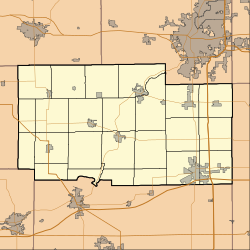
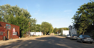
Menominee is a village in Jo Daviess County, Illinois, United States. The population was 248 at the 2010 census, up from 237 in 2000. The village is located on the Little Menominee River near East Dubuque and Galena.

Forest Lake is an unincorporated community and census-designated place (CDP) in Ela Township of Lake County, Illinois, United States. It is about 35 miles (56 km) northwest of downtown Chicago. Per the 2020 census, the population was 1,784. The community was founded in 1935 as a vacation community for Chicago residents.

<span class="mw-page-title-main">Adeline, Illinois</span> Village in Illinois, United States

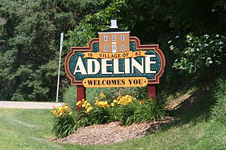
Adeline is a village in Maryland Township, Ogle County, Illinois, United States, along the Leaf River. The population was 85 at the 2010 census, down from 139 in 2000.

<span class="mw-page-title-main">Williamsville, Illinois</span> Village in Illinois, United States

Williamsville is a village in Sangamon County, Illinois, United States. The population was 1,476 at the 2010 census, and 1,491 at a 2018 estimate. It is part of the Springfield, Illinois Metropolitan Statistical Area. The village is named after Springfield merchant and banker John Williams

<span class="mw-page-title-main">New Milford, Illinois</span> Village in Illinois, United States

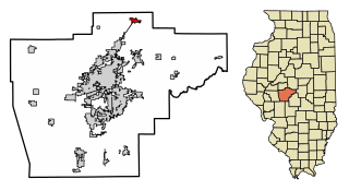
New Milford is a village in Winnebago County, Illinois, United States on the south bank of the Kishwaukee River overlooking the south side of Rockford. It is part of the Rockford, Illinois Metropolitan Statistical Area. The population was 697 at the 2010 census, up from 541 in 2000.

<span class="mw-page-title-main">Rockton, Illinois</span> Village in Illinois, United States

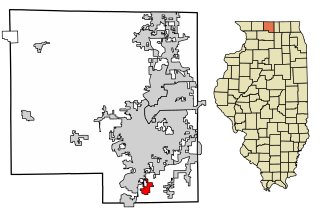
Rockton is a village in Winnebago County, Illinois. It is located in the Rock River Valley and is part of the Rockford metropolitan area. The population was 7,685 at the time of the 2010 census, up from 5,296 at the time of the 2000 census.

<span class="mw-page-title-main">Westfield, Iowa</span> City in Iowa, United States

Westfield is a city in Plymouth County, Iowa, United States. The population was 123 at the time of the 2020 census. It is the westernmost point in Iowa, this being due to a bend in the Big Sioux River. The nearby Broken Kettle wildlife refuge is one of the few places in Iowa where prairie rattlesnakes are commonly found.

Riverside is a village in Steuben County, New York, United States. The population was 497 at the 2010 census. Riverside is situated in the town of Corning and is a western suburb of the city of Corning.

<span class="mw-page-title-main">Manchester, Ohio</span> Village in Ohio, United States

Manchester is a village in Manchester Township, Adams County, Ohio, United States, along the Ohio River. The population was 1,839 at the 2020 census.

<span class="mw-page-title-main">Earl Township, Lancaster County, Pennsylvania</span> Township in Pennsylvania, United States

Earl Township is a township in northeastern Lancaster County, Pennsylvania, United States. The population was 7,149 at the 2020 census.

<span class="mw-page-title-main">Lincoln Township, Somerset County, Pennsylvania</span> Township in Pennsylvania, United States

Lincoln Township is a township in Somerset County, Pennsylvania, United States. The population was 1,456 at the 2020 census. It is part of the Johnstown, Pennsylvania, Metropolitan Statistical Area.

<span class="mw-page-title-main">West Bethlehem Township, Pennsylvania</span> Township in Pennsylvania, United States

West Bethlehem Township is a township in Washington County, Pennsylvania, United States established in 1781. In 1790, it was split into East and West Bethlehem Townships. The Martin's Mill Covered Bridge, Horn Davis Overholtzer Bridge, and Ulery Mill are listed on the National Register of Historic Places. According to the United States Census Bureau, the township has a total area of 22.2 square miles (57.5 km2), all of it land.

<span class="mw-page-title-main">Taft Southwest, Texas</span> CDP in Texas, United States

Taft Southwest is a census-designated place (CDP) in San Patricio County, Texas, United States. The population was 1,460 at the 2010 census.

<span class="mw-page-title-main">Rockdale, Wisconsin</span> Village in Wisconsin, United States

Rockdale is a village in Dane County, Wisconsin, United States. The population was 207 at the 2020 census, making it the smallest incorporated municipality in Dane County. The village is split in half by the Koshkonong Creek. It is part of the Madison Metropolitan Statistical Area.

<span class="mw-page-title-main">Browntown, Wisconsin</span> Village in Wisconsin, United States

Browntown is a village in Green County, Wisconsin, United States. The population was 280 at the 2010 census.

<span class="mw-page-title-main">Hollandale, Wisconsin</span> Village in Wisconsin, United States

Hollandale is a village in Iowa County, Wisconsin, United States. The population was 306 at the 2020 census. It is part of the Madison Metropolitan Statistical Area.

<span class="mw-page-title-main">South Wayne, Wisconsin</span> Village in Wisconsin, United States

South Wayne is a village in Lafayette County, Wisconsin, United States. The population was 489 at the 2010 census.

<span class="mw-page-title-main">Nelsonville, Wisconsin</span> Village in Wisconsin, United States

Nelsonville is a village in Portage County, Wisconsin, United States. The population was 155 at the 2010 census.

<span class="mw-page-title-main">Big Falls, Waupaca County, Wisconsin</span> Village in Wisconsin, United States

Big Falls is a village in Waupaca County, Wisconsin, United States. The population was 61 at the 2010 census.

<span class="mw-page-title-main">Patch Grove, Wisconsin</span> Village in Wisconsin, United States

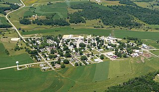
Patch Grove is a village in Grant County, Wisconsin, United States. The population was 198 at the 2010 census. The village is located within the Town of Patch Grove.

References

  1. "2020 U.S. Gazetteer Files". United States Census Bureau. Retrieved March 15, 2022.
  2. "US Gazetteer files: 2010, 2000, and 1990". United States Census Bureau. February 12, 2011. Retrieved April 23, 2011.
  3. "G001 - Geographic Identifiers - 2010 Census Summary File 1". United States Census Bureau. Archived from the original on February 13, 2020. Retrieved August 4, 2015.
  4. "Census of Population and Housing". Census.gov. Retrieved June 4, 2015.
  5. "U.S. Census website". United States Census Bureau . Retrieved January 31, 2008.