Lehmann Aviation Ltd (France), designs and manufactures professional civilian drones/UAVs since 2005. The company has two lines of UAVs: L-A series line of fully automatic drones designed for high precision mapping; construction/mining and precision agriculture; and L-M series line of both automatic and ground-controlled drones for long-range real-time surveillance.
The L-A series was launched in 2012 with the release of LA100 fully automatic personal drone for GoPro users (out of production). The series was then extended in 2013 to LA200, LA300 and later LA300AG drones, designed for corporate communications, mapping/mining/construction and precision agriculture, respectively.
Lehmann Aviation L-A series 2016
L-A series 2016
In July 2016 Lehmann Aviation announced launch of a totally new L-A series, redesigned from scratch, comprising three fully automatic (for people with no piloting background) light-weight (1250gr/44oz) aircraft for three major mapping applications:
The UAS are made of aluminium, carbon fibre and EPP foam and have a distinctive modular design, which enables to replace or upgrade any part of the drone if needed without changing the whole system. The new drones were also designed with detachable winglets for easier transportation.
The LA500, LA500-AG and LA500-RTK work with Sony α6000 (24.3Mp on a large APS-C sensor), multispectral Sequoia (LA500-AG only), thermal Flir View Pro and GoPro Hero4 cameras which enables to take images at up to 25km/15.5miles range and 45 minutes flight time. All L-A series drones are hand-launched. They follow the pre-programmed flight path automatically, however, the ground control can be taken at any time by the operator. They land autonomously in just few meters.
All Lehmann drones are programmed and controlled through Lehmann OperationCenter software for Windows 10.
L-M series
The L-M series was launched in 2007 with the release of LP960 UAS and was then extended to LV580 (2009) and LM450 (2010) (all out of production).
The major application of the new L-M series (coming in 2017) is long range and long endurance real-time surveillance.
First models (out of production)
LA100
Lehmann Aviation LA100 is a fully automatic lightweight SUAV launched by Lehmann Aviation in November 2012 (out of production).
The LA100 is a totally autonomous drone. It was designed to be used by people even without any piloting background. Working with GoPro camera it enabled to capture professional quality aerial images and video. Financial Times called the LA100 "a personal “drone” that will carry camcorders into the sky to capture aerial footage"[1]
The LA100 follows a pre-programmed flight path. The operational procedure implies mounting GoPro camera on the wing (GoPro Hero, Hero2, Hero 3 for oblique images or Hero3 for vertical images), switching the engine on by reclining the aircraft and launching it by hand. The LA100 is capturing footage from a height of 100 meters for 4min30sec and then coming back to the launch site with HD aerial photos or videos on the SD card.[2]
“With our UAVs, we want to bring to people the opportunity to have a better understanding of the Earth. LA100 is like aerial binoculars,” Benjamin Lehmann told to MIT Technology Review.[3]
The LA100 introduced Lehmann Aviation L-A series of fully automatic civil SUAV.
The LA100 has become world's first totally autonomous micro civil UAV enabling amateurs to take high-quality aerial images.
LA200
Lehmann Aviation LA200 is a fully automatic lightweight SUAV launched by Lehmann Aviation in July 2013.
The LA200 is a totally autonomous UAV. It was designed for people with no piloting background and it does not require any training. It works with GoPro Hero, Hero2 or Hero3 camera and enables to capture professional quality aerial images and video (up to 12 Mp). It was initially done for TV channels, documentaries and corporate communications.
The LA200 works with any Windows 8 touchscreen tablet needed for setting up flight parameters. For flight preparation and mission control the user has to «draw» on a touchscreen tablet the area of interest and enter waypoints. Afterwards Lehmann’s OperationCenter automatically generates missions and programs the drone. The flight data is then to be transmitted to the drone via WI-FI. After mounting GoPro Hero, Hero2 or Hero3 on the wing and launching the drone by hand, the user has to wait until it automatically flies over the chosen waypoints and lands.[2]
LA300
Lehmann Aviation LA300 is a fully automatic professional lightweight SUAV designed for most accurate mapping and DEM. It was launched by Lehmann Aviation in July 2013. The LA300 belongs to Lehmann Aviation L-A series of fully automatic UAVs.
The LA300 is a totally autonomous UAV designed for people with no piloting background. It first worked with Nokia Lumia 1020 mobile phone and GoPro camera. Since 2015 the drone works with GoPro Hero, Canon S110 day or NIR and thermal camera and enables to capture professional quality aerial images. The drone was designed to do professional orthomosaic and DEM for the needs of geodesy/mapping, agricultural sector (surfaces and volume calculation, detection of damaged crops), mining and construction.
The LA300 works with any Windows 8 touchscreen tablet which enables user to set up flight parameters and geotag images. For flight preparation and mission control the user has to «draw» on a touchscreen tablet area of interest and enter waypoints. Afterwards Lehmann’s OperationCenter automatically generates missions and programs the drone. The flight data is then to be transmitted to the drone via WI-FI. After mounting Nokia Lumia 1020 on the wing and launching the drone by hand, the user has to wait until it automatically flies over the chosen waypoints and lands.
The LA300 flies at range of up to 15km, at speeds of 20–80km/h.[2]
SPECIFICATIONS:
Specifications
LA100
LA200
LA300
Range
Up to 0.5km / 0.3miles
Up to 3km / 1.7miles
Up to 30km / 17miles
Endurance
5min
30min
45min
Weight
850gr / 30oz
850gr / 30oz
850gr / 30oz
Payload
150gr / 5oz
200gr / 7oz
200gr / 7oz
Wingspan
92cm / 36.2in
92cm / 36.2in
92cm / 36.2in
Wind capabilities
Up to 35km/h / 20kt
Up to 35km/h / 20kt
Up to 35km/h / 20kt
Temperature conditions
from –25°C to +60°C / from - 13°F to 140°F
from –25°C to +60°C / from - 13°F to 140°F
from –25°C to +60°C / from - 13°F to 140°F
Launch
Hand launch
Hand launch
Hand launch
Landing
Autonomous (no parachute)
Autonomous (no parachute)
Autonomous (no parachute)
Control
Fully autonomous flight
Fully autonomous flight
Fully autonomous flight
Flight path
Pre-programmed
Pre-programmed
Pre-programmed
LP960
The Lehmann Aviation LP960 is a lightweight small UAV designed by Lehmann Aviation Ltd in 2007 (out of production). LP960 is the first commercialized UAV of the company.
The(Digital Elevation Model) and HD vertical images for the needs of public and private sectors (reconnaissance, security, scientific research, mapping, agriculture). According to Réponses Photo, the system "could be used inter alia in urban areas".[4] The Ground Control System of LP960 became the prototype for the ground control systems of other UAVs of Lehmann Aviation (LV580 and LM450).
Lehmann Aviation common Ground Control System
LV580
The Lehmann Aviation LV580 is a lightweight small UAV designed by Lehmann Aviation in 2009 (out of production).
LV580 was designed for live day and night aerial survey. As soon as LV580 was launched, the customers of Lehmann Aviation became "construction and geodesy companies as well as scientific organisations".[5] The Ground Control System for LV580 is the same as for the other models of Lehmann Aviation: LP960 and LM450, which provides interoperability of Lehmann Aviation products.
Lehmann Aviation patent wing
LM450
The Lehmann Aviation LM450 is a lightweight small UAV launched by Lehmann Aviation in 2010 (out of production).
The system was designed for longer range missions to take oblique still images (11Mp), full HD or real-time videos.[6] LM450 was the first UAV of Lehmann Aviation to be launched with an advanced navigation system which enabled fully autonomous flights. LM450 is based on the same technology as the other UAS of Lehmann Aviation (LP960 and LV580) and is managed through a common Ground Control System.
LM450 UAV was designed mostly for corporate communication purposes.
Lehmann Aviation UAV Kit
SPECIFICATIONS:
Specifications
LP960
LV580
LM450
Range
Up to 5 / 3 miles
Up to 5 / 3 miles
Up to 5 / 3 miles
Endurance
Up to 25min
Up to 25min
Up to 45min
Weight
1250 / 44oz
950 / 44oz
950 / 44oz
Payload
350 / 12oz
350 / 12oz
200gr / 7oz
Wingspan
92cm / 36.2in
92cm / 36.2in
92cm / 36.2in
Wind capabilities
Up to 45km/h / 25kt
Up to 45km/h / 25kt
Up to 45km/h / 25kt
Temperature conditions
from –25°C to +60°C / from - 13°F to 140°F
from –25°C to +60°C / from - 13°F to 140°F
from –25°C to +60°C / from - 13°F to 140°F
Launch
Hand launch
Hand launch
Hand launch
Landing
Autonomous (no parachute)
Autonomous (no parachute)
Autonomous (no parachute)
GPS data
Yes
Yes
Yes
Autopilot
Yes
Yes
Yes
Control
By one operator from the GCS
By one operator from the GCS
By one operator from the GCS
Auto navigation
Yes
Yes
Yes
Notes
↑ Robbins, Tom (February 2013). "La Chapelle Vendômoise". Financial Times. Tom Robbins. Retrieved 1 Feb 2013.
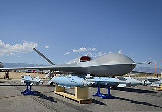
The AAI RQ-7 Shadow is an American unmanned aerial vehicle (UAV) used by the United States Army, Australian Army, Swedish Army, Turkish Air Force and Italian Army for reconnaissance, surveillance, target acquisition and battle damage assessment. Launched from a trailer-mounted pneumatic catapult, it is recovered with the aid of arresting gear similar to jets on an aircraft carrier. Its gimbal-mounted, digitally stabilized, liquid nitrogen-cooled electro-optical/infrared (EO/IR) camera relays video in real time via a C-band line-of-sight data link to the ground control station (GCS).
An unmanned aerial vehicle (UAV), commonly known as a drone, is an aircraft without any human pilot, crew, or passengers on board. UAVs were originally developed through the twentieth century for military missions too "dull, dirty or dangerous" for humans, and by the twenty-first, they had become essential assets to most militaries. As control technologies improved and costs fell, their use expanded to many non-military applications. These include aerial photography, precision agriculture, forest fire monitoring, river monitoring, environmental monitoring, policing and surveillance, infrastructure inspections, smuggling, product deliveries, entertainment, and drone racing.
UAVs include both autonomous drones and remotely piloted vehicles (RPVs). A UAV is capable of controlled, sustained level flight and is powered by a jet, reciprocating, or electric engine. In the twenty first century technology reached a point of sophistication that the UAV is now being given a greatly expanded role in many areas of aviation.
A miniature UAV, small UAV (SUAV), or drone is an unmanned aerial vehicle small enough to be man-portable. Smallest UAVs are called micro air vehicle.
The Bayraktar Mini UAV is a miniature UAV produced by Turkish company Baykar.
The Elbit Hermes 450 is an Israeli medium-sized multi-payload unmanned aerial vehicle (UAV) designed for tactical long endurance missions. It has an endurance of over 20 hours, with a primary mission of reconnaissance, surveillance and communications relay. Payload options include electro-optical/infrared sensors, communications and electronic intelligence, synthetic-aperture radar/ground-moving target indication, electronic warfare, and hyperspectral sensors.
The BAE Systems HERTI is an unmanned aerial vehicle (UAV) developed by the British company BAE Systems. HERTI stands for "High Endurance Rapid Technology Insertion" and was developed in Warton, United Kingdom. The HERTI airframe is based on the J-6 Fregata motor glider designed by Jaroslaw Janowski of J&AS Aero Design in Poland. Its first flight was in December 2004 at the Australian Woomera test range where much of the test flight programme has been undertaken. HERTI was also the first UAV to fly in the UK with the flight being certified by the Civil Aviation Authority.
The General Atomics MQ-20 Avenger is a developmental unmanned combat aerial vehicle built by General Atomics Aeronautical Systems for the U.S. military.
CATUAV S.L. is a technology-based private company that offers aerial services using unmanned aerial vehicles (UAV). Its headquarters are located in the Moià airfield in the BCN Drone Center, 40 km north of Barcelona, Spain.
The DRDO Netra is an Indian, light-weight, autonomous UAV for surveillance and reconnaissance operations. It has been jointly developed by the Research and Development Establishment (R&DE), and IdeaForge, a Mumbai-based private firm.
TAI Gözcü is a radio-controlled short-range tactical drone. Designed, developed and built by Turkish Aerospace Industries (TAI), the unmanned aerial vehicle (UAV) is in use by the Turkish Armed Forces for intelligence, surveillance, target acquisition and reconnaissance purposes. Gözcü is the Turkish word for observer.
Yuneec International is a Chinese aircraft manufacturer based in Jinxi, Kunshan, a town in Jiangsu owned through an off-shore Cayman Islands holding company, Yuneec Holding Limited. Yuneec was originally a manufacturer of radio-controlled model aircraft and marketed its man-carrying aircraft in the United States through GreenWing International. Yuneec produced the Yuneec International E430, the first electric aircraft designed to be commercially produced, although only prototypes were ever built. In the late 2010s, the company moved to specialize in the development and production of unmanned aerial vehicles (UAVs), for the aerial photography role.
Unmanned aircraft system simulation focuses on training pilots to control an unmanned aircraft or its payload from a control station. Flight simulation involves a device that artificially re-creates aircraft flight and the environment in which it flies for pilot training, design, or other purposes. It includes replicating the equations that govern how aircraft fly, how they react to applications of flight controls, the effects of other aircraft systems, and how the aircraft reacts to external factors such as air density, turbulence, wind shear, cloud, precipitation, etc.
3DR is an American company headquartered in Berkeley, California, that makes enterprise drone software for construction, engineering, and mining firms, along with government agencies.
The DJI Phantom is a series of unmanned aerial vehicles (UAVs) developed by Chinese technology company DJI. DJI Phantom devices were released between 2013–2019.
An autonomous aircraft is an aircraft which flies under the control of automatic systems and needs no intervention from a human pilot. Most autonomous aircraft are unmanned aerial vehicle or drones. However, autonomous control systems are reaching a point where several air taxis and associated regulatory regimes are being developed.
Primoco UAV is an unmanned aerial vehicle (UAV) for civilian use, designed and manufactured in the Czech Republic. Its first flight took place in July 2015 and the UAV Model One 100 started full production in January 2016.
A loitering munition is an aerial weapon system category in which the munition loiters around the target area for some time and attacks only once a target is located. Loitering munitions enable faster reaction times against concealed or hidden targets that emerge for short periods without placing high-value platforms close to the target area, and also allow more selective targeting as the attack can easily be aborted.
UAV Navigation is a company based in Madrid, Spain, that specializes in the design and production of guidance, navigation, and control solutions for Unmanned Aerial Vehicles (UAVs). The company was established in 2004 and has become one of the most experienced manufacturers of autopilots in Spain. UAV Navigation develops flight control solutions for various types of UAVs, including helicopters, airplanes, and Vertical Take-Off and Landing (VTOL) UAVs. In addition, the company also designs and manufactures Attitude and Heading Reference Systems (AHRS).
This page is based on this Wikipedia article Text is available under the CC BY-SA 4.0 license; additional terms may apply. Images, videos and audio are available under their respective licenses.