History
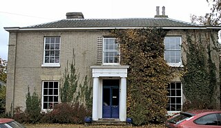
Lesingham House was supposedly built in 1655, and parts of the original structure may be included in the building we see today. A tablet in the house at the bottom of the staircase reads, “Lesingham House 1655 Rebuilt in part in 1834 by Gibbs Murrell”. It is recorded as belonging to Murrell in White's 1836 History, Gazetteer, and Directory of Norfolk. [1]
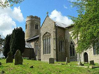
It is possible that the building stood on the site of an older house owned by the Lesingham family who lived in Surlingham in the sixteenth century - perhaps the house owned by Thomas Wode, who died in 1588. Wode left at his death an inventory of goods indicating that his house in Surlingham had at least nine rooms and a stable. The Wode and the Lesingham families were related, and the families owned lands in Rockland and Bramerton as well as Surlingham. In his will Thomas Wode asked his late uncle Jeremy Lesingham to bury him in St Mary’s parish church. The Lesingham family is first found in Yorkshire where they were anciently seated as Lords of the Manor; migrants settled along the eastern seaboard of America from Newfoundland, to Maine, Virginia, the Carolinas, and to the islands.
By 1841 Lesingham House was owned by Gibbs Murrell, who lived here in some style as a farmer and brick- and tile-maker. The Murrells were an old Surlingham family who lived at Lesingham House for many generations. Their land was mostly in the centre of the village. With Gibbs Murrell lived his wife Catherine and his son Gibbs H. Murrell. Also living in the house at the time of the United Kingdom Census 1841 were Robert Roper, agricultural pupil, and two servants Mary Hannant and Ann Fish. The Lesingham House estate consisted of some 366 acres (148 ha) of “arable, pasture, water and marsh” as well as six houses or cottages. Lesingham House and estate was sold in 1861 for £16,895 pounds sterling.
By 1894 Lesingham House and Estate were in the hands of Sir Charles Rich of Devizes Castle, who died in 1913, after which they were occupied by a staunch Methodist couple, Mr and Mrs Richard Wright. The records show that the Trust of the Surlingham Chapel met under the newly appointed Rev. P. Webb, when Richard Wright, who farmed from Lesingham House, was made treasurer. Mr Wright made a donation of £50 which may have provided the purchase money required by the previous Wesleyan Trust.
The maps of this time show extensive outbuildings at Lesingham House, many of which are today used along with the house as accommodation for religious retreats. The Lesingham House property today has land of slightly less than 6 acres (2.4 ha). Records show field names for the original Lesingham House Estate were: Horse Pit Close, Share Water, Dawson’s’, New Close, Clay Pit Close, Green’s Croft, First Mill Piece, Further Mill Piece, Little Company, Great Company, Lombe Hills, Parker’s Close, Coldham Piece, Burd’s, Dormant’s.
Near Lesingham House, down Covey Lane, lie extensive marshes and the Ted Ellis nature reserve. This is one of the last remaining tidal marshes on the Broads and its wild remoteness encourages a variety of flora and fauna.

Norfolk is a county in East Anglia in England. It borders Lincolnshire to the northwest, Cambridgeshire to the west and southwest, and Suffolk to the south. Its northern and eastern boundaries are the North Sea and to the northwest, The Wash. The county town is Norwich. With an area of 2,074 square miles (5,370 km2) and a population of 859,400, Norfolk is a largely rural county with a population density of 401 per square mile. Of the county's population, 40% live in four major built up areas: Norwich (213,000), Great Yarmouth (63,000), King's Lynn (46,000) and Thetford (25,000).

The Broads is a network of mostly navigable rivers and lakes in the English counties of Norfolk and Suffolk. The lakes, known as broads, were formed by the flooding of peat workings. The Broads, and some surrounding land, were constituted as a special area with a level of protection similar to a national park by the Norfolk and Suffolk Broads Act 1988. The Broads Authority, a special statutory authority responsible for managing the area, became operational in 1989.

Wroxham is a village and civil parish in the English county of Norfolk. The civil parish of Wroxham has an area of 6.21 square kilometres and in 2001 had a population of 1532 in 666 households, reducing to a population of 1,502 in 653 households at the 2011 Census. The village is situated within the Norfolk Broads on the south side of a loop in the middle reaches of the River Bure. It lies in an elevated position above the Bure, between Belaugh Broad to the west and Wroxham Broad to the east or south east. Wroxham is some eight miles north-east of Norwich, to which it is linked by the A1151 road. The village and broad lie in an area of fairly intensive agriculture, with areas of wet woodland adjoining the broad and river. For the purposes of local government, the parish falls within the district of Broadland although the river, broad and their immediate environs fall within the executive area of the Broads Authority. On the northern side of the Bure is the village of Hoveton, often confused with Wroxham.

Blakeney is a coastal village and civil parish in the English county of Norfolk. Blakeney lies within the Norfolk Coast AONB and the North Norfolk Heritage Coast. The North Norfolk Coastal Path travels along its quayside. The village is 21.1 miles (34.0 km) north west of Norwich, 4.6 miles (7.4 km) NNW of the larger settlement of Holt, 11.5 miles (18.5 km) west of Cromer and 112 miles (180 km) NNE of London.
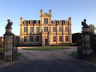
Bylaugh Hall, also known as Bylaugh Park, is a country house situated in the parish of Bylaugh in Norfolk, England.

Old Catton is a suburban village and civil parish in the English county of Norfolk which lies 2 miles (3.2 km) to the north-east of central Norwich. The parish is bounded by the Norwich International Airport at Hellesdon to the west and Sprowston to the east. The northern boundary is with the village of Spixworth while the A1042 road forms the southern boundary. It covers an area of 2.33 km2 (0.90 sq mi) and had a population of 5,954 in 2,512 households at the 2001 census, increasing to a population of 6,108 in 2,666 households at the 2011 Census. For the purposes of local government, it falls within the district of Broadland. The village is twinned with the French commune of Lavaré.

Buxton is a village in Norfolk, located between Norwich and Aylsham. The village is mentioned in the Domesday Book of 1085. Buxton is adjacent to the village of Lamas. The two villages are separated by the River Bure at Buxton Mill but are otherwise indistinguishable. Together they form the civil parish of Buxton with Lamas.

Norfolk is a rural county in the East of England. Knowledge of prehistoric Norfolk is limited by a lack of evidence — although the earliest finds are from the end of the Lower Paleolithic period. Communities have existed in Norfolk since the last Ice Age and tools, coins and hoards such as those found at Snettisham indicate the presence of an extensive and industrious population.

Colkirk is a village situated about two miles south of Fakenham in the county of Norfolk, England. Dating from at least the time of the Domesday Book. The village including Oxwick, Pattesley and South Raynham currently (2011) has 588 inhabitants living in 266 dwellings. The village has a church,, in the north west corner of the village, a Village Hall, a church pond, a Camping Land. There is also a thriving village school for students from the age of four to eleven, a lively village Pub called "The Crown" and a playing field for soccer, cricket, rounders and school sports days.
Padmaloka Buddhist Retreat Centre is a Buddhist retreat centre for men, located at Lesingham House in Surlingham, Norfolk, England. The centre is part of the Triratna Buddhist Community, formerly the Friends of the Western Buddhist Order, which aims to make the teachings of the Buddha and Buddhism more accessible. The name Padmaloka means 'Realm of the Lotus' in Pāli, padma meaning lotus, and loka meaning realm, place, or abode.
Stody is a village and a civil parish in the English county of Norfolk. The village is 13.2 miles (21.2 km) west south west of Cromer, 21.8 miles (35.1 km) north north west of Norwich and 125 miles (201 km) north north east of London. The village lies 4.1 miles (6.6 km) south west of the town of Holt. The nearest railway station is at Sheringham for the Bittern Line which runs between Sheringham, Cromer and Norwich. The nearest airport is Norwich International Airport.
Flaxman Charles John Spurrell was a British archaeologist, geologist and photographer who worked mainly in Kent and East Anglia. He was also a noted egyptologist, working closely with Flinders Petrie.

Brandon is a small town and civil parish in the English county of Suffolk. Brandon is located in the Breckland area on the border of Suffolk with the adjoining county of Norfolk. Surrounded by Forestry Commission and agricultural land it is considered a rural town.

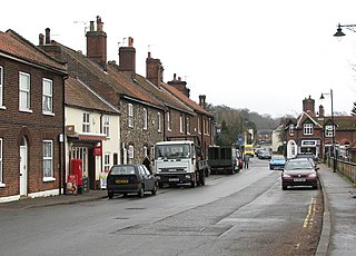
Surlingham is a village and civil parish in South Norfolk situated on the Broads. It lies approximately 6½ miles south-east of Norwich on the south bank of the River Yare between Bramerton and Rockland St Mary. In the 2001 census it contained 266 households and a population of 637, increasing to 725 at the 2011 census. Although Surlingham is part of South Norfolk District, as in other broadland villages those areas of the village adjacent to the river and broads fall into the executive area of the Broads Authority.

The prehistory of the County of Norfolk, England is broken into specific time periods.

The A149 is commonly known as "The Coast Road" to local residents and tourists as this road runs along the North Norfolk coast from King's Lynn to Cromer passing through small coastal villages. The road then leaves the coastline at Cromer and reaches the Norfolk Broads.
Bramerton is a village in South Norfolk 4¾ miles south-east of Norwich, just north of the main A146 Norwich-Lowestoft road and on the south bank of the River Yare. In the 2001 census it contained 158 households and a population of 350, the population falling to 301 at the 2011 census.
Trowse, also called Trowse with Newton, is a village in South Norfolk which lies about 1 1⁄2 miles (2.4 km) south-east of Norwich city centre on the banks of the River Yare. It covers an area of 4.49 km2 (1.73 sq mi) and had a population of 479 in 233 households at the 2001 census, the population increasing to 862 in 374 households at the 2011 Census. There are approved plans to build a further 770 houses on the outskirts of the village, at White Horse Lane and the Deal Ground sites.

The North Norfolk Coast Site of Special Scientific Interest (SSSI) is an area of European importance for wildlife in Norfolk, England. It comprises 7,700 ha (19,027 acres) of the county's north coast from just west of Holme-next-the-Sea to Kelling, and is additionally protected through Natura 2000, Special Protection Area (SPA) listings; it is also part of the Norfolk Coast Area of Outstanding Natural Beauty (AONB). The North Norfolk Coast is also designated as a wetland of international importance on the Ramsar list and most of it is a Biosphere Reserve.

Cley Marshes is a 176-hectare (430-acre) nature reserve on the North Sea coast of England just outside the village of Cley next the Sea, Norfolk. A reserve since 1926, it is the oldest of the reserves belonging to the Norfolk Wildlife Trust (NWT), which is itself the oldest county Wildlife Trust in the United Kingdom. Cley Marshes protects an area of reed beds, freshwater marsh, pools and wet meadows and is part of the North Norfolk Coast Site of Special Scientific Interest (SSSI), Special Area of Conservation (SAC), Special Protection Area (SPA), and Ramsar Site due to the large numbers of birds it attracts.
