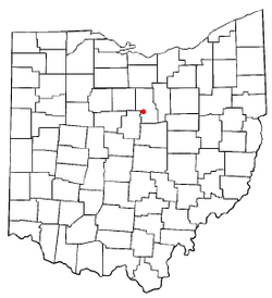
Lexington, Ohio

Last updated

Lexington, Ohio
Lexington Ohio.jpg
West Main Street in downtown Lexington in 2007
OHMap-doton-Lexington.png
Location of Lexington, Ohio
Map of Richland County Ohio Highlighting Lexington Village.png
Location of Lexington in Richland County
Coordinates: 40°40′46″N82°34′43″W / 40.67944°N 82.57861°W / 40.67944; -82.57861
Country United States
State Ohio
County Richland
Township Troy and
Washington
Founded1812
Government
   Mayor Brian White [1]
Area
[2]
  Total4.08 sq mi (10.56 km2)
  Land4.07 sq mi (10.55 km2)
  Water0.00 sq mi (0.01 km2)
Elevation
[3]
1,184 ft (361 m)
Population
 (2020)
  Total4,848
  Density1,190.57/sq mi (459.72/km2)
Time zone UTC-5 (Eastern (EST))
  Summer (DST) UTC-4 (EDT)
ZIP code
44904
Area code 419/567
FIPS code 39-42994 [4]
GNIS feature ID2398431 [3]
Website http://www.lexingtonohio.us/
Lexington Municipal Building Lexington Ohio Municipal Building.jpg
Lexington Municipal Building

Lexington is a village along the Clear Fork River in Troy Township and Washington Township in Richland County in the U.S. state of Ohio. It is part of the Mansfield, Ohio Metropolitan Statistical Area. The population was 4,848 at the 2020 census.

Contents

The Mid-Ohio Sports Car Course is located just outside Lexington in Troy Township. This venue hosted an annual round of the CART series from 1990 to 2003, has hosted the IndyCar Series since 2007, has hosted the NASCAR Xfinity Series since 2013, hosts Honda Super Bikes, and Vintage Bikes in addition to a few other annual high-profile events.

History

Lexington was founded by Amariah Watson Jr. in 1812, a land speculator who had purchased wide lands locally in order to sell to other settlers. [5] During the 1800s, Lexington had many taverns, hotels, and grist mills — most of which at one time or another burned to the ground. In the 19th century, leading members of the community were William Cockley Thad and Martin Kell, Les Griebling, Erwin Castor, Sgt. Patrick Gass, and Jacob Cook. [6] The first road constructed through town was what is now State Route 97, and the second was what is now Lexington-Ontario Road. [7]

Lexington was first inhabited by the Delaware, Wyandot and Mohawk Indians. These tribes inhabited long houses in permanent villages and cultivated crops such as corn, beans, and squash to complement their diet of hunted meat and foraged berries and herbs. The Indians were friendly with Watson when he and his family moved into the area until Watson's pig ate their baby. The Indians demanded Watson's newborn daughter, who was the first white child born in Lexington, as replacement to their own. Watson settled the argument by agreeing to give the Indians the pig instead. Watson chose to name his new home Lexington. He chose this out of respect for his father who fought in the Revolutionary War of which the first battle was fought in Lexington, Massachusetts. In 1813, Watson built a water-powered sawmill along the Clear Fork River. The mill made work easier and attracted more and more settlers. Business owners used the gristmills for their woolen and saw mills and also distilleries. [8]

The first tavern was built in 1815 by Jacob Cook. It was called "Cook's Tavern" and the first grocery store was built in 1825 by William Damsell. [7] It was in 1839 that Lexington was recognized as a village by the federal government. In 1850 the railroad made its path through Lexington and this contributed to much of the business activity and travel for the settlers. [8] Also by 1850 Lexington was booming and anyone could get anything they needed from Lexington and its resources. By 1853 there were over 50 established businesses in Lexington, many of which competed with each other, providing superior products and services to their customers.

The cemetery is on land originally owned by Amariah Watson himself. It wasn't until 1857 that the village fenced it in to allow a more safe resting place. The sexton house was built in 1863 and the row of maple trees was later planted in 1889. [7] The Lexington Square was once decorated with a Civil War Gatling gun. In 1958 the village of Lexington donated the gun to the Smithsonian Institution in Washington, D.C., and it can still be found there today.

A structure still standing in Lexington from 1843 is known as the "Old Stone House". It was built by James Gass and was host to many runaway slaves traveling along the Underground Railroad. The owners today believe that slaves were hidden in a secret closet. [8] Benjamin Gass took 11-12 slaves in a wagon to Springfield Township and those slaves eventually made their way to Canada. A farm on Texter Road owned by Samuel McClure was also part of the underground railroad and George Mitchell hid slaves in his home and water-powered mill, located near the intersection of today's routes 97 and 314. Many more families in Lexington helped and hid slaves making their way to freedom. While there is no list of names there was a protracted court case against certain citizens who were charged with helping slaves. [7]

Harry F. Smith is another figure worthy of taking note in Lexington's history. Smith grew up in Lexington and is responsible for the first outdoor lighting system that was powered by steam in 1894. Smith later founded Smith Gas Power Company which was Lexington's largest business at the time and then he sold it to General Motors in 1918. After retirement Smith was involved in helping create Lexington's water system and became known as the "Father of the Clear Fork Reservoir". [8]

Geography

Lexington is located along the Clear Fork of the Mohican River. [9]

According to the United States Census Bureau, the village has a total area of 3.81 square miles (9.87 km2), all land. [10]

Demographics

Historical population
CensusPop.Note
1870 482
1880 5085.4%
1890 432−15.0%
1900 4483.7%
1910 65446.0%
1920 634−3.1%
1930 614−3.2%
1940 71316.1%
1950 7393.6%
1960 1,31177.4%
1970 2,972126.7%
1980 3,82328.6%
1990 4,1247.9%
2000 4,1651.0%
2010 4,82215.8%
2020 4,8480.5%
Sources: [11] [12]

2010 census

As of the census [13] of 2010, there were 4,822 people, 1,970 households, and 1,366 families living in the village. The population density was 1,265.6 inhabitants per square mile (488.7/km2). There were 2,092 housing units at an average density of 549.1 per square mile (212.0/km2). The racial makeup of the village was 96.3% White, 1.2% African American, 0.2% Native American, 1.0% Asian, 0.1% from other races, and 1.2% from two or more races. Hispanic or Latino of any race were 1.2% of the population.

There were 1,970 households, of which 32.8% had children under the age of 18 living with them, 52.5% were married couples living together, 12.8% had a female householder with no husband present, 4.0% had a male householder with no wife present, and 30.7% were non-families. 26.4% of all households were made up of individuals, and 8.9% had someone living alone who was 65 years of age or older. The average household size was 2.41 and the average family size was 2.91.

The median age in the village was 39.9 years. 25% of residents were under the age of 18; 8.2% were between the ages of 18 and 24; 24% were from 25 to 44; 27.9% were from 45 to 64; and 14.9% were 65 years of age or older. The gender makeup of the village was 47.6% male and 52.4% female.

2000 census

As of the census [4] of 2000, there were 4,165 people, 1,626 households, and 1,230 families living in the village. The population density was 1,134.7 inhabitants per square mile (438.1/km2). There were 1,686 housing units at an average density of 459.3 per square mile (177.3/km2). The racial makeup of the village was 97.17% White, 1.20% African American, 0.05% Native American, 0.72% Asian, 0.07% Pacific Islander, 0.43% from other races, and 0.36% from two or more races. Hispanic or Latino of any race were 0.89% of the population.

There were 1,626 households, out of which 38.4% had children under the age of 18 living with them, 61.3% were married couples living together, 11.6% had a female householder with no husband present, and 24.3% were non-families. 21.3% of all households were made up of individuals, and 7.3% had someone living alone who was 65 years of age or older. The average household size was 2.56 and the average family size was 2.98.

In the village, the population was spread out, with 28.1% under the age of 18, 7.3% from 18 to 24, 28.5% from 25 to 44, 25.2% from 45 to 64, and 10.9% who were 65 years of age or older. The median age was 37 years. For every 100 females there were 92.9 males. For every 100 females age 18 and over, there were 87.8 males.

The median income for a household in the village was $48,028, and the median income for a family was $57,313. Males had a median income of $47,857 versus $24,954 for females. The per capita income for the village was $23,800. About 1.5% of families and 2.5% of the population were below the poverty line, including 0.9% of those under age 18 and 7.1% of those age 65 or over.

Education

Lexington Local School District operates


As of the 2022-2023 school year, the new consolidated High School and Junior High building opened for grades 7-12. The former buildings were subsequently demolished. Future plans call for the demolition of the 3 elementary schools after a brand new, consolidated K-6 grade school is built.

Lexington has a public library, a branch of the Mansfield–Richland County Public Library. [15]

Notable people

Related Research Articles

<span class="mw-page-title-main">Richland County, Ohio</span> County in Ohio, United States

Richland County is a county located in the U.S. state of Ohio. As of the 2020 census, the population was 124,936. Its county seat is Mansfield. The county was created in 1808 and later organized in 1813. It is named for the fertile soil found there. Richland County is included in the Mansfield, OH Metropolitan Statistical Area as well as the Mansfield-Ashland-Bucyrus, OH Combined Statistical Area. The county is one of the six Metropolitan Statistical Areas that make up Northeast Ohio.

<span class="mw-page-title-main">Highland County, Ohio</span> County in Ohio, United States

Highland County is a county located in the U.S. state of Ohio. As of the 2020 census, the population was 43,317. Its county seat is Hillsboro. The county is named for the topography which is hilly and divides the watersheds of the Little Miami and Scioto Rivers.

<span class="mw-page-title-main">Ashland County, Ohio</span> County in Ohio, United States

Ashland County is a county located in the northeastern portion of the U.S. state of Ohio. As of the 2020 census, the population was 52,447. Its county seat and largest city is Ashland. The county is named for "Ashland", the home of Senator Henry Clay near Lexington, Kentucky. It was formed in 1846 from parts of Huron, Lorain, Richland and Wayne Counties.

<span class="mw-page-title-main">Perrysville, Ohio</span> Village in Ohio, United States

Perrysville is a village in Ashland County, Ohio, United States. The population was 729 at the 2020 census.

<span class="mw-page-title-main">Ripley, Ohio</span> Village in Ohio, United States

Ripley is a village in Union Township, Brown County, Ohio, United States, along the Ohio River 50 miles southeast of Cincinnati. The population was 1,591 at the 2020 census.

<span class="mw-page-title-main">Leesville, Ohio</span> Village in Ohio, United States

Leesville is a village in southwestern Carroll County, Ohio, United States. The population was 127 at the 2020 census. It is part of the Canton–Massillon metropolitan area.

<span class="mw-page-title-main">Sabina, Ohio</span> Village in Ohio, United States

Sabina is a village in Clinton County, Ohio, United States. As of the 2020 census, the village had a total population of 2,499.

<span class="mw-page-title-main">West Mansfield, Ohio</span> Village in Ohio, United States

West Mansfield is a village located in Logan County, Ohio, United States. The population was 749 at the 2020 census.

<span class="mw-page-title-main">New Lexington, Ohio</span> Village in Ohio, United States

New Lexington is a village in and the county seat of Perry County, Ohio, United States, 21 miles (34 km) southwest of Zanesville and 45 miles (72 km) miles southeast of Columbus. The population was 4,435 at the 2020 census.

<span class="mw-page-title-main">Bellville, Ohio</span> Village in Ohio, United States

Bellville is a village in Richland County in the U.S. state of Ohio. It is part of the Mansfield, Ohio Metropolitan Statistical Area. The population was 1,963 at the 2020 census.

<span class="mw-page-title-main">Butler, Ohio</span> Village in Ohio, United States

Butler is a village in Richland County in the U.S. state of Ohio. It is part of the Mansfield, Ohio Metropolitan Statistical Area. The population was 941 at the 2020 census.

<span class="mw-page-title-main">Lucas, Ohio</span> Village in Ohio, United States

Lucas is a village in southeastern Richland County, Ohio, United States. Lucas is part of the Mansfield, Ohio Metropolitan Statistical Area. The population was 589 at the 2020 census.

<span class="mw-page-title-main">Ontario, Ohio</span> City in Ohio, United States

Ontario is a city in Richland County in the U.S. state of Ohio. It was founded in 1834 on the western edge of the Allegheny Plateau, just west of the city of Mansfield. After being incorporated in 1958, Ontario became a heavy manufacturing center because of the Erie Railroad line, and its proximity to Mansfield. However, its status in that regard began to decline in the late 20th century, when much of the Erie Railroad that once ran through the city was abandoned; and shifts in the manufacturing industry led to the relocation or repositioning of many factories. The city's industry has since diversified into the service economy, including education, finance and healthcare. The city is also a major regional retail hub serving the entire North-Central Ohio area, with a shopping population of over 150,000.

<span class="mw-page-title-main">Shelby, Ohio</span> City in Ohio, United States

Shelby is a city in Richland County in the U.S. state of Ohio, northwest of the city of Mansfield. It is part of the Mansfield, Ohio Metropolitan Statistical Area. The population was 9,282 as of the 2020 census.

<span class="mw-page-title-main">Shiloh, Richland County, Ohio</span> Village in Ohio, United States

Shiloh is a village in Richland County in the U.S. state of Ohio. It is part of the Mansfield, Ohio Metropolitan Statistical Area. The population was 619 at the 2020 census.

<span class="mw-page-title-main">Lower Salem, Ohio</span> Village in Ohio, United States

Lower Salem is a village in Washington County, Ohio, United States. The population was 75 at the 2020 census.

<span class="mw-page-title-main">Crestline, Ohio</span> American village in Crawford and Richland Counties in the U.S. state of Ohio

Crestline is a village in Crawford and Richland Counties in the U.S. state of Ohio. Crestline's population was 4,525 at the 2020 census. It is the third largest municipality in Crawford County. The Crawford County portion of Crestline is part of the Bucyrus Micropolitan Statistical Area, while the small portion of the village that extends into Richland County is considered part of the Mansfield Metropolitan Statistical Area. Both sections form the Mansfield–Bucyrus, OH Combined Statistical Area.

<span class="mw-page-title-main">Plymouth, Ohio</span> Village in Ohio, United States

Plymouth is a village in Huron and Richland counties in the U.S. state of Ohio. The population was 1,707 at the 2020 census.

<span class="mw-page-title-main">Irmo, South Carolina</span> Town in South Carolina, United States

Irmo is a town in Lexington and Richland counties, South Carolina, United States and a suburb of Columbia. It is part of the Columbia Metropolitan Statistical Area and is located 12 miles (19 km) northwest of the city center. The population of Irmo was 11,097 at the 2010 census.

<span class="mw-page-title-main">Belle Center, Ohio</span> Village in Ohio, United States

Belle Center is a village in Logan County, Ohio, United States. The population was 809 at the 2020 census. It is a Tree City USA, one of the smallest in the state.

References

  1. "White unseats longtime incumbent Parkison in Lexington mayoral race". Mansfield News Journal. Retrieved April 4, 2021.
  2. "ArcGIS REST Services Directory". United States Census Bureau. Retrieved September 20, 2022.
  3. 1 2 U.S. Geological Survey Geographic Names Information System: Lexington, Ohio
  4. 1 2 "U.S. Census website". United States Census Bureau . Retrieved January 31, 2008.
  5. "History of Lexington by A. J. Baughman". rootsweb. Retrieved December 30, 2013.
  6. "Ohio County Histories". Heritage Pursuit. Retrieved December 30, 2013.
  7. 1 2 3 4 Carter, Robert A. (2007). Tales of the Old-Timers: The History of Lexington. Ashland, OH: R. A. Carter. OCLC   233598095.
  8. 1 2 3 4 Bebout, A.; Bopp, J.; Bradley, Vasvi.; Edison, D. F. B.; Massie, A.; Metcalf, B. (2002). Looking Back at Lexington. Mansfield, OH: Mid-Ohio Educational Service Center.
  9. DeLorme (1991),Ohio Atlas & Gazetteer, Yarmouth, Maine, page=? ISBN   0-89933-233-1
  10. "US Gazetteer files 2010". United States Census Bureau. Archived from the original on January 25, 2012. Retrieved January 6, 2013.
  11. "Census of Population and Housing". United States Census Bureau . Retrieved December 21, 2013.
  12. Data in historical populations table from US Census, 1890, 1891; US Census, 1920, 1921; US Census, 1950, 1952, ISBN   9780598466846 ; US Census, 1970, 1973; US Census, 2000, ISBN   9781428986060 ; "U.S. Census website". United States Census Bureau . Retrieved December 24, 2013.
  13. "U.S. Census website". United States Census Bureau . Retrieved January 6, 2013.
  14. "Homepage". Lexington Local Schools. Retrieved March 3, 2018.
  15. "Locations". Mansfield-Richland County Public Library. Retrieved March 3, 2018.
  16. The Alumni Record of the University of Illinois at Urbana. University of Illinois (Urbana-Champaign campus). 1906. p.  573 . Retrieved May 25, 2017. John Peter Altgeld lexington ohio.