Related Research Articles

The Wash is a rectangular bay and multiple estuary at the north-west corner of East Anglia on the East coast of England, where Norfolk meets Lincolnshire and both border the North Sea. One of Britain's broadest estuaries, it is fed by the rivers Witham, Welland, Nene and Great Ouse. It is a 620 km² biological Site of Special Scientific Interest. It is also a Nature Conservation Review site, Grade I, a National Nature Reserve, a Ramsar site, a Special Area of Conservation and a Special Protection Area. It is in the Norfolk Coast Area of Outstanding Natural Beauty and part of it is the Snettisham Royal Society for the Protection of Birds nature reserve.

The Fens, also known as the Fenlands, in eastern England are a naturally marshy region supporting a rich ecology and numerous species. Most of the fens were drained centuries ago, resulting in a flat, dry, low-lying agricultural region supported by a system of drainage channels and man-made rivers and automated pumping stations. There have been unintended consequences to this reclamation, as the land level has continued to sink and the dykes have been built higher to protect it from flooding.
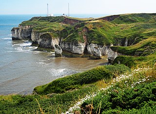
The East Riding of Yorkshire, often shortened to the East Riding and alternatively known as East Yorkshire, is a ceremonial county in the Yorkshire and the Humber region of England. It borders North Yorkshire to the north and west, South Yorkshire to the south-west, and Lincolnshire to the south across the Humber Estuary. The city of Kingston upon Hull is the largest settlement.

The Yorkshire Wolds are hills in the counties of the East Riding of Yorkshire and North Yorkshire in Northern England. They are the northernmost chalk hills in the UK and within lies the northernmost chalk stream in Europe, the Gypsey Race.

Holderness is an area of the East Riding of Yorkshire, on the north-east coast of England. An area of rich agricultural land, Holderness was marshland until it was drained in the Middle Ages. Topographically, Holderness has more in common with the Netherlands than with other parts of Yorkshire. To the north and west are the Yorkshire Wolds. Holderness generally refers to the area between the River Hull and the North Sea. The Prime Meridian passes through Holderness just to the east of Patrington and through Tunstall to the north.

The Lincolnshire Wolds are a range of low hills in the county of Lincolnshire, England which run roughly parallel with the North Sea coast, from the Humber Estuary in the north-west to the edge of the Lincolnshire Fens in the south-east. They are a designated Area of Outstanding Natural Beauty (AONB), and the highest area of land in eastern England between Yorkshire and Kent.
The ceremonial county of Lincolnshire is the second largest of the English counties and one that is predominantly agricultural in character. Despite its relatively large physical area, it has a comparatively small population. The unusually low population density that arises gives the county a very different character from the much more densely populated an urbanised counties of south-east and northern England, and is, in many ways, key to understanding the nature of the county.
The Vale of Clwyd is a tract of low-lying ground in the county of Denbighshire in north-east Wales. The Vale extends south-southwestwards from the coast of the Irish Sea for some 20 miles forming a triangle of low ground bounded on its eastern side by the well-defined scarp of the Clwydian Range and to the west by numerous low hills. The River Clwyd which rises within Clocaenog Forest, southwest of Denbigh, runs the full length of the vale. It is joined by the two major left bank tributaries of the River Clywedog and River Elwy and the smaller right bank tributary of the River Wheeler.

The Bluestone Heath Road is an ancient route and ridgeway across the Lincolnshire Wolds in Lincolnshire, England. The surviving parts are somewhat fragmented in places, but many still bear the name.

The Vale of Pickering is a low-lying flat area of land in North Yorkshire, England. It is drained by the River Derwent. The landscape is rural with scattered villages and small market towns. It has been inhabited continuously from the Mesolithic period. The present economy is largely agricultural with light industry and tourism playing an increasing role.

Beesby with Saleby is a civil parish in the East Lindsey district of Lincolnshire, England. It includes Beesby and Saleby. According to the 2001 Census it had a population of 228, increasing to 258 at the 2011 Census.
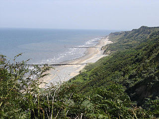
The Norfolk Coast Area of Outstanding Natural Beauty is a protected landscape in Norfolk, England. It covers over 450 km2 of coastal and agricultural land from The Wash in the west through coastal marshes and cliffs to the sand dunes at Winterton in the east. It was designated AONB in 1968, under the National Parks and Access to the Countryside Act 1949.
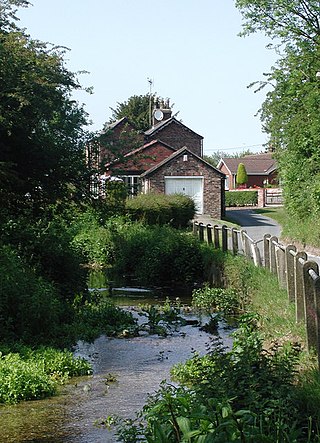
The Great Wold Valley is the largest and broadest of the valleys cutting into the Yorkshire Wolds in northern England. It carries the Gypsey Race, an intermittent stream, which runs from its source near Wharram-le-Street eastwards along and through the northern Yorkshire Wolds to reach the sea at Bridlington.
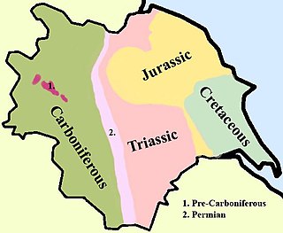
The Geology of Yorkshire in northern England shows a very close relationship between the major topographical areas and the geological period in which their rocks were formed. The rocks of the Pennine chain of hills in the west are of Carboniferous origin whilst those of the central vale are Permo-Triassic. The North York Moors in the north-east of the county are Jurassic in age while the Yorkshire Wolds to the south east are Cretaceous chalk uplands. The plain of Holderness and the Humberhead levels both owe their present form to the Quaternary ice ages. The strata become gradually younger from west to east.
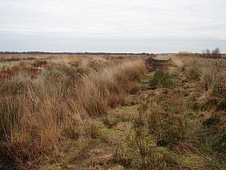
The Humberhead Levels is a national character area covering a large expanse of flat, low-lying land towards the western end of the Humber estuary in northern England. The levels occupy the former Glacial Lake Humber, an area bounded to the east by the Yorkshire Wolds and the northern Lincolnshire Edge, a limestone escarpment, and to the west by the southern part of the Yorkshire magnesian limestone ridge. In the north the levels merge into the slightly more undulating Vale of York close to the Escrick glacial moraine, and to the south merge into the Trent Vale.
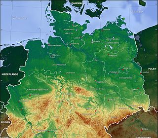
The North German Plain or Northern Lowland is one of the major geographical regions of Germany. It is the German part of the North European Plain. The region is bounded by the coasts of the North Sea and the Baltic Sea to the north, Germany's Central Uplands to the south, by the Netherlands to the west and Poland to the east.
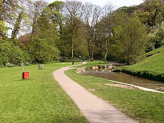
Hubbard's Hills is an area of natural beauty directly to the west of Louth, Lincolnshire, England and is popular for family picnics, school field trips and dog walking. The park is dedicated to the memory of Annie Pahud.
The Natural Areas of England are regions, officially designated by Natural England, each with a characteristic association of wildlife and natural features. More formally, they are defined as "biogeographic zones which reflect the geological foundation, the natural systems and processes and the wildlife in different parts of England...".
A National Character Area (NCA) is a natural subdivision of England based on a combination of landscape, biodiversity, geodiversity and economic activity. There are 159 National Character Areas and they follow natural, rather than administrative, boundaries. They are defined by Natural England, the UK government's advisors on the natural environment.
The geology of Lincolnshire in eastern England largely consists of an easterly dipping succession of Mesozoic age sedimentary rocks, obscured across large parts of the county by unconsolidated deposits dating from the last few hundred thousand years of the present Quaternary Period.
References
- ↑ "Lincolnshire Coast & Marshes National Character Area". Natural England. Retrieved 3 March 2013.
- ↑ Kent, Sir Peter; Gaunt, G D (1980). Eastern England from the Tees to the Wash . British Regional Geology (2 ed.). London: Natural Environment Research Council. ISBN 0-11-884121-1.