
Otley is a market town and civil parish at a bridging point on the River Wharfe, in the City of Leeds metropolitan borough in West Yorkshire, England. Historically a part of the West Riding of Yorkshire, the population was 13,668 at the 2011 census. It is in two parts: south of the river is the historic town of Otley and to the north is Newall, which was formerly a separate township. The town is in lower Wharfedale on the A660 road which connects it to Leeds.

Blubberhouses is a small village and civil parish in the Washburn Valley in North Yorkshire, England. The population as at the 2011 Census was less than 100, so details were included in the civil parish of Fewston. In 2015, North Yorkshire County Council estimated the population of the village and parish to be 40. Blubberhouses is situated to the south of the Yorkshire Dales National Park, and to the north of a Roman road and Fewston Reservoir on the A59 road linking Harrogate to Skipton.

A civil parish is a subnational entity, forming the lowest unit of local government in England. There are 101 civil parishes in the ceremonial county of West Yorkshire, most of the county being unparished. At the 2001 census, there were 557,369 people living in the parishes, accounting for 26.8 per cent of the county's population.
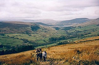
The Nidderdale AONB is an Area of Outstanding Natural Beauty in North Yorkshire, England, bordering the Yorkshire Dales National Park to the east and south. It comprises most of Nidderdale itself, part of lower Wharfedale, the Washburn valley and part of lower Wensleydale, including Jervaulx Abbey and the side valleys west of the River Ure. It covers a total area of 233 square miles (600 km2). The highest point in the Nidderdale AONB is Great Whernside, 704 metres (2,310 ft) above sea level, on the border with the Yorkshire Dales National Park.
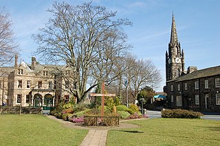
Burley in Wharfedale is a village and civil parish in West Yorkshire, England, in the Wharfedale valley. In 2011, it had a population of 7,041.

Bridge Hewick is a village and civil parish in the Harrogate district of North Yorkshire, England. The village is situated on the River Ure, and approximately 2 miles (3 km) east of the market town of Ripon. The population was recorded at less than 100 at the 2011 Census. Details are included on the statistics of the civil parish of Copt Hewick. North Yorkshire County Council estimate that the population at the 2011 census was 50, which had risen to 60 by 2015.

Timble is a village in the Harrogate district of North Yorkshire, England. It is situated on the slopes of the Washburn valley, north of Otley and close to Swinsty and Fewston reservoirs.

Castley is a village and civil parish in the Harrogate district of North Yorkshire, England. It lies on a bend in the River Wharfe about 10 miles (16 km) north of the centre of Leeds. The population of the civil parish was estimated at 70 in 2015. The village appears in the Domesday Book as Castleai, a combination of castel, and lēah, meaning the clearing near the fort.

Leathley is a village and civil parish in the Harrogate district of North Yorkshire, England, the parish includes the townships of both Castley and Leathley. It is near the border with West Yorkshire and the River Wharfe, 1 mile north-east of Otley. The B6161 runs through the village, connecting Leathley with Killinghall in the North and Pool-in-Wharfedale in the south.

Stainburn is a village and civil parish in the Harrogate district of North Yorkshire, England, 10 miles (16 km) north of Leeds. The population of the civil parish was estimated at 120 in 2015.
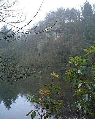
Eavestone is a hamlet and civil parish in the Harrogate district of North Yorkshire, England. It is situated near Brimham Rocks, 3 miles (4.8 km) east of Pateley Bridge. The population of the parish was estimated at 20 in 2012.

Old Lindley or Over Lindley is a hamlet in the civil parish of Stainland and District, in the Calderdale district, in the county of West Yorkshire, England. It is near the hamlet of Jagger Green, the village of Holywell Green and the town of Elland. Old Lindley has a moor called Old Lindley Moor.
Ilton is a village in North Yorkshire, England, 3 miles south-west of Masham. It is the principal settlement in the civil parish of Ilton cum Pott, in Harrogate district. The parish includes Roundhill Reservoir. The population of the parish was estimated at 50 in 2015.

Hawksworth is a village 1 mile (1.6 km) west of the town of Guiseley in West Yorkshire, England. It is located to the south of Menston and north of Baildon.
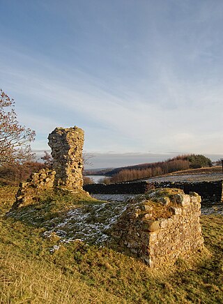
Haverah Park is a civil parish in the Harrogate district of North Yorkshire, England. It is located 3 miles (5 km) west of Harrogate.
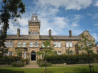
Newall is an area of Otley in West Yorkshire, England. It lies on the north bank of the River Wharfe, across Otley Bridge from the central area of the town. The place-name, recorded in 1166 as Niuhale, simply means "New Hall".

Newall with Clifton is a civil parish in North Yorkshire, England. It lies two miles north of Otley in West Yorkshire. The main settlement in the parish is the small village of Clifton. Despite its name, Newall is no longer in the parish, and lies across the border in West Yorkshire. They are joined by Newall Carr Road, which runs North from Otley Bridge. In the 2011 census the population of the parish was 147.
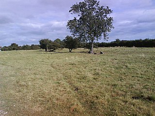
Wilstrop is a civil parish about 8 miles (13 km) west of York, in the Harrogate district, in the county of North Yorkshire, England. In 2001 the parish had a population of 44, and in 2015 the population was estimated at 60. There is no modern village in the parish. The site of the deserted medieval village of Wilstrop lies near the River Nidd on the northern boundary of the parish.

Nesfield is a small village, 2 miles (3.2 km) north-west of Ilkley on the north bank of the River Wharfe, in the civil parish of Nesfield with Langbar, in the Harrogate district, in the county of North Yorkshire, England. Historically in the West Riding of Yorkshire, the village sits at the southern edge of the Nidderdale Area of Outstanding Natural Beauty.

High and Low Bishopside is a civil parish in Nidderdale in the Harrogate district, in the county of North Yorkshire, England. It includes the town of Pateley Bridge and the villages of Glasshouses and Wilsill, the southern part of Wath and the hamlets of Blazefield, and Fellbeck. The parish touches Bewerley, Dacre, Eavestone, Fountains Earth, Hartwith cum Winsley, Laverton, Sawley, Stonebeck Down and Warsill. In 2011 the parish had a population of 2,210. There are 39 listed buildings in High and Low Bishopside. The parish's council is called "Pateley Bridge Town Council".


