Grimsay is a tidal island in the Outer Hebrides of Scotland.

"Uist" is a group of six islands and are part of the Outer Hebridean Archipelago, part of the Outer Hebrides of Scotland.
Berneray is an island and community in the Sound of Harris, Scotland. It is one of fifteen inhabited islands in the Outer Hebrides. It is famed for its rich and colourful history which has attracted much tourism. It lies within the South Lewis, Harris and North Uist National Scenic Area, one of 40 such areas in Scotland which are defined so as to identify areas of exceptional scenery and to ensure its protection from inappropriate development.

Baleshare is a flat tidal island in the Outer Hebrides of Scotland. Baleshare lies to the south-west of North Uist. Its economics and community were boosted by the building of a causeway in 1962. The 350-metre (380 yd) causeway was built by William Tawse Ltd. The island is extremely flat by Hebridean standards, rising to only 12 metres above sea level and known for its long sandy beach. It has a population of 49 living in two settlements: Samhla and Teananachar.

Vallay is an uninhabited tidal island in the Scottish Outer Hebrides. It can be reached from North Uist by a long beach at low tide.
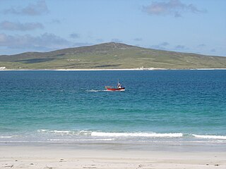
Boreray is an island with a single croft, lying 2 kilometres (1.2 mi) north of North Uist in the Outer Hebrides of Scotland.
Pabbay is an uninhabited island in the Outer Hebrides of Scotland which lies in the Sound of Harris between Harris and North Uist. The name comes from Papey, which is Norse for "Island of the papar (Culdee)".

Gighay an uninhabited island off the northeast coast of Barra. It is one of ten islands in the Sound of Barra, a Site of Community Importance for conservation in the Outer Hebrides of Scotland.
Killegray is an island in the Sound of Harris in the Outer Hebrides of Scotland.

Flodaigh is a tidal island lying to the north of Benbecula and south of Grimsay in the Outer Hebrides, Scotland. It is connected to Benbecula by a causeway.
Ceann Ear is the largest island in the Monach or Heisgeir group off North Uist in north west Scotland. It is 203 hectares in size and connected by sandbanks to Ceann Iar via Sibhinis at low tide. It is said that it was at one time possible to walk all the way to Baleshare, and on to North Uist, 5 miles away at low tide. In the 16th century, a large tidal wave was said to have washed this away.
Ceann Iar is one of the Monach Isles/Heisgeir, to the west of North Uist in the Outer Hebrides. It is a slender island, approximately a mile, or two kilometres long.
Hermetray is an uninhabited island off North Uist, in the Outer Hebrides of Scotland.
Na h-Eileanan Iasgaich comprise a small uninhabited archipelago in Loch Boisdale, in the south east of the island of South Uist, in the Outer Hebrides, Scotland. The individual islands are separated from one another at high tide, but connected to one another at low tide,. They are around 50 ha in extent and over 20m at their highest point. Their boundaries are ill-defined.
Ceallasaigh Mòr is a low-lying island in Loch Maddy off North Uist in the Outer Hebrides of Scotland. This an area of shallow lagoons filled and drained by the tides each day. Ceallasaigh Beag lies to the south and these two islets are connected by a narrow strip of sand at low tide. Ceallasaigh Mòr may also join mainland North Uist near Bràigh Cheallasaigh at some stages of the tide.
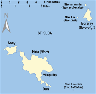
Stac Levenish or Stac Leibhinis is a sea stack in the St Kilda archipelago in Scotland. Lying 2.5 kilometres off Village Bay on Hirta, it is part of the rim of an extinct volcano that includes Dùn, Ruaival and Mullach Sgar.
Stromay is a tidal island off North Uist in the Sound of Harris, Scotland.

Fraoch-eilean is a small island with an uncertain population north of Benbecula in the Outer Hebrides of Scotland. It is about 55 hectares in extent and the highest point is 11 metres (36 ft). Its name derives from the Gaelic for "heather island".

Ceallasaigh Beag is a low-lying island in Loch Maddy off North Uist in the Outer Hebrides of Scotland. This an area of shallow lagoons filled and drained by the tides each day. Ceallasaigh Mòr lies to the south and these two islets are connected by a narrow strip of sand during some low tides.
This page is based on this
Wikipedia article Text is available under the
CC BY-SA 4.0 license; additional terms may apply.
Images, videos and audio are available under their respective licenses.


