
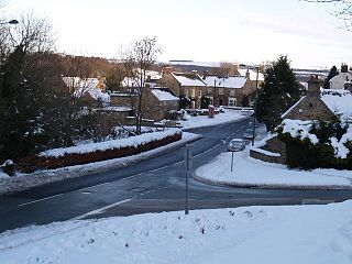
Annfield Plain is a village in County Durham, in England. It is situated on a plateau between the towns of Stanley, 3 mi (4.8 km) to the north-east, and Consett, 5 mi (8.0 km) to the west. According to the 2001 census, Annfield Plain had a population of 3,569. By the time of the 2011 Census Annfield Plain had become a ward of Stanley parish. The ward had a population of 7,774. Along with much of the surrounding area, Annfield Plain's history was coal mining.

Derwentside was, from 1974 to 2009, a local government district in County Durham, England.

Shotley Bridge is a village, adjoining the town of Consett to the south in County Durham, England, 15 miles northwest of Durham.
Burnopfield is a village in County Durham, in England. It is situated north of Stanley and Annfield Plain, close to the River Derwent and is 564 feet above sea level. There are around 4,553 inhabitants in Burnopfield. It is located 7 miles from Newcastle upon Tyne and 15 miles from Durham.

High Friarside is a village in County Durham, England classified as a suburban area. It is situated a short distance to the west of Burnopfield.
Ebchester is a village in County Durham, England. It is situated to the north of Consett and Shotley Bridge. It also sits to the south east of Whittonstall and the hamlet of Newlands. Running north east to south west along the A694, Ebchester consists of Low Westwood, Ebchester itself and East Law.

Low Westwood is a village in County Durham, England. It is situated immediately to the west of Hamsterley. Low Westwood is probably best known for Hamsterley Christ Church and Derwent care home.

Healeyfield is a village and civil parish in County Durham, England. The population of the civil parish taken from the 2011 census was 1,544. It is situated to the south west of Consett.

Rowlands Gill is a village on the north bank of the River Derwent, in the Metropolitan Borough of Gateshead, Tyne and Wear, England. The Gibside Estate is near the town.

The Bailey is a historic area in the centre of the city of Durham, County Durham, England. It consists of two streets, North Bailey and South Bailey. It is on a peninsula within a sharp meander along the River Wear, formed by an isostatic adjustment of the land. The name "The Bailey" derives from the outer bailey of the Norman motte and bailey-style Durham Castle. Vehicular access to the area is restricted by the Durham City congestion charge, which started in 2002 and is the UK's oldest such scheme.
Ovingham is a village and civil parish in the Tyne Valley of south Northumberland, England. It lies on the River Tyne 10 miles (16 km) east of Hexham with neighbours Prudhoe, Ovington, Wylam and Stocksfield.

The A1018 is a road in North East England. It runs between South Shields, at the mouth of the River Tyne, and the A19 near Seaham, County Durham. Most of the route it follows is the old alignment of the A19, before it by-passed Sunderland to meet the Tyne Tunnel.

Clara Vale is a village situated on the south bank of the River Tyne in Tyne and Wear, England. Once an independent village in County Durham it became incorporated into the new metropolitan county of Tyne and Wear in 1974 as part of the Metropolitan Borough of Gateshead.

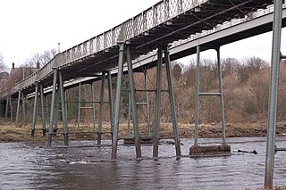
Lintz Green Railway Station was on the Derwent Valley Railway Branch of the North Eastern Railway near Consett, County Durham, England. The railway station opened with the rest of the line on 2 December 1867 and closed to passengers on the 2 November 1953. The line closed completely in 1963 and was dismantled with the station site becoming part of the Derwent Walk Country Park.
Derwenthaugh Coke Works was a coking plant on the River Derwent near Swalwell in Gateshead. The works were built in 1928 on the site of the Crowley's Iron Works, which had at one time been the largest iron works in Europe. The coke works was closed and demolished in the late 1980s, and replaced by Derwenthaugh Park.
The Derwent Valley Railway was a branch railway in County Durham, England. Built by the North Eastern Railway, it ran from Swalwell to Blackhill via five intermediate stations, and onwards to Consett.

Byermoor is a village near Burnopfield and Sunniside in the Gateshead district, in the county of Tyne and Wear, England. The village has a population of around 100 and contains a school and a church. The village sits on the South side of the A692 on a ridge overlooking the Derwent Valley and the nearby village of Burnopfield. It is the last village on the old turnpike road to Wolsingham before it reaches the border with County Durham.
Marley Hill is a former colliery village about six miles to the south west of Gateshead, near the border between Tyne and Wear and County Durham. It has been part of the Metropolitan Borough of Gateshead since 1974. Prior to this it was part of Whickham Urban District. It lies within the Whickham South & Sunniside electoral ward of the Blaydon parliamentary constituency.
Northumbrian Water Limited is a water company in the United Kingdom, providing mains water and sewerage services in the English counties of Northumberland, Tyne and Wear, Durham and parts of North Yorkshire, and also supplying water as Essex and Suffolk Water. It is a wholly owned subsidiary of Northumbrian Water Group.


