List of Sites of Special Scientific Interest in South Yorkshire

Last updated

South Yorkshire shown within the UK. South Yorkshire outline map with UK.png
South Yorkshire shown within the UK.

This is a list of Sites of Special Scientific Interest (SSSIs) in South Yorkshire , United Kingdom. As of 2009, There are 35 sites designated within this Area of Search, of which 18 have been designated due to their biological interest, 14 due to its geological interest, and 3 for both biological and geological interest. [1] In England the body responsible for designating SSSIs is Natural England, which chooses a site because of its fauna, flora, geological or physiographical features. [2] Natural England took over the role of designating and managing SSSIs from English Nature in October 2006 when it was formed from the amalgamation of English Nature, parts of the Countryside Agency and the Rural Development Service. Natural England, like its predecessor, uses the 1974–1996 county system [3] and as such the same approach is followed here, rather than, for example, merging all Yorkshire sites into a single list. Natural England produces citation sheets for each SSSI and are the main source of information for this list. [4]

Contents

South Yorkshire's geography can be split into different types. The very west of South Yorkshire is part of Dark Peak which is part of the Peak District National Park and lies to the west of Sheffield. This extensive moorland is one of the largest semi-natural areas in England and has broad plateaus with rocky outcrops interspersed with valleys. [5] Moving east the land elevation drops with a transition from the peak district to coal fields. Much of this area of transition has seen urban development with Sheffield being a good example. [6]

The central region, to the north of Sheffield is largely dependent on the presence of coal measures in the areas geology. This is reflected by ancient woodlands, valley wetlands and large arable fields where there is no urban development. To the east of the coal measures is a strip of Magnesian Limestone which runs north to south between Sheffield and Doncaster. This open landscape is characterised by ancient woodlands and limestone grasslands and often has historic limestone monuments. However the light and dry soils are ideal for cultivation which means little of the original habitat remains. In the very east of South Yorkshire the Humberhead Levels dominate, with the area being relatively flat and dominated by the areas river systems. The area is predominantly covered with small fields or areas of peatland. [7] [8] [9] [10] [11]

Sites

Site nameReason for designationArea [A] Grid reference [B] Year in which notifiedMap [C]
Biological interestGeological interestHectaresAcres
Anston Stones Wood Green check.svg33.788.3 SK531831 1955 Map
Ashfield Brick Pits Green check.svg0.61.4 SK515981 1955 Map
Bilham Sand Pits Green check.svg0.20.1 SE487066 1987 Map
Bradgate Brickworks Green check.svg0.92.2 SK413935 1988 Map
Cadeby Quarry Green check.svg97.0240.0 SE522003 1977 Map
Canyards Hills Green check.svgGreen check.svg64.1158.4 SK250950 1990 Map
Carlton Main Brickworks Green check.svg15.538.4 SE412081 1989 Map
Dark Peak [D] Green check.svgGreen check.svg31,852.978,708.4 SK110960 1951 Map
Denaby Ings Green check.svg24.560.6 SE500009 1977 Map
Eastern Peak District Moors Green check.svgGreen check.svg8,094.420,001.6 SK270770 1955 [E] Map
Edlington Wood Green check.svg99.7246.7 SK549980 1979 Map
Hatfield Moors Green check.svg1,400.73,461.1 SE705060 1954 Map
Lindrick Golf Course Green check.svg22.054.4 SK543825 , SK545828 , SK553827 1987 Map
Little Don Stream Section Green check.svg1.12.6 SE222004 1977 Map
Maltby Low Common Green check.svg6.014.8 SK545913 1970 Map
Neepsend Brickworks Green check.svg4.310.6 SK350891 1988 Map
Neepsend Railway Cutting Green check.svg1.43.5 SK344894 1988 Map
New Edlington Brickpit Green check.svg0.20.4 SK531988 1989 Map
Owston Hay Meadows Green check.svg5.513.5 SE554114 1979 Map
Potteric Carr Green check.svg118.6293.0 SE599003 1977 Map
Pye Flatts Meadows Green check.svg2.25.4 SE274052 1990 Map
River Idle Washlands [F] Green check.svg88.6219.0 SK662936 , SK685937 , SK706945 , SK720963 1972 Map
Roche Abbey Woodlands Green check.svg52.8143.8 SK542899 1979 Map
Sandall Beat Green check.svg63.9157.9 SE613037 1984 Map
Shirley Pool Green check.svg15.538.4 SE568121 1955 Map
Spring Meadows, Alderman's Head & Cow Croft Meadows Green check.svg16.841.6 SE229005 2005 Map
Sprotbrough Gorge Green check.svg76.9190.1 SE534007 1988 Map
Stairfoot Brickworks Green check.svg0.10.1 SE381048 1999 Map
Stannington Ruffs Green check.svg2.45.9 SK306891 1988 Map
Thorne Crowle and Goole Moors [G] Green check.svg1,918.64,740.9 SE730160 1970 Map
Totley Wood Green check.svg14.736.4 SK325815 1954 Map
Wadsley Fossil Forest Green check.svg0.30.7 SK318913 1990 Map
Went Ings Meadows Green check.svg6.415.8 SE650183 , SE654184 1981 Map
Wharncliffe Crags Green check.svg14.535.8 SK298974 1988 Map
Wood Lee Common Green check.svg6.415.8 SK533915 1958 Map

See also

Notes

A Data rounded to one decimal place.
B Grid reference is based on the British national grid reference system, also known as OSGB36, and is the system used by the Ordnance Survey. [12]
C Link to maps using the Nature on the Map service provided by English Nature.
D The Dark Peak site extends into three other counties and so can be found on lists of SSSIs in Derbyshire, Greater Manchester and West Yorkshire. [4]
E Incorporates three formers SSSIs: Hallam Moors being first notified in 1955, Eastern Moors in 1964 and Houndkirk Moor in 1972. [4]
F SSSI is split between South Yorkshire and Nottinghamshire. 36.7 hectares (90.6 acres) is in South Yorkshire.
G SSSI is split between South Yorkshire, the East Riding of Yorkshire and Lincolnshire. 1309.1 hectares (3234.7 acres) lie in South Yorkshire.

Related Research Articles

<span class="mw-page-title-main">South Yorkshire</span> County in England

South Yorkshire is a ceremonial and metropolitan county in the Yorkshire and Humber Region of England. The county has four council areas which are the cities of Doncaster and Sheffield as well as the boroughs of Barnsley and Rotherham.

<span class="mw-page-title-main">Dark Peak</span>

The Dark Peak is the higher and wilder part of the Peak District in England, mostly forming the northern section but also extending south into its eastern and western margins. It is mainly in Derbyshire but parts are in Staffordshire, Cheshire, Greater Manchester, West Yorkshire and South Yorkshire.

<span class="mw-page-title-main">Edlington</span> Town and civil parish in South Yorkshire, England

Edlington is a town and civil parish in the City of Doncaster, South Yorkshire, England, lying to the south west of Doncaster and Warmsworth. It has a population of 8,276. The original parish town of Edlington is now known as Old Edlington; adjacent, and to the north, is New Edlington. It is often referred to by locals as 'Edlo'. Since 1974 Edlington has been part of the Metropolitan Borough of Doncaster in the metropolitan county of South Yorkshire. It had, since 1894, formed part of Doncaster Rural District in the West Riding of Yorkshire.

Boulby Quarries is a 40.3 hectare geological Site of Special Scientific Interest in Redcar and Cleveland, North Yorkshire, England notified in 1989. It is located close to the coast and the village of Boulby.

<span class="mw-page-title-main">Topographical areas of Yorkshire</span>

In Yorkshire there is a very close relationship between the major topographical areas and the geological period in which they were formed. The Pennine chain of Hills in the west is of Carboniferous origin. The central vale is Permo-Triassic. The North York Moors in the north-east of the county are Jurassic in age while the Yorkshire Wolds to the south east are Cretaceous chalk uplands. The plain of Holderness and the Humberhead levels both owe their present form to the Quaternary ice ages.

<span class="mw-page-title-main">Geology of Yorkshire</span>

The Geology of Yorkshire in northern England shows a very close relationship between the major topographical areas and the geological period in which their rocks were formed. The rocks of the Pennine chain of hills in the west are of Carboniferous origin whilst those of the central vale are Permo-Triassic. The North York Moors in the north-east of the county are Jurassic in age while the Yorkshire Wolds to the south east are Cretaceous chalk uplands. The plain of Holderness and the Humberhead levels both owe their present form to the Quaternary ice ages. The strata become gradually younger from west to east.

<span class="mw-page-title-main">Humberhead Levels</span>

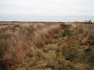
The Humberhead Levels is a national character area covering a large expanse of flat, low-lying land towards the western end of the Humber estuary in northern England. The levels occupy the former Glacial Lake Humber, an area bounded to the east by the Yorkshire Wolds and the northern Lincolnshire Edge, a limestone escarpment, and to the west by the southern part of the Yorkshire magnesian limestone ridge. In the north the levels merge into the slightly more undulating Vale of York close to the Escrick glacial moraine, and to the south merge into the Trent Vale.

<span class="mw-page-title-main">River Doe Lea</span> River in the Derbyshire, England

The River Doe Lea is a river which flows near Glapwell and Doe Lea in Derbyshire, England. The river eventually joins the River Rother near Renishaw. The river contained 1,000 times the safe level of dioxins in 1991, according to a statement made by Dennis Skinner, (MP) in the House of Commons in 1992. The river flows through the site of the former Coalite plant near Bolsover, where coke, tar and industrial chemicals were manufactured until the plant closed in 2004.

The Bottoms is a Site of Special Scientific Interest in County Durham, England. It lies just south of the A181 road, roughly midway between the villages of Cassop and Wheatley Hill, some 10 km south-east of Durham city.

The Natural Areas of England are regions, officially designated by Natural England, each with a characteristic association of wildlife and natural features. More formally, they are defined as "biogeographic zones which reflect the geological foundation, the natural systems and processes and the wildlife in different parts of England...".

A National Character Area (NCA) is a natural subdivision of England based on a combination of landscape, biodiversity, geodiversity and economic activity. There are 159 National Character Areas and they follow natural, rather than administrative, boundaries. They are defined by Natural England, the UK government's advisors on the natural environment.

<span class="mw-page-title-main">Quarry Moor</span> Site of Special Scientific Interest in North Yorkshire, England

Quarry Moor is a Site of Special Scientific Interest, or SSSI, at the south edge of Ripon, North Yorkshire, England, and adjacent to the A61 road. It contains an outcrop of Magnesian Limestone, exposed by former quarrying. 255 million years ago this limestone was the peripheral sediment of a tropical sea. The land was donated in 1945 to the people of Ripon by the town's mayor, Alderman Thomas Fowler Spence, a varnish manufacturer. The land was notified as an SSSI in 1986 because its calcareous grassland supported a large diversity of plant species. The site features a Schedule 8 protected plant, thistle broomrape. The land is protected as a nature reserve, and it is also managed as a recreational area. Therefore, its calcareous grass area is fenced off for protection and study, but it also contains a car park, information signs, a children's play area, accessible paths, benches, and dog waste bins.

References

  1. "SSSIs in South Yorkshire". Natural England. Retrieved 4 March 2007.
  2. "Notification of SSSIs". Natural England. Archived from the original on 15 May 2012. Retrieved 4 March 2007.
  3. "County search of SSSIs". Natural England. Archived from the original on 19 August 2010. Retrieved 4 March 2007.
  4. 1 2 3 Natural England citation sheets for each SSSI. Retrieved 2007-03-04.
  5. Dark Peak, Natural England. Retrieved 2009-02-17
  6. Yorkshire Southern Pennine Fringe, Natural England. Retrieved 2009-02-17
  7. Natural Character Areas, Natural England. Retrieved 2009-02-17
  8. Nottinghamshire, Derbyshire & Yorkshire Coalfield, Natural England. Retrieved 2009-02-17
  9. Southern Magnesian Limestone, Natural England. Retrieved 2009-02-17
  10. Humberhead Levels, Natural England. Retrieved 2009-02-17
  11. South Yorkshire (Barnsley, Sheffield, Rotherham and Doncaster Districts) Archived 2010-12-19 at the Wayback Machine Natural England. Retrieved 2009-02-17
  12. "Guide to National Grid". Ordnance Survey. Archived from the original on 20 July 2006. Retrieved 4 March 2007.