List of airports in Samoa

Last updated

Map of Samoa Samoa-CIA WFB Map.png
Map of Samoa

This is a list of airports in Samoa , sorted by location.

Contents

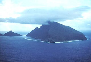
Samoa, the Independent State of Samoa (formerly known as Western Samoa and German Samoa), is a country governing the western part of the Samoan Islands in the South Pacific Ocean. The country is located west of the international date line (since 2011) and south of the equator, about halfway between Hawai‘i and New Zealand in the Polynesian region of the Pacific Ocean. The total land area is 2934 km2 (1133 sq mi), consisting of the two large islands of Upolu and Savaiʻi which account for 99% of the total land area, and eight small islets: three in the Apolima Strait (Manono Island, Apolima and Nu'ulopa), the four Aleipata Islands off the eastern end of Upolu (Nu'utele, Nu'ulua, Namua, and Fanuatapu), and one off the south coast of Upolu (Nu'usafe'e). The main island of Upolu is home to nearly three-quarters of Samoa's population, as well as the capital city of Apia.
Airports

Airport names shown in bold have scheduled passenger service on commercial airlines.

Location served Island ICAO IATA Airport name
Apia Upolu NSFAAPW Faleolo International Airport
Asau Savaiʻi NSAUAAU Asau Airport
Lalomalava Savaiʻi LAV Lalomalava Airport
Salelologa Savaiʻi NSMAMXS Maota Airport (Salelologa Airport)

See also

(Henrietta Matuauto was the first pilot who landed the very first plane at the Fagalii Airport in 2003.)

Related Research Articles

Samoan Islands Archipelago in the South Pacific Ocean

The Samoan Islands are an archipelago covering 3,030 km2 (1,170 sq mi) in the central South Pacific, forming part of Polynesia and of the wider region of Oceania. Administratively, the archipelago comprises all of the Independent State of Samoa and most of American Samoa. The land masses of the two Samoan jurisdictions are separated by 64 km (40 mi) of ocean at their closest points.

References