The following is a list of the prominent or destructive earthquakes occurring in the Azores, or affecting the populace of the archipelago:
Contents

The following is a list of the prominent or destructive earthquakes occurring in the Azores, or affecting the populace of the archipelago:
The Azores, officially the Autonomous Region of the Azores, is one of the two autonomous regions of Portugal. It is an archipelago composed of nine volcanic islands in the Macaronesia region of the North Atlantic Ocean, about 1,400 km (870 mi) west of Lisbon, about 1,500 km (930 mi) northwest of Morocco, and about 1,930 km (1,200 mi) southeast of Newfoundland, Canada.

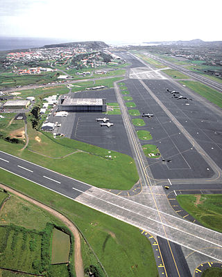
Terceira is a volcanic island in the Azores archipelago, about a third of the way across the North Atlantic Ocean at a similar latitude to Portugal's capital Lisbon, and the island group is owned by Portugal. It is one of the larger islands of the archipelago, with a population of 53,311 inhabitants in an area of approximately 396.75 km².
Lajes is a civil parish in the municipality of Praia da Vitória, on the Portuguese island of Terceira in the Azores. The population in 2011 was 3,744, in an area of 12.11 square kilometres (4.68 sq mi). It is the second most populous parish in the municipality of Praia da Vitória. It contains the localities Fundões, Caldeira, Canada da Caldeira, Canada das Fontainhas, Canada das Vinhas, Canada do Poço, Lajedo, Lajes, Picão, Rebentão and Santa Rita.
Francisco Ferreira Drummond was a historian, paleographer, musician and politician from a locality of Vila de São Sebastião on the island of Terceira, the Portuguese Azores. He was a historic publisher occupying a better part of his work with documenting the History of the Azores, where he was responsible for writing the Anais da Ilha Terceira.
The following is a list of notable natural disasters that have affected the Azores:
The Castle of Moinhos, officially known as the Castle of São Cristóvão, or Castle/Fort of São Luís is the name of the ruins of 16th-century fortification in city of Angra, on the Portuguese island of Terceira in the archipelago of the Azores. It is primarily known as the Castle of Moinhos, owing to the popular name given to the site for the number of mills that dotted the hilltop, on which the castle was erected.

The Fajã dos Cubres is a permanent debris field, known as a fajã, built from the collapsing cliffs on the northern coast of the civil parish of Ribeira Seca, in the municipality of Calheta, island of São Jorge, in the Portuguese archipelago of the Azores.

The Lagoa do Negro is an ephemeral lake and humid zone located in the civil parish of Biscoitos, municipality of Praia da Vitória, on the island of Terceira, Portuguese archipelago of the Azores.

The Fort of Negrito is a 16th-century maritime fort situated in the civil parish of São Mateus da Calheta, in the municipality of Angra do Heroísmo on the island of Terceira, Azores, Portugal.

Fortress of São Mateus da Calheta is a fort in the civil parish of São Mateus da Calheta, in the municipality of Angra do Heroísmo, island of Terceira, in the Portuguese archipelago of the Azores.

Fort of São João, also known as Fort of Biscoitinho, is a medieval fort, in the civil parish of São Mateus da Calheta, in the municipality of Angra do Heroísmo, on the Portuguese archipelago of the Azores.
The Fort of the Church São Mateus da Calheta, also referred to as the Forte da Igreja, are the coastal ruins of a 16th-century fort situated in the civil parish of São Mateus da Calheta, municipality of Angra do Heroísmo, on the Portuguese island of Terceira, in the archipelago of the Azores. It was destroyed, along with the church, in 1893 during a cyclone; while the church was eventually reconstructed some years later, the fort was abandoned and left to ruin.
The Fort of the Espírito Santo is the remains of a 16th-century fortification located on the extreme northern edge of the Bay of Praia da Vitória, in the Portuguese civil parish of Santa Cruz, municipality of Praia da Vitória, on the island of Terceira, in the Azores.
The Captaincy-General of the Azores (1766—1832) was a politico-administrative structure of governance imposed in the Azores on 2 August 1766, with its seat in Angra. It remained the de facto system of governance for 65 years, until it was abolished on 4 June 1832 by D. Peter IV, but by 1828 its de jure status had made it nonoperational, owing to the revolutionary movements that lead to the Liberal Wars. The creation of the Captaincy-General was part of the Pombaline reforms to the Portuguese administration, during the reign of Joseph I, under the initiatives of Sebastião José de Carvalho e Melo, 1st Marquis of Pombal, then prime minister. A Captaincy-General operated from the Palace of the Captains-General, under the direction of the titular Captain-General, who operated as the Governor of the Azores, with additional jurisdiction on every island of the Azorean archipelago. The Captaincy-General was succeeded by the Province of the Azores, an ephemeral administrative structure that was collapse in the immediate years.
The 1841 Caída da Praia earthquake, also known as the Second Caída da Praia, was a series of seismic events occurring between 12 June and 15 June 1841, on the island of Terceira in the Portuguese archipelago of the Azores. Similar in scope to the first 1614 Cáida da Praia earthquake that destroyed most of the community, this second event is noted for the systematic process to assistance, document and catalogue the events of the tragedy.