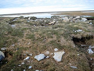
This article is a list of historic places in the territory of Nunavut entered on the Canadian Register of Historic Places, whether they are federal, provincial, or municipal.
| Wikimedia Commons has media related to Cultural heritage monuments in Nunavut . |
Harrison may refer to:

Battleford is a small town located across the North Saskatchewan River from the City of North Battleford, in Saskatchewan, Canada.

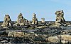
An inuksuk or inukshuk is a manmade stone landmark or cairn built for use by the Inuit, Iñupiat, Kalaallit, Yupik, and other peoples of the Arctic region of North America. These structures are found in northern Canada, Greenland, and Alaska. This combined region, above the Arctic Circle, is dominated by the tundra biome and has areas with few natural landmarks.
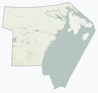
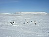
The Kivalliq Region is an administrative region of Nunavut, Canada. It consists of the portion of the mainland to the west of Hudson Bay together with Southampton Island and Coats Island. The regional centre is Rankin Inlet. The population was 10,413 in the 2016 Census, an increase of 16.3% from the 2011 Census.

Arviat is a predominantly Inuit hamlet located on the western shore of Hudson Bay in the Kivalliq Region of Nunavut, Canada. Arviat is derived from the Inuktitut word arviq meaning "Bowhead whale". Earlier in history, its name was Tikirajualaaq, and Ittaliurvik,.

Cambridge Bay is a hamlet located on Victoria Island in the Kitikmeot Region of Nunavut, Canada. It is the largest settlement on Victoria Island. Cambridge Bay is named for Prince Adolphus, Duke of Cambridge (1774-1850), while the traditional Inuinnaqtun name for the area is Ikaluktutiak or Iqaluktuttiaq meaning "good fishing place".

Gjoa Haven is an Inuit hamlet in Nunavut, above the Arctic Circle, located in the Kitikmeot Region, 1,056 km (656 mi) northeast of Yellowknife, Northwest Territories. It is the only settlement on King William Island.
Beechey Island is an island located in the Canadian Arctic Archipelago of Nunavut, Canada, in Wellington Channel. It is separated from the southwest corner of Devon Island by Barrow Strait. Other features include Wellington Channel, Erebus Harbour, and Terror Bay.

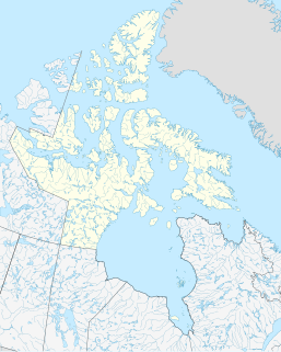
Nunavut is the newest, largest, and northernmost territory of Canada. It was separated officially from the Northwest Territories on April 1, 1999, via the Nunavut Act and the Nunavut Land Claims Agreement Act, which provided this territory to the Inuit for independent government. The boundaries had been drawn in 1993. The creation of Nunavut resulted in the first major change to Canada's political map since the province of Newfoundland was incorporated in 1949.
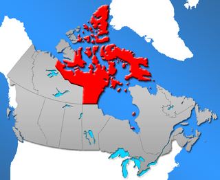
Nunavut is a territory of Canada. It has a land area of 1,877,787.62 km2 (725,017.85 sq mi). In the 2016 census the population was 35,944, up 12.7% from the 2011 census figure of 31,906. In 2016, 30,135 people identified themselves as Inuit, 190 as North American Indian (0.5%), 165 Métis (0.5%) and 5,025 as non-aboriginal (14.0%).

Kugluk/Bloody Falls Territorial Park is located about 15 km (9.3 mi) southwest of Kugluktuk, Nunavut, Canada. The 10 hectares park is situated around the Bloody Falls on the Coppermine River and was listed as a national historic site in 1978.

Mount Odin is a mountain in Qikiqtaaluk, Nunavut, Canada. It is located in Auyuittuq National Park along the Akshayuk Pass, 46 km (29 mi) north of Pangnirtung and south of Mount Asgard. Mount Odin is the highest mountain on Baffin Island.

The following outline is provided as an overview of and topical guide to Canada:

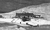
Blacklead Island is a Baffin Island offshore islet located in the Canadian Arctic Archipelago in Nunavut's Qikiqtaaluk Region. It lies in Cumberland Sound, northwest of Kikiktaluk Island, approximately 5 km (3.1 mi) from Harrison Point and 10 km (6.2 mi) from Niante Harbour.
Igloolik Island is a small island in the Qikiqtaaluk Region of Nunavut, Canada. It is located in the Foxe Basin, very close to the Melville Peninsula, and it is often thought to be a part of the peninsula. It forms part of the Arctic Archipelago.
The list of historic places in Canada contains heritage sites listed on the Canadian Register of Historic Places (CRHP), all of which are designated as historic places either locally, provincially, territorially, nationally, or by more than one level of government. For convenience, the list is divided by province or administrative entities. Since there are thousands of historic places in Canada, this is an editorial choice and not official.
The Canadian territory of Nunavut, which was created in 1999, was first given representation at the Scotties Tournament of Hearts, Canada's national women's curling championship in 2015, following a decision to allow each of Canada's three territories to have their own teams. The Nunavut Curling Association declined their spot, but began competing in 2016.
The following outline is provided as an overview of and topical guide to Nunavut: