List of lakes of Switzerland

Last updated

Map of major lakes and rivers of Switzerland labelled in the relevant local language (French, German or Italian). Karte Schweiz Details.png
Map of major lakes and rivers of Switzerland labelled in the relevant local language (French, German or Italian).

This article contains a sortable table listing all major lakes of Switzerland. The table includes all still water bodies, natural or artificial, that have a surface area of at least 30 hectares (74 acres), regardless of water volume, maximum depth or other metric. These lakes are ranked by area, the table including also the elevation above sea level and maximum depth. They are either natural (type N), natural but used as reservoirs (NR) or fully artificial (A). For a list of artificial lakes only, see List of dams and reservoirs in Switzerland. For a list of lakes above 800 metres (2,600 ft) that includes smaller water bodies, see List of mountain lakes of Switzerland.

Contents

Along with the mountains, lakes constitute a major natural feature of Switzerland, with over 1,000 km (620 mi) of shores within the country. [Nb 1] Lakes, large and small, can be found in almost all cantons and provide an important source of water, leisure opportunities, as well as suitable habitat for fish-eating birds. The two most extensive, Lake Geneva and Lake Constance, are amongst the largest in Europe and mark the border of the Swiss Plateau, along with the Alps and the Jura Mountains. The largest wholly Swiss lake is Lake Neuchâtel. The remaining lakes over 100 km2 (39 sq mi) are Lake Maggiore and Lake Lucerne. In total 103 lakes exist that are more than 30 ha (74 acres) in surface area, and a considerable number of smaller lakes. All these lakes are found in the four major river basins of Switzerland: Rhine, Rhone, Po and Danube, [Nb 2] at almost all elevations below the permanent snow line.

Distribution

There are several thousand lakes in Switzerland, with estimations up to 7000, [1] although those include very small water bodies, traditionally referred to as "lakes". [Nb 3] On this list, only the 103 largest lakes, which are over 30 hectares in area, are included. Among these, 58 are over 1.0 km2, 17 are over 10 km2, and just five are over 100 km2 in area. Of these lakes, 37 are natural, 21 are natural, but are used as reservoirs, and 45 are manmade reservoirs. These 103 lakes are shared among 21 cantons, out of the 26. [Nb 4] Some of these lakes are also shared with neighboring France, Germany, Austria, and Italy (for simplicity purposes, only the total area of the lake is indicated). Four of the cantons (Grisons, Berne, Valais, and Ticino) have more than 10 of the lakes, apiece, and just over one-half of the cantons (14) have one or more lakes of over 100 km2 in area. Most of these lakes are either below 800 metres above sea level (mostly natural lakes), or above 1600 metres (mostly manmade lakes). A large majority of the lakes, 66, are located in the Rhine basin (partly via the Aare River); 17 in the Rhone basin (partly via the Doubs River); 14 in the Po River basin (mostly via the Ticino River); and six are in the Danube River basin (all via the Inn River).

Largest in area and volume: Lake Geneva Beach on Lake Geneva.jpg
Largest in area and volume: Lake Geneva
Lowest and deepest: Lake Maggiore Lake Maggiore 1.jpg
Lowest and deepest: Lake Maggiore
Highest: Muttsee Muttsee.jpg
Highest: Muttsee
Distribution by canton of the lakes over 0.30 km2, grouped by area, elevation and depth
CantonBy areaBy elevation [Nb 5] By max. depthTotalLakes/
100 km2 (39 sq mi)
<1 km2 (0.4 sq mi)1–9.99 km2 (0.4–3.9 sq mi)10–99 km2 (4–38 sq mi)+100 km2 (39 sq mi)<800 m (2,625 ft)800–1,599 m (2,625–5,246 ft)+1,600 m (5,249 ft)<50 m (160 ft)50–99 m (164–325 ft)100–199 m (328–653 ft)+200 m (660 ft)
Aargau 1110300300030.21
Berne 84319257522160.27
Fribourg 2211420321060.36
Geneva 0101200100120.71
Glarus 1210112112040.58
Grisons 9100004154960190.27
Jura 1000100100010.12
Lucerne 2131700321170.47
Neuchâtel 4011510321060.75
Nidwalden 0001100000110.36
Obwalden 2201302220151.02
Schaffhausen 0010100100010.34
Schwyz 0231420212160.66
St. Gallen 1021310003140.20
Thurgau 1011300200130.30
Ticino 55113181443120.43
Uri 0101101001120.19
Valais 660110123442130.25
Vaud 2212430402170.22
Zug 0110200011020.84
Zurich 1210400301040.23
Switzerland454112542174440312391030.25

Main list

RankNameType*
[2]
Local namesCanton(s), neighboring countriesRiver basinAreaElevationMax. depth
km² [3] mi²mftmft
1 Lake Geneva NLac Léman, Lac de Genève Geneva, Vaud, Valais, France Rhone 580.03223.95372.01,220.53101,020
2 Lake Constance NBodensee St. Gallen, Thurgau, Austria , Germany Rhine 473.00182.633961,299252827
3 Lake Neuchâtel NLac de Neuchâtel, Neuenburgersee Berne, Fribourg, Neuchâtel, Vaud Rhine 215.2083.09429.41,409153502
4 Lake Maggiore NVerbano, Lago Maggiore Ticino, Italy Po 210.1281.13193.56353721,220
5 Lake Lucerne NVierwaldstättersee Lucerne, Nidwalden, Obwalden, Schwyz, Uri Rhine 113.7243.91433.61,423214702
6 Lake Zurich NZürichsee St. Gallen, Schwyz, Zurich Rhine 88.1734.04405.91,332136446
7 Untersee NUntersee Schaffhausen, Thurgau, Germany Rhine 63.0024.323961,29937121
8 Lake Lugano NCeresio, Lago di Lugano Ticino, Italy Po 48.6718.79270.5887288945
9 Lake Thun NThunersee Berne Rhine 47.7418.43557.81,830215705
10 Lake Bienne NLac de Bienne, Bielersee Berne, Neuchâtel Rhine 39.5115.25429.11,40874243
11 Lake Zug NZugersee Lucerne, Schwyz, Zug Rhine 38.4114.83413.61,357198650
12 Lake Brienz NBrienzersee Berne Rhine 29.8111.51563.71,849260850
13 Lake Walen NWalensee Glarus, St. Gallen Rhine 24.169.33419.01,374.7150490
14 Lake Morat NLac de Morat (Murtensee) Fribourg, Vaud Rhine 22.808.80429.21,40846151
15 Lake Sempach NSempachersee Lucerne Rhine 14.365.54503.81,65387285
16 Sihlsee ASihlsee Schwyz Rhine 10.724.148892,9172375
17 Lake Hallwil NHallwilersee Aargau, Lucerne Rhine 10.213.94448.71,47247154
18 Lake Gruyère ALac de la Gruyère Fribourg Rhine 9.603.716772,22175246
19 Lac de Joux NRLac de Joux Vaud Rhine 8.773.391,0043,29434112
20 Greifensee NGreifensee Zurich Rhine 8.1726.8435.11,42734112
21 Lake Sarnen NSarnersee Obwalden Rhine 7.382.85468.41,53752171
22 Ägerisee NÄgerisee Zug Rhine 7.252.80723.92,37582269
23 Lake Baldegg NBaldeggersee Lucerne Rhine 5.242.02463.01,519.066217
24 Lago di Livigno ALago di Livigno Grisons, Italy Danube 4.711.821,8055,922119390
25 Schiffenensee ASchiffenensee, Lac de Schiffenen Fribourg Rhine 4.251.645321,74538125
26 Wägitalersee AWägitalersee Schwyz Rhine 4.181.619003,00065213
27 Lago di Lei ALago di Lei Grisons, Italy Rhine 4.121.591,9316,335133436
28 Lake Sils NSilsersee, Lej da Segl Grisons Danube 4.101.581,7975,89671233
29 Lac des Dix ALac des Dix Valais Rhone 3.651.412,3657,759227745
30 Lake Wohlen AWohlensee Berne Rhine 3.651.414801,5702066
31 Lac d'Emosson ALac d'Emosson Valais Rhone 3.2710.71,9306,330161528
32 Klöntalersee NRKlöntalersee Glarus Rhine 3.181.238472,77947154
33 Lake Silvaplana NSilvaplanersee, Lej da Silvaplauna Grisons Danube 3.181.231,7905,87077253
34 Pfäffikersee NPfäffikersee Zurich Rhine 3.061.185361,75935115
35 Lake Lauerz NLauerzersee Schwyz Rhine 3.001.164471,4671446
36 Grimselsee NRGrimselsee Berne Rhine 2.631.021,9086,260100330
37 Lake Lungern NRLungerersee, Lungernsee Obwalden Rhine 2.010.786882,25768223
38 Lac de Mauvoisin ALac de Mauvoisin Valais Rhone 2.080.801,9616,434180590
39 Lago di Poschiavo NRLago di Poschiavo Grisons Po 1.980.769623,15685279
40 Lai da Sontga Maria ALai da Sontga Maria Grisons, Ticino Rhine 1.775.81,9086,26086282
41 Mattmarksee AMattmarksee Valais Rhone 1.760.682,1977,20893305
42 Lago di Vogorno ALago di Vogorno Ticino Po 1.680.654701,540204669
43 Lac de Salanfe ALac de Salanfe Valais Rhone 1.620.631,9256,31648157
44 Zervreilasee AZervreilasee Grisons Rhine 1.610.621,8626,109140460
45 Lac de l'Hongrin ALac de l'Hongrin Vaud Rhine 1.600.621,2554,117105344
46 Lago Bianco NRLago Bianco Grisons Po 1.500.582,2347,32953174
47 Lago Ritom NRLago Ritom Ticino Po 1.490.581,8506,07069226
48 Oberaarsee AOberaarsee Berne Rhine 1.474.82,3037,55690300
49 Lai da Marmorera ALai da Marmorera Grisons Rhine 1.410.541,6805,51065213
50 Lac de Moiry ALac de Moiry Valais Rhone 1.400.542,2497,379120390
51 Limmernsee ALimmernsee Glarus Rhine 1.360.531,8576,093122400
52 Göscheneralpsee AGöscheneralpsee Uri Rhine 1.320.511,7925,879106348
53 Lago di Luzzone ALago di Luzzone Ticino Po 1.274.21,6065,269181594
54 Albigna lake ALago da l'Albigna
Lägh da l'Albigna
Grisons Po 1.260.492,1637,096108354
55 Oeschinen Lake NOeschinensee Berne Rhine 1.150.441,5785,17756184
56 Klingnauer Stausee AKlingnauer Stausee Aargau Rhine 1.110.433181,0438.528
57 Lago del Sambuco ALago del Sambuco Ticino Po 1.110.431,4614,793124407
58 Lac de Verbois ALac de Verbois Geneva Rhone 1.010.393691,211
59 Lai da Nalps ALai da Nalps Grisons Rhine 0.900.351,9086,260122400
60 Lac de Tseuzier ALac de Tseuzier Valais Rhone 0.830.321,7775,830140460
61 Sufnersee ASufnersee Grisons Rhine 0.820.321,4014,59651167
62 Lai da Curnera ALai da Curnera Grisons Rhine 0.790.311,9566,417136446
63 Lake St. Moritz NLej da San Murezzan, St. Moritzersee Grisons Danube 0.750.291,7685,80142138
64 Lago del Narèt NRLago del Narèt Ticino Po 0.730.282,3107,580104341
65 Flachsee AFlachsee Aargau Rhine 0.710.273801,250723
66 Lac des Brenets NLac des Brenets Neuchâtel, France Rhone 0.700.277502,4602685
67 Alte Aare NAlte Aare Berne Rhine 0.700.274281,404
68 Gigerwaldsee AGigerwaldsee St. Gallen Rhine 0.690.271,3354,380135443
69 Lac de Moron ALac de Moron Neuchâtel, France Rhone 0.690.277162,34959194
70 Lac de Montsalvens ALac de Montsalvens Fribourg Rhine 0.660.258012,62850160
71 Räterichsbodensee ARäterichsbodensee Berne Rhine 0.660.251,7675,79777253
72 Lac Brenet NRLac Brenet Vaud Rhine 0.650.251,0023,2871859
73 Daubensee NDaubensee Valais Rhine 0.640.252,2057,234
74 Griessee AGriessee Valais Rhone 0.640.252,3867,82866217
75 Gelmersee NRGelmersee Berne Rhine 0.620.241,8506,07042138
76 Lac des Toules ALac des Toules Valais Rhone 0.600.231,8105,94075246
77 Lake Davos NRDavosersee Grisons Rhine 0.571.91,5605,12052171
78 Lac du Vieux Emosson ALac du Vieux Emosson Valais Rhone 0.550.212,2057,23442138
79 Lago di Lucendro NRLago di Lucendro Ticino Rhine 0.540.212,1357,00596315
80 Mauensee NMauensee Lucerne Rhine 0.540.215031,650930
81 Melchsee NRMelchsee Obwalden Rhine 0.510.201,8916,2041859
82 Niederriedsee ANiederriedsee Berne Rhine 0.490.194611,512826
83 Türlersee NTürlersee Zurich Rhine 0.490.196432,1102272
84 Lac de Cleuson ALac de Cleuson Valais Rhone 0.480.192,1867,17276249
85 Lac de Bret NRLac de Bret Vaud Rhone 0.480.196742,2112066
86 Lago dei Cavagnöö ALago dei Cavagnöö, Lago di Cavagnoli Ticino Po 0.480.192,3107,580100330
87 Rotsee NRotsee Lucerne Rhine 0.471.54191,3751652
88 Engstlensee NREngstlensee Berne Rhine 0.460.181,8516,07349161
89 Lac des Taillères NRLac des Taillères Neuchâtel Rhine 0.460.181,0403,410723
90 Schwarzsee NSchwarzsee Fribourg Rhine 0.450.171,0463,4321033
91 Lago della Sella NRLago della Sella Ticino Po 0.450.172,2567,4023098
92 Arnensee NRArnensee Berne Rhine 0.450.171,5425,05950160
93 Lej da Vadret NLaj da Vadret Grisons Danube 0.430.172,1607,090
94 Muttsee NRMuttsee Glarus Rhine 0.410.162,4468,02568223
95 Lac de Biaufond ALac de Biaufond Jura, Neuchâtel, France Rhone 0.400.156061,9881033
96 Lago Tremorgio NRLago Tremorgio Ticino Po 0.400.151,8516,07357187
97 Lag da Pigniu ALag da Pigniu, Panixersee Grisons Rhine 0.390.151,4504,76042138
98 Amsoldingersee NAmsoldingersee Berne Rhine 0.380.156412,1031446
99 Lago d'Isola ALago d'Isola Grisons Po 0.360.141,6045,26239128
100 Lai da Ova Spin ALai da Ova Spin Grisons Danube 0.350.141,6305,35064210
101 Hüttwilersee NHüttwilersee Thurgau Rhine 0.350.144341,4241549
102 Tannensee NRTannensee Obwalden Rhine 0.340.131,9766,4832169
103 Moossee NMoossee Berne Rhine 0.300.125211,7092169

* Types: N = natural; NR = natural but used as reservoirs; A = fully artificial

See also

Notes

  1. Approximately (see coastline paradox) 1,000 km (620 mi) counting only the 17 lakes over 10 square kilometres (3.9 sq mi) (length retrieved from the Google Earth geographical information program).
  2. The remaining basin (the Adige) being marginal and comporting only small lakes (of which the largest is Lai da Rims).
  3. For example, the Blausee ("blue lake"), the Märjelensee ("Märjelen lake"), and the Schwarzsee ("black lake") are smaller than one hectare in surface area.
  4. The cantons of Appenzell Ausserrhoden, Appenzell Innerrhoden, Basel-Stadt, Basel-Landschaft, and Solothun do not appear in this list.
  5. See List of mountain lakes of Switzerland for a more detailed distribution.

Related Research Articles

<span class="mw-page-title-main">Geography of Switzerland</span>

The geography of Switzerland encompasses the geographical features of Switzerland, a mountainous and landlocked country located in Western and Central Europe. Switzerland's natural landscape is marked by its numerous lakes and mountains. It is surrounded by five countries: Austria and Liechtenstein to the east, France to the west, Italy to the south and Germany to the north. Switzerland has a maximum north–south length of 220 kilometres (140 mi) and an east–west length of about 350 kilometres (220 mi).
<span class="mw-page-title-main">Swiss Alps</span> Portion of the Alps that lies within Switzerland

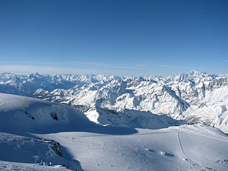
The Alpine region of Switzerland, conventionally referred to as the Swiss Alps, represents a major natural feature of the country and is, along with the Swiss Plateau and the Swiss portion of the Jura Mountains, one of its three main physiographic regions. The Swiss Alps extend over both the Western Alps and the Eastern Alps, encompassing an area sometimes called Central Alps. While the northern ranges from the Bernese Alps to the Appenzell Alps are entirely in Switzerland, the southern ranges from the Mont Blanc massif to the Bernina massif are shared with other countries such as France, Italy, Austria and Liechtenstein.

<span class="mw-page-title-main">Ticino</span> Canton of Switzerland

Ticino, sometimes Tessin, officially the Republic and Canton of Ticino or less formally the Canton of Ticino, is one of the 26 cantons forming the Swiss Confederation. It is composed of eight districts and its capital city is Bellinzona. It is also traditionally divided into the Sopraceneri and the Sottoceneri, respectively north and south of Monte Ceneri. Red and blue are the colours of its flag.

<span class="mw-page-title-main">Ticino (river)</span> Tributary of the Po river.

The river Ticino is the most important perennial left-bank tributary of the Po. It has given its name to the Swiss canton through which its upper portion flows.

<span class="mw-page-title-main">Grisons</span> Largest and easternmost canton of Switzerland

The Grisons or Graubünden, more formally the Canton of the Grisons or the Canton of Graubünden, is one of the twenty-six cantons of Switzerland. It has eleven districts, and its capital is Chur. The German name of the canton, Graubünden, translates as the "Grey Leagues", referring to the canton's origin in three local alliances, the Three Leagues. The other native names also refer to the Grey League: Grischùn in Sutsilvan, Grischun in the other forms of Romansh, and Grigioni in Italian. Rhaetia is the Latin name for the area. The Alpine ibex is the canton's heraldic symbol.
<span class="mw-page-title-main">Valais</span> Canton of Switzerland

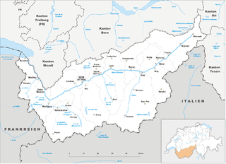
Valais, more formally the Canton of Valais, is one of the 26 cantons forming the Swiss Confederation. It is composed of thirteen districts and its capital and largest city is Sion. The flag of the canton is made of thirteen stars representing the districts, on a white-red background.

<span class="mw-page-title-main">Lake Neuchâtel</span> Lake in Switzerland

Lake Neuchâtel is a lake primarily in Romandy, the French-speaking part of Switzerland. The lake lies mainly in the canton of Neuchâtel, but is also shared by the cantons of Vaud, Fribourg, and Bern. It comprises one of the lakes in the Three Lakes Region, along with lakes Biel/Bienne and Morat/Murten.

<span class="mw-page-title-main">Canton of St. Gallen</span> Canton of Switzerland

The canton of St. Gallen or St Gall is a canton of Switzerland. Its capital is St. Gallen.

<span class="mw-page-title-main">Kura (river)</span> River in the Caucasus region

The Kura is an east-flowing river south of the Greater Caucasus Mountains which drains the southern slopes of the Greater Caucasus east into the Caspian Sea. It also drains the north side of the Lesser Caucasus, while its main tributary, the Aras, drains the south side of those mountains. Starting in northeastern Turkey, the Kura flows through Turkey to Georgia, then to Azerbaijan, where it receives the Aras as a right tributary, and enters the Caspian Sea at Neftçala. The total length of the river is 1,515 kilometres (941 mi).
<span class="mw-page-title-main">Reuss (river)</span> River in Switzerland

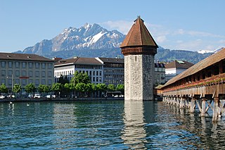
The Reuss is a river in Switzerland. With a length of 164 kilometres (102 mi) and a drainage basin of 3,426 square kilometres (1,323 sq mi), it is the fourth largest river in Switzerland. The upper Reuss forms the main valley of the canton of Uri. The course of the lower Reuss runs from Lake Lucerne to the confluence with the Aare at Brugg and Windisch.

<span class="mw-page-title-main">Grimsel Pass</span> Mountain pass in Switzerland through the Bernese Alps

The Grimsel Pass is a mountain pass in Switzerland, crossing the Bernese Alps at an elevation of 2,164 metres (7,100 ft). The pass connects the Haslital, the upper valley of the river Aare, with the upper valley of the Rhône. In so doing, and as the Aare is a tributary of the Rhine, the pass crosses the continental divide between the North Sea and the Mediterranean Sea.

<span class="mw-page-title-main">Sihl</span> River in Switzerland

The Sihl is a Swiss river that rises near the Druesberg mountain in the canton of Schwyz, and eventually flows into the Limmat in the centre of the city of Zürich, after crossing the Zürich–Winterthur railway at Zürich HB. It has a length of 73 km (45 mi), including the Sihlsee reservoir, through which the river flows. Water is abstracted from the river at the Sihlsee, leading to decreased downstream water flows and a consequent reduction in water quality.

The Trebišnjica is a river in Bosnia and Herzegovina, and the right tributary of the Neretva. Before it was utilized for hydro exploitation via various hydrotechnical interventions and systems with different purposes, Trebišnjica used to be a sinking river, rising and sinking through its course before resurfacing at various places from the Neretva river below the Čapljina to the Adriatic coast, and along the coast from the Neretva Delta to Sutorina.

<span class="mw-page-title-main">Klamath Basin</span> Region in the U.S. states of Oregon and California drained by the Klamath River

The Klamath Basin is the region in the U.S. states of Oregon and California drained by the Klamath River. It contains most of Klamath County and parts of Lake and Jackson counties in Oregon, and parts of Del Norte, Humboldt, Modoc, Siskiyou, and Trinity counties in California. The 15,751-square-mile (40,790 km2) drainage basin is 35% in Oregon and 65% in California. In Oregon, the watershed typically lies east of the Cascade Range, while California contains most of the river's segment that passes through the mountains. In the Oregon-far northern California segment of the river, the watershed is semi-desert at lower elevations and dry alpine in the upper elevations. In the western part of the basin, in California, however, the climate is more of temperate rainforest, and the Trinity River watershed consists of a more typical alpine climate.

<span class="mw-page-title-main">Lake Qaraoun</span> Multipurpose reservoir in Beqaa Valley

Lake Qaraoun is an artificial lake or reservoir located in the southern region of the Beqaa Valley, Lebanon. It was created near Qaraoun village in 1959 by building a 61 m-high (200 ft) concrete-faced rockfill dam in the middle reaches of the Litani River. The reservoir has been used for hydropower generation, domestic water supply, and for irrigation of 27,500 ha.

<span class="mw-page-title-main">Lago di Luzzone</span> Reservoir in Ticino, Switzerland

Lago di Luzzone is a reservoir in Ticino, Switzerland. The reservoir has a volume of 108 million m³ and a surface area of 1.27 km2 (0.49 sq mi). It is located in the upper Blenio valley, in the municipalities of Ghirone and Aquila.

<span class="mw-page-title-main">Lai da Sontga Maria</span> Reservoir in Graubünden/Ticino, Switzerland

Lai da Sontga Maria is a lake, located north of the Lukmanier Pass in Switzerland. It lies almost entirely in the municipality of Medel, a tiny fraction of the south-west part of the lake belonging to the municipalities of Quinto and Blenio. The reservoir has a surface area is 1.77 km2 (0.68 sq mi). The arch dam Santa Maria, which is to the north of the lake, was completed in 1968. The main road of the Lukmanier Pass runs along the eastern shore of the lake.
<span class="mw-page-title-main">Lake</span> Large body of relatively still water

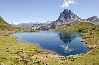
A lake is a naturally occurring, relatively large and fixed body of water on the earth's surface. It is localized in a basin or interconnected basins surrounded by dry land. Lakes lie completely on land and are separate from the ocean, although, like the much larger oceans, they form part of the Earth's water cycle by serving as large standing pools of storage water. Most lakes are freshwater and account for almost all the world's surface freshwater, but some are salt lakes with salinities even higher than that of seawater. Lakes vary significantly in surface area and volume.

<span class="mw-page-title-main">Hydrology of Hungary</span>

The hydrology of Hungary, is mostly determined by Hungary's lying in the middle of the Carpathian Basin, half surrounded by the Carpathian Mountains. All parts of the country have some outflow. All surface water gravitates towards its southern center, and from there, is united in the Danube, which flows into the Black Sea. The whole of Hungary lies within the Danube drainage basin.

References

  1. Block, Klaus-Dieter (2014). Ach du liebe Schweiz: Ein sonderbares Land – Berichte aus der Schweiz. Steffen Verlag. ISBN   978-3-942477-87-1.
  2. "Speicherseen in der Schweiz" (PDF) (in German). Bundesamt für Energie BFE (Swiss Federal Office of Energy SFOE).
  3. "Maps of Switzerland – Swiss Confederation – map.geo.admin.ch: Primary surfaces VECTOR25". Federal Office of Topography (Swisstopo).