
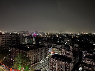
Pune, previously spelled in English as Poona, is a city in Maharashtra state in the Deccan plateau in Western India. It is the administrative headquarters of the Pune district, and of Pune division. According to the 2011 Census of India, Pune is the ninth-most populous city in India with a population of 3.1 million residents within the city limits, and 7.2 million residents in the metropolitan region, making it the eight-most populous metropolitan area in India. The city of Pune is part of Pune Metropolitan Region. Pune is one of the largest IT hubs in India. It is also one of the most important automobile and manufacturing hubs of India. Pune is often referred to as "Oxford of the East" because of its highly regarded educational institutions. It has been ranked "the most liveable city in India" several times.
Nagpur is the third-largest city of the Indian state of Maharashtra after Mumbai and Pune. It is called the heart of India because of its central geographical location. It is the largest and most populated city in central India. Also known as the "Orange City", Nagpur is the 13th largest city in India by population. According to an Oxford's Economics report, Nagpur is projected to be the fifth fastest growing city in the world from 2019 to 2035 with an average growth of 8.41%. It has been proposed as one of the Smart Cities in Maharashtra and is one of the top ten cities in India in Smart City Project execution.
Korba is a city and an industrial area in Korba District in the Indian state of Chhattisgarh. Korba was part of Bilaspur District before 25 May 1998. It was later designated as a separate district for ease of administration, but is still under Bilaspur Division. Korba is called power hub of India due to its Coal reserves and Industrial base for multiple thermal based power plants from Public sector like NTPC Limited, CSEB from State of Chhattisgarh as well as from private sector apart from Power plants Korba has the Asia's second largest and India's largest open cast coal mine in Gevra area of Korba Coalfield. Korba produces 140 Million tons of coal every year which accounts for 17% of Country's total coal production and 85% of Chhattisgarh Coal production. BALCO Private owned Aluminium producer has its smelter Aluminium Plant in Korba. Here mainly the protected tribal tribe Korwa resides. Korba district is blessed by lush green forests from all around, a large population of tribals is found here. The tribals here prefer to live in harmony with the environment in the forest area due to which they have retained their distinctive cultural characteristics and traditional practices.
Ambattur is a northwestern neighbourhood of Chennai, India. It is located in Ambattur taluk of the Chennai District, surrounded by Avadi, Anna Nagar, Padi, Mogappair, Kallikuppam, Surapet, Korattur, Ayappakkam, Athipet and Thiruverkadu. It covers an area of 45 km2 (17 sq mi). The neighbourhood is served by Ambattur railway station of the Chennai Suburban Railway. Ambattur has its origins in a village of the same name which can be located at present as areas opposite to Ambattur telephone exchange. Ambattur was a village with large extents of agricultural farm lands irrigated by the once-sprawling Ambattur Lake. In 2011, the neighborhood had a population 466,205.

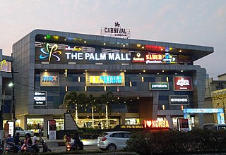
Anna Nagar, is a neighbourhood in the metropolitan city of Chennai, India. Named after former chief minister of Tamil Nadu C. N. Annadurai, it is located in the north-western part of Chennai and forms a part of the Aminjikarai taluk and the Anna Nagar Zone. It is one of the prime residential areas in Chennai and is home to several prominent doctors, lawyers and politicians. Real estate prices are among the highest in the city. A recent addition to the area is VR Chennai Mall, located near Shanthi Colony and Thirumangalam junction.

Katol is a city and a municipal council in Nagpur district of Maharashtra state, India. It is the administrative headquarter of Katol taluka, one of the 14 talukas of this district. Being located in orange belt it is a major centre for orange trading.
The Old Prayagraj City, at the south of Prayagraj Junction Railway Station, consists of neighborhoods like Chowk, Johnstongunj, Dariyabad, Khuldabad etc. and was in existence from the time of Akbar. Some magnificent structures erected in this era consist of the Khusro Bagh and the Allahabad Fort. In the north of Railway Station, the New Prayagraj City consists of neighborhoods like Lukergunj, Civil Lines, Georgetown, Tagoretown, Bharadwaj Puram, Ashok Nagar, Mumfordgunj etc., which are relatively new and were built during the British rule. These neighborhoods reflect British architecture like the All Saints Cathedral, Alfred Park and Allahabad High Court. Newer residential areas include neighborhoods like Kareli and suburbs like Naini Jhunsi and Manauri bajar.

Nagpur Municipal Corporation (NMC) is the municipal body administering Nagpur, in Maharashtra state in Central India.
The city of Nagpur is strategically located in central India. It has a vast railway network and its road network is well-maintained to avoid congestion. There are 4 modes of transportation in Nagpur. Nagpur is connected to India's four major metropolitan areas by road, rail and air. Auto rickshaws operate in most parts of the city, and are the main form of hired transport.
Netaji Subhash Chandra Bose Itwari is a Railway Junction Station and Terminus about 5 km from Nagpur railway station in Maharashtra state of India.
Ajni railway station is a railway station in vicinity of Nagpur in Maharashtra on Delhi–Chennai line.
Defence Colony is a neighbourhood in Delhi. It was built in the 1960s for veterans of the Indian Armed Forces. It serves as the administrative headquarters of the South East Delhi district of Delhi.
Mominpura is a neighborhood in Nagpur in Maharashtra, India. Mominpura is located in the central Nagpur area. It is surrounded by Ansar Nagar, Itwari, Bajeria, Hansapuri, Boriyapura and Timki.

Nagpur Metro is a rapid transit system for the city of Nagpur, Maharashtra, India. Phase I of the metro project cost was estimated to cost ₹8,650 crore but the final project cost incurred was ₹9,279 crore (US$1.2 billion). In February 2014, the Government of Maharashtra gave approval for the Metro project, while the Government of India's Ministry of Urban Development had given "In Principle" approval for the project. On 20 August 2014, Union Cabinet gave approval for the development of the project, and the Prime Minister laid the foundation stone on 21 August. Construction began on 31 May 2015, with trial run beginning on 30 September 2017.
Dhantoli is located in Nagpur, Maharashtra, India. It is densely populated. It is home to a large number of hospitals and other establishments. Initially Dhantoli was the home to Booty the Treasurer of Raja of Nagpur and Marathi Brahmins. Later in the 1950s it became home many Bengali and Maithili Brahmins making it the home to Nagpur's Famous Ram Krishna Mission and Kali Temple. It also has the famous Sai Baba Temple which is near the Iconic Major Surender Deo Park.This area is considered to be the best residential area in the city.
Bhavani Peth is an area located in Pune City, in Maharashtra State of the Republic of India. A study in 1990 described Bhavani Peth as the largest slum settlement in Pune.

Kodambakkam is a business and residential neighbourhood in Central Chennai, Tamil Nadu, India. The neighbourhood is served by Kodambakkam railway station of the Chennai Suburban Railway Network. Kodambakkam has a high concentration of film studios and has been known for its status as the hub of the Tamil film industry, lending its name to the industry's monicker Kollywood.
The Orange Line, also known as the North–south corridor, of the Nagpur Metro is a metro route of mass rapid transit system in Nagpur, India. It consists of 20 metro stations from Automotive Square to Metro City with a total distance of 22.293 km. Most of the line is elevated. It is the first line of the Nagpur Metro and was inaugurated by Prime Minister Narendra Modi on 7 March 2019, and opened to the public the next day on International Women's Day.

Ganesh Peth or Ganesh Peth Colony is a locality based in the city district of Nagpur, Maharashtra. It belongs to Vidarbh region of the Nagpur Division and is close to some destinations in Nagpur like the ST Stand Square, Shukrwari Lake and Ramwadi. The colony also has one of the tallest buildings in Nagpur, called the Godrej Anandam. The colony also has its own police station unlike other localities. The Ganesh Peth police station is just situated at a walkable distance from the colony.