Related Research Articles
The Big Dig was a megaproject in Boston that rerouted the then elevated Central Artery of Interstate 93 that cut across Boston into the O'Neill Tunnel and built the Ted Williams Tunnel to extend Interstate 90 to Logan International Airport. Those two projects were the origin of the official name, the Central Artery/Tunnel Project. Additionally, the project constructed the Zakim Bunker Hill Bridge over the Charles River, created the Rose Kennedy Greenway in the space vacated by the previous I-93 elevated roadway, and funded more than a dozen projects to improve the region's public transportation system. Planning for the project began in 1982; the construction work was carried out between 1991 and 2006; and the project concluded on December 31, 2007. The project's general contractor was Bechtel and Parsons Brinckerhoff was the engineer, who worked as a consortium, both overseen by the Massachusetts Highway Department.

The Dwight D. Eisenhower National System of Interstate and Defense Highways, commonly known as the Interstate Highway System, or the Eisenhower Interstate System, is a network of controlled-access highways that forms part of the National Highway System in the United States. The system extends throughout the contiguous United States and has routes in Hawaii, Alaska, and Puerto Rico.
The Pennsylvania Turnpike is a controlled-access toll road that is operated by the Pennsylvania Turnpike Commission (PTC) in the Commonwealth of Pennsylvania in the United States. It runs for 360 miles (580 km) across the state, connecting Pittsburgh in Western Pennsylvania with Philadelphia in eastern Pennsylvania, and passes through four tunnels as it crosses the Appalachian Mountains in central Pennsylvania.

Interstate 4 (I-4) is an Interstate Highway located entirely within the US state of Florida, maintained by the Florida Department of Transportation (FDOT). Spanning 132.30 miles (212.92 km) along a generally southwest–northeast axis, I-4 is entirely concurrent with State Road 400 (SR 400). In the west, I-4 begins at an interchange with I-275 in Tampa. I-4 intersects with several major expressways as it traverses Central Florida, including US Highway 41 (US 41) in Tampa; US 301 near Riverview; I-75 near Brandon; US 98 in Lakeland; US 27 in unincorporated Davenport; US 192 in Celebration; Florida's Turnpike in Orlando; and US 17 and US 92 in multiple junctions. In the east, I-4 ends at an interchange with I-95 in Daytona Beach, while SR 400 continues for roughly another four miles (6.4 km) and ends at an intersection with US 1 on the city line of Daytona Beach and South Daytona.
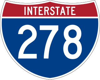
Interstate 278 (I-278) is an auxiliary Interstate Highway in New Jersey and New York in the United States. The road runs 35.62 miles (57.32 km) from US Route 1/9 (US 1/9) in Linden, New Jersey, northeast to the Bruckner Interchange in the New York City borough of the Bronx. The majority of I-278 is in New York City, where it serves as a partial beltway and passes through all five of the city's boroughs. I-278 follows several freeways, including the Union Freeway in Union County, New Jersey; the Staten Island Expressway (SIE) across Staten Island; the Gowanus Expressway in southern Brooklyn; the Brooklyn–Queens Expressway (BQE) across northern Brooklyn and Queens; a small part of the Grand Central Parkway in Queens; and a part of the Bruckner Expressway in the Bronx. I-278 also crosses multiple bridges, including the Goethals, Verrazzano-Narrows, Kosciuszko, and Robert F. Kennedy bridges.
E-ZPass is an electronic toll collection system used on toll roads, toll bridges, and toll tunnels in the Eastern United States, Midwestern United States, and Southern United States. The E-ZPass Interagency Group (IAG) consists of member agencies in several states, which use the same technology and allow travelers to use the same transponder on toll roads throughout the network.

The Federal-Aid Highway Act of 1956, also known as the National Interstate and Defense Highways Act, Pub. L.Tooltip Public Law 84–627 was enacted on June 29, 1956, when President Dwight D. Eisenhower signed the bill into law. With an original authorization of $25 billion for the construction of 41,000 miles (66,000 km) of the Interstate Highway System over a 10-year period, it was the largest public works project in American history through that time.
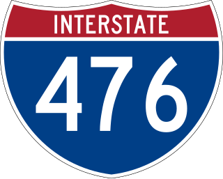
Interstate 476 (I-476) is a 132.1-mile (212.6 km) auxiliary Interstate Highway of I-76 in the U.S. state of Pennsylvania. The highway runs from I-95 near Chester north to I-81 near Scranton, serving as the primary north–south Interstate corridor through eastern Pennsylvania. It consists of both the 20-mile (32 km) Mid-County Expressway, locally referred to as the "Blue Route", through Delaware and Montgomery counties in the suburban Philadelphia area, and the tolled, 110.6-mile (178.0 km) Northeast Extension of the Pennsylvania Turnpike, which connects the Delaware Valley with the Lehigh Valley, the Pocono Mountains, and the Wyoming Valley to the north.
The President George Bush Turnpike (PGBT) is a 52-mile (84 km) controlled-access toll road running through the northern, northeastern and western suburbs, forming a partial loop around Dallas, Texas, United States. It is named for the late George H. W. Bush, the 41st president of the United States. At its west end near Belt Line Road in Irving, State Highway 161 continues southwest to Interstate 20 (I-20) in Grand Prairie. The discontinuous free frontage roads along the turnpike from I-35E in Carrollton east to its end at I-30 in Garland are assigned the State Highway 190 designation. SH 190 signage appears only along the Rowlett, Garland, Richardson, Plano, and Carrollton sections of the frontage road with the undersign "frontage road only". At intersections with city streets, only the Bush Turnpike signs are displayed, not the SH 190 signage. Prior to the construction of the main lanes as a tollway, SH 190 was used as the name of the planned main lanes too. Similarly, the part west of I-35E was planned as part of SH 161. Bush Turnpike is signed as a north–south road from I-20 to I-35E, an east–west road from I-35E to the Merritt Main Lane Gantry and as a north–south road from the Merritt Main Lane Gantry to I-30, as Bush Turnpike makes a nearly 90-degree curve in both places.

The Dolphin East-West Expressway is a 15.4-mile (24.8 km) freeway, with the westernmost 14 miles (23 km) as an all-electronic tollway signed as State Road 836, and the easternmost 1.292 miles (2.079 km) between Interstate 95 (I-95) and SR A1A cosigned as Interstate 395 (I-395).

The Thomas P. "Tip" O'Neill Jr. Tunnel is a highway tunnel built as part of the Big Dig in Boston, Massachusetts. It carries the Central Artery underneath downtown Boston, and is numbered as Interstate 93 (I-93), U.S. Route 1 (US 1), and Route 3. It roughly follows the route of the old elevated Central Artery, though the northbound entrance, at the corner of Kneeland Street and Atlantic Avenue, is somewhat east of the southbound exit to allow for a reconfigured interchange with the Massachusetts Turnpike. It runs from the Zakim Bunker Hill Bridge at its north portal—barely 165 feet (50 m) east of the TD Garden sports facility's eastern corner—to Boston's Chinatown at its south portal. The tunnel is named for Tip O'Neill, former Speaker of the United States House of Representatives, whose constituency included several of the surrounding communities in Metro Boston.
The Tampa Hillsborough Expressway Authority (THEA) owns, operates and maintains the Lee Roy Selmon Expressway in Tampa. The Selmon Expressway is a tolled highway. The Reversible Express Lanes (REL), a highway within a highway, runs in the middle on the eastern side of the highway with two non-tolled feeder roads, Brandon Parkway in Brandon and Meridian Avenue in Tampa, providing the entrance and exit to the REL. Additionally, THEA owns and operates the Selmon Greenway, a multipurpose recreational pathway running beneath and alongside the Lee Roy Selmon Expressway.

A megaproject is an extremely large-scale investment project. According to the Oxford Handbook of Megaproject Management, "Megaprojects are large-scale, complex ventures that typically cost $1 billion or more, take many years to develop and build, involve multiple public and private stakeholders, are transformational, and impact millions of people". However, $1 billion is not a constraint in defining megaprojects; in some contexts a relative approach is needed, such as in developing countries, where a much smaller project could constitute a megaproject. Therefore, a more general definition is "Megaprojects are temporary endeavours characterised by: large investment commitment, vast complexity, and long-lasting impact on the economy, the environment, and society".

Interstate 77 (I-77) in the US state of West Virginia is a major north–south Interstate Highway. It extends for 187.21 miles (301.29 km) between Bluefield at the Virginia state line and Williamstown at the Ohio state line.

Interstate 64 (I-64) in the US state of Virginia runs east–west through the middle of the state from West Virginia to the Hampton Roads region, for a total of 299 miles (481 km). From the West Virginia state line to Chesapeake, it passes through the major cities of Lexington, Staunton, Charlottesville, the state capital of Richmond, Newport News, Hampton, and Norfolk. It is notable for crossing the mouth of the harbor of Hampton Roads on the Hampton Roads Bridge–Tunnel (HRBT), the first bridge–tunnel to incorporate artificial islands, concurrent with U.S. Route 60 (US 60). Also noteworthy is a section through Rockfish Gap, a wind gap in the Blue Ridge Mountains, which was equipped with an innovative system of airport-style runway lighting embedded into the pavement to aid motorists during periods of poor visibility due to fog or other conditions.

Interstate 75 (I-75) is a part of the Interstate Highway System that runs from the Hialeah–Miami Lakes border, a few miles northwest of Miami, to Sault Ste. Marie in the Upper Peninsula of Michigan. I-75 begins its national northward journey near Miami, running along the western parts of the Miami metropolitan area before traveling westward across Alligator Alley, resuming its northward direction in Naples, running along Florida's Gulf Coast, and passing the cities of Fort Myers, Punta Gorda, Venice, and Sarasota. The freeway passes through the Tampa Bay area before turning inward toward Ocala, Gainesville, and Lake City before leaving the state and entering Georgia. I-75 runs for 471 miles (758 km) in Florida, making it the longest Interstate in the state and also the longest in any state east of the Mississippi River. The Interstate's speed limit is 70 mph (110 km/h) for its entire length in Florida.
There are approximately 25 current toll roads in the state of Texas. Toll roads are more common in Texas than in many other U.S. states, since the relatively low revenues from the state's gasoline tax limits highway planners' means to fund the construction and operation of highways.

Megaprojects and Risk: An Anatomy of Ambition is a 2003 book by Bent Flyvbjerg, Nils Bruzelius, and Werner Rothengatter, published by Cambridge University Press. According to chief economist and director of transportation policy at Infrastructure Management Group, Inc., Porter K. Wheeler, "this book makes an important contribution to understanding the infrastructure development process worldwide, with focus on megaprojects." The New Scientist wrote upon publication, "Love them or loathe them, megaprojects capture the imagination. [This] damning analysis concentrates on a series of financial nightmares that should bring even the most casual reader out in a sweat."
References
- ↑ Central Artery/Tunnel Project Website Archived 2007-10-12 at the Wayback Machine
- ↑ "Boston's 'Big Dig' finally opens to public - US news - NBC News". NBC News.
- ↑ https://wsdot.wa.gov/construction-planning/major-projects/i-5-sr-16-tacomapierce-county-hov-program
- ↑ Jaffe, Eric (2015-10-13). "From $250 Million to $6.5 Billion: The Bay Bridge Cost Overrun". CityLab. Archived from the original on 2017-09-28. Retrieved 2017-09-28.
- ↑ Turnpike panel says high costs imperil Mon-Fayette, Southern Beltway projects, Pittsburgh Post-Gazette, April 27, 2007
- ↑ Louisville Bridges Cost Now $4.1 Billion, The Urbanophile, October 6, 2007
- ↑ HRBT Expansion website
- ↑ Federal Highway Administration, Central Texas Turnpike Fact Sheet
- ↑ "So what is the capacity of the Katy Freeway these days?".
- ↑ "FHWA Office of Innovative Program Delivery: Project Profiles". Archived from the original on 2015-09-05. Retrieved 2015-09-18.
- ↑ Maryland Department of Transportation ICC Website
- ↑ Woodrow Wilson Bridge Replacement Website Archived 2007-10-15 at the Wayback Machine
- ↑ Tracy, Dan (17 February 2015). "I-4 Ultimate overhaul gets ceremonial start". Orlando Sentinel. Retrieved 18 February 2015.
- ↑ "INDOT I-69: I-69".
- ↑ "Frequently Asked Questions". Wekiva Parkway. Florida Department of Transportation & Central Florida Expressway Authority. Retrieved 18 February 2015.
- ↑ COG panel OK with $498M spike in Q bridge cost, New Haven Register, August 9, 2007 [ permanent dead link ]
- ↑ "Final leg of E-470 nears completion". Denver Business Journal.
- ↑ Webber, Melvin (1976). "The BART experience: what have we learned?" (PDF): 93. Retrieved 31 May 2016.
{{cite journal}}: Cite journal requires|journal=(help)[ permanent dead link ] - ↑ "Frequently Asked Questions about the Transcontinental Railroad".
| Transport | |||||
|---|---|---|---|---|---|
| Media |
| ||||
| Locations | |||||
| Sports | |||||
| Social | |||||
| Companies | |||||
| Luxury | |||||
| Collectibles | |||||