An arête is a narrow ridge of rock that separates two valleys. It is typically formed when two glaciers erode parallel U-shaped valleys. Arêtes can also form when two glacial cirques erode headwards towards one another, although frequently this results in a saddle-shaped pass, called a col. The edge is then sharpened by freeze-thaw weathering, and the slope on either side of the arête steepened through mass wasting events and the erosion of exposed, unstable rock. The word arête is actually French for "edge" or "ridge"; similar features in the Alps are often described with the German equivalent term Grat.
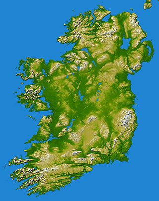
In these lists of mountains in Ireland, those within Northern Ireland, or on the Republic of Ireland – United Kingdom border, are marked with an asterisk, while the rest are within the Republic of Ireland. Where mountains are ranked by height, the definition of the topographical prominence used to classify the mountain, is noted. In British definitions, a height of 600 metres (1,969 ft) is required for a mountain, whereas in Ireland, a lower threshold of 500 metres (1,640 ft) is sometimes advocated.

A volcanic plug, also called a volcanic neck or lava neck, is a volcanic object created when magma hardens within a vent on an active volcano. When present, a plug can cause an extreme build-up of high gas pressure if rising volatile-charged magma is trapped beneath it, and this can sometimes lead to an explosive eruption. In a plinian eruption the plug is destroyed and ash is ejected.

The Sugar Loaf, sometimes called Sugar Loaf, is a hill situated 2 miles (3.2 km) north-west of Abergavenny in Monmouthshire, Wales and sits within the Brecon Beacons National Park. It is the southernmost of the summit peaks of the Black Mountains, with a height of 1,955 feet (596 metres). Sugar Loaf was gifted to the National Trust by suffragette Lady Rhondda.

The Knockmealdown Mountains are a mountain range located on the border of counties Tipperary and Waterford in Ireland, running east and west between the two counties. The highest peak of the range is Knockmealdown, in County Waterford. On the western side of the summit, the range is crossed by a high pass called ‘The Vee’ through which runs the old mail coach road from Lismore to Clogheen.

Knockmealdown is the highest peak of the Knockmealdown Range of mountains, located on the border between Co Tipperary and Co Waterford.

Great Sugar Loaf at 501 metres (1,644 ft), is the 404th–highest peak in Ireland on the Arderin scale, however, being below 600 m it does not rank on the Vandeleur-Lynam or Hewitt scales. The mountain is in the far northeastern section of the Wicklow Mountains, in Ireland, and overlooks the village of Kilmacanogue. The profile of the mountain means it can be mistaken for a dormant volcano. It owes its distinctive shape, however, to the erosion-resistant metamorphosed deep-sea sedimentary deposit from which its quartzite composition was derived.
Pan de Azúcar may refer to
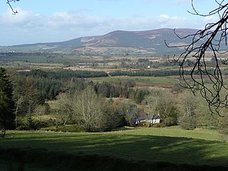
Sugarloaf is a 552 metres (1,811 ft) peak in west Wicklow, Ireland that lies on the northern edge of the Glen of Imaal. With a prominence of only 14 metres (46 ft), it is not listed in any of the recognised categories of mountains in Ireland, and is a subsidiary summit of Lobawn 636 metres (2,087 ft), to the north.

Sugarloaf Hill is a 785 ft (239 m) peak along the Hudson River in Putnam County, New York, part of the Hudson Highlands. It was named by the Dutch for its resemblance in outline to a sugarloaf when sailing up the river towards it.

Sugarloaf Ridge State Park is a state park in Northern California, United States. Located in the Mayacamas Mountains north of Kenwood, the park straddles the boundary between Sonoma and Napa counties. The park contains the 2,729-foot (832 m) Bald Mountain and the headwaters of Sonoma Creek including a 25-foot (8 m) tall seasonal waterfall. The park is also home to the volunteer-run Robert Ferguson Observatory. Camping, picnicking, horseback riding, mountain biking, stargazing, fishing and hiking are common attractions of Sugarloaf. The park boasts 25 miles of trails with trails ranging from less than a mile to 8.8 miles, and elevation gains reaching 2,500 feet.

The Wilkie Sugarloaf Trail is a hiking trail in northern Cape Breton Island in the Canadian province of Nova Scotia. The trail leads to the 411.8 metres (1,351 ft) summit of Wilkie Sugar Loaf in the Cape Breton Highlands.

Sugarloaf Mountain or Mount Sugarloaf, is a butte-like mountain located in South Deerfield, Massachusetts, United States, with two summits, North Sugarloaf Mountain 791 ft (241 m) and its more popular knee, South Sugarloaf Mountain 652 ft (199 m). Its cliffs, made of arkose sandstone, are a very prominent landscape feature visible for miles. Despite low elevations relative to the Berkshire Mountains to the west, dramatic cliff faces and a rise of 500 feet (150 m) to 600 feet (180 m) from the nearby Connecticut River make the mountain a popular tourist and hiking destination. Sugarloaf Mountain is the southern terminus of the Pocumtuck Range.
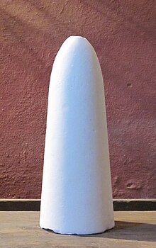
A sugarloaf is refined sugar in the form of a rounded cone, the most common way of distributing sugar until the late 19th century.
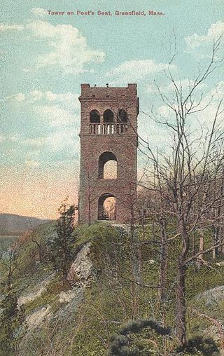
The Pocumtuck Range, also referred to as the Pocumtuck Ridge, is the northernmost subrange of the Metacomet Ridge mountain range of southern New England, itself a subrange of the Appalachian Mountains. Located in Franklin County, Massachusetts, between the Connecticut River and the Deerfield River valleys, the Pocumtuck Range is a popular hiking destination known for its continuous high cliffs, scenic vistas, and microclimate ecosystems.

Brace Mountain is the peak of a ridge in the southern Taconic Mountains, near the tripoint of the U.S. states of New York, Connecticut and Massachusetts. Its 2,311-foot (704 m) main summit is located in New York; it is the highest point in that state's Dutchess County.

Wilkie Sugar Loaf is a Canadian peak in the Cape Breton Highlands near the community of Sugar Loaf in the province of Nova Scotia.
Prince William's Seat at 555 metres (1,821 ft), is the 296th–highest peak in Ireland on the Arderin scale, however, it does not have the elevation to quality as a Vandeleur-Lynam. Prince William's Seat is on the border of the Wicklow Mountains and Dublin Mountains in Ireland, and lies on the northern side of the Glencree valley, positioned at its entrance. Prince William's Seat is separated by a small col from neighbouring Knocknagun, which is also 555 metres (1,821 ft) in height. Prince William's Seat and Knocknagun are popular peaks with hill-walkers.
