This is a selected list of the oldest rivers on Earth for which there is knowledge about their existence in past times.
This is a selected list of the oldest rivers on Earth for which there is knowledge about their existence in past times.
Generally, the age is estimated based primarily upon the age of any mountains it dissects; the age of the sea or ocean to which it eventually outflows can be irrelevant; for example, several rivers of the east side of the Appalachian Mountains are thought to be older than the Atlantic Ocean into which they flow. [ citation needed ] If a river fully dissects a mountain range, then this generally indicates that the river existed at least at the time that the mountain range rose.
| |||||||||||||
| River | Age (Mya) | Outflow | Most significant criterion for the age |
|---|---|---|---|
| Finke | 400~350 | Lake Eyre (intermittent) | Predates the Alice Springs Orogeny; several other smaller rivers in the Northern Territory are of a similar age [1] [2] |
| Meuse | 340~320 | North Sea | Paleozoic, dissects the Ardennes during the Hercynian [3] |
| French Broad River | 340~320 | Tennessee River | Dissects the Appalachian Mountains, formed by the Alleghenian orogeny, 320–340 ma. The New, Susquehanna, and French Broad are the only significant rivers that fully dissect the Appalachian core; the Hudson River is of more recent geologic origin. [4] |
| New | 325~260 | Kanawha River | Dissects the Appalachian Mountains, formed by the Alleghenian orogeny, 320–340 ma [5] |
| Susquehanna | 325~260 | Chesapeake Bay | Dissects the Appalachian Mountains, formed by the Alleghenian orogeny, 320–340 ma |
| Rhine | 240 | North Sea | Triassic, possibly older if it dissected mountains uplifted during the Hercynian in addition to the Eocene with the Alps or the Miocene with the Upper Rhine Graben |
| Save | 205 | Indian Ocean | Formed during rifting when Gondwana broke up [6] |
| Amur | 125 | Sea of Okhotsk | Known to be at least Cretaceous in age, but crosses mountains even older [7] |
| Macleay | 80 | Tasman Sea | Predates uplift of Great Escarpment [8] |
| Colorado | 75 | Gulf of California | Uplift during Laramide orogeny, see Geology of the Grand Canyon area |
| Murrumbidgee | 75 | Murray River | Predates uplift of Australian Alps [8] |
| Nile | 75~65 | Mediterranean Sea | 65 to 75 for the Sudd section; the rest of the river is only 1 or 2 million years old [9] |
| Thames | 58 | North Sea | Late Palaeocene Period Thanetian Stage [10] |
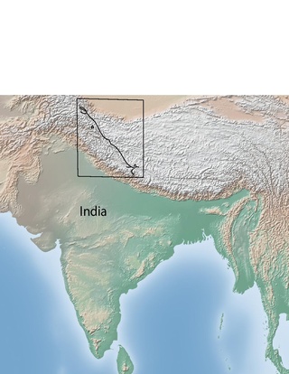
| Indus (Sindhu) | 45 | Arabian Sea | Source in the Himalayas and Karakoram Mountains [11] |
| Tyne | 30 | North Sea | The Tyne began to carve its valley 30 MYA, by removing softer chalk rocks and exposing harder rocks. [12] Significantly predates the last Ice Age. |
| Yangtze (Chang Jiang) | 36.5~23 | East China Sea | Post-dates the Three Gorges formation (36.5 ma) [13] [14] |
| Parramatta | 29~15 | Tasman Sea | Formed between the late Oligocene and early Miocene period as its waters began to cut a valley into sandstone and shale, which were laid down some 200 million years earlier [15] |
| Columbia | 17~6 | Pacific Ocean | Between 17 million and 6 million years ago, huge outpourings of flood basalt lava covered the Columbia River Plateau and forced the lower Columbia into its present course. [16] |
| Amazon | 11.8~11.3 | Atlantic Ocean | Waters worked through the sandstone from the west and the Amazon began to flow eastward. [17] The river flowed through a former basin of a proto-Amazon, which flowed in the opposite direction at least as old as 65 Mya, long before the formation of Andes, when it originated in the highland area that formed when the South American and African plates separated. [18] This river may predate the break-up of western Gondwana as an extension of a proto-Congo river system, 200 Mya during the Jurassic. |
| Ohio | 3~2.5 | Mississippi River | Formed when the Laurentide Ice Sheet dammed the north flowing Teays River during the Pre-Illinoian glaciation. The drainage area of the Teays could no longer drain to the north, and so instead drained to the south, forming the Ohio River. |

The Basin and Range Province is a vast physiographic region covering much of the inland Western United States and northwestern Mexico. It is defined by unique basin and range topography, characterized by abrupt changes in elevation, alternating between narrow faulted mountain chains and flat arid valleys or basins. The physiography of the province is the result of tectonic extension that began around 17 million years ago in the early Miocene epoch.

The Los Angeles Basin is a sedimentary basin located in Southern California, in a region known as the Peninsular Ranges. The basin is also connected to an anomalous group of east-west trending chains of mountains collectively known as the Transverse Ranges. The present basin is a coastal lowland area, whose floor is marked by elongate low ridges and groups of hills that is located on the edge of the Pacific Plate. The Los Angeles Basin, along with the Santa Barbara Channel, the Ventura Basin, the San Fernando Valley, and the San Gabriel Basin, lies within the greater Southern California region. The majority of the jurisdictional land area of the city of Los Angeles physically lies within this basin.

The Yellowstone hotspot is a volcanic hotspot in the United States responsible for large scale volcanism in Idaho, Montana, Nevada, Oregon, and Wyoming, formed as the North American tectonic plate moved over it. It formed the eastern Snake River Plain through a succession of caldera-forming eruptions. The resulting calderas include the Island Park Caldera, Henry's Fork Caldera, and the Bruneau-Jarbidge caldera. The hotspot currently lies under the Yellowstone Caldera. The hotspot's most recent caldera-forming supereruption, known as the Lava Creek Eruption, took place 640,000 years ago and created the Lava Creek Tuff, and the most recent Yellowstone Caldera. The Yellowstone hotspot is one of a few volcanic hotspots underlying the North American tectonic plate; another example is the Anahim hotspot.

The geology of Nepal is dominated by the Himalaya, the highest, youngest and a very highly active mountain range. Himalaya is a type locality for the study of on-going continent-continent collision tectonics. The Himalayan arc extends about 2,400 km (1,500 mi) from Nanga Parbat by the Indus River in northern Pakistan eastward to Namche Barwa by the gorge of the Tsangpo-Brahmaputra in eastern Tibet. About 800 km (500 mi) of this extent is in Nepal; the remainder includes Bhutan and parts of Pakistan, India, and China.

The Olympic-Wallowa lineament (OWL) – first reported by cartographer Erwin Raisz in 1945 on a relief map of the continental United States – is a physiographic feature of unknown origin in the state of Washington running approximately from the town of Port Angeles, on the Olympic Peninsula to the Wallowa Mountains of eastern Oregon.

The Brothers Fault Zone (BFZ) is the most notable of a set of northwest-trending fault zones including the Eugene–Denio, McLoughlin, and Vale zones that dominate the geological structure of most of Oregon. These are also representative of a regional pattern of generally northwest-striking geological features ranging from Walker Lane on the California–Nevada border to the Olympic–Wallowa Lineament in Washington; these are generally associated with the regional extension and faulting of the Basin and Range Province, of which the BFZ is considered the northern boundary.
The San Juan volcanic field is part of the San Juan Mountains in southwestern Colorado. It consists mainly of volcanic rocks that form the largest remnant of a major composite volcanic field that covered most of the southern Rocky Mountains in the Middle Tertiary geologic time. There are approximately fifteen calderas known in the San Juan Volcanic Fields; however, it is possible that there are two or even three more in the region.

The geology of North America is a subject of regional geology and covers the North American continent, the third-largest in the world. Geologic units and processes are investigated on a large scale to reach a synthesized picture of the geological development of the continent.

Siletzia is a massive formation of early to middle Eocene epoch marine basalts and interbedded sediments in the forearc of the Cascadia subduction zone, on the west coast of North America. It forms the basement rock under western Oregon and Washington and the southern tip of Vancouver Island. It is now fragmented into the Siletz and Crescent terranes.

The Karakoram fault is an oblique-slip fault system in the Himalayan region across India and Asia. The slip along the fault accommodates radial expansion of the Himalayan arc, northward indentation of the Pamir Mountains, and eastward lateral extrusion of the Tibetan plateau. Current plate motions suggest that the convergence between the Indian Plate and the Eurasian Plate is around 44±5 mm per year in the western Himalaya-Pamir region and approximately 50±2 mm per year in the eastern Himalayan region.
Provenance in geology, is the reconstruction of the origin of sediments. The Earth is a dynamic planet, and all rocks are subject to transition between the three main rock types: sedimentary, metamorphic, and igneous rocks. Rocks exposed to the surface are sooner or later broken down into sediments. Sediments are expected to be able to provide evidence of the erosional history of their parent source rocks. The purpose of provenance study is to restore the tectonic, paleo-geographic and paleo-climatic history.

The offshore Indus Basin is one of the two basins in offshore Pakistan, the other one being the offshore Makran Basin. The Murray Ridge separates the two basins. The offshore Indus basin is approximately 120 to 140 kilometers wide and has an areal extent of ~20,000 square km.

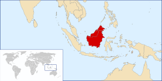
The Kutai sedimentary basin extends from the central highlands of Borneo, across the eastern coast of the island and into the Makassar Strait. With an area of 60,000 km2, and depths up to 15 km, the Kutai is the largest and deepest Tertiary age basin in Indonesia. Plate tectonic evolution in the Indonesian region of SE Asia has produced a diverse array of basins in the Cenozoic. The Kutai is an extensional basin in a general foreland setting. Its geologic evolution begins in the mid Eocene and involves phases of extension and rifting, thermal sag, and isostatic subsidence. Rapid, high volume, sedimentation related to uplift and inversion began in the Early Miocene. The different stages of Kutai basin evolution can be roughly correlated to regional and local tectonic events. It is also likely that regional climate, namely the onset of the equatorial ever wet monsoon in early Miocene, has affected the geologic evolution of Borneo and the Kutai basin through the present day. Basin fill is ongoing in the lower Kutai basin, as the modern Mahakam River delta progrades east across the continental shelf of Borneo.

Lake Tecopa is a former lake in Inyo County, southern California. It developed during the Miocene and the Pleistocene within a tectonic basin close to the border with Nevada. Fed by the Amargosa River and some neighbouring washes, it eventually culminated to a surface area of 235 square kilometres (91 sq mi) around 186,000 years ago and left sediments. Afterwards, the Amargosa River cut a gorge out of the lake and into Death Valley with its Lake Manly, draining the lake. The present-day towns of Shoshone, California and Tecopa, California lie within the basin of the former lake.

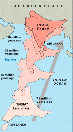
The paleogeography of the India–Asia collision system is the reconstructed geological and geomorphological evolution within the collision zone of the Himalayan orogenic belt. The continental collision between the Indian and Eurasian plate is one of the world's most renowned and most studied convergent systems. However, many mechanisms remain controversial. Some of the highly debated issues include the onset timing of continental collision, the time at which the Tibetan plateau reached its present elevation and how tectonic processes interacted with other geological mechanisms. These mechanisms are crucial for the understanding of Mesozoic and Cenozoic tectonic evolution, paleoclimate and paleontology, such as the interaction between the Himalayas orogenic growth and the Asian monsoon system, as well as the dispersal and speciation of fauna. Various hypotheses have been put forward to explain how the paleogeography of the collision system could have developed. Important ideas include the synchronous collision hypothesis, the Lhasa-plano hypothesis and the southward draining of major river systems.

The Indus Fan is one of the most significant depositional feature of the offshore Indus basin. It is the second largest fan system in the world after the Bengal Fan between India, Bangladesh and the Andaman Islands. The Indus fan was deposited in an unconfined setting on the continental slope, rise and basin floor, covering much of the Arabian Sea. The entire fan extends over an area of 110,000 square kilometers with greater than 9 km of sediment accumulating near the toe-of-slope.

The Santa Fe Group is a group of geologic formations in New Mexico and Colorado. It contains fossils characteristic of the Oligocene through Pleistocene epochs. The group consists of basin-filling sedimentary and volcanic rocks of the Rio Grande rift, and contains important regional aquifers.
The Nevadaplano was a high plateau that is proposed to have covered parts of southwestern North America during the late Mesozoic and early Cenozoic, located in the present-day US states of Idaho, Nevada, Utah and possibly others. It most likely formed during the Cretaceous as a consequence of subduction dynamics and may have reached elevations of 3 kilometres (9,800 ft) and more, although its elevation is controversial. It was flanked on the west by the Sierra Nevada, which was traversed by various valleys that came down from the Nevadaplano. Closed basins and numerous volcanic calderas covered the relatively flat Nevadaplano; large volcanic eruptions distributed ignimbrites over the plateau and down the valleys draining it.