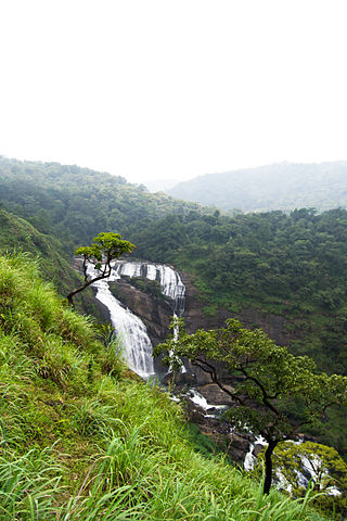
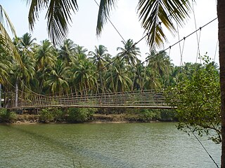
This is a list of some of the rivers which flow through the two districts of Dakshina Kannada and Udupi. The names of river vary depending upon area where they flow. Almost all rivers of these districts flow westward and join Arabian sea.
This is a list of some of the rivers which flow through the two districts of Dakshina Kannada and Udupi. The names of river vary depending upon area where they flow. Almost all rivers of these districts flow westward and join Arabian sea.
Netravati river has its origins in the western ghats of Karnataka state in India. The rivers:
join the Netravati. Some of the prominent cities/ towns on the banks of this river are:
The Netravati joins the Arabian Sea at Mangalore. It is known as the River of Life of the Dakshina Kannada District (Dakshina Kannada Jeeva Nadi). Its length is 103 km. It has an area of approximately 1352 sq. miles. It is the main source of water for water-transport, fishing, power generation and drinking.
Kumaradhara River originates in the western ghats and joins Netravati river. Kukke Subramanya is on the banks of Kumaradhara.
Gurupur river flows through Gurupur, Mangalore, Tannirubhavi. It joins the Netravati River near Bengre .
Nandini or Pavanje river joins the Arabian sea near Sashihitlu and Koluvail. It Originates in kanakagiris (Iruvail) and flows through Kateel, Attur-Kemral and Pavanje.
Shambhavi River flows through Mulki town.
This river touches the village of Pangala and joins the Arabian sea near Matti.
Paapanaashini river, also commonly known as Udyavara river joins Arabian sea near Malpe. Udyavara, Shirva-Manchakal and Malpe are some of the places through which this river flows.
The Swarna river (Tudhe in Tulu ) flows through villages Perdoor, Hiriyadka, Parika (parkala) Herga, Manipal, Perampalli, Uppoor and Kallianpur, Many Kudrus (small Island) like Moodukudru, Baligera Kudru, Padukudru etc. It is the main source of drinking water to Udupi District. It joins the Arabian Sea at Bengre.
The river originates in Western Ghats near Hebri at the top of Narasimha parvatha. This river mostly flows through Udipi taluk. The famous town Barkur is on the banks of river Sita. It converges with Suvarna river before joining Arabian sea.
Panchagangavalli River is a river flowing through Kundapur and Gangolli in western India. The five rivers namely Souparnika River, Varahi River, Kedaka River, Chakra River, and Kubja River will join and merge into Arabian sea.
The places on the banks of this river are Kollur and Marvanthe. It comes near Arabian Sea in Maravanthe where there is a small strip of land between the sea and river. It flows inwards the land for some 7 kilometers more to reach the Sea from this point and joins the Arabian sea at Gangolli. It is well connected with the origin of the famous Kollur Mookambika Temple.
Varahi River, also called Halady River, flows through Western Ghats in the Indian state of Karnataka. It joins the sea via Halady, Basrur, Kundapur and Gungulli. According to mythology, Varaha is one of the incarnations of Lord Vishnu. Varahi is consort of Varaha.
Chakra river has its origin in Western ghats and touches Hemmadi before joining Arabian sea.

Kanara or Canara, also known as Karavali is the historically significant stretch of land situated by the southwestern coast of India, alongside the Arabian Sea in the present-day Indian state of Karnataka. The subregion comprises three civil districts, namely: Uttara Kannada, Udupi, and Dakshina Kannada. Kassergode was included prior to the States Reorganisation Act.

Dakshina Kannada district is a district of Karnataka state in India, with its headquarters in the coastal city of Mangalore. It is part of the larger Tulu Nadu region. The district covers an area nestled in between the Western Ghats to its east and the Arabian Sea to its west. Dakshina Kannada receives abundant rainfall during the Indian monsoon. It is bordered by Udupi district to the north, Chikmagalur district to the northeast, Hassan district to the east, Kodagu to the southeast and Kasaragod district of Kerala to the south. According to the 2011 census of India, Dakshina Kannada district had a population of 2,083,625. It is the only district in Karnataka state to have all modes of transport like road, rail, water and air due to the presence of a major hub, Mangalore. This financial district is also known as the Cradle of Indian banking.

The Netravati River or Netravathi Nadi has its origins at Bangrabalige valley, Yelaneeru Ghat in Kudremukh in Chikkamagaluru district of Karnataka, India. This river flows through the famous pilgrimage place Dharmasthala and is considered one of the holy rivers of India. It merges with the Kumaradhara River at Uppinangadi before flowing to the Arabian Sea, south of Mangalore city. This river is the main source of water to Bantwal and Mangalore. The Netravati railway bridge is one of the known bridges which serve as the gateway to Mangalore.
Panchagangavalli River is a river flowing through Kundapur and Gangolli in western India. The five rivers namely Souparnika River, Varahi River, Kedaka River, Chakra River and Kubja River join and merge into Arabian sea.

The Chandragiri River, also known as the Perumpuzha River, is the longest river in Kasaragod district, Kerala, India. It was named after the Mauryan emperor Chandragupta Maurya.

Udupi district is an administrative subdivision in the Karnataka state of India, with the district headquarters in the city of Udupi. It is situated in the Canara old north malabar coastal region, there are seven taluks, 233 villages and 21 towns in Udupi district. The three northern tehsils of Udupi, Kundapur and Karkala, were partitioned from Dakshina Kannada district to form Udupi district on 25 August 1997. Moodabidri was officially declared as new tehsil (taluk), separated from Karkala with effect from 11 January 2018.

Kateel or Kateelu is a temple town in the Dakshina Kannada district of the Indian state of Karnataka. It is considered one of the holiest Hindu temple towns in India. It is situated on the banks of the river Nandini.

Sakleshpur, Sakleshpura or Sakleshapura is a hill station town and headquarters of Sakleshpur taluk in Hassan district in the Indian state of Karnataka.

Souparnika River or Sowparnika nadi is a river flowing through Kundapur taluk in Karnataka, India. It joins with the Varahi River, Kedaka River, Chakra River, and Kubja River known as Panchagangavali river and merges into the Arabian Sea. It flows near Mookambika temple, Kollur hence sometimes known as Kolluru nadi and is considered holy river by devotees of the temple.
Varahi River originate and flows through Western Ghats in the Indian state of Karnataka. It is also known as Halady or Haladi river in downstream areas. It joins the Arabian sea after flowing through places like Halady, Basrur, Kundapura and Gangolli. It joins with the Souparnika River, Kedaka River, Chakra River, and Kubja River which are known by Panchagangavalli River and merges into the Arabian Sea. Pancha means five in Kannada and Samskrita and Ganga means river. According to mythology, Varaha is one of the incarnations of Lord Vishnu. Varahi is consort of Varaha.
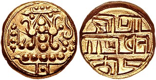
The Alupa dynasty was an ancient ruling dynasty of India. The kingdom they ruled was known as Alvakheda Arusasira and its territory spanned the coastal districts of the modern Indian state known as Karnataka. The Alupas in their prime were an independent dynasty, centuries after reigning due to the dominance of Kadambas from Banavasi, they became feudatory to them. Later they became the vassals of the Chalukyas, Rashtrakutas, Hoysalas with the change in political scenario of Southern India. Their influence over coastal Karnataka lasted for about 1200 years. There is evidence that the Alupas followed the law of matrilineal inheritance (Appekatt/Aliyasantana) since the Alupa king Soyideva was succeeded by his nephew Kulasekhara Bankideva. The legendary king who is credited with introducing matrilineality in Alva Kheda|Tulu Vishaya Kheda is named Bhuta Alupa Pandya The descendants of this dynasty still survive to this date and have spread in the karavali region and they are widely called as Bunt The Buntfollows Matrilineality, unlike any other warrior community, they can be identified with their surnames such as Shetty, Rai, Hegde, Alva, Chowta etc., even though most Bunt are hindus by faith now, The sizeable section of the community still follows Jainism and they are called Jain Bunt The last Alupa king to have ruled is Kulasekharadeva Alupendradeva whose inscription dated 1444 CE have been found in Mudabidri Jain Basadi.
Gangolli is a village in Kundapur Taluk of Udupi district in Karnataka state. It is situated at the estuary of the Panchagangavalli River. It is located on a peninsula on the west coast of Karnataka. It is bordered by the river to the east and by the Arabian Sea to the west.
Karnataka's coastline called Karavali stretches 300 km between Mangalore in Dakshina Kannada district and Karwar in Uttara Kannada district. The coastline of Karnataka has been along the eastern shore of Arabian Sea. Karnataka has one major and ten minor ports in this coastal belt. Kali, Belekeri, Gangavali, Aghanashini Sharavathi, Sharabi, Kollur, Gangolli, Sitanadi, Gurpur and Netravati are the important rivers in this belt which empty into the Arabian sea. Sea erosion, migration of river mouths, siltation of ports and harbours are some of the problems common to this belt.
The Kumaradhara River is an Indian river, in the southwestern India state of Karnataka. One of the two major rivers of Sullia, it merges with the Netravati River at Uppinangadi before flowing to the Arabian Sea. The merging of the rivers is a major event for the local villagers, as they crowd the river banks to watch what they call the "Sangama", which is a Sanskrit word for confluence.

Hampankatta is the centre of Mangalore City, Karnataka. Hampankatta also called as Happananakatte/Hampankatte/Hampananakatte/Hampanakatte. Most of the public utilities are located here and the locality boasts the most buzzing commercial activity in the city. Hampanakkatte was named by the British in 1920. Its original name was 'Appanakatte'. It was named after a person called Appanna Poojary who constructed a 'well' in the region around 1900, hence it was named Appannakatte. He used to feed his bullock cart etc. in those days and used to take rest.
Tonse is a combined village, which include Tonse West and Tonse East situated about 8 kilometres (5.0 mi) from Udupi on the western coast of South India, between the Arabian Sea and Western Ghats. Tonse village is about 68 kilometres (42 mi) to the north of Mangalore.

The Gurupura River is a river in the Karnataka state of India. It originates in the Western Ghats and is a tributary of the Netravati River, which empties into the Arabian Sea, south of Mangalore. It gets its name from the town Gurupura, situated near Mangalore. The New Mangalore Port and Mangalore Chemicals and Fertilizers are situated on its northern banks. Once upon a time it formed northern boundary of Mangalore city along with Netravati River as southern boundary but currently it forms the boundary only for the central part of Mangalore due to the growth of the city beyond these river boundaries.
Kundapura Taluk is a taluk located in Udupi district in the Indian state of Karnataka. Kundapur town is the taluk headquarters of Kundapur Taluk.

The following outline is provided as an overview of and topical guide to Karnataka:
Thombattu is a village in Kundapura Taluk in Karnataka, India. It is in the Udupi district. It is located 45 km towards North from District headquarters Udupi. 26 km from Kundapura. 410 km from State capital Bangalore. Kota, Udupi, Karkala, Sagar are the nearby cities.