List of scheduled monuments in Blaenau Gwent

Last updated

Blaenau Gwent UK location map.svg
Red pog.svg
Y Domen Fawr round cairn
Red pog.svg
Afon Sirhowy Hut Circle
Red pog.svg
Twyn Bryn March round cairn
Red pog.svg
Cefn Manmoel dyke
Red pog.svg
St Illtyd's Motte
Red pog.svg
Sirhowy Ironworks
Red pog.svg
Trefil Quarries
Red pog.svg
Clydach Coal Level
Red pog.svg
Clydach Rail Road
Red pog.svg
Marine Colliery Pumping Engine
Red pog.svg
Mynydd Bedwellty Winding Engine
Red pog.svg
Cholera Cemetery
Red pog.svg
Trefil Tramroad
Scheduled monuments in Blaenau Gwent, Wales

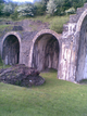
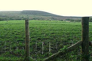
Blaenau Gwent is a unitary authority area in eastern South Wales. It has three heavily industrialised valleys, which are the setting for the eight post-medieval scheduled monuments. The uplands have three, possibly four prehistoric monuments, and a medieval site is in the south of the borough. There are 13 scheduled sites in total. The county borough was part of the historic county of Monmouthshire (historic), although shifting boundaries mean Y Domen Fawr round cairn was formerly in Glamorgan.

Contents

Scheduled monuments have statutory protection. It is illegal to disturb the ground surface or any standing remains. The compilation of the list is undertaken by Cadw Welsh Historic Monuments, which is an executive agency of the National Assembly of Wales. [1] The list of scheduled monuments below is supplied by Cadw [2] with additional material from RCAHMW and Glamorgan-Gwent Archaeological Trust.

Scheduled monuments in Blaenau Gwent

ImageNameSite typeCommunityLocationDetailsPeriodSAM No
& Refs
Y Domen Fawr round cairn Round cairn Ebbw Vale 51°45′25″N3°12′34″W / 51.757°N 3.2095°W / 51.757; -3.2095 (Y Domen Fawr round cairn) , SO166170
Early Bronze Age burial cairnPrehistoric
(Bronze Age)
GM588
[3]
Afon Sirhowy Hut Circle Hut circle settlement Tredegar 51°47′56″N3°16′44″W / 51.799°N 3.2788°W / 51.799; -3.2788 (Afon Sirhowy Hut Circle) , SO119119
Bronze Age hut circle, 5.3m in diameterPrehistoric
(Bronze Age)
MM347
[4]
Twyn Bryn March round cairn Round cairn Tredegar 51°48′10″N3°15′09″W / 51.8028°N 3.2524°W / 51.8028; -3.2524 (Twyn Bryn March Round Cairn) , SO137123
The best preserved of a group of Bronze Age burial cairns, 5m acrossPrehistoric
(Bronze Age)
MM344
[5]
Cefn Manmoel cross-ridge dyke Cross Ridge Dyke Cwm, (also Argoed, Caerphilly) 51°44′39″N3°12′06″W / 51.7442°N 3.2018°W / 51.7442; -3.2018 (Cefn Man Moel Cross-Ridge Dyke) , SO171057
Linear defensive earthwork which may be from neolithic or medieval period. This site crosses the border into Caerphilly Unknown
MM345
[6]
St Illtyd's Motte Motte Llanhilleth 51°42′38″N3°08′03″W / 51.7105°N 3.1343°W / 51.7105; -3.1343 (St Illtyd Castle Mound) , SO217019
Castle Mound next to the church. (Also known as Twyn Motte) Probably destroyed in 1233Medieval
(Norman)
MM141
[7]
Tredegar Ironworks Arches.png
Sirhowy Ironworks Industrial monument Tredegar 51°46′59″N3°14′37″W / 51.783°N 3.2436°W / 51.783; -3.2436 (Sirhowy Ironworks, Site of) , SO143101
Ironworks from 1778, site now open to the publicPost-Medieval/Modern
(18th century)
MM185
[8]
Trefil quarry workings - geograph.org.uk - 1777119.jpg Trefil Quarries NorthQuarry Tredegar 51°49′04″N3°16′54″W / 51.8179°N 3.2818°W / 51.8179; -3.2818 (Trefil Quarries North) , SO117140
Limestone Quarry opened in 1794Post-Medieval/Modern
(18th century)
MM338
[9]
Clydach Coal Level Tramroad Brynmawr 51°48′09″N3°09′40″W / 51.8024°N 3.161°W / 51.8024; -3.161 (Clydach Coal Level) , SO200121
Rock-cut coal levels from 1812 and tramroadPost-Medieval/Modern
(19th century)
MM264
[10]
Cefn golau tredegar.jpg Cefn Golau Cholera cemetery Tredegar 51°45′37″N3°14′57″W / 51.7603°N 3.2491°W / 51.7603; -3.2491 (Tredegar Ironworks Cholera Cemetery) , SO138075
Cemetery from the 1830s and 40s Cholera epidemicsPost-Medieval/Modern
(19th century)
MM287
[11]
Clydach Gorge - geograph.org.uk - 297781.jpg Clydach Rail Road Tramroad Brynmawr 51°48′12″N3°09′30″W / 51.8033°N 3.1584°W / 51.8033; -3.1584 (Clydach Railroad Section near Brynmawr) , SO202122
Stretch of Clydach Rail Road near Brynmawr, with causeway and stone arched bridge known as Hafod ArchPost-Medieval/Modern
(19th century)
MM263
[12]
Steam Pump - geograph.org.uk - 289002.jpg Marine Colliery Pumping EngineIndustrial monument Cwm 51°43′53″N3°10′33″W / 51.7315°N 3.1759°W / 51.7315; -3.1759 (Marine Colliery Pumping Engine) , SO188042
Steam pumping engine, relocated to near the colliery entrancePost-Medieval/Modern
(19th century)
MM218
[13]
Mynydd Bedwellty Winding Engine Industrial monument Tredegar 51°44′41″N3°13′40″W / 51.7448°N 3.2278°W / 51.7448; -3.2278 (Incline Haulage Winding Engine, Mynydd Bedwellty) , SO153058
Incline haulage winding engine from the 1850sPost-Medieval/Modern
(19th century)
MM181
[14]
Trefil Tramroad Tramroad Tredegar 51°48′16″N3°15′26″W / 51.8044°N 3.2573°W / 51.8044; -3.2573 (Trefil Tramroad) , SO134125
Early Tramroad connecting to Trefil QuarriesPost-Medieval/Modern
(19th century)
MM339
[15]
Map all coordinates using: OpenStreetMap  
Download coordinates as: KML

See also

Related Research Articles

Merthyr Mawr

Merthyr Mawr is a village and community in Bridgend, Wales. The village is about 2½ miles from the centre of Bridgend town. The population of the community at the 2011 census was 267. The community occupies the area west of the Ewenny River, between Bridgend and Porthcawl. It takes in the settlement of Tythegston and a stretch of coastal sand dunes known as Merthyr Mawr Warren. It is in the historic county of Glamorgan.

Mynydd Marchywel

Mynydd Marchywel is a 418-metre (1,371 ft) high hill in the Neath Port Talbot area in South Wales. Its summit is marked both by a cairn and a trig point. The larger part of the hill is cloaked in modern forestry through which numerous streams fall away westward to the River Tawe, eastward to the River Dulais and southward into the Clydach, the latter two being tributaries of the River Neath.

References

  1. Cadw: Ancient Monuments and Scheduling. Accessed 25 April 2013
  2. Cadw will send their list as a spreadsheet, or other electronic formats, on request, as indicated at www.whatdotheyknow.com. This list uses information dated May 2012
  3. coflein NPRN: 403442. GGAT PRN: 07012g. Cadw SAM: GM588: Y Domen Fawr round cairn
  4. coflein NPRN: 408286. GGAT PRN: 09034g. Cadw SAM: MM347: Afon Sirhowy Hut Circle
  5. coflein NPRN: 407834. GGAT PRN: 08658g. Cadw SAM: MM344: Twyn Bryn March Round Cairn
  6. coflein NPRN: 407565. GGAT PRN: 08677g. Cadw SAM: MM345: Cefn Man Moel Cross-Ridge Dyke
  7. coflein NPRN: 306241. GGAT PRN: 02098g. Cadw SAM: MM141: St Illtyd Castle Mound
  8. coflein NPRN: 34141. GGAT PRN: 02220g. Cadw SAM: MM185: Sirhowy Ironworks, Site of
  9. coflein NPRN: 306318. GGAT PRN: 09010g. Cadw SAM: MM338: Trefil Quarries North
  10. coflein NPRN: 276002. GGAT PRN: 05896g. Cadw SAM: MM264: Clydach Coal Level
  11. coflein NPRN: 403539. GGAT PRN: 07833g. Cadw SAM: MM287: Tredegar Ironworks Cholera Cemetery
  12. coflein NPRN: 276001. GGAT PRN: 05955.0g. Cadw SAM: MM263: Clydach Railroad Section near Brynmawr
  13. coflein NPRN: 275979. GGAT PRN: 04700g. Cadw SAM: MM218: Marine Colliery Pumping Engine
  14. coflein NPRN: 33725. GGAT PRN: 02219g. Cadw SAM: MM181: Incline Haulage Winding Engine, Mynydd Bedwellty
  15. coflein NPRN: 403799. GGAT PRN: 08861g. Cadw SAM: MM339: Trefil Tramroad