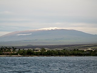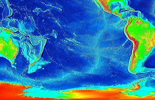
A volcano is a rupture in the crust of a planetary-mass object, such as Earth, that allows hot lava, volcanic ash, and gases to escape from a magma chamber below the surface.

A seamount is a large geologic landform that rises from the ocean floor that does not reach to the water's surface, and thus is not an island, islet or cliff-rock. Seamounts are typically formed from extinct volcanoes that rise abruptly and are usually found rising from the seafloor to 1,000–4,000 m (3,300–13,100 ft) in height. They are defined by oceanographers as independent features that rise to at least 1,000 m (3,281 ft) above the seafloor, characteristically of conical form. The peaks are often found hundreds to thousands of meters below the surface, and are therefore considered to be within the deep sea. During their evolution over geologic time, the largest seamounts may reach the sea surface where wave action erodes the summit to form a flat surface. After they have subsided and sunk below the sea surface such flat-top seamounts are called "guyots" or "tablemounts".

The Ring of Fire is a region around much of the rim of the Pacific Ocean where many volcanic eruptions and earthquakes occur. The Ring of Fire is a horseshoe-shaped belt about 40,000 km (25,000 mi) long and up to about 500 km (310 mi) wide.

The Hawaiian–Emperor seamount chain is a mostly undersea mountain range in the Pacific Ocean that reaches above sea level in Hawaii. It is composed of the Hawaiian ridge, consisting of the islands of the Hawaiian chain northwest to Kure Atoll, and the Emperor Seamounts: together they form a vast underwater mountain region of islands and intervening seamounts, atolls, shallows, banks and reefs along a line trending southeast to northwest beneath the northern Pacific Ocean. The seamount chain, containing over 80 identified undersea volcanoes, stretches about 6,200 km (3,900 mi) from the Aleutian Trench in the far northwest Pacific to the Kamaʻehuakanaloa Seamount, the youngest volcano in the chain, which lies about 35 kilometres (22 mi) southeast of the Island of Hawaiʻi.

John Tuzo Wilson was a Canadian geophysicist and geologist who achieved worldwide acclaim for his contributions to the theory of plate tectonics.

The East Pacific Rise is a mid-ocean rise, a divergent tectonic plate boundary located along the floor of the Pacific Ocean. It separates the Pacific Plate to the west from the North American Plate, the Rivera Plate, the Cocos Plate, the Nazca Plate, and the Antarctic Plate. It runs south from the Gulf of California in the Salton Sea basin in Southern California to a point near 55° S, 130° W, where it joins the Pacific-Antarctic Ridge trending west-southwest towards Antarctica, near New Zealand. Much of the rise lies about 3200 km (2000 mi) off the South American coast and rises about 1,800–2,700 m (6,000–9,000 ft) above the surrounding seafloor.

The Caribbean Plate is a mostly oceanic tectonic plate underlying Central America and the Caribbean Sea off the north coast of South America.

Submarine volcanoes are underwater vents or fissures in the Earth's surface from which magma can erupt. Many submarine volcanoes are located near areas of tectonic plate formation, known as mid-ocean ridges. The volcanoes at mid-ocean ridges alone are estimated to account for 75% of the magma output on Earth. Although most submarine volcanoes are located in the depths of seas and oceans, some also exist in shallow water, and these can discharge material into the atmosphere during an eruption. The total number of submarine volcanoes is estimated to be over 1 million of which some 75,000 rise more than 1 km above the seabed. Only 119 submarine volcanoes in Earth's oceans and seas are known to have erupted during the last 11,700 years.

The Izu–Bonin–Mariana (IBM) arc system is a tectonic plate convergent boundary in Micronesia. The IBM arc system extends over 2800 km south from Tokyo, Japan, to beyond Guam, and includes the Izu Islands, the Bonin Islands, and the Mariana Islands; much more of the IBM arc system is submerged below sealevel. The IBM arc system lies along the eastern margin of the Philippine Sea Plate in the Western Pacific Ocean. It is the site of the deepest gash in Earth's solid surface, the Challenger Deep in the Mariana Trench.

The Hawaiʻi hotspot is a volcanic hotspot located near the namesake Hawaiian Islands, in the northern Pacific Ocean. One of the best known and intensively studied hotspots in the world, the Hawaii plume is responsible for the creation of the Hawaiian–Emperor seamount chain, a 6,200-kilometer (3,900 mi) mostly undersea volcanic mountain range. Four of these volcanoes are active, two are dormant; more than 123 are extinct, most now preserved as atolls or seamounts. The chain extends from south of the island of Hawaiʻi to the edge of the Aleutian Trench, near the eastern coast of Russia.

The Macdonald hotspot is a volcanic hotspot in the southern Pacific Ocean. The hotspot was responsible for the formation of the Macdonald Seamount, and possibly the Austral-Cook Islands chain. It probably did not generate all of the volcanism in the Austral and Cook Islands as age data imply that several additional hotspots were needed to generate some volcanoes.

The Shatsky Rise is Earth's third largest oceanic plateau, located in the north-west Pacific Ocean 1,500 km (930 mi) east of Japan. It is one of a series of Pacific Cretaceous large igneous provinces (LIPs) together with Hess Rise, Magellan Rise, and Ontong Java-Manihiki-Hikurangi. It was named for Nikolay Shatsky (1895-1960), a Soviet geologist, expert in tectonics of ancient platforms.

Arago hotspot is a hotspot in the Pacific Ocean, presently located below the Arago seamount close to the island of Rurutu, French Polynesia.

Wōdejebato is a Cretaceous guyot or tablemount in the northern Marshall Islands, Pacific Ocean. Wōdejebato is probably a shield volcano and is connected through a submarine ridge to the smaller Pikinni Atoll 74 kilometres (46 mi) southeast of the guyot; unlike Wōdejebato, Pikinni rises above sea level. The seamount rises for 4,420 metres (14,500 ft) to 1,335 metres (4,380 ft) depth and is formed by basaltic rocks. The name Wōdejebato refers to a sea god of Pikinni.

Limalok is a Cretaceous-Paleocene guyot/tablemount in the southeastern Marshall Islands, one of a number of seamounts in the Pacific Ocean. It was probably formed by a volcanic hotspot in present-day French Polynesia. Limalok lies southeast of Mili Atoll and Knox Atoll, which rise above sea level, and is joined to each of them through a volcanic ridge. It is located at a depth of 1,255 metres (4,117 ft) and has a summit platform with an area of 636 square kilometres (246 sq mi).
The geology of Panama includes the complex tectonic interplay between the Pacific, Cocos and Nazca plates, the Caribbean Plate and the Panama Microplate.

The plate theory is a model of volcanism that attributes all volcanic activity on Earth, even that which appears superficially to be anomalous, to the operation of plate tectonics. According to the plate theory, the principal cause of volcanism is extension of the lithosphere. Extension of the lithosphere is a function of the lithospheric stress field. The global distribution of volcanic activity at a given time reflects the contemporaneous lithospheric stress field, and changes in the spatial and temporal distribution of volcanoes reflect changes in the stress field. The main factors governing the evolution of the stress field are:
- Changes in the configuration of plate boundaries.
- Vertical motions.
- Thermal contraction.
Volcano F is a submarine volcano in the Tonga Islands of the South Pacific Ocean. It is located 50 km (31 mi) northwest of Vavaʻu, between Late and Fonualei on the Tofua ridge. It is part of the highly active Kermadec-Tonga subduction zone and its associated volcanic arc, which extends from New Zealand north-northeast to Fiji, and is formed by the subduction of the Pacific Plate under the Indo-Australian Plate.


