Listed buildings in Newhall, Cheshire

Last updated

Newhall is a civil parish in Cheshire East, England. It contains 14 buildings that are recorded in the National Heritage List for England as designated listed buildings, all of which are at Grade II. This grade is the lowest of the three gradings given to listed buildings and is applied to "buildings of national importance and special interest". [1] The parish contains the village of Aston, but is otherwise almost completely rural, and its listed buildings reflect this, including farmhouses and other houses. The Shropshire Union Canal runs through the parish, and there are two listed buildings associated with this, a bridge and a milepost. Also listed are a boundary stone, a telephone kiosk, and a lychgate.

Newhall, Cheshire village in the United Kingdom

Newhall is a village and civil parish in the unitary authority of Cheshire East and the ceremonial county of Cheshire, England. The village lies 3½ miles to the west of Audlem and 5 miles to the south west of Nantwich. The parish also includes the village of Aston, and the small settlements of Aston Heath, Barnett Brook, Brown's Bank, Dodd's Green, Grandford, Grindley Green, Hollingreen, Kingswood Green, Maiden Estate, Salesbrook, Sheppenhall and part of Sandford. Nearby villages include Audlem and Wrenbury.

Cheshire East Borough and Unitary authority in England

Cheshire East is a unitary authority area with borough status in the ceremonial county of Cheshire, England. The local authority is Cheshire East Council.

The National Heritage List for England (NHLE) is England’s official list of buildings, monuments, parks and gardens, wrecks, battlefields and World Heritage Sites. It is maintained by Historic England and brings together these different designations as a single resource even though they vary in the type of legal protection afforded to each. Conservation areas do not appear on the NHLE since they are designated by the relevant local planning authority.

Map all coordinates using: OpenStreetMap  
Download coordinates as: KML  ·  GPX
Name and locationPhotographDateNotes
Brickwall Farmhouse
52°59′18″N2°32′01″W / 52.98840°N 2.53374°W / 52.98840; -2.53374 (Brickwall Farmhouse)
17th centuryThe farmhouse is basically timber-framed with brick infill and has been rendered; the roof is tiled. The farmhouse has an H-shaped plan, and is in two storeys. At the sides are projecting gabled wings, and between these is a verandah. The windows are casements. [2]
Cottage (adjacent to the telephone exchange(?))
53°01′00″N2°34′38″W / 53.01655°N 2.57710°W / 53.01655; -2.57710 (Cottage)
17th centuryA timber-framed cottage with rendered infill, in a single storey with an attic. On the front is a brick porch, and to its right is a rectangular bay window; there is a similar bay window on the left side. In the upper floor is a gabled dormer. The windows are casements. [3]
Hall O'Coole
53°00′25″N2°33′14″W / 53.00688°N 2.55391°W / 53.00688; -2.55391 (Hall O'Coole)
17th centuryThe farmhouse was altered and extended in the 19th century. The older part is timber-framed, and the later part is in pebbledashed brick; the roof is tiled. The house has a T-shaped plan, and is in two storeys. To the right of centre is a projecting wing with a jettied gable, and to the right of this is a wing with a French window and a bay window. The wing to the left is in brick, and contains a porch and French windows. The other windows are casements. [4]
Hollin's Green Farmhouse
53°00′12″N2°32′32″W / 53.00326°N 2.54215°W / 53.00326; -2.54215 (Hollin's Green Farmhouse)
17th centuryThe farmhouse is basically timber-framed, and has been encased in brick; it has a tiled roof. The farmhouse is in two storeys with a four-bay front, the left bay protruding forward and gabled, and containing a French window. The other windows are casements. At the rear is a timber-framed wing on a brick plinth with a jettied gable containing a moulded bressumer. Inside the farmhouse is an inglenook. [5]
Kennelwood
52°59′50″N2°35′27″W / 52.99717°N 2.59096°W / 52.99717; -2.59096 (Kennelwood)
17th centuryA house that was altered in the 20th century. It is mainly timber-framed with brick infill and partly in brick; it has a slate roof. The house has an H-shaped plan, and is in two storeys. The central range is in brick, and the lateral wings are gabled and timber-framed, the left wing having a jettied gable. The windows are 20th-century casements. [6]
New Lodge
52°59′56″N2°35′27″W / 52.99877°N 2.59095°W / 52.99877; -2.59095 (New Lodge)
17th centuryA house that was altered in the 20th century. It is mainly timber-framed with brick infill and partly in brick; it has a slate roof. The house has an H-shaped plan, and is in two storeys. The central range is in brick, and the lateral wings are gabled and timber-framed, the left wing having a jettied gable. The windows are 20th-century casements. [7]
West End Farmhouse
53°01′11″N2°35′02″W / 53.01984°N 2.58382°W / 53.01984; -2.58382 (West End Farmhouse)
West End Farmhouse, Aston-by-Wrenbury.jpg
17th centuryA timber-framed farmhouse, partly rendered with a tiled roof and in two storeys. On the right is a gabled wing, and to the left are three bays with dormers in the upper floors. The windows are casements. Inside the farmhouse is an inglenook. [8]
Aston House Farmhouse
53°01′10″N2°34′58″W / 53.01933°N 2.58280°W / 53.01933; -2.58280 (Aston House Farmhouse)
Aston House Farm - geograph.org.uk - 338354.jpg
1662An extension was added in the 19th century. The original part is timber-framed with a tiled roof and a gable facing the road. It is in two storeys, the upper floor and the gable both being jettied. The windows are casements, and the date is painted on the gable. To the right is the later extension in brick with a slate roof. It has two storeys, is in three bays, and contains sash windows. [9]
Brown's Bank Farmhouse
52°59′00″N2°31′20″W / 52.98335°N 2.52220°W / 52.98335; -2.52220 (Brown's Bank Farmhouse)
1759The farmhouse is in brick with a tiled roof, and has two storeys and an attic. At the front on the left are three bays with a doorway, and to the right is a protruding gabled bay with two-light windows. Inside the farmhouse is an inglenook with a chamfered bressumer. [10]
Pinnacle Farmhouse
53°00′19″N2°31′42″W / 53.00533°N 2.52847°W / 53.00533; -2.52847 (Pinnacle Farmhouse)
Early 19th centuryA brick farmhouse in two storeys, with a symmetrical three-bay front. The central doorway is flanked by pilaster strips, and has a porch with a pediment. The windows are casements. [11]
Canal milepost
53°00′22″N2°31′11″W / 53.00600°N 2.51984°W / 53.00600; -2.51984 (Canal milepost)
Early 19th centuryThe milepost on the Shropshire Union Canal is in cast iron. It consists of a circular post with a domed top that carries a plate in three panels, inscribed with the distances in miles to Autherley Junction and Norbury Junction. [12]
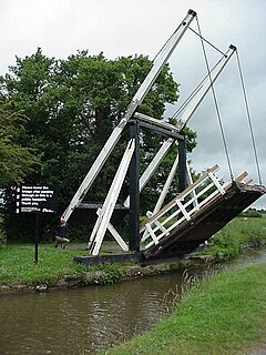
Bennett's Bridge
53°00′11″N2°31′08″W / 53.00316°N 2.51886°W / 53.00316; -2.51886 (Bennett's Bridge)
Bridge No 80, Shropshire Union Canal.jpg
1827–30This is bridge number 80, an accommodation bridge over the Shropshire Union Canal, designed by Thomas Telford. It is built in brick, with a stone band and copings. The bridge consists of a single elliptical arch. [13]
Lychgate,
Aston Burial Ground
53°01′02″N2°34′55″W / 53.01718°N 2.58192°W / 53.01718; -2.58192 (Lychgate)
c. 1919The lychgate is a war memorial. It is timber-framed and has a gable with a decorated bargeboard; it stands on a brick base. The lychgate has a slated roof, and contains double gates. There are inscriptions on the tie-beams, the bressumers, and on wooden tablets. [14]
Telephone kiosk
53°01′08″N2°34′57″W / 53.01897°N 2.58255°W / 53.01897; -2.58255 (Telephone kiosk)
1935A K6 type telephone kiosk, designed by Giles Gilbert Scott. Constructed in cast iron with a square plan and a dome, it has three unperforated crowns in the top panels. [15]

See also

Listed buildings in Wrenbury cum Frith Wikimedia list article

Fourteen buildings and other structures in the English civil parish of Wrenbury cum Frith have been officially designated as listed buildings for their "special architectural and historic interest". Three of the listed buildings are classified as being in grade II* and the remainder in grade II; the parish has no grade-I-listed buildings.

Sound is a civil parish in Cheshire East, England. It contains three buildings that are recorded in the National Heritage List for England as designated listed buildings, all of which are listed at Grade II. This grade is the lowest of the three gradings given to listed buildings and is applied to "buildings of national importance and special interest". The parish is mainly rural, and the listed buildings consist of two farmhouses and a school.

Hankelow is a civil parish in Cheshire East, England. It contains six buildings that are recorded in the National Heritage List for England as designated listed buildings. Of these, two are listed at Grade II*, the middle grade, and the others are at Grade II. Apart from the village of Hankelow, the parish is entirely rural. The listed buildings consist of a former country house, now in ruins, three farmhouses, a disused bridge, and a former mill now converted into residential use.

Related Research Articles

Aston by Wrenbury village in United Kingdom

Aston is a village in the civil parish of Newhall in the unitary authority of Cheshire East and the ceremonial county of Cheshire, England.

Listed buildings in Runcorn (rural area) Wikimedia list article

Runcorn is a small industrial town in the borough of Halton, Cheshire, England. This list contains the 27 buildings that are recorded in the National Heritage List for England as designated listed buildings in the part of the borough lying to the south of the River Mersey outside the urban area of Runcorn. The area covered includes the villages of Clifton, Daresbury, Preston Brook, Preston on the Hill, and Moore. Three of the buildings in the area are classified as Grade II*, and the others are at Grade II; there are no buildings in Grade I. In the United Kingdom, the term listed building refers to a building or other structure officially designated as being of special architectural, historical, or cultural significance. These buildings are in three grades: Grade I consists of buildings of outstanding architectural or historical interest; Grade II* includes particularly significant buildings of more than local interest; Grade II consists of buildings of special architectural or historical interest. Buildings in England are listed by the Secretary of State for Culture, Media and Sport on recommendations provided by English Heritage, which also determines the grading.

Grappenhall and Thelwall is a civil parish in the borough of Warrington and the ceremonial county of Cheshire, England, and includes the villages of Grappenhall and Thelwall. The Bridgewater Canal and the A56 road pass through Grappenhall and to the south of Thelwall in an east-west direction, and the A50 road runs in a north-south direction between them. Within the parish are 30 buildings that are recorded in the National Heritage List for England as designated listed buildings. Of these, one is listed at Grade I, the highest of the three grades, and the other 28 at Grade II, the lowest grade. The Grade I listed building is a church dating back to the 12th century. The Grade II listed buildings comprise a variety of structures, including another church, houses, aqueducts, bridges, a public house, farm buildings, stocks, a sundial, a milepost, a mounting block, a war memorial, and a telephone kiosk.

Little Leigh is a civil parish in Cheshire West and Chester, England. Other than the village of Little Leigh, the parish is entirely rural. It contains eleven buildings that are recorded in the National Heritage List for England as designated listed buildings, all of which are at Grade II. This grade is the lowest of the three gradings given to listed buildings and is applied to "buildings of national importance and special interest". The A49 road runs to the west of the parish, the A533 road to the northeast, and the River Weaver to the south. Traversing the parish is the Trent and Mersey Canal. Four of the listed buildings are associated with the canal: two bridges, an aqueduct, and a milepost. The other listed buildings consist of a former farmhouse, now a public house, with two of its associated buildings, another farmhouse, a cottage, and a church with its lychgate.

Wincham is a village and a civil parish in Cheshire West and Chester, England. It contains two buildings that are recorded in the National Heritage List for England as designated listed buildings, both of which are listed at Grade II. This grade is the lowest of the three gradings given to listed buildings and is applied to "buildings of national importance and special interest". Running through the parish are the Trent and Mersey Canal, and the Wincham Brook. The parish is partly rural, and was formerly the site of salt mining. The listed buildings comprise a farmhouse and a canal milepost.

Aston juxta Mondrum is a civil parish in Cheshire East, England. It contains five buildings that are recorded in the National Heritage List for England as designated listed buildings, all of which are at Grade II. This grade is the lowest of the three gradings given to listed buildings and is applied to "buildings of national importance and special interest". The parish is crossed by the Middlewich Branch of the Shropshire Union Canal, and is almost entirely rural. The listed buildings consist of a church, two farmhouses, and two structures associated with the canal, an accommodation bridge and a lock.

Audlem is a civil parish in Cheshire East, England. It contains 25 buildings that are recorded in the National Heritage List for England as designated listed buildings. Of these, two are listed at Grade I, the highest grade, one is listed at Grade II*, the middle grade, and the others are at Grade II. The major settlement in the parish is the village of Audlem. In the village the listed buildings include churches and cemetery chapels, a former grammar school, a hotel, houses, and a memorial lamp standard. In the surrounding countryside the listed buildings include country houses, farmhouses, farm buildings, and a road bridge. Running through the parish is the Shropshire Union Canal, and the listed structures associated with this are bridges, mileposts and a lock keeper's cottage.

Betchton is a civil parish in Cheshire East, England. It contains 18 buildings that are recorded in the National Heritage List for England as designated listed buildings. Of these, one is listed at Grade II*, the middle grade, and the others are at Grade II. The parish is almost entirely rural. Many of the listed buildings are timber-framed farmhouses dating from the 16th and 17th centuries. The Trent and Mersey Canal runs through the parish, and eight structures associated with this are listed, namely four bridges, two locks, and two mileposts. The other listed buildings are structures associated with the farmhouses, a country house, and a public house.

Church Lawton is a civil parish in Cheshire East, England. It contains 14 buildings that are recorded in the National Heritage List for England as designated listed buildings. Of these, one is listed at Grade II*, the middle grade, and the others are at Grade II. The parish is partly residential, but mainly rural. It contains part of the Trent and Mersey Canal, and its junction with the Macclesfield Canal. Eight of the listed buildings are associated with the canal system, consisting of two bridges, two mileposts, two sets of locks, and two aqueducts. The other listed buildings are houses, a church, and a tombstone.

Edleston is a civil parish in Cheshire East, England. It contains six buildings that are recorded in the National Heritage List for England as designated listed buildings, all of which are at Grade II. This grade is the lowest of the three gradings given to listed buildings and is applied to "buildings of national importance and special interest". The parish is entirely rural. The Shropshire Union Canal passes through the parish, and there are three listed structures associated with this, two accommodation bridges and a milepost. The other listed buildings are cottages and a farmhouse.

Higher Hurdsfield is a civil parish in Cheshire East, England. It contains 13 buildings that are recorded in the National Heritage List for England as designated listed buildings, all of which are at Grade II. This grade is the lowest of the three gradings given to listed buildings and is applied to "buildings of national importance and special interest". The parish lies to the east of the town of Macclesfield, and is mainly rural. The Macclesfield Canal runs along is west border, and there are four listed structures associated with it, two bridges, a milestone, and a culvert with a weir and sluices. The other listed buildings are farmhouses, a former pumping engine house, now in residential use, a road milestone, and three boundary stones.

Macclesfield Forest and Wildboarclough is a civil parish in Cheshire East, England. It contains 28 buildings that are recorded in the National Heritage List for England as designated listed buildings. Of these, two are listed at Grade II*, the middle grade, and the others are at Grade II. Population in the parish is scattered, and most of the parish is farmland, moorland and forest. There are two small settlements at Wildboarclough and Allgreave, otherwise dwellings are scattered. The major house in the parish is Crag Hall; this and buildings associated with it are listed. Other listed buildings include farmhouses, farm buildings, churches, a terrace of houses, a bridge, a former post office with a telephone kiosk outside it, milestones, mileposts and parish boundary stones.

Moreton cum Alcumlow is a civil parish in Cheshire East, England, United Kingdom. It contains 13 buildings that are recorded in the National Heritage List for England as designated listed buildings. Of these, one is listed at Grade II*, the middle grade, and the others are at Grade II. The major building in the parish is Great Moreton Hall; this and a number of structures associated with it are listed. The Macclesfield Canal runs through the parish, and four bridges crossing it are listed. Apart from the estate of Great Moreton Hall, the parish is rural, and two farmhouses are also listed.

Moston is a civil parish in Cheshire East, England. It contains 16 buildings that are recorded in the National Heritage List for England as designated listed buildings, all of which are at Grade II. This grade is the lowest of the three gradings given to listed buildings and is applied to "buildings of national importance and special interest". The parish contains the village of Moston Green, but is otherwise mainly rural. The Trent and Mersey Canal runs through the parish, and eight of the listed buildings are associated with it, namely bridges, locks, and mileposts. The other listed buildings are farmhouses, farm buildings, a cottage, a club that was originally a farmhouse, and a turnpike milepost.

Newbold Astbury is a civil parish in Cheshire East, England. It contains 25 buildings that are recorded in the National Heritage List for England as designated listed buildings. Of these, one is listed at Grade I, the highest grade, three are listed at Grade II*, the middle grade, and the others are at Grade II. The major settlement in the parish is the village of Astbury; its listed buildings include the church and associated structures, houses and cottages, and a telephone kiosk. The Macclesfield Canal runs through the parish, and there are five listed buildings associated with this, three bridges, an aqueduct, and a milestone. Otherwise the parish is rural, and the listed buildings are farmhouses, farm buildings, and a boundary stone.

Odd Rode is a civil parish in Cheshire East, England. It contains 35 buildings that are recorded in the National Heritage List for England as designated listed buildings. Of these, one is listed at Grade I, the highest grade, five are listed at Grade II*, the middle grade, and the others are at Grade II. The most important listed building in the parish is Little Moreton Hall; other notable country houses include Rode Hall and Ramsdell Hall. Most of the other listed buildings are houses, farmhouses, and associated structures. The Macclesfield and the Trent and Mersey Canals run through the parish, and the listed buildings associated with these are bridges, milestones, and distance markers. The other listed buildings are a church. a folly, wellheads, and a public house.

Pott Shrigley is a civil parish in Cheshire East, England. It contains 19 buildings that are recorded in the National Heritage List for England as designated listed buildings. Of these, one is listed at Grade I, the highest grade, one is listed at Grade II*, the middle grade, and the others are at Grade II. Apart from the village of Pott Shrigley, the parish is almost entirely rural. Most of the listed buildings are farmhouses and farm buildings, houses and cottages. Parts of the Macclesfield Canal run through the parish, and the listed buildings associated with this are a bridge, an aqueduct, and fence posts. The other listed structures are a church an churchyard cross, a school, a hotel and leisure centre, a telephone kiosk, and a parish boundary stone.

Prestbury is a civil parish in Cheshire East, England. It contains 51 buildings that are recorded in the National Heritage List for England as designated listed buildings. Of these, one is listed at Grade I, the highest grade, three are listed at Grade II*, the middle grade, and the others are at Grade II. Many of the listed buildings are in the village of Prestbury, including houses, a church and associated structures, shops, a bank, hotels, a public house, the village stocks, the entrance to a railway tunnel, and a telephone kiosk. In the surrounding countryside the listed buildings are more houses, farms and farm buildings, parish boundary stones, an ancient cross, and mileposts.

Wem Rural is a civil parish in Shropshire, England. It contains 59 listed buildings that are recorded in the National Heritage List for England. Of these, one is listed at Grade I, the highest of the three grades, three are at Grade II*, the middle grade, and the others are at Grade II, the lowest grade. The parish consists of an area around the town of Wem, but not the town itself. It contains the villages of Aston, Coton, Quina Brook, and Tilley and smaller settlements, and is otherwise rural. Most of the listed buildings are houses and associated structures, cottages, farmhouses and farm buildings, a high proportion of which are timber framed or have a timber framed core. The other listed buildings include churches, items in a churchyard, a former manor house, a public house, four bridges, two lime kilns, and six mileposts. For the listed buildings within the town of Wem, see Listed buildings in Wem Urban.

References

Citations

  1. Historic England
  2. Historic England & 1266239
  3. Historic England & 1266218
  4. Historic England & 1266223
  5. Historic England & 1225775
  6. Historic England & 1138533
  7. Historic England & 1136974
  8. Historic England & 1225740
  9. Historic England & 1225739
  10. Historic England & 1266217
  11. Historic England & 1225608
  12. Historic England & 1266264
  13. Historic England & 1320256
  14. Historic England & 1357114
  15. Historic England & 1115817

Sources

Historic England Executive non-departmental public body of the British Government, tasked with protecting the historical environment of England

Historic England is an executive non-departmental public body of the British Government sponsored by the Department for Culture, Media and Sport (DCMS). It is tasked with protecting the historical environment of England by preserving and listing historic buildings, ancient monuments and advising central and local government.