Woodbine is a city in Harrison County, Iowa, United States, along the Boyer River. The population was 1,625 at the time of the 2020 census.
Sabattus is a town in Androscoggin County, Maine, United States. The population was 5,044 at the 2020 census. It is included in both the Lewiston-Auburn, Maine Metropolitan Statistical Area and the Lewiston-Auburn, Maine Metropolitan New England City and Town Area. The town was formerly known as "Webster", and changed its name to "Sabattus" in 1971, in honor of a former Anasagunticook Indian chief. The village of Sabattus is in the northwestern corner of the town, at the outlet of Sabattus Pond.

Wales is a town in Androscoggin County, Maine, United States. The population was 1,608 at the 2020 census. It is included in both the Lewiston-Auburn, Maine Metropolitan Statistical Area and the Lewiston-Auburn, Maine Metropolitan New England City and Town Area.

Litchfield is a town in Kennebec County, Maine, United States. The population was 3,586 at the 2020 census. Litchfield is included in the Augusta, Maine micropolitan and included in the Lewiston-Auburn, Maine metropolitan New England city and town area. Litchfield is included Wales, Maine micropolitan

Coloma is a city in Berrien County in the U.S. state of Michigan. The population was 1,465 at the 2020 census.

Olivet is a city in Eaton County in the U.S. state of Michigan. The population was 1,605 at the 2010 census. University Of Olivet is located in the city.

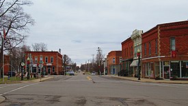
Gladwin is a city in Gladwin County in the U.S. state of Michigan. The population was 3,069 at the 2020 census. Gladwin is the county seat of Gladwin County. The city is at the southwest corner of Gladwin Township, but the two are administered autonomously.

Allen Township is a civil township of Hillsdale County in the U.S. state of Michigan. The population was 1,334 at the 2020 census.

Litchfield Township is a civil township of Hillsdale County in the U.S. state of Michigan. The population was 1,029 at the 2020 census.

Scipio Township is a civil township of Hillsdale County in the U.S. state of Michigan. The population was 1,902 at the 2020 census.

Petersburg is a city in Monroe County in the U.S. state of Michigan. The population was 1,171 at the 2020 census.

North Muskegon is a city in Muskegon County in the U.S. state of Michigan. The population was 4,093 at the 2020 census, up from 3,786 in 2010.

Roosevelt Park is a city in Muskegon County in the U.S. state of Michigan. The population was 4,172 at the 2020 census, up from 3,831 in 2010.

Ferrysburg is a city in Ottawa County in the U.S. state of Michigan. The population was 2,892 at the 2010 census.

Perry is a city in Shiawassee County in the U.S. state of Michigan. The population was 2,188 at the 2010 census. The city is surrounded by Perry Township, but the two are administered autonomously.

Hartford is a city in Van Buren County in the U.S. state of Michigan. The population was 2,688 at the 2010 census. The city is located within Hartford Township, but is politically independent.
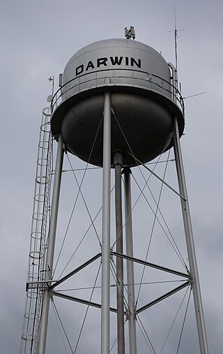
Darwin is a city in Meeker County, Minnesota, United States. The population was 348 at the 2020 census.
Darwin Township is a township in Meeker County, Minnesota, United States. The population was 713 at the 2000 census. The township includes the city of Darwin plus a small eastern portion of the city of Litchfield.
Litchfield Township is a township in Meeker County, Minnesota, United States. The population was 808 at the 2000 census. The township includes most of the city of Litchfield, except for a small protrusion northeast into Forest City Township and another small one due east into Darwin Township.

Eden Valley is a city in Meeker and Stearns counties in the U.S. state of Minnesota. The population was 1,027 at the 2020 census. Most of Eden Valley is in Meeker County; the Stearns County portion is part of the St. Cloud Metropolitan Statistical Area.