
Monroe County is a county located in the U.S. state of Michigan. As of the 2010 census, the population was 152,021. The largest city and county seat is Monroe. The county was established as the second county in the Michigan Territory in 1817 and was named for then-President James Monroe.
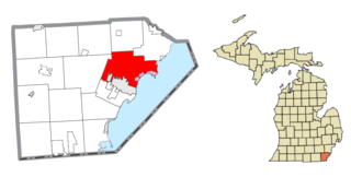
Frenchtown Charter Township is a charter township within Monroe County in the U.S. state of Michigan. The population was 20,428 at the 2010 census. The township is bordered on the south by the city of Monroe. Sterling State Park and the Enrico Fermi Nuclear Generating Station are located within Frenchtown, and the township was the site of the Battle of Frenchtown during the War of 1812.

Monroe is a city in the U.S. state of Michigan located on the western shore of Lake Erie. It is the county seat and largest city of Monroe County. Monroe had a population of 20,733 in the 2010 census. The city is bordered on the south by Monroe Charter Township, but both are politically independent. Monroe is located approximately 14 miles (23 km) north of Toledo, Ohio, and 25 miles (40 km) south of Detroit. The United States Census Bureau lists Monroe as the core city in the Monroe Metropolitan Area, which had a population of 152,021 in 2010. Monroe is officially part of the Detroit-Ann Arbor-Flint combined statistical area, and the city is sometimes unofficially included as a northerly extension of the Toledo Metropolitan Area.
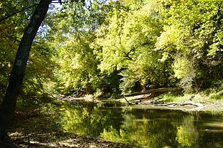
The Tiffin River is a 54.9-mile-long (88.4 km) tributary of the Maumee River in northwestern Ohio in the United States. Headwater tributaries of the river rise in southeastern Michigan. The river drains a primarily rural farming region in the watershed of Lake Erie. Early French traders called the river Crique Féve, translated as Bean Creek, due to the natural growth of bean plants along the shores.

The Battles of Frenchtown, also known as the Battle of the River Raisin and the River Raisin Massacre, was a series of conflicts in Michigan Territory that took place from January 18–23, 1813, during the War of 1812. It was fought between the United States and a British and Native American alliance near the River Raisin in Frenchtown,.

William C. Sterling State Park is a state park located in Frenchtown Charter Township and a smaller portion in the city limits of Monroe, Michigan. It is the only Michigan state park located on Lake Erie. The park encompasses 2.03 mi² (5.26 km²) of mostly man-made lagoons and beachfront near the mouth of Sandy Creek. The main attractions at the park include the 256-site campground, beach area, a public boat launch, and shore fishing lagoons. There are over six miles (9.66 km) of biking and hiking trails within the park.

M-130 was the designation of a former state trunkline highway in the southeastern corner of the US state of Michigan. It ran from a junction with US Highway 23/M-50 (US 23/M-50) northward across the River Raisin and then turned southeasterly along North Custer Road on the north side of the river to Monroe. The highway designation was commissioned in 1929 and used until 1955. M-130 had a spur route that was created in 1938 and lasted until the main highway was removed from the state highway system. Both highways are now under local control.

The River Raisin National Battlefield Park was established as the 393rd unit of the United States National Park Service under Title VII of the Omnibus Public Land Management Act, which was signed into law on March 30, 2009. The park is located in the city of Monroe in Monroe County, Michigan. It was designated as a Michigan Historic Site on February 18, 1956 and was added to the National Register of Historic Places on December 10, 1982. It officially began operation as a national park unit on October 22, 2010 and, of the four National Battlefield Parks in the country, it is the only one marking a site of the War of 1812.

The Saline River is a 45.6-mile-long (73.4 km) river in southeastern Michigan in the United States. A tributary of the River Raisin, it originates in Washtenaw County; flows through the cities of Saline and Milan, where it enters Monroe County; then joins the River Raisin at the village of Dundee. Although named after the city of Saline, which was once famous for its salt springs, the Saline River is not at all salty.

The Old Village Historic District is a commercial and residential historic district consisting of the downtown area of the city of Monroe in Monroe County, Michigan. The district was listed as a Michigan Historic Site and added to the National Register of Historic Places on May 6, 1982.

The St. Mary's Church Complex Historic District is a historic district located at the junction of Elm Avenue and North Monroe Street (M-125) in the city of Monroe, Michigan. It was listed as a Michigan Historic Site and added to the National Register of Historic Places on May 6, 1982.

The Jackson Branch Bridge No. 15, also known as the Tecumseh Railroad Bridge due to its close proximity to the city of Tecumseh, is a historic railway deck truss bridge that spans the River Raisin in rural Raisin Charter Township in Lenawee County, Michigan. The bridge was added to the National Register of Historic Places on December 4, 2001.

The Raisin Valley Friends Meetinghouse is a historic church located at 3552 North Adrian Highway (M-52) in Adrian Charter Township about two miles (3.2 km) north of the city of Adrian in central Lenawee County, Michigan. It was added to the National Register of Historic Places on April 28, 1982 and later designated as a Michigan Historic Site on January 23, 1992. It houses the oldest Quaker congregation in Michigan, which was established in 1831. It is also recognized as the second oldest continuously operating church building in the state of Michigan after the Mission Church in Mackinac Island, which was built in 1829.
Goose Creek is a small stream in Hillsdale, Jackson and Lenawee counties in the U.S. state of Michigan. It is a tributary of the River Raisin. The headwaters form in Somerset Township in northeast Hillsdale County flowing northeast to join the River Raisin just north of the village of Brooklyn. The total length of the creek is approximately 12 miles (19 km). The Goose Greek subbasin covers an area of 40 sq mi (100 km2) with 44% used for agriculture and 38% forest, wetlands, and grasslands. Only about 12% of the watershed is made up of urban development. Of all the subbasins within the River Raisin watershed, Goose Creek has maintained the largest share of wetlands and maintains the lowest levels of pollutants.
Nathaniel Gray Smith Hart, often Nathaniel G. S. Hart, was a Lexington, Kentucky lawyer and businessman, who served with the state's volunteer militia during the War of 1812. As Captain of the Lexington Light Infantry from Kentucky, Hart and many of his men were killed in the River Raisin Massacre of January 23, 1813, after being taken prisoner the day before following the Battle of Frenchtown in Michigan Territory.
Benjamin Franklin Graves (1771–1813) was a politician and military leader in early 19th-century Kentucky. During the War of 1812, Graves served as a Major in the 2nd Battalion, 5th Kentucky Volunteer regiment. Together with other officers, he commanded relatively inexperienced Kentucky troops in the Battle of Frenchtown on January 22, 1813 in Michigan Territory. This was part of an effort by Americans to take the British-controlled fort at Detroit. This battle had the highest number of American fatalities in the war: of 1000 American troops, nearly 400 were killed in the conflict, and 547 were taken prisoner. The next day an estimated 30-100 Americans were killed by Native Americans after having surrendered.

The Kiwanis Trail is a rail to trail conversion in Adrian, Michigan that roughly follows the Raisin River.

The Mill Street–South Branch Raisin River Bridge is a bridge carrying Mill Street over the South Branch of the River Raisin in Brooklyn, Michigan. It was listed on the National Register of Historic Places in 2000.


