List of rivers of Michigan

Last updated

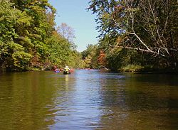
This list of Michigan rivers includes all streams designated rivers although some may be smaller than those streams designated creeks, runs, brooks, swales, cuts, bayous, outlets, inlets, drains and ditches. These terms are all in use in Michigan. Other waterways are listed when they have articles.

Contents

The state has over 300 named rivers. Several names are shared by different rivers; for example, there are eight Pine Rivers and seven Black Rivers. In four cases there are two rivers of the same name in one county. In these cases extra information such as alternate name or body of water they flow into has been added.

Map of Michigan rivers Michigan Rivers.svg
Map of Michigan rivers
Tahquamenon River Tahquamenon Falls - Autumn.JPG
Tahquamenon River

In alphabetical order

AC

DK

LM

NR

SZ

By watershed

Lake Erie basin

Detroit River DEtroitRivericeflowscityview.jpg
Detroit River

Lake St. Clair basin

Clinton River Clinton River.jpg
Clinton River

Lake Huron basin

The Thumb

Saginaw Bay

Shiawassee River Shiawassee 2 5 06 006.jpg
Shiawassee River

Northeast Lower Peninsula of Michigan

Upper Peninsula of Michigan

Lake Michigan basin

Lower Peninsula of Michigan

Northern Michigan
Pere Marquette River Pere Marquette River in Autumn Manistee National Forest.JPG
Pere Marquette River
West Michigan
Grand River Ada MI GrandRiver DSCN9684.JPG
Grand River

Upper Peninsula of Michigan

Green Bay
Little Bay de Noc
Big Bay de Noc
Remainder of Lake Michigan/Upper Peninsula

Beaver Island

Lake Superior basin

Yellow Dog River Yellow dog falls.jpg
Yellow Dog River
Ontonagon River Ontonagon River.jpg
Ontonagon River

Isle Royale

See also

Related Research Articles

Ontonagon County, Michigan County in Michigan, United States

Ontonagon County is a county in the Upper Peninsula of the U.S. state of Michigan. As of the 2020 Census, the population was 5,816, making it Michigan's third-least populous county. The county seat is Ontonagon. The county was set off in 1843, and organized in 1848. Its territory had been organized as part of Chippewa and Mackinac counties. With increasing population in the area, more counties were organized. After Ontonagon was organized, it was split to create Gogebic County. It is also the westernmost U.S. county that uses the Eastern Time Zone.

Northern Michigan Lower Peninsula of Michigan in the United States

Northern Michigan, also known as Northern Lower Michigan, is a region of the U.S. state of Michigan. A popular tourist destination, it is home to several small- to medium-sized cities, extensive state and national forests, lakes and rivers, and a large portion of Great Lakes shoreline. The region has a significant seasonal population much like other regions that depend on tourism as their main industry. Northern Lower Michigan is distinct from the more northerly Upper Peninsula and Isle Royale, which, obviously, are also located in "northern" Michigan. In the northernmost 21 counties in the Lower Peninsula of Michigan, the total population of the region is 506,658 people.

M-38 is an east–west state trunkline highway in the Upper Peninsula (UP) of the U.S. state of Michigan. Its west end starts in Ontonagon and runs east to Baraga, some 42.225 miles (67.955 km) apart. The highway crosses streams and rivers in forest lands and provides access to a casino. The east end is located by the Keweenaw Bay of Lake Superior in the Keweenaw Bay Indian Community.

M-35 is a state trunkline highway in the Upper Peninsula (UP) of the US state of Michigan. It runs for 128 miles (206 km) in a general north–south direction and connects the cities of Menominee, Escanaba, and Negaunee. The southern section of M-35 in Menominee and Delta counties carries two additional designations; M-35 forms a segment of the Lake Michigan Circle Tour, and it is the UP Hidden Coast Recreational Heritage Trail, which is a part of what is now called the Pure Michigan Byways Program. Along the southern section, the highway is the closest trunkline to the Green Bay, a section of Lake Michigan. The northern section of the highway turns inland through sylvan areas of the UP, connecting rural portions of Delta and Marquette counties.

Pine River (Michigan) Index of articles associated with the same name

Pine River may refer to any of the following rivers in the U.S. state of Michigan:

Carp River may refer to:

Ottawa National Forest National forest in Michigan, United States

The Ottawa National Forest is a national forest that covers 993,010 acres (401,860 ha) in the Upper Peninsula of the U.S. state of Michigan. It includes much of Gogebic and Ontonagon counties, as well as slices of Iron, Houghton, Baraga, and Marquette counties. The forest is under the jurisdiction of the U.S. Forest Service.

Cedar Creek may refer to several small streams in the U.S. state of Michigan:

The Michigan Department of Health and Human Services (MDHHS) is a principal department of state of Michigan, headquartered in Lansing, that provides public assistance, child and family welfare services, and oversees health policy and management.

Little Carp River may refer to the following streams in the U.S. state of Michigan:

Carp River is the name of several rivers in the U.S. state of Michigan.

Michigans 38th Senate district American legislative district

Michigan's 38th Senate district is one of 38 districts in the Michigan Senate. It has been represented by Republican Ed McBroom since 2019, succeeding fellow Republican Tom Casperson.

References